
close
3D
Trail Conditions
- Unknown
- Snow Groomed
- Snow Packed
- Snow Covered
- Snow Cover Partial
- Freeze/thaw Cycle
- Icy
- Prevalent Mud
- Wet
- Variable
- Ideal
- Dry
- Very Dry
Trail Flow (Ridden Direction)
Trailforks scans users activity logs to determine the most popular direction each trail is ridden. A good flowing trail network will have most trails flowing in a single direction according to their intension.
The colour categories are based on what percentage of users are riding a trail in its intended direction.
The colour categories are based on what percentage of users are riding a trail in its intended direction.
- > 96%
- > 90%
- > 80%
- > 70%
- > 50%
- < 50%
- bi-directional trail
- no data
Trail Last Used
Trailforks scans activity logs to determine the last time a trail was ridden.
- < 2 days
- < 1 week
- < 2 weeks
- < 1 month
- < 6 months
- > 6 months
Trail Ridden Direction
The intended direction a trail should be ridden.
- Downhill Only
- Downhill Primary
- Both Directions
- Uphill Primary
- Uphill Only
- One Direction
Contribute Details
Colors indicate trail is missing specified detail.
- Description
- Photos
- Description & Photos
- Videos
Trail Popularity ?
Trailforks scans activity logs to determine which trails are ridden the most in the last 9 months.
Trails are compared with nearby trails in the same city region with a possible 25 colour shades.
Think of this as a heatmap, more activities = more kinetic energy = warmer colors.
- most popular
- popular
- less popular
- not popular
ATV/ORV/OHV Filter
Max Vehicle Width
inches
US Cell Coverage
Legend

Radar Time
Activity Recordings
Trailforks uses anonymized public activity data.
?
Activity Recordings
Trailforks uses anonymized public activity data.
?
Winter Trails
Warning
A routing network for winter maps does not exist. Selecting trails using the winter trails layer has been disabled.
Missing Trails
Most Popular
Least Popular
Trails are colored based on popularity. The more popular a trail is, the more red. Less popular trails trend towards green.
Jump Magnitude Heatmap
Heatmap of where users jump on trails. Zoom in to see individual jumps, click circles to view jump details.
BC Backroad Status
![map legend]()
Service Road Atlas is a free to use, community-driven service for viewing and creating reports on the numerous back-country service roads around B.C. and Alberta.

Slope Aspect
Direction the slope faces
Trails Deemphasized
Trails are shown in grey.
Only show trails with no bike usage.
Suggested Layers
Based on selected activity type
Save the current map location and zoom level as your default home location whenever this page is loaded.
SaveLa Garfagnana (Carfaniana in basso latino, detta anche Alta valle del Serchio) è un'area storico-geografica della provincia di Lucca, in Toscana, compresa tra le Alpi Apuane a ovest e la catena principale dell'Appennino tosco-emiliano a est, confinante a nord con la Lunigiana, a ovest con la Versilia e la provincia di Massa-Carrara, a est con la regione Emilia-Romagna (province di Modena e Reggio nell’Emilia) e a sud con la Media Valle del Serchio. Interamente attraversata dal fiume Serchio e dai suoi numerosi affluenti e ricchissima di boschi, con un'altitudine che varia tra i 132 e i 2054 metri s.l.m.. Storicamente fece parte della "Provincia Carfaniane" anche la Media Valle del Serchio, immediatamente a sud della Garfagnana, fino al torrente Fegana sul lato appenninico e fino al torrente Pedogna sul lato apuano.
Primary Trail Type: All-Mountain & Downhill
eBikes Allowed:
Yes
 google parking directions plan a road trip here
Access Info:
Castelnuovo di Garfagnana
Links
This region uses the Uk/Euro style trail grading system.
Trail info last updated
Activities Click to view
- Mountain Bike
110 trails
- E-Bike
102 trails
- Horse
59 trails
- Hike
104 trails
- Trail Running
101 trails
- Dirtbike/Moto
9 trails
- ATV/ORV/OHV
7 trails
Region Details
- 35
- 24
- 37
- 8
- 7
Region Status
Caution as of Oct 21, 2026Stats
- Avg Trail Rating
- Trails (view details)
- 111
- Trails Mountain Bike
- 110
- Trails E-Bike
- 102
- Trails Gravel Bike
- 40
- Trails Adaptive Bike
- 5
- Trails Winter Fat Bike
- 6
- Trails Horse
- 59
- Trails Hike
- 104
- Trails Trail Running
- 101
- Trails Dirtbike/Moto
- 9
- Trails ATV/ORV/OHV
- 7
- Trails Snowshoe
- 1
- Trails Backcountry Ski
- 1
- Trails Nordic Ski
- 1
- Total Distance
- 138 miles
- Total Descent Distance
- 78 miles
- Total Descent
- 49,256 ft
- Total Vertical
- 5,347 ft
- Highest Trailhead
- 6,351 ft
- Reports
- 291
- Photos
- 222
- Completed Counter
- 2,903
Popular Garfagnana Mountain Biking Trails
• 80 ★ 4.7 • 3 miles • 240 ft • 77 •
Popular red difficulty singletrack. This multi-use trail can be used downhill primary with a 240 ft blue climb. Trail visibility is always easy to follow. On average it takes 40 minutes to complete this trail.
• 65 ★ 3.8 • 2 miles • 145 ft • 73 •
Moderately popular blue difficulty singletrack. This multi-use trail can be used downhill primary and has a moderate overall physical rating with a 145 ft blue climb. On average it takes 19 minutes to complete this trail.
• 100 ★ 4.4 • 2,579 ft • 19 ft • 67 •
Popular blue difficulty singletrack. This multi-use trail can be used both directions with a 19 ft blue climb. On average it takes 2 minutes to complete this trail.
• 65 ★ 4.0 • 1 mile • 0 ft • 61 •
Moderately popular green difficulty gravel path. This multi-use trail can be used both directions and has a easy overall physical rating with a 0 ft green climb. On average it takes 11 minutes to complete this trail.
• 85 ★ 4.0 • 2 miles • 364 ft • 56 •
From "San Pellegrino" to "Passo delle Radici"
• 90 ★ 5.0 • 1,568 ft • 158 ft • 52 •
Popular green difficulty singletrack. This multi-use trail can be used both directions. On average it takes 2 minutes to complete this trail.
Garfagnana Mountain Bike Routes
25 miles • 5,525 ft • 5 • Out & Back •
Un percorso invernale ad anello con partenza ed arrivo al Casone di Profecchia (1314 m slm), di circa 40...
102 miles • 20,563 ft • 4 • Out & Back •
Dal paese di Gallicano, punto di partenza dell’evento, si segue un sentiero lungo il torrente Turrite e...
49 miles • 9,779 ft • 9 • Out & Back •
Il percorso della Epic Day ha molte affinità con la veterana ed affermata Garfagnana Epic. In comune la...
89 miles • 18,356 ft • 13 • Out & Back •
Da Gallicano, punto di partenza, si raggiunge il piccolo abitato di Fiattone attraverso strada asfaltata e...
87 miles • 16,926 ft • 7 • Out & Back •
Tracciato della gara Garfagnana Epic 2021 Giorno 1 Per questa edizione 2021 tante le novità sul percorso....
92 miles • 15,235 ft • 3 • Out & Back •
l percorso, particolarmente variegato e tecnico, si sviluppa alternando strade sterrate, sentieri e brevi...
Photos of Garfagnana Mountain Bike
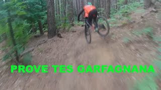
Videos of Garfagnana Mountain Bike


Recent Trail Reports
| status | trail | date | condition | info | user |
|---|---|---|---|---|---|
| Martinella DH | Oct 21, 2026 @ 10:11pm (Europe/Rome) Oct 21, 2026 | Wet | MoniCm0CQH | ||
| Sopranella | Oct 21, 2026 @ 10:10pm (Europe/Rome) Oct 21, 2026 | Wet | MoniCm0CQH | ||
| Sentiero della Contessa | Oct 4, 2026 @ 9:57am (Europe/San_Marino) Oct 4, 2026 | Dry | Giobike73 | ||
| CAI 74 | Oct 4, 2026 @ 9:57am (Europe/San_Marino) Oct 4, 2026 | Variable | Giobike73 | ||
| Mt. Castellino - Sella Del Prado | Sep 12, 2026 @ 9:44am (Europe/San_Marino) Sep 12, 2026 | Dry | boicmtb | ||
| Il Ponce | Aug 29, 2026 @ 8:02pm (Europe/Rome) Aug 29, 2026 | Unknown | Fattori | ||
| Strada Forestale Passo di Pradarena - Rifreddola | Jul 28, 2026 @ 8:48am (Europe/San_Marino) Jul 27, 2026 | Dry | Giobike73 | ||
| Grappa | Aug 15, 2026 @ 9:53am (Europe/San_Marino) Aug 15, 2026 | Ideal | SjeambecK | ||
| Accesso Al Grappa | Aug 15, 2026 @ 9:53am (Europe/San_Marino) Aug 15, 2026 | Variable | SjeambecK | ||
| Accesso Trail Il Ponce | Aug 15, 2026 @ 9:53am (Europe/San_Marino) Aug 15, 2026 | Variable | SjeambecK |
Activity Feed
| username | action | type | title | date |
|---|---|---|---|---|
| MoniCm0CQH | add | report | activity #106337439 and 1 more | Oct 21, 2026 @ 1:10pm Oct 21, 2026 |
| MoniCm0CQH | ridden | trail | activity #106337376 and 1 more | Oct 21, 2026 @ 1:09pm Oct 21, 2026 |
| pnilnonno | add | photo | activity #106266884 | Oct 20, 2026 @ 8:50am Oct 20, 2026 |
| days-on-trails | wishlist | trail | activity #105675279 and 4 more | Oct 11, 2026 @ 6:42am Oct 11, 2026 |
| DiscoSnow | wishlist | route | activity #105551802 | Oct 9, 2026 @ 1:45pm Oct 9, 2026 |
Recent Comments
| username | type | title | comment | date |
|---|---|---|---|---|
| trail | chiuso!!!! | Aug 29, 2026 @ 11:04am Aug 29, 2026 | ||
| report | vv | Jun 13, 2026 @ 11:44am Jun 13, 2026 | ||
| report | ciao credo che questa foto non sia del... | Jun 13, 2026 @ 2:42am Jun 13, 2026 | ||
| trail | Percorrendolo da San Pellegrino verso il passo... | May 8, 2026 @ 1:09pm May 8, 2026 | ||
| trail | Fantastico percorso. La salita richiede ottima... | May 8, 2026 @ 1:05pm May 8, 2026 |
Nearby Areas
| name | distance | ||||
|---|---|---|---|---|---|
| Sillico Trail Area | 5 | 13 | 3.9 km | ||
| Ciocco Bike Circle | 4 | 7 km | |||
| Alpe di Cusna Bike Park | 2 | 4 | 8.1 km | ||
| Gallicano | 3 | 5 | 8.3 km | ||
| Sant'Annapelago | 2 | 8.4 km |
Local Badges
-

Completionist0 awarded

Activity Type Stats
| activitytype | trails | distance | descent | descent distance | total vertical | rating | global rank | state rank | photos | reports | routes | activity logs |
|---|---|---|---|---|---|---|---|---|---|---|---|---|
| Mountain Bike | 110 | 138 miles | 49,255 ft | 78 miles | 5,348 ft | #1,205 | #32 | 169 | 291 | 15 | 1,335 | |
| E-Bike | 102 | 134 miles | 46,873 ft | 76 miles | 5,335 ft | #130 | #18 | 44 | 283 | 14 | 394 | |
| Gravel Bike | 40 | 69 miles | 11,591 ft | 28 miles | 4,662 ft | #9,484 | #456 | 3 | 9 | |||
| Adaptive Bike | 5 | 10 miles | 1,535 ft | 5 miles | 2,959 ft | #9,486 | #457 | 21 | ||||
| Winter Fat Bike | 6 | 17 miles | 3,812 ft | 9 miles | 3,465 ft | #9,484 | #456 | 2 | ||||
| Horse | 59 | 79 miles | 22,867 ft | 40 miles | 5,335 ft | #221 | #6 | 29 | ||||
| Hike | 104 | 131 miles | 47,113 ft | 75 miles | 5,348 ft | #1,200 | #32 | 6 | 288 | 1 | 97 | |
| Trail Running | 101 | 129 miles | 47,372 ft | 75 miles | 5,348 ft | #667 | #17 | 290 | 1 | 12 | ||
| Dirtbike/Moto | 9 | 13 miles | 6,713 ft | 10 miles | 4,078 ft | #238 | #3 | 5 | ||||
| ATV/ORV/OHV | 7 | 6 miles | 4,692 ft | 6 miles | 4,078 ft | #168 | #4 | 5 | ||||
| Snowshoe | 1 | |||||||||||
| Backcountry Ski | 1 | 1 | ||||||||||
| Nordic Ski | 1 |
Frequently Asked Questions
▼
What are the highest rated mountain biking trails in Garfagnana?
The highest rated mountain biking trails in Garfagnana are:
- Leone70 (4.4/5)
- CAI 74 (4.2/5)
- Fonte Dell'Amore (4.2/5)
- Foce Di Terrarossa (4.2/5)
- Sorgente Di Lamarossa (4.1/5)
▼
Where can I park to ride in Garfagnana?
There are 4 parking locations listed in Garfagnana. The most popular parking spots are: View all parking and trailhead locations on the map to plan your visit.
▼
What is the longest trail in Garfagnana?
The longest trail in Garfagnana is Scorticata at 3.0 miles. View all trails sorted by distance.
▼
What are the best & highest rated hiking trails in Garfagnana?
The best hiking trails in Garfagnana are: View all hiking trails sorted by popularity score.
▼
What are the best & highest rated trail running trails in Garfagnana?
The best trail running trails in Garfagnana are: View all trail running trails sorted by popularity score.
▼
What are the best & highest rated dirtbiking trails in Garfagnana?
The best dirtbiking trails in Garfagnana are: View all dirtbiking trails sorted by popularity score.
▼
How many trails are in Garfagnana?
Garfagnana has a total of 111 trails. Of those, 110 are designated for mountain biking. Browse top mountain biking trails in Garfagnana to find detailed information including difficulty ratings, distances, and trail conditions.
▼
Which trail has the most elevation gain in Garfagnana?
The trail with the most elevation gain in Garfagnana is Campaiana - Bocca Di Scala with 1,407 ft of elevation gain. View all trails sorted by elevation gain.
▼
Which trail has the most elevation descent in Garfagnana?
The trail with the most elevation descent in Garfagnana is Monte Prunese - Le Selve di Metello with 2,043 ft of elevation descent. View all trails sorted by elevation descent.
▼
What activities are most popular in Garfagnana?
Garfagnana supports the following activities: Mountain Biking, E-Biking, Horseback, Hiking, Trail Running, Dirtbiking, ATVing/Offroading.
▼
What are the steepest mountain biking trails in Garfagnana?
The steepest mountain biking trail in Garfagnana is PierUgo Climb with an average grade of 16.4%. View all trails sorted by grade.
▼
Are there any trails with scenic viewpoints in Garfagnana?
Yes, there are 4 scenic viewpoints marked along trails in Garfagnana. Some popular viewpoints include: Explore more points of interest to find trails with the best views.
▼
Are the trails open in Garfagnana?
The overall region status for Garfagnana is Minor Issue / Yellow. Out of 74 trails:
- Clear / Green: 51
- Minor Issue / Yellow: 15
- Significant Issue / Amber: 7
- Closed: 1
▼
What are the trail conditions in Garfagnana?
Based on trail reports from the past week in Garfagnana:
- Wet: 2 trails
▼
Can I ride an ebike in Garfagnana?
Yes, Garfagnana supports e-bike riding. There are 102 trails in Garfagnana that allow e-bikes. Check the e-bike trails listing for specific trail access details and any local regulations.
▼
What are the most popular mountain biking routes in Garfagnana?
The most popular mountain biking routes in Garfagnana are: View all mountain biking routes in Garfagnana.
▼
What are the most popular Strava Segments in Garfagnana?
The most popular Strava segments in Garfagnana are:
- Via Pergola Climb (671 athletes)
- Fontanone - Sella Di Campaiana (523 athletes)
- Via Strada Per Campaiana Climb (504 athletes)
▼
What trails are closed in Garfagnana?
There are currently 1 closed trails in Garfagnana. The breakdown of all trail statuses is:
- Clear / Green: 51
- Minor Issue / Yellow: 15
- Significant Issue / Amber: 7
- Closed: 1
▼
What are the most popular mountain biking trails in Garfagnana?
The most popular mountain biking trails in Garfagnana are: View all mountain biking trails sorted by popularity.
▼
What are the best beginner ride trails in Garfagnana?
The best beginner mountain biking trails in Garfagnana are:
- Ponte Ferroviario Della Villetta (5/5)
- Villetta - Giappone (4/5)
- Sorgente Di Lamarossa (5/5)
Activities
Trails
Points of Interest
- Oasi Lamastrone Lodge
- Osteria da Stella (Locanda/Ristorante) Other
- Big Bench #367 Metello Viewpoint
- Passo della Comunella Other
- Ponte Ferroviario Della Villetta Sight
- Rifugio Bocca Di Scala Lodge
- Rifugio Bocca Di Scala Lodge
- Mt. Asinara Summit
- Mt. Prado Summit
- Omini di Pietra della Paduletta Viewpoint
- By effeffe
 & contributors
- Admins: DanielePracchia
- #33708 - 5,163 views
- garfagnana activity log | embed map of Garfagnana mountain bike trails | garfagnana mountain biking points of interest
Downloading of trail gps tracks in kml & gpx formats is enabled for Garfagnana.
You must login to download files.
