close
-
Layers w
- Weather Layers
- Pro
- Pro
- Pro
- Pro
- Pro
- Pro
- More Layers
- Pro
- Pro
- Pro
- Pro
-
Upgrade to

3D
Trail Conditions
- Unknown
- Snow Groomed
- Snow Packed
- Snow Covered
- Snow Cover Partial
- Freeze/thaw Cycle
- Icy
- Prevalent Mud
- Wet
- Variable
- Ideal
- Dry
- Very Dry
Trail Flow (Ridden Direction)
Trailforks scans users ridelogs to determine the most popular direction each trail is ridden. A good flowing trail network will have most trails flowing in a single direction according to their intension.
The colour categories are based on what percentage of riders are riding a trail in its intended direction.
The colour categories are based on what percentage of riders are riding a trail in its intended direction.
- > 96%
- > 90%
- > 80%
- > 70%
- > 50%
- < 50%
- bi-directional trail
- no data
Trail Last Ridden
Trailforks scans ridelogs to determine the last time a trail was ridden.
- < 2 days
- < 1 week
- < 2 weeks
- < 1 month
- < 6 months
- > 6 months
Trail Ridden Direction
The intended direction a trail should be ridden.
- Downhill Only
- Downhill Primary
- Both Directions
- Uphill Primary
- Uphill Only
- One Direction
Contribute Details
Colors indicate trail is missing specified detail.
- Description
- Photos
- Description & Photos
- Videos
Trail Popularity ?
Trailforks scans ridelogs to determine which trails are ridden the most in the last 9 months.
Trails are compared with nearby trails in the same city region with a possible 25 colour shades.
Think of this as a heatmap, more rides = more kinetic energy = warmer colors.
- most popular
- popular
- less popular
- not popular
ATV/ORV/OHV Filter
Max Vehicle Width
inches
US Cell Coverage
Legend

Radar Time
Activity Recordings
Trailforks uses anonymized public activity data.
?
Activity Recordings
Trailforks uses anonymized public activity data.
?
Personal Heatmap
▶
Activity Types
all
/
none
▶
Options
2
Date range
month
–
Winter Trails
Warning
A routing network for winter maps does not exist. Selecting trails using the winter trails layer has been disabled.
Missing Trails
Most Popular
Least Popular
Trails are colored based on popularity. The more popular a trail is, the more red. Less popular trails trend towards green.
Jump Magnitude Heatmap
Heatmap of where riders jump on trails. Zoom in to see individual jumps, click circles to view jump details.
BC Backroad Status
![map legend]()
Service Road Atlas is a free to use, community-driven service for viewing and creating reports on the numerous back-country service roads around B.C. and Alberta.

Slope Aspect
Direction the slope faces
Trails Deemphasized
Trails are shown in grey.
Only show trails with no bike usage.
Suggested Layers
Based on selected activity type
Save the current map location and zoom level as your default home location whenever this page is loaded.
Save
No description for Gdów has been added yet!
Login or register to submit one.
This region uses the Uk/Euro style trail grading system.
Activities Click to view
- Mountain Bike
49 trails
- E-Bike
29 trails
- Adaptive Bike
0 trails
- Winter Fat Bike
0 trails
- Horse
4 trails
- Hike
49 trails
- Trail Running
48 trails
Region Details
- 30
- 9
- 8
- 2
Region Status
Caution as of Jan 10, 2026Stats
- Avg Trail Rating
- Trails (view details)
- 50
- Trails Mountain Bike
- 49
- Trails E-Bike
- 29
- Trails Horse
- 4
- Trails Hike
- 49
- Trails Trail Running
- 48
- Trails Dirtbike/Moto
- 3
- Trails Observed Trials
- 1
- Trails ATV/ORV/OHV
- 2
- Total Distance
- 26 miles
- Total Descent Distance
- 11 miles
- Total Descent
- 3,015 ft
- Total Vertical
- 555 ft
- Highest Trailhead
- 1,245 ft
- Reports
- 35
- Photos
- 18
- Ridden Counter
- 38
Sub Regions
-
Hucisko
- 2
- 3
- 1
Popular Gdów Mountain Biking Trails
• 5 ★ 0.0 • 2,927 ft • 29 ft • 2 •
Less popular green difficulty singletrack. This mountain bike primary trail can be used both directions and has a easy overall physical rating with a 29 ft blue climb. Trail visibility is always easy to follow. On average it takes 3 minutes to complete this trail.
• 5 ★ 0.0 • 1,745 ft • 3 ft • 1 •
Less popular green difficulty singletrack. This mountain bike primary trail can be used both directions and has a easy overall physical rating with a 3 ft blue climb. Trail visibility is always easy to follow.
• 5 ★ 0.0 • 1,847 ft • 11 ft • 1 •
Leśna droga + singiel wiodące pomiędzy neolitycznymi kurhanami Jawczyc.
• 100 ★ 0.0 • 1,125 ft • 0 ft • 1 •
Popular blue difficulty singletrack. This mountain bike primary trail can be used both directions and has a easy overall physical rating with a 0 ft blue climb. Trail visibility is always easy to follow. On average it takes minutes to complete this trail.
• 5 ★ 0.0 • 1,946 ft • 0 ft • 1 •
Less popular blue difficulty singletrack. This mountain bike primary trail can be used both directions and has a easy overall physical rating with a 0 ft blue climb. Trail visibility is always easy to follow.
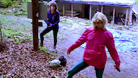
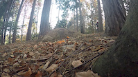
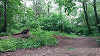
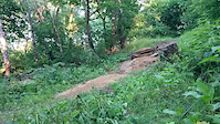
Photos of Gdów Mountain Bike
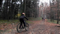
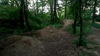
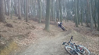
Videos of Gdów Mountain Bike
trail: Powrót
0:52 |
51 |
Jul 1, 2019
trail: Hopka
0:13 |
21 |
Jan 18, 2019
trail: Hopka
0:04 |
12 |
Jan 18, 2019

trail: Kraków
0:30 |
5 |
Feb 8, 2017
trail: Hopka
0:06 |
20 |
Jun 16, 2016
trail: Hopka
0:16 |
12 |
Jun 16, 2016
trail: Hopka
0:06 |
14 |
Jun 16, 2016
trail: Powrót
0:30 |
201 |
Mar 28, 2016
Recent Trail Reports
| status | trail | date | condition | info | user |
|---|---|---|---|---|---|
| Nad Wsią | Nov 25, 2024 @ 8:49am Nov 25, 2024 | Wet | sebasg3r | ||
| Ciemny Iglasty | Feb 24, 2024 @ 10:10pm Feb 24, 2024 | Prevalent Mud | sebasg3r | ||
| Dwór | Feb 24, 2024 @ 10:10pm Feb 24, 2024 | Prevalent Mud | sebasg3r | ||
| Pod Lasem | Feb 24, 2024 @ 3:14am Feb 24, 2024 | Prevalent Mud | sebasg3r | ||
| Krzesło | Apr 24, 2021 @ 1:41am Apr 24, 2021 | Wet | Rafinio | ||
| Działy | Apr 24, 2021 @ 1:41am Apr 24, 2021 | Wet | Rafinio | ||
| Żeleńskich | Apr 23, 2021 @ 10:48pm Apr 23, 2021 | Variable | sebasg3r | ||
| Kurhanowy | Apr 23, 2021 @ 10:46pm Apr 23, 2021 | Variable | sebasg3r | ||
| Wieśniak Drive | Mar 30, 2021 @ 11:46am Mar 30, 2021 | Variable | Rafinio | ||
| Podrudnik | Mar 14, 2021 @ 8:22am Mar 14, 2021 | Wet | Rafinio |
Activity Feed
| username | action | type | title | date |
|---|---|---|---|---|
| trailforks | add | video | activity #97716756 | Jun 24, 2026 @ 12:26pm Jun 24, 2026 |
| trailforks | add | video | activity #94756082 | May 15, 2026 @ 10:00am May 15, 2026 |
| trailforks | add | video | activity #72918993 | Jun 2, 2025 @ 12:00am Jun 2, 2025 |
| trailforks | add | video | activity #72875710 | Jun 1, 2025 @ 11:00am Jun 1, 2025 |
| sebasg3r | add | report | activity #62395045 | Nov 28, 2024 @ 4:48am Nov 28, 2024 |
Recent Comments
| username | type | title | comment | date |
|---|---|---|---|---|
| trail | To nie jest singletrack, ale szeroka droga... | May 22, 2023 @ 12:23am May 22, 2023 | ||
| trail | To nie jest singletrack, ale szeroka droga... | May 22, 2023 @ 12:23am May 22, 2023 | ||
| trail | To nie jest singletrack, ale szeroka droga... | May 22, 2023 @ 12:23am May 22, 2023 | ||
| trail | To nie jest singletrack, ale szeroka droga... | May 22, 2023 @ 12:17am May 22, 2023 | ||
| trail | To nie jest singletrack, ale szeroka droga... | May 22, 2023 @ 12:16am May 22, 2023 |
Local Badges
-

Epic Mountain Bike Climb 2k1 awarded -

Climbing 10k Badge3 awarded -

Mountain Biking 100k Badge0 awarded -

Epic Ride Descent 2k1 awarded -

Descent 10k Badge3 awarded -

Descent 100k Badge0 awarded
Activity Type Stats
| activitytype | trails | distance | descent | descent distance | total vertical | rating | global rank | state rank | photos | reports | routes | ridelogs |
|---|---|---|---|---|---|---|---|---|---|---|---|---|
| Mountain Bike | 49 | 26 miles | 3,015 ft | 11 miles | 554 ft | #7,604 | #204 | 18 | 35 | 551 | ||
| E-Bike | 29 | 15 miles | 1,175 ft | 5 miles | 554 ft | #5,186 | #374 | 25 | 30 | |||
| Horse | 4 | 2 miles | 217 ft | 3,796 ft | 443 ft | #1,955 | #283 | 17 | ||||
| Hike | 49 | 26 miles | 2,818 ft | 10 miles | 554 ft | #6,389 | #122 | 35 | 16 | |||
| Trail Running | 48 | 26 miles | 2,818 ft | 10 miles | 554 ft | #5,920 | #115 | 35 | ||||
| Dirtbike/Moto | 3 | 2 miles | 554 ft | 1 mile | 358 ft | 17 | ||||||
| Observed Trials | 1 | 1 mile | 203 ft | 4,114 ft | 190 ft | 2 | ||||||
| ATV/ORV/OHV | 2 | 1,368 ft | 154 ft | 13 |
Frequently Asked Questions About Gdów
▼
What are the best places to ride in Gdów?
Gdów has 1 areas to explore for mountain biking. The top rated areas are:
▼
What are the highest rated mountain biking trails in Gdów?
The highest rated mountain biking trails in Gdów are:
- Nad Wsią (0/5)
- Hopka (0/5)
- Grobowiec (0/5)
- Nad Łąkami (0/5)
- Ciemny Iglasty (0/5)
▼
What is the best time of the year to ride in Gdów?
Based on ride log data, the most popular months to ride in Gdów are:
- February (1 activities)
- December (1 activities)
▼
Where can I park to ride in Gdów?
There are 6 parking locations listed in Gdów. The most popular parking spots are: View all parking and trailhead locations on the map to plan your visit.
- By sebasg3r & contributors
- Admins: apply
- #41699 - 951 views
- gdów activity log | embed map of Gdów mountain bike trails | gdów mountain biking points of interest
Downloading of trail gps tracks in kml & gpx formats is enabled for Gdów.
You must login to download files.