close
-
Layers w
- Weather Layers
- Pro
- Pro
- Pro
- Pro
- Pro
- Pro
- More Layers
- Pro
- Pro
- Pro
- Pro
-
Upgrade to

3D
Trail Conditions
- Unknown
- Snow Groomed
- Snow Packed
- Snow Covered
- Snow Cover Partial
- Freeze/thaw Cycle
- Icy
- Prevalent Mud
- Wet
- Variable
- Ideal
- Dry
- Very Dry
Trail Flow (Ridden Direction)
Trailforks scans users ridelogs to determine the most popular direction each trail is ridden. A good flowing trail network will have most trails flowing in a single direction according to their intension.
The colour categories are based on what percentage of riders are riding a trail in its intended direction.
The colour categories are based on what percentage of riders are riding a trail in its intended direction.
- > 96%
- > 90%
- > 80%
- > 70%
- > 50%
- < 50%
- bi-directional trail
- no data
Trail Last Ridden
Trailforks scans ridelogs to determine the last time a trail was ridden.
- < 2 days
- < 1 week
- < 2 weeks
- < 1 month
- < 6 months
- > 6 months
Trail Ridden Direction
The intended direction a trail should be ridden.
- Downhill Only
- Downhill Primary
- Both Directions
- Uphill Primary
- Uphill Only
- One Direction
Contribute Details
Colors indicate trail is missing specified detail.
- Description
- Photos
- Description & Photos
- Videos
Trail Popularity ?
Trailforks scans ridelogs to determine which trails are ridden the most in the last 9 months.
Trails are compared with nearby trails in the same city region with a possible 25 colour shades.
Think of this as a heatmap, more rides = more kinetic energy = warmer colors.
- most popular
- popular
- less popular
- not popular
ATV/ORV/OHV Filter
Max Vehicle Width
inches
US Cell Coverage
Legend

Radar Time
Activity Recordings
Trailforks uses anonymized public activity data.
?
Activity Recordings
Trailforks uses anonymized public activity data.
?
Personal Heatmap
▶
Activity Types
all
/
none
▶
Options
2
Date range
month
–
Winter Trails
Warning
A routing network for winter maps does not exist. Selecting trails using the winter trails layer has been disabled.
Missing Trails
Most Popular
Least Popular
Trails are colored based on popularity. The more popular a trail is, the more red. Less popular trails trend towards green.
Jump Magnitude Heatmap
Heatmap of where riders jump on trails. Zoom in to see individual jumps, click circles to view jump details.
BC Backroad Status
![map legend]()
Service Road Atlas is a free to use, community-driven service for viewing and creating reports on the numerous back-country service roads around B.C. and Alberta.

Slope Aspect
Direction the slope faces
Trails Deemphasized
Trails are shown in grey.
Only show trails with no bike usage.
Suggested Layers
Based on selected activity type
Save the current map location and zoom level as your default home location whenever this page is loaded.
Save
No description for Gray has been added yet!
Login or register to submit one.
Activities Click to view
- Mountain Bike
46 trails
- E-Bike
44 trails
- Adaptive Bike
0 trails
- Hike
30 trails
- Trail Running
29 trails
Region Details
- 11
- 9
- 24
- 1
- 1
Region Status
Open as of May 24, 2026Local Trail Association
Stats
- Avg Trail Rating
- Trails (view details)
- 46
- Trails Mountain Bike
- 46
- Trails E-Bike
- 44
- Trails Hike
- 30
- Trails Trail Running
- 29
- Trails ATV/ORV/OHV
- 1
- Trails Snowshoe
- 1
- Trails Backcountry Ski
- 1
- Total Distance
- 19 miles
- Total Descent
- 1,805 ft
- Total Vertical
- 222 ft
- Highest Trailhead
- 486 ft
- Reports
- 119
- Photos
- 30
- Ridden Counter
- 6,856
Sub Regions
-
Libby Hill Trails
- 9
- 24
- 1
- 1
Popular Gray Mountain Biking Trails
• 100 ★ 5.0 • 1,047 ft • 0 ft • 508 •
1 of 3 downhill oriented trails with steep descents and jumps. This trail is downhill only.
• 100 ★ 5.0 • 804 ft • 0 ft • 319 •
Jump/flow trail built in 2021 (updated in 2023) with doubles and berms all rollable and modest in size. New extension below this trail, Libby Thrill, was built in 2022 and continues from this trail after crossing the doubletrack at the...
• 100 ★ 4.7 • 892 ft • 0 ft • 315 •
This is a double black jump trail. These jumps are considerably larger than . Please walk the trail before riding to make sure all landings are clear and to scope the jumps before taking the leap. PLEASE DO NOT WALK OR BIKE UP THE...
• 90 ★ 0.0 • 1,798 ft • 112 ft • 299 •
Popular green difficulty singletrack. This mountain bike primary trail can be used both directions. On average it takes 4 minutes to complete this trail.
• 70 ★ 0.0 • 3,402 ft • 68 ft • 275 •
Fast and fun downhill from the top or easy climb from the bottom.
• 65 ★ 5.0 • 1,138 ft • 0 ft • 270 •
2 of 3 downhill oriented trails. This trail is climbable but YIELD to downhill riders. There's doubletrack at the bottom that could be taken back to the top of these trails.
Gray Mountain Bike Routes
• 5 miles • 894 ft • 31 •
• 5 miles • 543 ft • 31 •
• 3 miles • 339 ft • 17 •
• 7 miles • 723 ft • 24 •
• 6 miles • 758 ft • 16 •
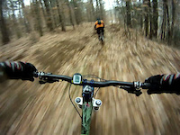
Photos of Gray Mountain Bike
Videos of Gray Mountain Bike

trail: Hidden Gem
3:10 |
500 |
Aug 15, 2017
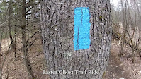
trail: Ghost
2:15 |
305 |
Apr 8, 2012

trail: Squirrel
0:54 |
81 |
Dec 10, 2011

trail: Squirrel
0:53 |
59 |
Nov 20, 2011
trail: Squirrel
2:27 |
109 |
Nov 20, 2011

trail: Squirrel
2:26 |
76 |
Nov 15, 2011
trail: Squirrel
0:04 |
103 |
Nov 14, 2011

trail: Squirrel
0:35 |
64 |
Nov 14, 2011
Recent Trail Reports
| status | trail | date | condition | info | user |
|---|---|---|---|---|---|
| Fox #3 | May 24, 2026 @ 7:56am (America/New_York) May 24, 2026 | Dry | Ben3756 | ||
| Libby Thrills | May 23, 2026 @ 6:54pm (America/New_York) May 23, 2026 | Dry | Ben3756 | ||
| Fox #1 | May 23, 2026 @ 6:52pm (America/New_York) May 23, 2026 | Dry | Ben3756 | ||
| Libby Chill | Apr 14, 2026 @ 1:42pm (America/New_York) Apr 14, 2026 | Variable | mgrohman | ||
| Mink | Apr 14, 2026 @ 1:42pm (America/New_York) Apr 14, 2026 | Ideal | mgrohman | ||
| Opportunity | Jul 22, 2025 @ 9:55am Jul 22, 2025 | Ideal | SemperGumby | ||
| Harold Libbey | Jul 22, 2025 @ 9:55am Jul 22, 2025 | Dry | SemperGumby | ||
| Lynx | Jul 22, 2025 @ 9:55am Jul 22, 2025 | Dry | SemperGumby | ||
| Outback | Jul 22, 2025 @ 7:53am Jul 22, 2025 | Wet | SemperGumby | ||
| Fox #2 | Nov 11, 2024 @ 3:09pm Nov 11, 2024 | Variable | mgrohman |
Activity Feed
| username | action | type | title | date |
|---|---|---|---|---|
| Ben3756 | add | report | activity #95397333 | May 24, 2026 @ 4:56am May 24, 2026 |
| Ben3756 | add | report | activity #95361831 and 1 more | May 23, 2026 @ 3:52pm May 23, 2026 |
| xBsXwB | add | report | activity #94576916 | May 12, 2026 @ 12:19pm May 12, 2026 |
| mgrohman | add | report | activity #92654439 and 3 more | Apr 15, 2026 @ 5:49am Apr 15, 2026 |
| SamtV4L0 | wishlist | region | activity #89410800 | Feb 23, 2026 @ 6:29am Feb 23, 2026 |
Recent Comments
| username | type | title | comment | date |
|---|---|---|---|---|
| trail | Worth your time | Mar 24, 2025 @ 9:00am Mar 24, 2025 | ||
| trail | This trail seems to have been abandoned. | Oct 23, 2024 @ 6:48am Oct 23, 2024 | ||
| trail | Disused. Trees down. Lots. | Sep 11, 2024 @ 2:43pm Sep 11, 2024 | ||
| report | The Secret Trail, Secret Trail Loop, and... | Mar 29, 2024 @ 4:38am Mar 29, 2024 | ||
| trail | To clarify the Secret trail is open and... | Feb 14, 2024 @ 4:40am Feb 14, 2024 |
Local Badges
-

Epic Mountain Bike Climb 2k0 awarded -

Climbing 10k Badge3 awarded -

Mountain Biking 100k Badge0 awarded -

Epic Ride Descent 2k0 awarded -

Descent 10k Badge3 awarded -

Descent 100k Badge0 awarded
Activity Type Stats
| activitytype | trails | distance | descent | descent distance | total vertical | rating | global rank | state rank | photos | reports | routes | ridelogs |
|---|---|---|---|---|---|---|---|---|---|---|---|---|
| Mountain Bike | 46 | 19 miles | 1,804 ft | 7 miles | 223 ft | #3,211 | #1,102 | 30 | 119 | 1 | 3,039 | |
| E-Bike | 44 | 18 miles | 1,683 ft | 7 miles | 180 ft | #4,927 | #1,549 | 105 | 50 | |||
| Hike | 30 | 15 miles | 1,214 ft | 6 miles | 213 ft | #8,972 | #3,157 | 102 | 112 | |||
| Trail Running | 29 | 14 miles | 1,214 ft | 6 miles | 213 ft | #8,657 | #2,896 | 102 | 39 | |||
| ATV/ORV/OHV | 1 | 2 miles | 128 ft | 5,243 ft | 112 ft | 7 | 1 | |||||
| Snowshoe | 1 | 3,228 ft | 46 ft | 1,453 ft | 36 ft | 6 | ||||||
| Backcountry Ski | 1 | 3,228 ft | 46 ft | 1,453 ft | 36 ft | 4 |
Frequently Asked Questions About Gray
▼
What are the best places to ride in Gray?
Gray has 1 areas to explore for mountain biking. The top rated areas are:
▼
What are the highest rated mountain biking trails in Gray?
The highest rated mountain biking trails in Gray are:
- Libby Thrills (4.2/5)
- Fox #1 (4.1/5)
- Fox #2 (4.1/5)
- Fox #3 (4.1/5)
- Libby Chill (4.1/5)
▼
What is the best time of the year to ride in Gray?
Based on ride log data, the most popular months to ride in Gray are:
- July (62 activities)
- May (60 activities)
- September (49 activities)
▼
Where can I park to ride in Gray?
There are 1 parking locations listed in Gray. The most popular parking spots are:
- By obiwanknope
 & contributors
 - Admins: NEMBAEXEC, GP NEMBA
- #6295 - 3,366 views
- gray activity log | embed map of Gray mountain bike trails | gray mountain biking points of interest
Downloading of trail gps tracks in kml & gpx formats is enabled for Gray.
You must login to download files.