close
-
Layers w
- Weather Layers
- Pro
- Pro
- Pro
- Pro
- Pro
- Pro
- More Layers
- Pro
- Pro
- Pro
- Pro
-
Upgrade to

3D
Trail Conditions
- Unknown
- Snow Groomed
- Snow Packed
- Snow Covered
- Snow Cover Partial
- Freeze/thaw Cycle
- Icy
- Prevalent Mud
- Wet
- Variable
- Ideal
- Dry
- Very Dry
Trail Flow (Ridden Direction)
Trailforks scans users ridelogs to determine the most popular direction each trail is ridden. A good flowing trail network will have most trails flowing in a single direction according to their intension.
The colour categories are based on what percentage of riders are riding a trail in its intended direction.
The colour categories are based on what percentage of riders are riding a trail in its intended direction.
- > 96%
- > 90%
- > 80%
- > 70%
- > 50%
- < 50%
- bi-directional trail
- no data
Trail Last Ridden
Trailforks scans ridelogs to determine the last time a trail was ridden.
- < 2 days
- < 1 week
- < 2 weeks
- < 1 month
- < 6 months
- > 6 months
Trail Ridden Direction
The intended direction a trail should be ridden.
- Downhill Only
- Downhill Primary
- Both Directions
- Uphill Primary
- Uphill Only
- One Direction
Contribute Details
Colors indicate trail is missing specified detail.
- Description
- Photos
- Description & Photos
- Videos
Trail Popularity ?
Trailforks scans ridelogs to determine which trails are ridden the most in the last 9 months.
Trails are compared with nearby trails in the same city region with a possible 25 colour shades.
Think of this as a heatmap, more rides = more kinetic energy = warmer colors.
- most popular
- popular
- less popular
- not popular
ATV/ORV/OHV Filter
Max Vehicle Width
inches
US Cell Coverage
Legend

Radar Time
Activity Recordings
Trailforks uses anonymized public activity data.
?
Activity Recordings
Trailforks uses anonymized public activity data.
?
Personal Heatmap
▶
Activity Types
all
/
none
▶
Options
2
Date range
month
–
Winter Trails
Warning
A routing network for winter maps does not exist. Selecting trails using the winter trails layer has been disabled.
Missing Trails
Most Popular
Least Popular
Trails are colored based on popularity. The more popular a trail is, the more red. Less popular trails trend towards green.
Jump Magnitude Heatmap
Heatmap of where riders jump on trails. Zoom in to see individual jumps, click circles to view jump details.
BC Backroad Status
![map legend]()
Service Road Atlas is a free to use, community-driven service for viewing and creating reports on the numerous back-country service roads around B.C. and Alberta.

Slope Aspect
Direction the slope faces
Trails Deemphasized
Trails are shown in grey.
Only show trails with no bike usage.
Suggested Layers
Based on selected activity type
Save the current map location and zoom level as your default home location whenever this page is loaded.
Save
No description for Gresse-en-Vercors has been added yet!
Login or register to submit one.
This region uses the Uk/Euro style trail grading system.
Activities Click to view
- Mountain Bike
48 trails
- E-Bike
47 trails
- Adaptive Bike
- Hike
32 trails
- Trail Running
32 trails
Region Details
- 16
- 1
- 12
- 12
- 3
Region Status
Open as of Nov 9, 2025Stats
- Avg Trail Rating
- Trails (view details)
- 44
- Trails Mountain Bike
- 48
- Trails E-Bike
- 47
- Trails Hike
- 32
- Trails Trail Running
- 32
- Total Distance
- 6 miles
- Total Descent Distance
- 4 miles
- Total Descent
- 4,001 ft
- Total Vertical
- 1,372 ft
- Highest Trailhead
- 5,472 ft
- Reports
- 27
- Photos
- 6
- Ridden Counter
- 140
Popular Gresse-en-Vercors Mountain Biking Trails
• 100 ★ 5.0 • 1,709 ft • 0 ft • 8 •
Trail enduro shapé, dans la bonne terre quelques racines. La première partie est la pente avec des bons virages. La seconde partie est plus rapide avec moins de pente mais toujours très fun avec quelques petits sauts. EN : Shaped...
• 95 ★ 4.0 • 2,510 ft • 0 ft • 6 •
Trail enduro plutot fun, ca commence par quelques virages avant de passer sur un pont en bois suivi d'une relance. La seconde moitié a toujours un bon flow avec des virages dans la terre et quelques racines. A rather fun enduro trail,...
• 95 ★ 0.0 • 3,501 ft • 605 ft • 5 • • hike
Popular red difficulty singletrack. This hike primary trail can be used both directions. Trail visibility is always easy to follow.
• 90 ★ 5.0 • 1,345 ft • 5 ft • 4 •
Le Trail commence par un petite relance puis ca roule plutot rapidement dans la bonne terre entre les sapins. The trail starts with a short uphill part and then it's fast the loam between the trees.
• 75 ★ 0.0 • 3,488 ft • 142 ft • 3 • • hike
Popular blue difficulty singletrack. This hike primary trail can be used downhill primary. Trail visibility is always easy to follow.
• 80 ★ 0.0 • 1 mile • 91 ft • 3 • • hike
Popular red difficulty singletrack. This hike primary trail can be used both directions.
• 75 ★ 5.0 • 646 ft • 0 ft • 3 •
Trail avec un bon flow dans la pente et des petits appuis pour nous rattraper, à la frontière entre rouge et noir, le tout dans la bonne terre et quelques racines. Trail with good flow on the slope and small supports to catch us, on...
• 65 ★ 0.0 • 499 ft • 0 ft • 3 •
Moderately popular blue difficulty singletrack. This mountain bike primary trail can be used downhill only. It features berm. Trail visibility is always easy to follow.
Videos of Gresse-en-Vercors Mountain Bike
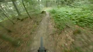
trail: Tourtel Twist
0:42 |
22 |
Jul 3, 2025 , Gresse-en-Vercors
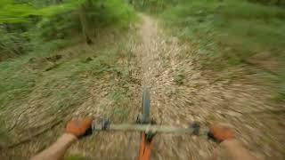
trail: Rince Cochon
2:37 |
35 |
Jul 3, 2025 , Gresse-en-Vercors
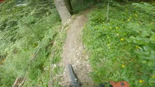
trail: Délirium
2:00 |
65 |
Jul 3, 2025 , Gresse-en-Vercors
Recent Trail Reports
| status | trail | date | condition | info | user |
|---|---|---|---|---|---|
| Tourtel Twist | Nov 9, 2025 @ 9:31am (Europe/Monaco) Nov 9, 2025 | Wet | thomasguerin | ||
| Délirium | Nov 9, 2025 @ 9:31am (Europe/Monaco) Nov 9, 2025 | Wet | thomasguerin | ||
| Baconet | Nov 9, 2025 @ 9:31am (Europe/Monaco) Nov 9, 2025 | Ideal | thomasguerin | ||
| L'Aup Chauplane | Oct 25, 2025 @ 9:27am (Europe/Monaco) Oct 25, 2025 | Variable | thomasguerin | ||
| Somme Longue | Oct 25, 2025 @ 9:27am (Europe/Monaco) Oct 25, 2025 | Wet | thomasguerin | ||
| Triolache | Oct 4, 2025 @ 9:38am (Europe/Monaco) Oct 4, 2025 | Ideal | thomasguerin | ||
| Ravin du Barri | Oct 4, 2025 @ 9:38am (Europe/Monaco) Oct 4, 2025 | Ideal | thomasguerin | ||
| Quinquambaye UpHill | Oct 4, 2025 @ 9:38am (Europe/Monaco) Oct 4, 2025 | Ideal | thomasguerin | ||
| Maximator | Sep 7, 2025 @ 10:10am Sep 7, 2025 | Variable | provencemb B MTB Co | ||
| Les Cotes Upper | Sep 7, 2025 @ 10:08am Sep 7, 2025 | Ideal | provencemb B MTB Co |
Activity Feed
| username | action | type | title | date |
|---|---|---|---|---|
| provencemb | update | trail | activity #95241984 | May 22, 2026 @ 7:48am May 22, 2026 |
| thomasguerin | add | report | activity #83853020 and 2 more | Nov 9, 2025 @ 7:07am Nov 9, 2025 |
| thomasguerin | add | photo | activity #83276355 and 1 more | Oct 30, 2025 @ 11:32am Oct 30, 2025 |
| provencemb | like | report | activity #83039814 | Oct 26, 2025 @ 3:56am Oct 26, 2025 |
| thomasguerin | add | report | activity #82977567 and 1 more | Oct 25, 2025 @ 6:26am Oct 25, 2025 |
Recent Comments
| username | type | title | comment | date |
|---|---|---|---|---|
| trail | Faire preuve de courage sur la dernière... | Aug 16, 2025 @ 1:25am Aug 16, 2025 | ||
| trail | Attention trail non entretenu, à éviter,... | Aug 16, 2025 @ 1:22am Aug 16, 2025 | ||
| trail | Coupe de bois pour création d'un champs pour... | Jul 19, 2024 @ 3:30am Jul 19, 2024 |
Local Badges
-

Epic Mountain Bike Climb 2k0 awarded -

Climbing 10k Badge0 awarded -

Mountain Biking 100k Badge0 awarded -

Epic Ride Descent 2k0 awarded -

Descent 10k Badge0 awarded -

Descent 100k Badge0 awarded
Activity Type Stats
| activitytype | trails | distance | descent | descent distance | total vertical | rating | global rank | state rank | photos | reports | routes | ridelogs |
|---|---|---|---|---|---|---|---|---|---|---|---|---|
| Mountain Bike | 48 | 6 miles | 3,999 ft | 4 miles | 1,371 ft | #8,737 | #514 | 6 | 27 | 40 | ||
| E-Bike | 47 | 6 miles | 3,999 ft | 4 miles | 1,371 ft | #5,912 | #422 | 27 | 2 | |||
| Hike | 32 | 3 miles | 991 ft | 1 mile | 1,237 ft | #9,288 | #433 | 26 | 21 | |||
| Trail Running | 32 | 3 miles | 991 ft | 1 mile | 1,237 ft | #10,321 | #544 | 26 | 6 |
Frequently Asked Questions About Gresse-en-Vercors
▼
What are the highest rated mountain biking trails in Gresse-en-Vercors?
The highest rated mountain biking trails in Gresse-en-Vercors are:
- Délirium (4.1/5)
- Tourtel Twist (4.1/5)
- Maximator (4.1/5)
- Rince Cochon (4/5)
- Les Cotes (4/5)
▼
Where can I park to ride in Gresse-en-Vercors?
There are 4 parking locations listed in Gresse-en-Vercors. The most popular parking spots are: View all parking and trailhead locations on the map to plan your visit.
▼
What is the longest trail in Gresse-en-Vercors?
The longest trail in Gresse-en-Vercors is Baconet at 1.4 miles. View all trails sorted by distance.
▼
What are the best & highest rated hiking trails in Gresse-en-Vercors?
The best hiking trails in Gresse-en-Vercors are: View all hiking trails sorted by popularity score.
Activities
Trails
Points of Interest
- By provencemb
 B MTB Co & contributors
 - Admins: B MTB Co, JordiBN, Whipperman
- #67382 - 439 views
- gresse-en-vercors activity log | embed map of Gresse-en-Vercors mountain bike trails | gresse-en-vercors mountain biking points of interest
Downloading of trail gps tracks in kml & gpx formats is enabled for Gresse-en-Vercors.
You must login to download files.