close
-
Layers w
- Weather Layers
- Pro
- Pro
- Pro
- Pro
- Pro
- Pro
- More Layers
- Pro
- Pro
- Pro
- Pro
-
Upgrade to

3D
Trail Conditions
- Unknown
- Snow Groomed
- Snow Packed
- Snow Covered
- Snow Cover Partial
- Freeze/thaw Cycle
- Icy
- Prevalent Mud
- Wet
- Variable
- Ideal
- Dry
- Very Dry
Trail Flow (Ridden Direction)
Trailforks scans users ridelogs to determine the most popular direction each trail is ridden. A good flowing trail network will have most trails flowing in a single direction according to their intension.
The colour categories are based on what percentage of riders are riding a trail in its intended direction.
The colour categories are based on what percentage of riders are riding a trail in its intended direction.
- > 96%
- > 90%
- > 80%
- > 70%
- > 50%
- < 50%
- bi-directional trail
- no data
Trail Last Ridden
Trailforks scans ridelogs to determine the last time a trail was ridden.
- < 2 days
- < 1 week
- < 2 weeks
- < 1 month
- < 6 months
- > 6 months
Trail Ridden Direction
The intended direction a trail should be ridden.
- Downhill Only
- Downhill Primary
- Both Directions
- Uphill Primary
- Uphill Only
- One Direction
Contribute Details
Colors indicate trail is missing specified detail.
- Description
- Photos
- Description & Photos
- Videos
Trail Popularity ?
Trailforks scans ridelogs to determine which trails are ridden the most in the last 9 months.
Trails are compared with nearby trails in the same city region with a possible 25 colour shades.
Think of this as a heatmap, more rides = more kinetic energy = warmer colors.
- most popular
- popular
- less popular
- not popular
ATV/ORV/OHV Filter
Max Vehicle Width
inches
US Cell Coverage
Legend

Radar Time
Activity Recordings
Trailforks uses anonymized public activity data.
?
Activity Recordings
Trailforks uses anonymized public activity data.
?
Personal Heatmap
▶
Activity Types
all
/
none
▶
Options
2
Date range
month
–
Winter Trails
Warning
A routing network for winter maps does not exist. Selecting trails using the winter trails layer has been disabled.
Missing Trails
Most Popular
Least Popular
Trails are colored based on popularity. The more popular a trail is, the more red. Less popular trails trend towards green.
Jump Magnitude Heatmap
Heatmap of where riders jump on trails. Zoom in to see individual jumps, click circles to view jump details.
BC Backroad Status
![map legend]()
Service Road Atlas is a free to use, community-driven service for viewing and creating reports on the numerous back-country service roads around B.C. and Alberta.

Slope Aspect
Direction the slope faces
Trails Deemphasized
Trails are shown in grey.
Only show trails with no bike usage.
Suggested Layers
Based on selected activity type
Save the current map location and zoom level as your default home location whenever this page is loaded.
Save
No description for Grindelwald has been added yet!
Login or register to submit one.
This region uses the Uk/Euro style trail grading system.
Activities Click to view
- Mountain Bike
55 trails
- E-Bike
52 trails
- Gravel Bike
0 trails
- Adaptive Bike
0 trails
- Hike
55 trails
- Trail Running
55 trails
Region Details
- 13
- 14
- 13
- 14
- 1
Region Status
Open as of Jun 28, 2026Stats
- Avg Trail Rating
- Trails (view details)
- 57
- Trails Mountain Bike
- 55
- Trails E-Bike
- 52
- Trails Hike
- 55
- Trails Trail Running
- 55
- Total Distance
- 57 miles
- Total Descent Distance
- 36 miles
- Total Descent
- 27,533 ft
- Total Vertical
- 5,333 ft
- Highest Trailhead
- 7,647 ft
- Reports
- 259
- Photos
- 139
- Ridden Counter
- 8,118
Popular Grindelwald Mountain Biking Trails
• 100 ★ 3.6 • 1,555 ft • 0 ft • 338 •
Nice singletrack, flow at the start, and then full of roots, and to finish a steep part like a WC track !
• 95 ★ 4.2 • 2 miles • 4 ft • 318 •
Great views from Bachalpsee and all the way down to Restaurant . Worth stopping for a cold drink or something to eat on the super terrace.
• 100 ★ 4.8 • 3,760 ft • 89 ft • 297 •
Fun traverse through forest. Also popular with hikers
• 95 ★ 4.3 • 2,979 ft • 0 ft • 259 •
Highly rated popular blue difficulty singletrack. This multi-use trail can be used downhill primary. On average it takes 7 minutes to complete this trail.
• 90 ★ 4.7 • 492 ft • 0 ft • 176 •
Popular green difficulty singletrack. This mountain bike primary trail can be used downhill primary. On average it takes minutes to complete this trail.
• 85 ★ 4.3 • 1,791 ft • 0 ft • 155 •
Loose track with gravel, easy and fun to ride, watch out for hikers !
• 65 ★ 4.3 • 2 miles • 564 ft • 133 • • hike
Nice crossing singletrack, nice view, some small tech parts, mostly easy.
• 75 ★ 4.0 • 994 ft • 0 ft • 106 •
Popular green difficulty singletrack. This multi-use trail can be used downhill primary. On average it takes 1 minutes to complete this trail.
Grindelwald Mountain Bike Routes
★ 4.0 • 19 miles • 4,687 ft • 7 • Loop •
This trail is suitable for trail beginners and advanced, but already require an advanced mountain bike...
16 miles • 4,132 ft • 1 •
A long but pleasant climb over asphalt roads and field paths leads you over Grosse Scheidegg to the ridge....
24 miles • 4,302 ft • 1 •
A special feature of this ascent is its proximity to the Eiger. Like a patron saint, he sits enthroned...
10 miles • 189 ft • 5 •
The trail starts at Kleine Scheidegg in front of Eiger, Moench & Jungfrau. The first part is a gentle...
26 miles • 5,109 ft • 1 •
But that's not all the highlights yet: Starting with a nice, long and easy ascent, which becomes very...
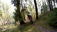
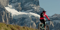
Photos of Grindelwald Mountain Bike
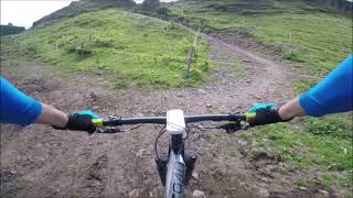
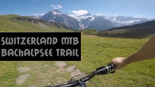
Videos of Grindelwald Mountain Bike
trail: Red Bank
0:58 |
310 |
Mar 28, 2020
trail: First-Bachalpsee
2:40 |
256 |
Apr 10, 2019
trail: Bachaplsee-Waldspitz B
10:29 |
491 |
Sep 13, 2021 , Grindelwald
trail: Bachaplsee-Waldspitz A
7:50 |
1049 |
Jan 2, 2019 , Grindelwald
Recent Trail Reports
Activity Feed
| username | action | type | title | date |
|---|---|---|---|---|
| Tuffany | ridden | trail | activity #98319449 | Jul 3, 2026 @ 1:45am Jul 3, 2026 |
| XysPzC | wishlist | route | activity #98247589 | Jul 1, 2026 @ 10:09pm Jul 1, 2026 |
| Bilbobuts | add | photo | activity #98061430 and 5 more | Jun 29, 2026 @ 7:16am Jun 29, 2026 |
| Marc1915 | add | report | activity #98006504 and 9 more | Jun 28, 2026 @ 10:57am Jun 28, 2026 |
| XysPzC | wishlist | route | activity #97944034 | Jun 27, 2026 @ 3:58pm Jun 27, 2026 |
Recent Comments
| username | type | title | comment | date |
|---|---|---|---|---|
| trail | Like a dream for all-mountain biker, good... | Jul 15, 2025 @ 12:56am Jul 15, 2025 | ||
| report | Dieser Trail ist laut Einheimische verboten | Jun 18, 2025 @ 9:00am Jun 18, 2025 | ||
| trail | Fun trail but gets difficult to follow the... | Aug 8, 2024 @ 11:08am Aug 8, 2024 | ||
| trail | More scenic option but some gravelly uphill... | Jul 23, 2024 @ 11:53am Jul 23, 2024 | ||
| trail | A lot of pushing uphill involved. We started... | Jul 23, 2024 @ 11:47am Jul 23, 2024 |
Local Badges
-

10 Green Trails33 awarded -

Epic Ride Climb 2k368 awarded -

Climbing 10k Badge33 awarded -

Climbing 100k Badge2 awarded -

Epic Ride Descent 2k442 awarded -

Descent 10k Badge44 awarded
Bike & Skill Parks
| name | type | city | rating |
|---|---|---|---|
| Grindelwald Ride | skill park | Grindelwald |
Activity Type Stats
| activitytype | trails | distance | descent | descent distance | total vertical | rating | global rank | state rank | photos | reports | routes | ridelogs |
|---|---|---|---|---|---|---|---|---|---|---|---|---|
| Mountain Bike | 55 | 54 miles | 26,263 ft | 34 miles | 5,335 ft | #1,437 | #16 | 128 | 259 | 8 | 3,252 | |
| E-Bike | 52 | 53 miles | 25,741 ft | 34 miles | 5,335 ft | #837 | #61 | 7 | 247 | 651 | ||
| Hike | 55 | 56 miles | 27,228 ft | 36 miles | 5,335 ft | #1,111 | #25 | 3 | 257 | 2,234 | ||
| Trail Running | 55 | 56 miles | 27,228 ft | 36 miles | 5,335 ft | #920 | #20 | 256 | 214 |
Frequently Asked Questions About Grindelwald
▼
What are the highest rated mountain biking trails in Grindelwald?
The highest rated mountain biking trails in Grindelwald are:
- Flat Track (4.5/5)
- Scheidegg-Derby S4 (4.2/5)
- G-Ride Park (4.2/5)
- WoodyChipsy (4.2/5)
- Bachaplsee-Waldspitz B (4.2/5)
▼
What is the best time of the year to ride in Grindelwald?
Based on ride log data, the most popular months to ride in Grindelwald are:
- July (47 activities)
- June (40 activities)
- August (39 activities)
▼
Where can I park to ride in Grindelwald?
There are 1 parking locations listed in Grindelwald. The most popular parking spots are:
▼
What is the longest trail in Grindelwald?
The longest trail in Grindelwald is Tschuggen at 3.4 miles. View all trails sorted by distance.
Activities
Trails
Points of Interest
- By Kiwifritz & contributors
- Admins: apply
- #14582 - 22,686 views
- grindelwald activity log | embed map of Grindelwald mountain bike trails | grindelwald mountain biking points of interest
Downloading of trail gps tracks in kml & gpx formats is enabled for Grindelwald.
You must login to download files.