close
-
Layers w
- Weather Layers
- Pro
- Pro
- Pro
- Pro
- Pro
- Pro
- More Layers
- Pro
- Pro
- Pro
- Pro
-
Upgrade to

3D
Trail Conditions
- Unknown
- Snow Groomed
- Snow Packed
- Snow Covered
- Snow Cover Partial
- Freeze/thaw Cycle
- Icy
- Prevalent Mud
- Wet
- Variable
- Ideal
- Dry
- Very Dry
Trail Flow (Ridden Direction)
Trailforks scans users ridelogs to determine the most popular direction each trail is ridden. A good flowing trail network will have most trails flowing in a single direction according to their intension.
The colour categories are based on what percentage of riders are riding a trail in its intended direction.
The colour categories are based on what percentage of riders are riding a trail in its intended direction.
- > 96%
- > 90%
- > 80%
- > 70%
- > 50%
- < 50%
- bi-directional trail
- no data
Trail Last Ridden
Trailforks scans ridelogs to determine the last time a trail was ridden.
- < 2 days
- < 1 week
- < 2 weeks
- < 1 month
- < 6 months
- > 6 months
Trail Ridden Direction
The intended direction a trail should be ridden.
- Downhill Only
- Downhill Primary
- Both Directions
- Uphill Primary
- Uphill Only
- One Direction
Contribute Details
Colors indicate trail is missing specified detail.
- Description
- Photos
- Description & Photos
- Videos
Trail Popularity ?
Trailforks scans ridelogs to determine which trails are ridden the most in the last 9 months.
Trails are compared with nearby trails in the same city region with a possible 25 colour shades.
Think of this as a heatmap, more rides = more kinetic energy = warmer colors.
- most popular
- popular
- less popular
- not popular
ATV/ORV/OHV Filter
Max Vehicle Width
inches
US Cell Coverage
Legend

Radar Time
Activity Recordings
Trailforks uses anonymized public activity data.
?
Activity Recordings
Trailforks uses anonymized public activity data.
?
Personal Heatmap
▶
Activity Types
all
/
none
▶
Options
2
Date range
month
–
Winter Trails
Warning
A routing network for winter maps does not exist. Selecting trails using the winter trails layer has been disabled.
Missing Trails
Most Popular
Least Popular
Trails are colored based on popularity. The more popular a trail is, the more red. Less popular trails trend towards green.
Jump Magnitude Heatmap
Heatmap of where riders jump on trails. Zoom in to see individual jumps, click circles to view jump details.
BC Backroad Status
![map legend]()
Service Road Atlas is a free to use, community-driven service for viewing and creating reports on the numerous back-country service roads around B.C. and Alberta.

Slope Aspect
Direction the slope faces
Trails Deemphasized
Trails are shown in grey.
Only show trails with no bike usage.
Suggested Layers
Based on selected activity type
Save the current map location and zoom level as your default home location whenever this page is loaded.
SavePopular Trail Networks
view all areas »
No description for Grosseto has been added yet!
Login or register to submit one.
This region uses the Uk/Euro style trail grading system.
Activities Click to view
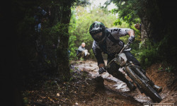
- Mountain Bike
1,049 trails
- E-Bike
910 trails
- Horse
85 trails
- Hike
777 trails
- Trail Running
774 trails
- Dirtbike/Moto
32 trails
- Observed Trials
0 trails
- ATV/ORV/OHV
23 trails
Region Details
- 358
- 69
- 258
- 278
- 65
- 15
- 1
Stats
- Avg Trail Rating
- Trails (view details)
- 1,064
- Trails Mountain Bike
- 1,053
- Trails E-Bike
- 910
- Trails Gravel Bike
- 109
- Trails Adaptive Bike
- 167
- Trails Winter Fat Bike
- 88
- Trails Horse
- 85
- Trails Hike
- 777
- Trails Trail Running
- 774
- Trails Dirtbike/Moto
- 32
- Trails ATV/ORV/OHV
- 23
- Trails Downhill Ski
- 2
- Trails Nordic Ski
- 2
- Total Distance
- 851 miles
- Total Descent
- 220,116 ft
- Total Vertical
- 5,672 ft
- Highest Trailhead
- 5,673 ft
- Reports
- 10,814
- Photos
- 1,689
- Ridden Counter
- 121,609
Articles
Throwback Thursday: EWS #1, Punta Ala - A Decade Later
May 18, 2023 from pinkbike.com
Today marks a decade since the Enduro World Series held its first ever race in Punta Ala, Italy.
Throwback Thursday: 22 Bikes from the First Ever EWS Race
Sep 26, 2019 from pinkbike.com
26" wheels, triple chainrings and Tracy Moseley winning on a prototype 29er. Things have definitely changed since the EWS first tackled the slopes...
Sub Regions
- Batignano (54)
- Boccheggiano (11)
- Castiglione della Pescaia (99)
- Castiglione Trail Park (31)
- Tirli Trail Park (17)
- Follonica (190)
- Montioni Trail Park (146)
- Gavorrano (83)
- Gavorrano Trail Area (24)
- Giuncarico trails (43)
- Pelagone Trail Area (8)
- Grosseto (3)
- isola del giglio (12)
- Massa Marittima (178)
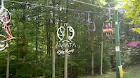
- Monte Amiata (75)
- Amiata Freeride Bike Resort (18)
- Santa Fiora (25)
- Monte Argentario (225)
- Montebuono Dispensa (1)
- Monterotondo Marittimo (20)
- Montieri (38)
- Pitigliano (GR) (5)
- Prata (14)
- Punta Ala (75)
- Bandite Trail Area (68)
- Roccastrada (6)
- Sassoforte trail park (1)
- Sticciano (31)
- Scarlino (18)
- Talamone (12)
- Tirli (1)
Popular Grosseto Mountain Biking Trails
• 100 ★ 4.9 • 1 mile • 575 ft • 1,359 •
Highly rated popular blue difficulty singletrack. This mountain bike primary trail can be used downhill only and has a hard overall physical rating with a 575 ft blue climb. It features berm, bridge and roller coaster. Trail visibility is always easy to follow. On average it takes 17 minutes to complete this trail.
• 100 ★ 4.7 • 1,752 ft • 145 ft • 1,334 •
nice uphill beside the white road to monte arsenti
• 100 ★ 4.8 • 3,445 ft • 0 ft • 1,310 •
Highly rated popular green difficulty singletrack. This mountain bike primary trail can be used downhill primary. It features berm. On average it takes 5 minutes to complete this trail.
• 95 ★ 4.7 • 2 miles • 27 ft • 1,281 •
Highly rated popular red difficulty singletrack. This mountain bike primary trail can be used downhill only. It features berm, drop, jump, ladder bridge, log ride, rock garden and roller coaster. Trail visibility is always easy to follow. On average it takes 20 minutes to complete this trail.
• 90 ★ 4.8 • 1 mile • 0 ft • 926 •
Highly rated popular blue difficulty singletrack. This mountain bike primary trail can be used downhill only. It features berm, drop, jump and rock garden. Trail visibility is always easy to follow. On average it takes 6 minutes to complete this trail.
• 95 ★ 4.7 • 2 miles • 7 ft • 858 •
Blue difficult trail with no hard features. Good for beginners and kids.
• 80 ★ 4.8 • 2 miles • 3 ft • 793 •
Highly rated popular black difficulty singletrack. This mountain bike primary trail can be used downhill only. It features berm and rock face. On average it takes 17 minutes to complete this trail.
Grosseto Mountain Bike Routes
★ 4.5 • 15 miles • 3,229 ft • 9 • Point to Point •
it is a connection between the village of Massa Marittima and Monterotondo through beautiful and wild...
★ 3.5 • 22 miles • 3,206 ft • 3 • Loop •
Punta Ala Trail Center's enduro trails are numerous and range from flowy and fast to steep and technical,...
★ 4.4 • 14 miles • 2,172 ft • 6 •
The perfect way to get a feel for some of the super-flowy trails in nearby Massa Marittima.
14 miles • 2,371 ft • 7 • Point to Point •
it is a connection between the village of Monterotondo and Massa Marittima through beautiful and wild...
17 miles • 2,098 ft • 5 •
Route in Park through the trails (13a) and (11a). Passage and visit on the tower of (old church)
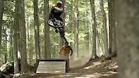
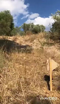
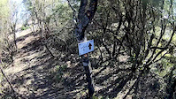
Photos of Grosseto Mountain Bike
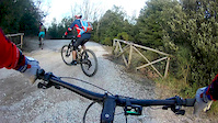
Videos of Grosseto Mountain Bike
featured
![Amiata Freeride Bike Resort]()
trail: 8volante High
2:12 |
251 |
Feb 18, 2019
trail: ChamperHill
0:48 |
48 |
Sep 11, 2021
trail: Crocicchio
2:35 |
95 |
Feb 17, 2020
trail: Insoglio
0:48 |
145 |
Apr 7, 2019
trail: Arsenti Up
3:10 |
103 |
Feb 17, 2019
trail: Fluida
3:31 |
207 |
May 25, 2018

trail: Termine 24
2:16 |
171 |
May 7, 2017
Current Trail Warnings
| status | trail | date | condition | user | info |
|---|---|---|---|---|---|
| Poggio Pinzi Monte Amiata | Jul 8, 2026 @ 1:31pm (Europe/Rome) Jul 8, 2026 | Unknown | Giuliano8399 | ||
| Poggio Pinzi Bis Monte Amiata | Jul 8, 2026 @ 1:30pm (Europe/Rome) Jul 8, 2026 | Unknown | Giuliano8399 | ||
| Querce Monte Argentario | Jul 6, 2026 @ 2:22pm (Europe/Rome) Jul 6, 2026 | Variable | gabriperego | Rovi ovunque e auto che blocca un... |
Recent Trail Reports
| status | trail | date | condition | info | user |
|---|---|---|---|---|---|
| Labbrata Monte Argentario | Jul 11, 2026 @ 8:04pm (Europe/Rome) 2 days | Dry | gabriperego | ||
| Emilio Monte Argentario | Jul 11, 2026 @ 8:03pm (Europe/Rome) 2 days | Ideal | gabriperego | ||
| Partemi Monte Argentario | Jul 11, 2026 @ 8:03pm (Europe/Rome) 2 days | Ideal | gabriperego | ||
| Miniere Monte Argentario | Jul 11, 2026 @ 8:02pm (Europe/Rome) 2 days | Dry | gabriperego | ||
| Via di Mezzo Monte Argentario | Jul 9, 2026 @ 6:50pm (Europe/Rome) Jul 9, 2026 | Ideal | gabriperego | ||
| Tramonto Trail Monte Argentario | Jul 9, 2026 @ 6:49pm (Europe/Rome) Jul 9, 2026 | Dry | gabriperego | ||
| Biancane DH lower Monterotondo trail park | Jul 9, 2026 @ 4:19pm (Europe/Rome) Jul 9, 2026 | Dry | FabianeiT4d4 | ||
| Biancane DH upper Monterotondo trail park | Jul 9, 2026 @ 4:18pm (Europe/Rome) Jul 9, 2026 | Dry | FabianeiT4d4 | ||
| Confine up Monterotondo trail park | Jul 9, 2026 @ 4:16pm (Europe/Rome) Jul 9, 2026 | Dry | FabianeiT4d4 | ||
| Buia Monterotondo trail park | Jul 9, 2026 @ 4:14pm (Europe/Rome) Jul 9, 2026 | Dry | FabianeiT4d4 |
Activity Feed
| username | action | type | title | date |
|---|---|---|---|---|
| matteo82 | comment | trail | activity #99107605 | Jul 13, 2026 @ 10:02am 2 hours |
| gabriperego | add | report | activity #98952754 and 3 more | Jul 11, 2026 @ 11:02am 2 days |
| GuidoBPKwq4 | vote | trail | activity #98804544 | Jul 9, 2026 @ 12:16pm Jul 9, 2026 |
| GuidoBPKwq4 | ridden | trail | activity #98804540 | Jul 9, 2026 @ 12:16pm Jul 9, 2026 |
| GuidoBPKwq4 | vote | trail | activity #98804137 and 8 more | Jul 9, 2026 @ 12:11pm Jul 9, 2026 |
Recent Comments
| username | type | title | comment | date |
|---|---|---|---|---|
| trail | Non riesco a trovare l’ingresso al sentiero... | Jul 13, 2026 @ 10:02am 2 hours | ||
| trail | 2 very steep parts in there that most likely... | Jul 9, 2026 @ 7:17am Jul 9, 2026 | ||
| trail | Dont bother. 0 star | Jul 9, 2026 @ 4:12am Jul 9, 2026 | ||
| trail | Wildschweine auf dem Trail! | Jul 8, 2026 @ 9:03am Jul 8, 2026 | ||
| trail | Nice flowy trail. Do it clockwise as... | Jul 8, 2026 @ 5:55am Jul 8, 2026 |
Local Badges
-

Monte Amiata 2k descend792 awarded -

Epic Mountain Bike Climb 2k0 awarded -

10 Blue Trails1 awarded -
Epic Mountain Bike Climb 2k0 awarded -
10 Blue Trails21 awarded -
Epic Mountain Bike Climb 2k1 awarded
Bike & Skill Parks
| name | type | city | rating |
|---|---|---|---|
| Amiata Freeride Bike Resort | bike park | Monte Amiata | |
| Pump Track Massa Vecchia | skill park | Massa Marittima | |
| Monterotondo pump track | skill park | Monterotondo Marittimo | |
| Skill Park Massa Vecchia | skill park | Massa Marittima | |
| Montieri bike school park | skill park | Montieri |
Local Trail Supporters
- PuntAla Camping Resort
- Schurter Trails, Bikeattac, Schurterbikeschool
![]()
![]()
![]()
![]()
![Tuscan Hill Enduro]()
Activity Type Stats
| activitytype | trails | distance | descent | descent distance | total vertical | rating | global rank | state rank | photos | reports | routes | ridelogs |
|---|---|---|---|---|---|---|---|---|---|---|---|---|
| Mountain Bike | 1,049 | 838 miles | 214,721 ft | 428 miles | 5,525 ft | 1,614 | 10,809 | 38 | 49,933 | |||
| E-Bike | 910 | 700 miles | 163,468 ft | 347 miles | 5,164 ft | 17 | 9,617 | 24 | 16,035 | |||
| Gravel Bike | 109 | 116 miles | 11,283 ft | 37 miles | 4,826 ft | 836 | 1 | 484 | ||||
| Adaptive Bike | 167 | 205 miles | 24,268 ft | 78 miles | 4,685 ft | 1,559 | 1 | 1 | ||||
| Winter Fat Bike | 88 | 72 miles | 6,765 ft | 29 miles | 4,751 ft | 243 | 1 | |||||
| Horse | 85 | 112 miles | 17,986 ft | 52 miles | 5,164 ft | 852 | 4 | |||||
| Hike | 777 | 684 miles | 143,035 ft | 314 miles | 5,673 ft | 6 | 9,367 | 2 | 894 | |||
| Trail Running | 774 | 681 miles | 143,848 ft | 315 miles | 5,669 ft | 9,374 | 2 | 609 | ||||
| Dirtbike/Moto | 32 | 57 miles | 5,955 ft | 19 miles | 4,678 ft | 766 | 1 | |||||
| ATV/ORV/OHV | 23 | 48 miles | 2,428 ft | 12 miles | 3,806 ft | 762 | 1 | |||||
| Downhill Ski | 2 | 1 mile | 1,289 ft | 1 mile | 784 ft | 2 | 10 | |||||
| Nordic Ski | 2 | 1 mile | 1,289 ft | 1 mile | 784 ft | 2 |
Frequently Asked Questions About Grosseto
▼
What are the best places to ride in Grosseto?
Grosseto has 17 areas to explore for mountain biking. The top rated areas are:
▼
What are the highest rated mountain biking trails in Grosseto?
The highest rated mountain biking trails in Grosseto are:
- Spaghetti Uphill (4.8/5)
- Senal (4.7/5)
- Canyon (4.7/5)
- Rock‘n Roll Queen (4.6/5)
- Insoglio (4.6/5)
▼
What is the best time of the year to ride in Grosseto?
Based on ride log data, the most popular months to ride in Grosseto are:
- June (386 activities)
- October (335 activities)
- August (311 activities)
▼
What is the longest trail in Grosseto?
The longest trail in Grosseto is Anello Rifugi at 5.3 miles. View all trails sorted by distance.
Activities
Trails
Points of Interest
- Parco naturalistico delle Biancane Viewpoint
- Capanno A2RG Other
- Croce Monumentale Viewpoint
- Valle dell'Inferno Viewpoint
- Punto Panoramico Viewpoint
- ripetitore Viewpoint
- Torre Argentiera Viewpoint
- Forte del Pozzarello Viewpoint
- Drop Scuola TTF
- MUBIA - geomuseo delle biancane Other
- Monte Amiata (5,676 ft)
- Corno di Bellaria (5,308 ft)
- Sierra (5,171 ft)
- By denitopia
 TRAILFORKS VTA & contributors
 - Admins: denitopia, marcoangeletti, cemoorelife, DanielePracchia
- #11653 - 12,048 views
- grosseto activity log | embed map of Grosseto mountain bike trails | grosseto mountain biking points of interest
Downloading of trail gps tracks in kml & gpx formats is enabled for Grosseto.
You must login to download files.