close
-
Layers w
- Weather Layers
- Pro
- Pro
- Pro
- Pro
- Pro
- Pro
- More Layers
- Pro
- Pro
- Pro
- Pro
-
Upgrade to

3D
Trail Conditions
- Unknown
- Snow Groomed
- Snow Packed
- Snow Covered
- Snow Cover Partial
- Freeze/thaw Cycle
- Icy
- Prevalent Mud
- Wet
- Variable
- Ideal
- Dry
- Very Dry
Trail Flow (Ridden Direction)
Trailforks scans users ridelogs to determine the most popular direction each trail is ridden. A good flowing trail network will have most trails flowing in a single direction according to their intension.
The colour categories are based on what percentage of riders are riding a trail in its intended direction.
The colour categories are based on what percentage of riders are riding a trail in its intended direction.
- > 96%
- > 90%
- > 80%
- > 70%
- > 50%
- < 50%
- bi-directional trail
- no data
Trail Last Ridden
Trailforks scans ridelogs to determine the last time a trail was ridden.
- < 2 days
- < 1 week
- < 2 weeks
- < 1 month
- < 6 months
- > 6 months
Trail Ridden Direction
The intended direction a trail should be ridden.
- Downhill Only
- Downhill Primary
- Both Directions
- Uphill Primary
- Uphill Only
- One Direction
Contribute Details
Colors indicate trail is missing specified detail.
- Description
- Photos
- Description & Photos
- Videos
Trail Popularity ?
Trailforks scans ridelogs to determine which trails are ridden the most in the last 9 months.
Trails are compared with nearby trails in the same city region with a possible 25 colour shades.
Think of this as a heatmap, more rides = more kinetic energy = warmer colors.
- most popular
- popular
- less popular
- not popular
ATV/ORV/OHV Filter
Max Vehicle Width
inches
US Cell Coverage
Legend

Radar Time
Activity Recordings
Trailforks uses anonymized public activity data.
?
Activity Recordings
Trailforks uses anonymized public activity data.
?
Personal Heatmap
▶
Activity Types
all
/
none
▶
Options
2
Date range
month
–
Winter Trails
Warning
A routing network for winter maps does not exist. Selecting trails using the winter trails layer has been disabled.
Missing Trails
Most Popular
Least Popular
Trails are colored based on popularity. The more popular a trail is, the more red. Less popular trails trend towards green.
Jump Magnitude Heatmap
Heatmap of where riders jump on trails. Zoom in to see individual jumps, click circles to view jump details.
BC Backroad Status
![map legend]()
Service Road Atlas is a free to use, community-driven service for viewing and creating reports on the numerous back-country service roads around B.C. and Alberta.

Slope Aspect
Direction the slope faces
Trails Deemphasized
Trails are shown in grey.
Only show trails with no bike usage.
Suggested Layers
Based on selected activity type
Save the current map location and zoom level as your default home location whenever this page is loaded.
Save
No description for Haifa has been added yet!
Login or register to submit one.
AKA: חיפה
This region uses the Uk/Euro style trail grading system.
Activities Click to view
- Mountain Bike
71 trails
- E-Bike
71 trails
- Gravel Bike
0 trails
- Adaptive Bike
0 trails
- Winter Fat Bike
0 trails
- Hike
73 trails
- Trail Running
71 trails
Region Details
- 12
- 18
- 30
- 10
Region Status
Open as of May 12, 2026Stats
- Avg Trail Rating
- Trails (view details)
- 75
- Trails Mountain Bike
- 71
- Trails E-Bike
- 71
- Trails Horse
- 2
- Trails Hike
- 73
- Trails Trail Running
- 71
- Trails Dirtbike/Moto
- 1
- Trails ATV/ORV/OHV
- 1
- Total Distance
- 54 miles
- Total Descent
- 14,289 ft
- Total Vertical
- 1,647 ft
- Highest Trailhead
- 1,710 ft
- Reports
- 268
- Photos
- 16
- Ridden Counter
- 3,923
Sub Regions
-
Mt. Carmel National Park
- 6
- 11
- 5
-
The Forester's House
- 12
- 18
- 4
Popular Haifa Mountain Biking Trails
• 65 ★ 4.7 • 1 mile • 307 ft • 102 •
Moderately popular blue difficulty singletrack. This multi-use trail can be used both directions and has a moderate overall physical rating with a 307 ft blue climb. On average it takes 18 minutes to complete this trail.
• 55 ★ 4.0 • 3,294 ft • 10 ft • 96 •
Moderately popular blue difficulty singletrack. This mountain bike primary trail can be used downhill primary and has a moderate overall physical rating with a 10 ft blue climb. On average it takes 3 minutes to complete this trail.
• 80 ★ 4.0 • 1,083 ft • 0 ft • 93 •
Popular blue difficulty singletrack. This mountain bike primary trail can be used downhill primary. On average it takes 1 minutes to complete this trail.
• 85 ★ 4.0 • 2,270 ft • 43 ft • 86 •
Popular blue difficulty singletrack. This mountain bike primary trail can be used downhill primary with a 43 ft blue climb. On average it takes 3 minutes to complete this trail.
• 50 ★ 3.8 • 1 mile • 0 ft • 85 •
Entry is a steep loose rain drain, cross a white dirt road into the trail that runs in a dry stream bed. There are various types of elements along the first part of the trail such as a short wall ride and some small drops. Later on...
• 50 ★ 4.0 • 1,831 ft • 0 ft • 83 •
Moderately popular red difficulty singletrack. This mountain bike primary trail can be used downhill primary with a 0 ft black diamond climb. On average it takes 5 minutes to complete this trail.
• 25 ★ 4.7 • 2 miles • 227 ft • 82 •
An excellent AM trail, very demanding on one hand, but highly rewarding on the other. One of the Highlights of the Carmel region, featuring tight technical sections, switchbacks, and rock gardens. Most of the trail is under the forest...
Photos of Haifa Mountain Bike
Videos of Haifa Mountain Bike
trail: Yagur Descender
3:12 |
301 |
Feb 29, 2016
2:06 |
432 |
Jun 27, 2014
trail: University slopes
5:58 |
183 |
Jun 5, 2022 , Haifa

trail: Shokef
10:23 |
222 |
Jul 7, 2009

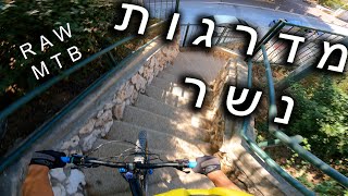
trail: טיילת הגשרים
0:25 |
281 |
Oct 26, 2020 , Haifa

trail: Urban Strairs DH
6:41 |
518 |
Oct 17, 2020 , Haifa

trail: Yagur Descender
4:48 |
581 |
Oct 17, 2020 , Haifa

trail: Shokef
6:43 |
629 |
Feb 22, 2020 , Haifa
Recent Trail Reports
| status | trail | date | condition | info | user |
|---|---|---|---|---|---|
| Pine View | May 13, 2026 @ 6:54am (Asia/Jerusalem) May 12, 2026 | Dry | Yakioz | ||
| Nachal Bustan 3 | Jan 30, 2026 @ 3:04pm (Asia/Jerusalem) Jan 30, 2026 | Wet | menibat | ||
| Sewerage system | Jan 2, 2026 @ 9:08am (Asia/Jerusalem) Jan 1, 2026 | Variable | ilialin | ||
| Dorot Way | Jan 2, 2026 @ 9:08am (Asia/Jerusalem) Jan 1, 2026 | Variable | ilialin | ||
| Antenna descender | Jan 2, 2026 @ 9:08am (Asia/Jerusalem) Jan 1, 2026 | Variable | ilialin | ||
| Rakafot - Damun | Jan 2, 2026 @ 9:08am (Asia/Jerusalem) Jan 1, 2026 | Variable | ilialin | ||
| Urban Strairs DH | Jul 8, 2025 @ 10:40am Jul 8, 2025 | Very Dry | noam864 | ||
| Short Finale | Jun 22, 2025 @ 5:46am Jun 22, 2025 | Dry | ilialin | ||
| Old Hai Bar | Jun 22, 2025 @ 5:46am Jun 22, 2025 | Dry | ilialin | ||
| Nahal Alon | May 25, 2025 @ 9:25am May 25, 2025 | Very Dry | Bigben80 |
Activity Feed
| username | action | type | title | date |
|---|---|---|---|---|
| Bigben80 | vote | trail | activity #98324148 | Jul 3, 2026 @ 4:43am 2 days |
| lpavel | ridden | trail | activity #98142339 | Jun 30, 2026 @ 10:48am Jun 30, 2026 |
| Frodo-collins | ridden | trail | activity #94966433 and 1 more | May 18, 2026 @ 3:39am May 18, 2026 |
| Yakioz | add | report | activity #94638144 | May 13, 2026 @ 10:53am May 13, 2026 |
| Bigben80 | vote | trail | activity #93644052 | Apr 29, 2026 @ 6:44am Apr 29, 2026 |
Recent Comments
| username | type | title | comment | date |
|---|---|---|---|---|
| trail | Definitely more red trail than blue | Sep 30, 2025 @ 10:39am Sep 30, 2025 | ||
| trail | Brutal ,technical ,rocky short Single... | Nov 28, 2023 @ 3:01am Nov 28, 2023 | ||
| report | Surface mud: sticky soil, slippy roots | Nov 6, 2020 @ 6:27am Nov 6, 2020 | ||
| report | wet but ridable | Jan 17, 2019 @ 4:11am Jan 17, 2019 | ||
| report | Red trails are not for beginners !!! | Sep 5, 2018 @ 9:33am Sep 5, 2018 |
Local Badges
-

Epic Ride Climb 2k54 awarded -

Climbing 10k Badge52 awarded -

Climbing 100k Badge8 awarded -

Epic Ride Descent 2k65 awarded -

Descent 10k Badge52 awarded -

Descent 100k Badge9 awarded
Bike & Skill Parks
| name | type | city | rating |
|---|---|---|---|
| Haifa Pump track | skill park | Haifa |
Activity Type Stats
| activitytype | trails | distance | descent | descent distance | total vertical | rating | global rank | state rank | photos | reports | routes | ridelogs |
|---|---|---|---|---|---|---|---|---|---|---|---|---|
| Mountain Bike | 71 | 49 miles | 11,808 ft | 27 miles | 1,647 ft | #1,156 | #1 | 14 | 268 | 9,460 | ||
| E-Bike | 71 | 50 miles | 12,700 ft | 28 miles | 1,647 ft | #314 | #1 | 1 | 258 | 1,434 | ||
| Horse | 2 | 15 miles | 1,801 ft | 7 miles | 535 ft | 39 | ||||||
| Hike | 73 | 53 miles | 13,704 ft | 29 miles | 1,647 ft | #1,421 | #1 | 1 | 275 | 503 | ||
| Trail Running | 71 | 52 miles | 12,782 ft | 28 miles | 1,627 ft | #1,098 | #1 | 275 | 144 | |||
| Dirtbike/Moto | 1 | 14 miles | 1,352 ft | 7 miles | 522 ft | 39 | 3 | |||||
| ATV/ORV/OHV | 1 | 14 miles | 1,352 ft | 7 miles | 522 ft | 39 |
Frequently Asked Questions About Haifa
▼
What are the best places to ride in Haifa?
Haifa has 2 areas to explore for mountain biking. The top rated areas are:
▼
What are the highest rated mountain biking trails in Haifa?
The highest rated mountain biking trails in Haifa are:
- Upper Nesher (4.2/5)
- Nahal Kelah (4.2/5)
- Yagur Descender (4.2/5)
- Andarta (4.1/5)
- Shokef Part A (4.1/5)
▼
What is the best time of the year to ride in Haifa?
Based on ride log data, the most popular months to ride in Haifa are:
- July (82 activities)
- June (68 activities)
- September (65 activities)
▼
Where can I park to ride in Haifa?
There are 5 parking locations listed in Haifa. The most popular parking spots are: View all parking and trailhead locations on the map to plan your visit.
Activities
Trails
Points of Interest
- By fuzzyBuzz & contributors
- Admins: ziv2102
- #5276 - 9,236 views
- haifa activity log | embed map of Haifa mountain bike trails | haifa mountain biking points of interest
Downloading of trail gps tracks in kml & gpx formats is enabled for Haifa.
You must login to download files.