close
-
Layers w
- Weather Layers
- Pro
- Pro
- Pro
- Pro
- Pro
- Pro
- More Layers
- Pro
- Pro
- Pro
- Pro
-
Upgrade to

3D
Trail Conditions
- Unknown
- Snow Groomed
- Snow Packed
- Snow Covered
- Snow Cover Partial
- Freeze/thaw Cycle
- Icy
- Prevalent Mud
- Wet
- Variable
- Ideal
- Dry
- Very Dry
Trail Flow (Ridden Direction)
Trailforks scans users activity logs to determine the most popular direction each trail is ridden. A good flowing trail network will have most trails flowing in a single direction according to their intension.
The colour categories are based on what percentage of users are riding a trail in its intended direction.
The colour categories are based on what percentage of users are riding a trail in its intended direction.
- > 96%
- > 90%
- > 80%
- > 70%
- > 50%
- < 50%
- bi-directional trail
- no data
Trail Last Ridden
Trailforks scans activity logs to determine the last time a trail was ridden.
- < 2 days
- < 1 week
- < 2 weeks
- < 1 month
- < 6 months
- > 6 months
Trail Ridden Direction
The intended direction a trail should be ridden.
- Downhill Only
- Downhill Primary
- Both Directions
- Uphill Primary
- Uphill Only
- One Direction
Contribute Details
Colors indicate trail is missing specified detail.
- Description
- Photos
- Description & Photos
- Videos
Trail Popularity ?
Trailforks scans activity logs to determine which trails are ridden the most in the last 9 months.
Trails are compared with nearby trails in the same city region with a possible 25 colour shades.
Think of this as a heatmap, more activities = more kinetic energy = warmer colors.
- most popular
- popular
- less popular
- not popular
ATV/ORV/OHV Filter
Max Vehicle Width
inches
US Cell Coverage
Legend

Radar Time
Activity Recordings
Trailforks uses anonymized public activity data.
?
Activity Recordings
Trailforks uses anonymized public activity data.
?
Personal Heatmap
▶
Activity Types
all
/
none
▶
Options
2
Date range
month
–
Winter Trails
Warning
A routing network for winter maps does not exist. Selecting trails using the winter trails layer has been disabled.
Missing Trails
Most Popular
Least Popular
Trails are colored based on popularity. The more popular a trail is, the more red. Less popular trails trend towards green.
Jump Magnitude Heatmap
Heatmap of where users jump on trails. Zoom in to see individual jumps, click circles to view jump details.
BC Backroad Status
![map legend]()
Service Road Atlas is a free to use, community-driven service for viewing and creating reports on the numerous back-country service roads around B.C. and Alberta.

Slope Aspect
Direction the slope faces
Trails Deemphasized
Trails are shown in grey.
Only show trails with no bike usage.
Suggested Layers
Based on selected activity type
Save the current map location and zoom level as your default home location whenever this page is loaded.
SaveThis region is Unsanctioned, Ride at your own Risk!
No description for Hemer has been added yet! Login or register to submit one.This region uses the Uk/Euro style trail grading system.
Activities Click to view
- Mountain Bike
28 trails
- E-Bike
28 trails
- Adaptive Bike
0 trails
- Winter Fat Bike
0 trails
- Hike
20 trails
- Trail Running
20 trails
Region Details
- 1
- 8
- 8
- 8
- 2
Region Status
Open as of Jul 26, 2026Stats
- Avg Trail Rating
- Trails (view details)
- 27
- Trails Mountain Bike
- 28
- Trails E-Bike
- 28
- Trails Hike
- 20
- Trails Trail Running
- 20
- Total Distance
- 11 miles
- Total Descent
- 8,529 ft
- Total Vertical
- 1,181 ft
- Highest Trailhead
- 1,779 ft
- Reports
- 383
- Photos
- 70
- Completed Counter
- 1,561
Popular Hemer Mountain Biking Trails
• 95 ★ 4.8 • 2,302 ft • 40 ft • 134 •
Technical rock trail where you wouldn't expect it at all. Great challenging Trail. Fast and raw at the top and tight and technical from mid to bottom.
• 90 ★ 4.8 • 1 mile • 64 ft • 114 •
Great Trail for everyone who has some experience on a Bike, some flow, some roots, some offcambers, some small jumps and very versatile.
• 85 ★ 5.0 • 5,250 ft • 11 ft • 103 •
Nice trail with some roots and some moderate jumps (mostly with chickenways). One of my favourites.
• 70 ★ 4.8 • 3,897 ft • 27 ft • 98 •
Natural single trail, the faster you go, the more difficult it gets.
• 5 ★ 4.9 • 2,192 ft • 4 ft • 72 •
Steep and gnarly..... but so much fun...... When riding this trail, please use the lower entry through .... and the to bypass the freshly planted trees and the protected area at the top.
• 5 ★ 4.4 • 3,937 ft • 9 ft • 69 •
Highly rated less popular red difficulty singletrack. This mountain bike primary trail. It features bridge. Exposure: Normal Injury Risk. Trail visibility is always easy to follow. On average it takes 6 minutes to complete this trail.
• 5 ★ 4.9 • 3,320 ft • 49 ft • 68 •
many many roots, choose your line wisely. Can get scary at high speeds ;-)
• 5 ★ 5.0 • 1,109 ft • 0 ft • 62 •
Pedal for the flow at the top. Steep mid section with some fast straights and tight turns. The lower section is more mellow again. But pay attention to the roots when it's wet, they can get really nasty. Use this Trail to enter the from...
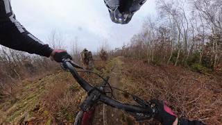
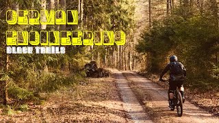
Photos of Hemer Mountain Bike
Videos of Hemer Mountain Bike
trail: Steinmännchen Trail
5:01 |
32 |
Feb 22, 2026 , Hemer

trail: (Hasi -) Goldigger
2:57 |
384 |
Mar 12, 2021 , Hemer

trail: Hasi Gold
2:57 |
370 |
Mar 12, 2021 , Hemer

trail: Straight Line
14:59 |
384 |
Jun 11, 2020 , Hemer

trail: Ants Trail
14:59 |
386 |
Jun 11, 2020 , Hemer

trail: Eastern Spice
14:59 |
229 |
Jun 11, 2020 , Hemer

trail: Tannennadelöhr
14:59 |
352 |
Jun 11, 2020 , Hemer
trail: Adam and ....
14:59 |
209 |
Jun 11, 2020 , Hemer
Recent Trail Reports
| status | trail | date | condition | info | user |
|---|---|---|---|---|---|
| Hangmen | Jul 26, 2026 @ 3:21pm (Europe/Berlin) Jul 26, 2026 | Dry | Stephan13 | ||
| Big "O" | Jun 1, 2026 @ 7:47am (Europe/Berlin) May 31, 2026 | Dry | markusro | ||
| Steinmännchen Trail | May 28, 2026 @ 7:48am (Europe/Berlin) May 27, 2026 | Ideal | markusro | ||
| Tannennadelöhr | Apr 29, 2026 @ 3:09pm (Europe/Berlin) Apr 29, 2026 | Dry | sourland-mapper | ||
| Big O 2a | Apr 26, 2026 @ 2:33pm (Europe/Berlin) Apr 26, 2026 | Ideal | sourland-mapper | ||
| Black Beauty | Apr 25, 2026 @ 12:48pm (Europe/Luxembourg) Apr 25, 2026 | Very Dry | RidewithRens | ||
| DownZumKreuz | Feb 9, 2026 @ 7:34am (Europe/Berlin) Feb 8, 2026 | Variable | markusro | ||
| FunLine | Feb 9, 2026 @ 7:28am (Europe/Berlin) Feb 8, 2026 | Variable | markusro | ||
| Road from Quarry | Oct 19, 2025 @ 1:57pm (Europe/Luxembourg) Oct 19, 2025 | Ideal | deba | ||
| Small Buttersack | Aug 20, 2025 @ 4:14pm Aug 20, 2025 | Dry | deba |
Activity Feed
| username | action | type | title | date |
|---|---|---|---|---|
| erikvandeburgt | wishlist | trail | activity #100322046 | Jul 29, 2026 @ 10:36pm 1 day |
| Stephan13 | add | report | activity #100048584 | Jul 26, 2026 @ 6:21am Jul 26, 2026 |
| Stephan13 | ridden | trail | activity #100048462 | Jul 26, 2026 @ 6:19am Jul 26, 2026 |
| update | event | activity #99311970 | Jul 16, 2026 @ 8:52am Jul 16, 2026 | |
| update | event | activity #98745004 | Jul 8, 2026 @ 4:07pm Jul 8, 2026 |
Recent Comments
| username | type | title | comment | date |
|---|---|---|---|---|
| trail | Im Unterenteil kurz Stücke vom harvester... | Mar 7, 2026 @ 2:06am Mar 7, 2026 | ||
| trail | Existiert nicht mehr. | Oct 12, 2025 @ 12:29am Oct 12, 2025 | ||
| trail | Wieder komplett fahrbar, teilweise neue Strecke | Jan 4, 2025 @ 7:56am Jan 4, 2025 | ||
| trail | Schöner breiter Trail , kann man auch bei... | Oct 30, 2024 @ 7:34am Oct 30, 2024 | ||
| trail | Gut befahrbar alles frei. | Jul 22, 2024 @ 12:43pm Jul 22, 2024 |
Local Badges
-

Epic Ride Climb 2k24 awarded -

Climbing 10k Badge27 awarded -

Climbing 100k Badge1 awarded -

Epic Ride Descent 2k23 awarded -

Descent 10k Badge29 awarded -

Descent 100k Badge1 awarded
Activity Type Stats
| activitytype | trails | distance | descent | descent distance | total vertical | rating | global rank | state rank | photos | reports | routes | activity logs |
|---|---|---|---|---|---|---|---|---|---|---|---|---|
| Mountain Bike | 28 | 11 miles | 8,530 ft | 10 miles | 1,181 ft | #3,058 | #32 | 68 | 383 | 2,648 | ||
| E-Bike | 28 | 11 miles | 8,530 ft | 10 miles | 1,181 ft | #2,430 | #42 | 2 | 236 | 698 | ||
| Hike | 20 | 9 miles | 5,771 ft | 7 miles | 1,181 ft | #5,323 | #53 | 337 | 165 | |||
| Trail Running | 20 | 9 miles | 5,771 ft | 7 miles | 1,181 ft | #4,727 | #49 | 337 | 4 |
Frequently Asked Questions About Hemer
▼
What are the highest rated mountain biking trails in Hemer?
The highest rated mountain biking trails in Hemer are:
- Big "O" (4.5/5)
- Rocky Forest (4.5/5)
- Straight Line (4.5/5)
- Steinmännchen Trail (4.5/5)
- Ants Trail (4.4/5)
▼
What is the best time of the year to ride in Hemer?
Based on activity log data, the most popular months to ride in Hemer are:
- July (42 activities)
- April (37 activities)
- March (31 activities)
▼
Where can I park to ride in Hemer?
▼
What is the longest trail in Hemer?
The longest trail in Hemer is Big "O" at 1.2 miles. View all trails sorted by distance.
Activities
Trails
Points of Interest
- By pleaseenternamehere
 TRAILFORKS & contributors
 - Admins: pleaseenternamehere
- #22123 - 12,596 views
- hemer activity log | embed map of Hemer mountain bike trails | hemer mountain biking points of interest
Downloading of trail gps tracks in kml & gpx formats is enabled for Hemer.
You must login to download files.