close
-
Layers w
- Weather Layers
- Pro
- Pro
- Pro
- Pro
- Pro
- Pro
- More Layers
- Pro
- Pro
- Pro
- Pro
-
Upgrade to

3D
Trail Conditions
- Unknown
- Snow Groomed
- Snow Packed
- Snow Covered
- Snow Cover Partial
- Freeze/thaw Cycle
- Icy
- Prevalent Mud
- Wet
- Variable
- Ideal
- Dry
- Very Dry
Trail Flow (Ridden Direction)
Trailforks scans users ridelogs to determine the most popular direction each trail is ridden. A good flowing trail network will have most trails flowing in a single direction according to their intension.
The colour categories are based on what percentage of riders are riding a trail in its intended direction.
The colour categories are based on what percentage of riders are riding a trail in its intended direction.
- > 96%
- > 90%
- > 80%
- > 70%
- > 50%
- < 50%
- bi-directional trail
- no data
Trail Last Ridden
Trailforks scans ridelogs to determine the last time a trail was ridden.
- < 2 days
- < 1 week
- < 2 weeks
- < 1 month
- < 6 months
- > 6 months
Trail Ridden Direction
The intended direction a trail should be ridden.
- Downhill Only
- Downhill Primary
- Both Directions
- Uphill Primary
- Uphill Only
- One Direction
Contribute Details
Colors indicate trail is missing specified detail.
- Description
- Photos
- Description & Photos
- Videos
Trail Popularity ?
Trailforks scans ridelogs to determine which trails are ridden the most in the last 9 months.
Trails are compared with nearby trails in the same city region with a possible 25 colour shades.
Think of this as a heatmap, more rides = more kinetic energy = warmer colors.
- most popular
- popular
- less popular
- not popular
ATV/ORV/OHV Filter
Max Vehicle Width
inches
US Cell Coverage
Legend

Radar Time
Activity Recordings
Trailforks uses anonymized public activity data.
?
Activity Recordings
Trailforks uses anonymized public activity data.
?
Personal Heatmap
▶
Activity Types
all
/
none
▶
Options
2
Date range
month
–
Winter Trails
Warning
A routing network for winter maps does not exist. Selecting trails using the winter trails layer has been disabled.
Missing Trails
Most Popular
Least Popular
Trails are colored based on popularity. The more popular a trail is, the more red. Less popular trails trend towards green.
Jump Magnitude Heatmap
Heatmap of where riders jump on trails. Zoom in to see individual jumps, click circles to view jump details.
BC Backroad Status
![map legend]()
Service Road Atlas is a free to use, community-driven service for viewing and creating reports on the numerous back-country service roads around B.C. and Alberta.

Slope Aspect
Direction the slope faces
Trails Deemphasized
Trails are shown in grey.
Only show trails with no bike usage.
Suggested Layers
Based on selected activity type
Save the current map location and zoom level as your default home location whenever this page is loaded.
Save
No description for Hill has been added yet!
Login or register to submit one.
Activities Click to view
- Mountain Bike
15 trails
- Gravel Bike
2 trails
- Adaptive Bike
0 trails
- Hike
15 trails
- Trail Running
15 trails
Region Details
- 4
- 3
- 6
- 2
Region Status
Open as of Jun 16, 2026Stats
- Avg Trail Rating
- Trails (view details)
- 15
- Trails Mountain Bike
- 15
- Trails Gravel Bike
- 2
- Trails Hike
- 15
- Trails Trail Running
- 15
- Total Distance
- 11 miles
- Total Descent
- 2,171 ft
- Total Vertical
- 643 ft
- Highest Trailhead
- 1,718 ft
- Reports
- 95
- Photos
- 18
- Ridden Counter
- 2,262
Sub Regions
-
Page Hill
- 3
- 6
- 2
Popular Hill Mountain Biking Trails
• 80 ★ 5.0 • 3,497 ft • 0 ft • 240 •
Super sick downhill flow trail, and the main reason most people come ride here. Not marked as downhill only, but you would have to be insane to want to climb this. Starts in the woods on top of a hill, and then bursts out into a...
• 100 ★ 4.4 • 3,494 ft • 174 ft • 223 •
Popular blue difficulty singletrack. This mountain bike primary trail can be used both directions. On average it takes 13 minutes to complete this trail.
• 95 ★ 4.3 • 1,821 ft • 102 ft • 192 •
Popular green difficulty singletrack. This mountain bike primary trail. On average it takes 4 minutes to complete this trail.
• 90 ★ 4.0 • 2,526 ft • 37 ft • 186 •
Popular green difficulty singletrack. This mountain bike primary trail can be used both directions. On average it takes 5 minutes to complete this trail.
• 55 ★ 2.5 • 2 miles • 488 ft • 173 •
Moderately popular black diamond difficulty singletrack. This mountain bike primary trail can be used both directions. On average it takes 36 minutes to complete this trail.
• 35 ★ 4.0 • 4,442 ft • 87 ft • 158 •
Less popular blue difficulty singletrack. This mountain bike primary trail can be used both directions. On average it takes 8 minutes to complete this trail.
• 50 ★ 3.0 • 1,548 ft • 29 ft • 139 •
Moderately popular blue difficulty singletrack. This mountain bike primary trail can be used both directions. On average it takes 3 minutes to complete this trail.
Hill Mountain Bike Routes
6 miles • 910 ft • 5 •
Short loop from Clough. Not a ton of climbing and does Dude the wrong way. Maybe not fun, but will find out!
• 4 miles • 533 ft • 6 •
• 5 miles • 663 ft • 5 •
• 6 miles • 899 ft • 6 •
• 9 miles • 1,099 ft • 9 •
• 7 miles • 1,084 ft • 10 •
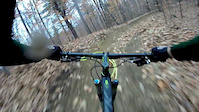
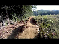
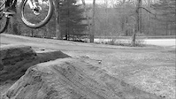
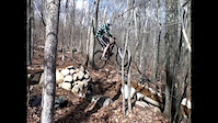
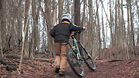
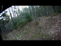
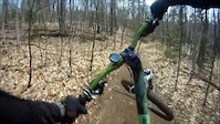
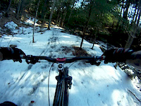
Photos of Hill Mountain Bike
Videos of Hill Mountain Bike
trail: Shock Therapy
2:59 |
362 |
Feb 17, 2017
trail: Shock Therapy
3:58 |
1933 |
Aug 10, 2014
trail: Spring
3:40 |
528 |
May 29, 2013
trail: Spring
0:24 |
246 |
Apr 1, 2013
trail: Spring
2:17 |
324 |
Mar 14, 2013
trail: Voltage
0:54 |
141 |
Apr 16, 2012
trail: Spring
0:23 |
97 |
Apr 7, 2012
trail: Spring
2:19 |
82 |
Mar 21, 2012
Recent Trail Reports
| status | trail | date | condition | info | user |
|---|---|---|---|---|---|
| Bug Out | Sep 27, 2025 @ 3:52pm (America/New_York) Sep 27, 2025 | Variable | Oldbikersam | ||
| Hydra | Sep 27, 2025 @ 3:52pm (America/New_York) Sep 27, 2025 | Ideal | Oldbikersam | ||
| Hard Hat | Sep 27, 2025 @ 3:52pm (America/New_York) Sep 27, 2025 | Ideal | Oldbikersam | ||
| Shock Therapy | Sep 27, 2025 @ 3:52pm (America/New_York) Sep 27, 2025 | Variable | Oldbikersam | ||
| Page Bypass | Sep 27, 2025 @ 3:52pm (America/New_York) Sep 27, 2025 | Variable | Oldbikersam | ||
| Spring | Sep 27, 2025 @ 3:52pm (America/New_York) Sep 27, 2025 | Variable | Oldbikersam | ||
| Access Road | Sep 27, 2025 @ 3:52pm (America/New_York) Sep 27, 2025 | Variable | Oldbikersam | ||
| Clough Road Connector | Sep 27, 2025 @ 3:52pm (America/New_York) Sep 27, 2025 | Variable | Oldbikersam | ||
| Bear Claw | Oct 4, 2023 @ 2:03pm Oct 4, 2023 | Ideal | grizzlyadamsdidhaveabeard | ||
| Voltage | Oct 4, 2023 @ 2:03pm Oct 4, 2023 | Ideal | grizzlyadamsdidhaveabeard |
Activity Feed
| username | action | type | title | date |
|---|---|---|---|---|
| Mike03079 | ridden | trail | activity #95879810 | May 30, 2026 @ 12:50pm May 30, 2026 |
| emrobertson44 | wishlist | trail | activity #95538085 | May 25, 2026 @ 6:44pm May 25, 2026 |
| emrobertson44 | wishlist | trail | activity #93321359 | Apr 24, 2026 @ 6:31pm Apr 24, 2026 |
| Mwv1987 | wishlist | region | activity #92595598 | Apr 14, 2026 @ 7:21am Apr 14, 2026 |
| CaptainSternn | wishlist | trail | activity #92070212 | Apr 6, 2026 @ 12:18pm Apr 6, 2026 |
Recent Comments
| username | type | title | comment | date |
|---|---|---|---|---|
| trail | Needs a lawnmower for the section off the... | May 27, 2024 @ 3:13pm May 27, 2024 | ||
| report | Okuikkuuuik | Aug 5, 2023 @ 11:52am Aug 5, 2023 | ||
| trail | Many of the berms could use a bit more... | May 13, 2023 @ 11:40am May 13, 2023 | ||
| report | That's country livin' | May 2, 2023 @ 1:20pm May 2, 2023 | ||
| report | Large tree down in one spot next to trail, a... | Apr 22, 2023 @ 5:34am Apr 22, 2023 |
Local Badges
-

Epic Ride Climb 2k5 awarded -

Climbing 10k Badge4 awarded -

Climbing 100k Badge1 awarded -

Epic Ride Descent 2k11 awarded -

Descent 10k Badge4 awarded -

Descent 100k Badge1 awarded
Local Trail Supporters
- Central NH NEMBA
Activity Type Stats
| activitytype | trails | distance | descent | descent distance | total vertical | rating | global rank | state rank | photos | reports | routes | ridelogs |
|---|---|---|---|---|---|---|---|---|---|---|---|---|
| Mountain Bike | 15 | 11 miles | 2,172 ft | 4 miles | 643 ft | #5,702 | #1,924 | 18 | 95 | 1 | 1,614 | |
| Gravel Bike | 2 | 4,892 ft | 177 ft | 2,195 ft | 351 ft | #744 | #1,238 | 4 | 3 | |||
| Hike | 15 | 11 miles | 2,172 ft | 4 miles | 643 ft | #10,711 | #3,819 | 92 | 32 | |||
| Trail Running | 15 | 11 miles | 2,172 ft | 4 miles | 643 ft | #10,222 | #3,494 | 92 | 3 |
Frequently Asked Questions About Hill
▼
What are the best places to ride in Hill?
Hill has 1 areas to explore for mountain biking. The top rated areas are:
▼
What are the highest rated mountain biking trails in Hill?
The highest rated mountain biking trails in Hill are:
- Shock Therapy (4.4/5)
- Bug Out (4.1/5)
- Bear Claw (4.1/5)
- Voltage (4.1/5)
- Hard Hat (4/5)
▼
What is the best time of the year to ride in Hill?
Based on ride log data, the most popular months to ride in Hill are:
- June (32 activities)
- September (19 activities)
- May (18 activities)
▼
Where can I park to ride in Hill?
There are 4 parking locations listed in Hill. The most popular parking spots are: View all parking and trailhead locations on the map to plan your visit.
Trails
Points of Interest
- By Greg-D
 PemiV NEMBA GWF & contributors
 - Admins: CNH NEMBA, SNH NEMBA, UWV
- #5075 - 2,147 views
- hill activity log | embed map of Hill mountain bike trails | hill mountain biking points of interest
Downloading of trail gps tracks in kml & gpx formats is enabled for Hill.
You must login to download files.