close
-
Layers w
- Weather Layers
- Pro
- Pro
- Pro
- Pro
- Pro
- Pro
- More Layers
- Pro
- Pro
- Pro
- Pro
-
Upgrade to

3D
Trail Conditions
- Unknown
- Snow Groomed
- Snow Packed
- Snow Covered
- Snow Cover Partial
- Freeze/thaw Cycle
- Icy
- Prevalent Mud
- Wet
- Variable
- Ideal
- Dry
- Very Dry
Trail Flow (Ridden Direction)
Trailforks scans users activity logs to determine the most popular direction each trail is ridden. A good flowing trail network will have most trails flowing in a single direction according to their intension.
The colour categories are based on what percentage of users are riding a trail in its intended direction.
The colour categories are based on what percentage of users are riding a trail in its intended direction.
- > 96%
- > 90%
- > 80%
- > 70%
- > 50%
- < 50%
- bi-directional trail
- no data
Trail Last Ridden
Trailforks scans activity logs to determine the last time a trail was ridden.
- < 2 days
- < 1 week
- < 2 weeks
- < 1 month
- < 6 months
- > 6 months
Trail Ridden Direction
The intended direction a trail should be ridden.
- Downhill Only
- Downhill Primary
- Both Directions
- Uphill Primary
- Uphill Only
- One Direction
Contribute Details
Colors indicate trail is missing specified detail.
- Description
- Photos
- Description & Photos
- Videos
Trail Popularity ?
Trailforks scans activity logs to determine which trails are ridden the most in the last 9 months.
Trails are compared with nearby trails in the same city region with a possible 25 colour shades.
Think of this as a heatmap, more activities = more kinetic energy = warmer colors.
- most popular
- popular
- less popular
- not popular
ATV/ORV/OHV Filter
Max Vehicle Width
inches
US Cell Coverage
Legend

Radar Time
Activity Recordings
Trailforks uses anonymized public activity data.
?
Activity Recordings
Trailforks uses anonymized public activity data.
?
Personal Heatmap
▶
Activity Types
all
/
none
▶
Options
2
Date range
month
–
Winter Trails
Warning
A routing network for winter maps does not exist. Selecting trails using the winter trails layer has been disabled.
Missing Trails
Most Popular
Least Popular
Trails are colored based on popularity. The more popular a trail is, the more red. Less popular trails trend towards green.
Jump Magnitude Heatmap
Heatmap of where users jump on trails. Zoom in to see individual jumps, click circles to view jump details.
BC Backroad Status
![map legend]()
Service Road Atlas is a free to use, community-driven service for viewing and creating reports on the numerous back-country service roads around B.C. and Alberta.

Slope Aspect
Direction the slope faces
Trails Deemphasized
Trails are shown in grey.
Only show trails with no bike usage.
Suggested Layers
Based on selected activity type
Save the current map location and zoom level as your default home location whenever this page is loaded.
Save
No description for Howick has been added yet!
Login or register to submit one.
Activities Click to view
- Mountain Bike
496 trails
- E-Bike
494 trails
- Gravel Bike
14 trails
- Hike
490 trails
- Trail Running
490 trails
Region Details
- 197
- 54
- 170
- 19
- 1
- 1
Region Status
Open as of 51 minsLocal Trail Association
Stats
- Avg Trail Rating
- Trails (view details)
- 442
- Trails Mountain Bike
- 496
- Trails E-Bike
- 494
- Trails Gravel Bike
- 14
- Trails Winter Fat Bike
- 16
- Trails Hike
- 490
- Trails Trail Running
- 490
- Total Distance
- 312 miles
- Total Descent
- 39,197 ft
- Total Vertical
- 2,180 ft
- Highest Trailhead
- 5,510 ft
- Reports
- 2,814
- Photos
- 42
- Completed Counter
- 20,198
Articles

Video: Building & Riding Sustainable Trails in South Africa in 'Soil Searching - Quiet Craftsman'
May 5, 2020 from pinkbike.com
Meet Hylton Turvey, a trail builder who finds inspiration in the shape of the land itself.
Sub Regions
-
Karkloof Country Club
- 54
- 170
- 20
- 1
- 1
Popular Howick Mountain Biking Trails
• 90 ★ 4.0 • 2,375 ft • 23 ft • 190 •
Popular blue difficulty singletrack. This multi-use trail. On average it takes 7 minutes to complete this trail.
• 90 ★ 4.0 • 2,513 ft • 55 ft • 173 •
Popular blue difficulty singletrack. This multi-use trail. On average it takes 8 minutes to complete this trail.
• 100 ★ 5.0 • 3,120 ft • 7 ft • 165 •
Popular blue difficulty singletrack. This mountain bike primary trail can be used downhill only and has a moderate overall physical rating. It features berm, bridge, drop, jump and gap jump. Trail visibility is always easy to follow. On average it takes 3 minutes to complete this trail.
• 95 ★ 3.0 • 3,789 ft • 30 ft • 158 •
Popular blue difficulty singletrack. This multi-use trail. On average it takes 2 minutes to complete this trail.
• 80 ★ 5.0 • 4,377 ft • 143 ft • 154 •
Popular blue difficulty singletrack. This multi-use trail can be used downhill primary. It features rock face. On average it takes 6 minutes to complete this trail.
• 85 ★ 5.0 • 5,138 ft • 101 ft • 153 •
Popular blue difficulty singletrack. This multi-use trail can be used downhill primary. On average it takes 9 minutes to complete this trail.
• 90 ★ 5.0 • 561 ft • 17 ft • 143 •
Popular blue difficulty mixed. This multi-use trail can be used both directions and has a moderate overall physical rating with a 17 ft blue climb. Trail visibility is always easy to follow. On average it takes minutes to complete this trail.
• 85 ★ 5.0 • 1 mile • 59 ft • 143 •
Popular blue difficulty singletrack. This multi-use trail can be used downhill primary. On average it takes 7 minutes to complete this trail.
Howick Mountain Bike Routes
2 miles • 63 ft • 0 • Loop •
Easy beginners route that suites all ages. The River Trail shares the last 1km of this route
• 26 miles • 2,583 ft • 12 •
• 29 miles • 3,278 ft • 1 •
• 15 miles • 1,478 ft • 5 •
• 22 miles • 2,331 ft • 12 •
• 22 miles • 1,598 ft • 3 •
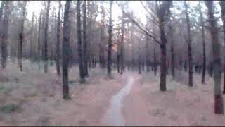
Photos of Howick Mountain Bike
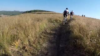
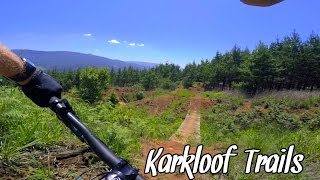
Videos of Howick Mountain Bike
3:12 |
441 |
Feb 10, 2020

2:02 |
410 |
Feb 10, 2020

2:04 |
454 |
Feb 10, 2020
4:59 |
351 |
Feb 10, 2020

3:30 |
284 |
Feb 10, 2020
4:48 |
406 |
Feb 10, 2020
3:22 |
293 |
Feb 10, 2020
3:40 |
268 |
Feb 10, 2020
Recent Trail Reports
| status | trail | date | condition | info | user |
|---|---|---|---|---|---|
| Hyslops | Jul 30, 2026 @ 10:54am (Africa/Johannesburg) 51 mins | Ideal | KKMTBTrails KARKLOOF | ||
| New Track | Jul 30, 2026 @ 10:03am (Africa/Johannesburg) 2 hours | Ideal | trailfoxkzn KZN MTB | ||
| More Nyaga Nyaga | Jul 30, 2026 @ 10:03am (Africa/Johannesburg) 2 hours | Dry | trailfoxkzn KZN MTB | ||
| Sheep's Pass | Jul 25, 2026 @ 7:46am (Africa/Johannesburg) Jul 24, 2026 | Ideal | KKMTBTrails KARKLOOF | ||
| Supa Tube (difficult) | Jul 24, 2026 @ 6:40pm (Africa/Johannesburg) Jul 24, 2026 | Ideal | KKMTBTrails KARKLOOF | ||
| Orchard Trail | Jul 24, 2026 @ 12:36pm (Africa/Johannesburg) Jul 24, 2026 | Dry | KKMTBTrails KARKLOOF | ||
| Quarry Road | Jul 22, 2026 @ 2:45pm (Africa/Johannesburg) Jul 22, 2026 | Ideal | KKMTBTrails KARKLOOF | ||
| Newby | Jul 22, 2026 @ 2:43pm (Africa/Johannesburg) Jul 22, 2026 | Ideal | KKMTBTrails KARKLOOF | ||
| Fly Over | Jul 22, 2026 @ 2:42pm (Africa/Johannesburg) Jul 22, 2026 | Ideal | KKMTBTrails KARKLOOF | ||
| Mind the Gap | Jul 22, 2026 @ 2:40pm (Africa/Johannesburg) Jul 22, 2026 | Dry | KKMTBTrails KARKLOOF |
Activity Feed
| username | action | type | title | date |
|---|---|---|---|---|
| KKMTBTrails | add | poi | activity #100328419 | Jul 30, 2026 @ 2:01am 44 mins |
| KKMTBTrails | update | trail | activity #100328329 and 1 more | Jul 30, 2026 @ 1:58am 47 mins |
| KKMTBTrails | add | report | activity #100328226 | Jul 30, 2026 @ 1:54am 51 mins |
| trailfoxkzn | add | report | activity #100326871 and 1 more | Jul 30, 2026 @ 1:03am 2 hours |
| trailfoxkzn | add | photo | activity #100326560 and 5 more | Jul 30, 2026 @ 12:53am 2 hours |
Recent Comments
| username | type | title | comment | date |
|---|---|---|---|---|
| trail | Enjoyable , short rock garden to navigate | Jun 7, 2026 @ 5:19am Jun 7, 2026 | ||
| trail | Brilliant beginner , downhill single track , a... | Jun 7, 2026 @ 5:14am Jun 7, 2026 | ||
| trail | Beginner friendly , one or two rocks ,... | Jun 7, 2026 @ 5:10am Jun 7, 2026 | ||
| trail | Lovely single downhill , beginner friendly | Jun 7, 2026 @ 5:07am Jun 7, 2026 | ||
| trail | nice single track downhill , fairly easy till... | Jun 7, 2026 @ 5:06am Jun 7, 2026 |
Local Badges
-

Top 10 Trails0 awarded -

Descent 100k Badge11 awarded -

Big Ride 30k2,592 awarded -

Epic Ride 50k778 awarded -

Completionist0 awarded -
Completionist0 awarded
Local Trail Supporters
- Outpost
- Timber Solutions
Activity Type Stats
| activitytype | trails | distance | descent | descent distance | total vertical | rating | global rank | state rank | photos | reports | routes | activity logs |
|---|---|---|---|---|---|---|---|---|---|---|---|---|
| Mountain Bike | 496 | 312 miles | 39,196 ft | 142 miles | 2,182 ft | #375 | #9 | 98 | 2,814 | 1 | 9,887 | |
| E-Bike | 494 | 312 miles | 39,173 ft | 142 miles | 2,182 ft | #162 | #34 | 2,723 | 4 | 498 | ||
| Gravel Bike | 14 | #227 | #31 | 5 | 1 | 11 | ||||||
| Winter Fat Bike | 16 | #778 | #11 | 5 | ||||||||
| Hike | 490 | 311 miles | 38,438 ft | 140 miles | 2,182 ft | #293 | #11 | 6 | 2,810 | 2 | 464 | |
| Trail Running | 490 | 311 miles | 38,793 ft | 141 miles | 2,182 ft | #216 | #9 | 2 | 2,813 | 7 | 1,645 |
Frequently Asked Questions About Howick
▼
What are the best places to ride in Howick?
Howick has 1 areas to explore for mountain biking. The top rated areas are:
▼
What are the highest rated mountain biking trails in Howick?
The highest rated mountain biking trails in Howick are:
- Richerts Realm (4.2/5)
- Face Extension (4.1/5)
- Prodigal Son (4.1/5)
- Prodigal Son - Lower (4.1/5)
- Keira's Trail (4.1/5)
▼
What is the best time of the year to ride in Howick?
Based on activity log data, the most popular months to ride in Howick are:
- December (33 activities)
- August (30 activities)
- July (23 activities)
▼
Where can I park to ride in Howick?
There are 2 parking locations listed in Howick. The most popular parking spots are:
Activities
Trails
- By wesseljacobsz
 TRAILFORKS WAM SBP SWW & contributors
 - Admins: Midlands
- #9404 - 9,500 views
- howick activity log | embed map of Howick mountain bike trails | howick mountain biking points of interest polygons
Downloading of trail gps tracks in kml & gpx formats is enabled for Howick.
You must login to download files.