close
-
Layers w
- Weather Layers
- Pro
- Pro
- Pro
- Pro
- Pro
- Pro
- More Layers
- Pro
- Pro
- Pro
- Pro
-
Upgrade to

3D
Trail Conditions
- Unknown
- Snow Groomed
- Snow Packed
- Snow Covered
- Snow Cover Partial
- Freeze/thaw Cycle
- Icy
- Prevalent Mud
- Wet
- Variable
- Ideal
- Dry
- Very Dry
Trail Flow (Ridden Direction)
Trailforks scans users ridelogs to determine the most popular direction each trail is ridden. A good flowing trail network will have most trails flowing in a single direction according to their intension.
The colour categories are based on what percentage of riders are riding a trail in its intended direction.
The colour categories are based on what percentage of riders are riding a trail in its intended direction.
- > 96%
- > 90%
- > 80%
- > 70%
- > 50%
- < 50%
- bi-directional trail
- no data
Trail Last Ridden
Trailforks scans ridelogs to determine the last time a trail was ridden.
- < 2 days
- < 1 week
- < 2 weeks
- < 1 month
- < 6 months
- > 6 months
Trail Ridden Direction
The intended direction a trail should be ridden.
- Downhill Only
- Downhill Primary
- Both Directions
- Uphill Primary
- Uphill Only
- One Direction
Contribute Details
Colors indicate trail is missing specified detail.
- Description
- Photos
- Description & Photos
- Videos
Trail Popularity ?
Trailforks scans ridelogs to determine which trails are ridden the most in the last 9 months.
Trails are compared with nearby trails in the same city region with a possible 25 colour shades.
Think of this as a heatmap, more rides = more kinetic energy = warmer colors.
- most popular
- popular
- less popular
- not popular
ATV/ORV/OHV Filter
Max Vehicle Width
inches
US Cell Coverage
Legend

Radar Time
Activity Recordings
Trailforks uses anonymized public activity data.
?
Activity Recordings
Trailforks uses anonymized public activity data.
?
Personal Heatmap
▶
Activity Types
all
/
none
▶
Options
2
Date range
month
–
Winter Trails
Warning
A routing network for winter maps does not exist. Selecting trails using the winter trails layer has been disabled.
Missing Trails
Most Popular
Least Popular
Trails are colored based on popularity. The more popular a trail is, the more red. Less popular trails trend towards green.
Jump Magnitude Heatmap
Heatmap of where riders jump on trails. Zoom in to see individual jumps, click circles to view jump details.
BC Backroad Status
![map legend]()
Service Road Atlas is a free to use, community-driven service for viewing and creating reports on the numerous back-country service roads around B.C. and Alberta.

Slope Aspect
Direction the slope faces
Trails Deemphasized
Trails are shown in grey.
Only show trails with no bike usage.
Suggested Layers
Based on selected activity type
Save the current map location and zoom level as your default home location whenever this page is loaded.
Save
No description for Ig has been added yet!
Login or register to submit one.
This region uses the Uk/Euro style trail grading system.
Activities Click to view
- Mountain Bike
7 trails
- E-Bike
1 trails
- Gravel Bike
0 trails
- Adaptive Bike
0 trails
- Winter Fat Bike
0 trails
- Hike
4 trails
- Trail Running
4 trails
Region Details
- 3
- 1
- 1
- 2
Region Status
Caution as of May 19, 2026Stats
- Avg Trail Rating
- Trails (view details)
- 7
- Trails Mountain Bike
- 7
- Trails E-Bike
- 1
- Trails Hike
- 4
- Trails Trail Running
- 4
- Total Distance
- 12 miles
- Total Descent
- 4,645 ft
- Total Vertical
- 2,158 ft
- Highest Trailhead
- 3,158 ft
- Reports
- 127
- Photos
- 14
- Ridden Counter
- 527
Sub Regions
-
Krim
- 1
- 1
- 2
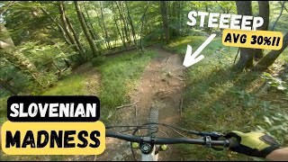
Popular Ig Mountain Biking Trails
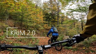
• 65 ★ 5.0 • 1,739 ft • 0 ft • 87 •
Alternative line to Krim 2.0 descent. Dynamic and natural forest trail.
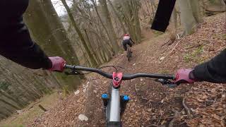
Ig Mountain Bike Routes
4 miles • 126 ft • 0 • Point to Point •
Prijazen spust z vrh Krima preko Malinovca dol v Kot /Strahomer
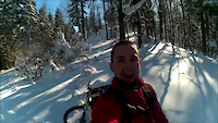
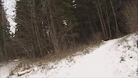
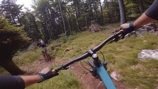
Photos of Ig Mountain Bike
Recent Trail Reports
| status | trail | date | condition | info | user |
|---|---|---|---|---|---|
| Ahaška brutala | Jun 26, 2025 @ 9:40am Jun 26, 2025 | Ideal | Perov84 | ||
| Krim 2.5 | May 2, 2025 @ 2:14pm May 2, 2025 | Variable | JanG | ||
| M3DO | May 2, 2025 @ 2:11pm May 2, 2025 | Variable | JanG | ||
| Pungart - Trail1 | Feb 22, 2024 @ 12:49am Feb 22, 2024 | Dry | Mark123123 | ||
| Krim 2.0 | Jan 4, 2024 @ 8:45am Jan 4, 2024 | Variable | Jurlee | ||
| Iška vas - Krim 2.0 | Mar 24, 2023 @ 9:16am Mar 24, 2023 | Dry | Primoz |
Activity Feed
| username | action | type | title | date |
|---|---|---|---|---|
| gstanisic | wishlist | trail | activity #91496623 | Mar 29, 2026 @ 1:02am Mar 29, 2026 |
| ambro164 | like | report | activity #90208928 | Mar 8, 2026 @ 10:01am Mar 8, 2026 |
| ambro164 | difficultyvote | trail | activity #90208704 | Mar 8, 2026 @ 9:59am Mar 8, 2026 |
| Jan1508 | wishlist | trail | activity #87795517 and 1 more | Jan 25, 2026 @ 8:39am Jan 25, 2026 |
| crisotop | comment | trail | activity #80739805 and 1 more | Sep 20, 2025 @ 8:33am Sep 20, 2025 |
Recent Comments
| username | type | title | comment | date |
|---|---|---|---|---|
| trail | I bet this was fun 10 years ago - now... | Sep 20, 2025 @ 8:34am Sep 20, 2025 | ||
| trail | Top section next to impossible to find. Thank... | Sep 20, 2025 @ 8:33am Sep 20, 2025 | ||
| trail | Nice short and fast trail, not too difficult,... | Jun 14, 2023 @ 5:16am Jun 14, 2023 | ||
| report | Trail is in perfect condition - shaped an no... | Apr 11, 2023 @ 11:17am Apr 11, 2023 |
Activity Type Stats
| activitytype | trails | distance | descent | descent distance | total vertical | rating | global rank | state rank | photos | reports | routes | ridelogs |
|---|---|---|---|---|---|---|---|---|---|---|---|---|
| Mountain Bike | 7 | 12 miles | 4,646 ft | 5 miles | 2,159 ft | #4,361 | #42 | 14 | 127 | 1 | 2,647 | |
| E-Bike | 1 | 7 miles | 400 ft | 1 mile | 1,949 ft | #4,414 | #43 | 92 | 1 | 169 | ||
| Hike | 4 | 10 miles | 3,058 ft | 4 miles | 2,021 ft | #6,651 | #49 | 111 | 656 | |||
| Trail Running | 4 | 10 miles | 3,058 ft | 4 miles | 2,021 ft | #6,213 | #49 | 111 | 33 |
Frequently Asked Questions About Ig
▼
What are the best places to ride in Ig?
Ig has 1 areas to explore for mountain biking. The top rated areas are:
▼
What are the highest rated mountain biking trails in Ig?
The highest rated mountain biking trails in Ig are:
- Krim 2.5 (4.2/5)
- Krim 2.0 (4.2/5)
- M3DO (4.1/5)
- E6 (Škrilje-Iška) (0/5)
▼
What is the best time of the year to ride in Ig?
Based on ride log data, the most popular months to ride in Ig are:
- October (32 activities)
- April (32 activities)
- August (28 activities)
▼
Where can I park to ride in Ig?
There are 1 parking locations listed in Ig. The most popular parking spots are:
Activities
Trails
- By zocknroll
 TRAILFORKS TRAILANDIJA & contributors
 - Admins: VjekoslavKrsanac, zocknroll, KD DešFleš
- #29579 - 1,592 views
- ig activity log | embed map of Ig mountain bike trails | ig mountain biking points of interest
Downloading of trail gps tracks in kml & gpx formats is enabled for Ig.
You must login to download files.