close
-
Layers w
- Weather Layers
- Pro
- Pro
- Pro
- Pro
- Pro
- Pro
- More Layers
- Pro
- Pro
- Pro
- Pro
-
Upgrade to

3D
Trail Conditions
- Unknown
- Snow Groomed
- Snow Packed
- Snow Covered
- Snow Cover Partial
- Freeze/thaw Cycle
- Icy
- Prevalent Mud
- Wet
- Variable
- Ideal
- Dry
- Very Dry
Trail Flow (Ridden Direction)
Trailforks scans users activity logs to determine the most popular direction each trail is ridden. A good flowing trail network will have most trails flowing in a single direction according to their intension.
The colour categories are based on what percentage of users are riding a trail in its intended direction.
The colour categories are based on what percentage of users are riding a trail in its intended direction.
- > 96%
- > 90%
- > 80%
- > 70%
- > 50%
- < 50%
- bi-directional trail
- no data
Trail Last Ridden
Trailforks scans activity logs to determine the last time a trail was ridden.
- < 2 days
- < 1 week
- < 2 weeks
- < 1 month
- < 6 months
- > 6 months
Trail Ridden Direction
The intended direction a trail should be ridden.
- Downhill Only
- Downhill Primary
- Both Directions
- Uphill Primary
- Uphill Only
- One Direction
Contribute Details
Colors indicate trail is missing specified detail.
- Description
- Photos
- Description & Photos
- Videos
Trail Popularity ?
Trailforks scans activity logs to determine which trails are ridden the most in the last 9 months.
Trails are compared with nearby trails in the same city region with a possible 25 colour shades.
Think of this as a heatmap, more activities = more kinetic energy = warmer colors.
- most popular
- popular
- less popular
- not popular
ATV/ORV/OHV Filter
Max Vehicle Width
inches
US Cell Coverage
Legend

Radar Time
Activity Recordings
Trailforks uses anonymized public activity data.
?
Activity Recordings
Trailforks uses anonymized public activity data.
?
Personal Heatmap
▶
Activity Types
all
/
none
▶
Options
2
Date range
month
–
Winter Trails
Warning
A routing network for winter maps does not exist. Selecting trails using the winter trails layer has been disabled.
Missing Trails
Most Popular
Least Popular
Trails are colored based on popularity. The more popular a trail is, the more red. Less popular trails trend towards green.
Jump Magnitude Heatmap
Heatmap of where users jump on trails. Zoom in to see individual jumps, click circles to view jump details.
BC Backroad Status
![map legend]()
Service Road Atlas is a free to use, community-driven service for viewing and creating reports on the numerous back-country service roads around B.C. and Alberta.

Slope Aspect
Direction the slope faces
Trails Deemphasized
Trails are shown in grey.
Only show trails with no bike usage.
Suggested Layers
Based on selected activity type
Save the current map location and zoom level as your default home location whenever this page is loaded.
SaveThis region is Unsanctioned, Ride at your own Risk!
No description for Ilava has been added yet! Login or register to submit one.Activities Click to view
- Mountain Bike
47 trails
- E-Bike
10 trails
- Gravel Bike
0 trails
- Adaptive Bike
0 trails
- Winter Fat Bike
0 trails
- Hike
39 trails
- Trail Running
39 trails
Region Details
- 16
- 12
- 12
- 4
- 2
Region Status
Open as of Jul 27, 2026Stats
- Avg Trail Rating
- Trails (view details)
- 47
- Trails Mountain Bike
- 47
- Trails E-Bike
- 10
- Trails Horse
- 1
- Trails Hike
- 39
- Trails Trail Running
- 39
- Total Distance
- 55 miles
- Total Descent
- 19,143 ft
- Total Vertical
- 3,032 ft
- Highest Trailhead
- 3,907 ft
- Reports
- 348
- Photos
- 103
- Completed Counter
- 1,121
Sub Regions
-
Belušské Traily
- 6
- 1
-
Mojtín
- 3
- 5
- 2
- 1
Popular Ilava Mountain Biking Trails
• 85 ★ 4.9 • 2 miles • 341 ft • 44 •
Highly rated popular blue difficulty wilderness trail. This mountain bike primary trail can be used downhill only and has a moderate overall physical rating with a 341 ft blue climb. It features rock garden. On average it takes 30 minutes to complete this trail.
• 75 ★ 4.4 • 3,412 ft • 15 ft • 33 •
Krátka zábavna vsuvka pri návrate z trailu smerom do Beluše
• 60 ★ 4.2 • 1 mile • 147 ft • 33 •
Highly rated moderately popular blue difficulty wilderness trail. This mountain bike primary trail can be used downhill primary and has a moderate overall physical rating with a 147 ft blue climb. On average it takes 16 minutes to complete this trail.
• 100 ★ 4.4 • 1 mile • 69 ft • 26 •
Popular blue difficulty singletrack. This mountain bike primary trail can be used downhill primary. It features jump and rock garden. On average it takes 13 minutes to complete this trail.
• 80 ★ 4.7 • 3,835 ft • 0 ft • 22 •
Popular blue difficulty singletrack. This mountain bike primary trail can be used downhill only and has a moderate overall physical rating. On average it takes 6 minutes to complete this trail.
• 95 ★ 4.5 • 2,959 ft • 0 ft • 22 •
Popular green difficulty singletrack. This mountain bike primary trail can be used downhill only and has a easy overall physical rating. Trail visibility is always easy to follow. On average it takes 10 minutes to complete this trail.
Ilava Mountain Bike Routes
16 miles • 3,552 ft • 0 •
Suchý vrch (1 028 m n. m.) je najvyšší vrch Nitrických vrchov, geomorfologického podcelku...
22 miles • 2,504 ft • 0 • Loop •
Zliechov - Cicermanske sedlo - Cavoj - Zliechov
Photos of Ilava Mountain Bike
Current Trail Warnings
| status | trail | date | condition | user | info |
|---|---|---|---|---|---|
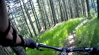
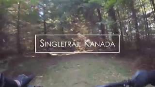
| Kanada | Jul 27, 2026 @ 1:13pm (Europe/Bratislava) Jul 27, 2026 | Dry | MirecS | Nadrolený štrk a kamene v úzkej... |
Recent Trail Reports
| status | trail | date | condition | info | user |
|---|---|---|---|---|---|
| DDH 1 | Jun 23, 2026 @ 6:51am (America/Vancouver) Jun 23, 2026 | Ideal | Malarkie | ||
| DDH 3 | Jun 23, 2026 @ 6:50am (America/Vancouver) Jun 23, 2026 | Ideal | Malarkie | ||
| Dzuro | May 2, 2026 @ 10:07pm (Europe/Bratislava) May 2, 2026 | Ideal | lu24ho | ||
| Climb to Dzuro Mazáčka | Apr 25, 2026 @ 10:26am (Europe/Bratislava) Apr 25, 2026 | Ideal | tomtoylc | ||
| Climb Kanada | Apr 25, 2026 @ 10:26am (Europe/Bratislava) Apr 25, 2026 | Ideal | tomtoylc | ||
| Kamenica | Apr 2, 2026 @ 7:12am (America/Vancouver) Apr 2, 2026 | Unknown | R1Q9Es | ||
| Žltý kvet | Aug 23, 2025 @ 5:05pm Aug 23, 2025 | Ideal | mascot4m | ||
| Butkoff | Aug 23, 2025 @ 12:57pm Aug 23, 2025 | Ideal | kocnere | ||
| Mojcínsky Trail | Aug 23, 2025 @ 12:57pm Aug 23, 2025 | Ideal | kocnere | ||
| Climb to žltý kvet and mojcínsky | Aug 23, 2025 @ 12:57pm Aug 23, 2025 | Ideal | kocnere |
Activity Feed
| username | action | type | title | date |
|---|---|---|---|---|
| MirecS | add | report | activity #100120750 | Jul 27, 2026 @ 4:16am Jul 27, 2026 |
| Malarkie | add | report | activity #97623428 and 1 more | Jun 23, 2026 @ 6:50am Jun 23, 2026 |
| Chihan | ridden | trail | activity #96141888 | Jun 3, 2026 @ 2:11am Jun 3, 2026 |
| AntonzxaDf2 | add | photo | activity #95193212 and 2 more | May 21, 2026 @ 12:15pm May 21, 2026 |
| lu24ho | add | report | activity #93888977 | May 2, 2026 @ 1:07pm May 2, 2026 |
Recent Comments
| username | type | title | comment | date |
|---|---|---|---|---|
| trail | Toto rozhodne nie je zelený trail, technické... | Aug 23, 2025 @ 11:19am Aug 23, 2025 | ||
| trail | Ako uz bolo spomenute, je to trochu HC vyslap,... | Sep 16, 2021 @ 1:54am Sep 16, 2021 | ||
| trail | Bol som po roku a oproti minulajsku pribudlo... | Sep 16, 2021 @ 1:47am Sep 16, 2021 | ||
| trail | Luxusny trail, ktory ma takmer vsetko. V... | Sep 16, 2021 @ 1:34am Sep 16, 2021 | ||
| trail | Pekny prirodny trail, v druhej polovici ako sa... | Sep 16, 2021 @ 1:30am Sep 16, 2021 |
Local Badges
-

Epic Ride Climb 2k92 awarded -

Climbing 10k Badge34 awarded -

Climbing 100k Badge2 awarded -

Epic Ride Descent 2k93 awarded -

Descent 10k Badge34 awarded -

Descent 100k Badge2 awarded
Bike & Skill Parks
| name | type | city | rating |
|---|---|---|---|
| Sverepec | skill park | Ilava |
Activity Type Stats
| activitytype | trails | distance | descent | descent distance | total vertical | rating | global rank | state rank | photos | reports | routes | activity logs |
|---|---|---|---|---|---|---|---|---|---|---|---|---|
| Mountain Bike | 47 | 55 miles | 19,144 ft | 25 miles | 3,031 ft | #1,973 | #21 | 103 | 348 | 2 | 3,588 | |
| E-Bike | 10 | 14 miles | 4,439 ft | 6 miles | 1,926 ft | #2,666 | #33 | 292 | 1 | 265 | ||
| Horse | 1 | 1 mile | 266 ft | 3,094 ft | 207 ft | 29 | ||||||
| Hike | 39 | 51 miles | 16,381 ft | 22 miles | 3,031 ft | #2,504 | #26 | 338 | 783 | |||
| Trail Running | 39 | 51 miles | 16,381 ft | 22 miles | 3,031 ft | #2,051 | #24 | 338 | 47 |
Frequently Asked Questions About Ilava
▼
What are the best places to ride in Ilava?
Ilava has 2 areas to explore for mountain biking. The top rated areas are:
▼
What are the highest rated mountain biking trails in Ilava?
The highest rated mountain biking trails in Ilava are:
- Mazáčka 2.sekcia (4.5/5)
- Kanada (4.4/5)
- Sidonka (4.3/5)
- Dzuro (4.2/5)
- XIII. Komnata (4.1/5)
▼
What is the best time of the year to ride in Ilava?
Based on activity log data, the most popular months to ride in Ilava are:
- June (17 activities)
- September (9 activities)
- July (6 activities)
▼
Where can I park to ride in Ilava?
There are 2 parking locations listed in Ilava. The most popular parking spots are:
Activities
Trails
Points of Interest
- By jxxw
 TRAILFORKS & contributors
 - Admins: jxxw
- #19304 - 3,036 views
- ilava activity log | embed map of Ilava mountain bike trails | ilava mountain biking points of interest
Downloading of trail gps tracks in kml & gpx formats is enabled for Ilava.
You must login to download files.