close
-
Layers w
- Weather Layers
- Pro
- Pro
- Pro
- Pro
- Pro
- Pro
- More Layers
- Pro
- Pro
- Pro
- Pro
-
Upgrade to

3D
Trail Conditions
- Unknown
- Snow Groomed
- Snow Packed
- Snow Covered
- Snow Cover Partial
- Freeze/thaw Cycle
- Icy
- Prevalent Mud
- Wet
- Variable
- Ideal
- Dry
- Very Dry
Trail Flow (Ridden Direction)
Trailforks scans users ridelogs to determine the most popular direction each trail is ridden. A good flowing trail network will have most trails flowing in a single direction according to their intension.
The colour categories are based on what percentage of riders are riding a trail in its intended direction.
The colour categories are based on what percentage of riders are riding a trail in its intended direction.
- > 96%
- > 90%
- > 80%
- > 70%
- > 50%
- < 50%
- bi-directional trail
- no data
Trail Last Ridden
Trailforks scans ridelogs to determine the last time a trail was ridden.
- < 2 days
- < 1 week
- < 2 weeks
- < 1 month
- < 6 months
- > 6 months
Trail Ridden Direction
The intended direction a trail should be ridden.
- Downhill Only
- Downhill Primary
- Both Directions
- Uphill Primary
- Uphill Only
- One Direction
Contribute Details
Colors indicate trail is missing specified detail.
- Description
- Photos
- Description & Photos
- Videos
Trail Popularity ?
Trailforks scans ridelogs to determine which trails are ridden the most in the last 9 months.
Trails are compared with nearby trails in the same city region with a possible 25 colour shades.
Think of this as a heatmap, more rides = more kinetic energy = warmer colors.
- most popular
- popular
- less popular
- not popular
ATV/ORV/OHV Filter
Max Vehicle Width
inches
US Cell Coverage
Legend

Radar Time
Activity Recordings
Trailforks uses anonymized public activity data.
?
Activity Recordings
Trailforks uses anonymized public activity data.
?
Personal Heatmap
▶
Activity Types
all
/
none
▶
Options
2
Date range
month
–
Winter Trails
Warning
A routing network for winter maps does not exist. Selecting trails using the winter trails layer has been disabled.
Missing Trails
Most Popular
Least Popular
Trails are colored based on popularity. The more popular a trail is, the more red. Less popular trails trend towards green.
Jump Magnitude Heatmap
Heatmap of where riders jump on trails. Zoom in to see individual jumps, click circles to view jump details.
BC Backroad Status
![map legend]()
Service Road Atlas is a free to use, community-driven service for viewing and creating reports on the numerous back-country service roads around B.C. and Alberta.

Slope Aspect
Direction the slope faces
Trails Deemphasized
Trails are shown in grey.
Only show trails with no bike usage.
Suggested Layers
Based on selected activity type
Save the current map location and zoom level as your default home location whenever this page is loaded.
Save
No description for Ischgl has been added yet!
Login or register to submit one.
This region uses the Uk/Euro style trail grading system.
Activities Click to view
- Mountain Bike
45 trails
- E-Bike
44 trails
- Adaptive Bike
2 trails
- Winter Fat Bike
0 trails
- Hike
44 trails
- Trail Running
44 trails
- Downhill Ski
30 trails
- Backcountry Ski
50 trails
Region Details
- 13
- 8
- 5
Region Status
Open as of Sep 14, 2025Stats
- Avg Trail Rating
- Trails (view details)
- 94
- Trails Mountain Bike
- 45
- Trails E-Bike
- 44
- Trails Adaptive Bike
- 2
- Trails Hike
- 44
- Trails Trail Running
- 44
- Trails Downhill Ski
- 30
- Trails Backcountry Ski
- 50
- Total Distance
- 152 miles
- Total Descent
- 75,286 ft
- Total Vertical
- 6,332 ft
- Highest Trailhead
- 10,106 ft
- Reports
- 50
- Photos
- 40
- Ridden Counter
- 4,789
Popular Ischgl Mountain Biking Trails
• 80 ★ 4.0 • 5 miles • 69 ft • 165 •
Highly rated popular red difficulty alpine singletrack. This mountain bike primary trail can be used downhill primary and has a hard overall physical rating. It features drop, jump and wallride. Trail visibility is always easy to follow. On average it takes 1 hour2 minutes to complete this trail.
• 100 ★ 3.0 • 2 miles • 8 ft • 143 •
Alpine flowtrail with beautiful views and some small jumps. It is easily rideable for beginners, but also lots of fun for better riders. Mostly graveled, but also with some rocks. Trail was built in 2018 – sometimes you can also find...
• 60 ★ 2.8 • 2 miles • 224 ft • 93 •
Moderately popular blue difficulty alpine singletrack. This mountain bike primary trail. On average it takes 51 minutes to complete this trail.
• ★ 1.0 • 1,125 ft • 0 ft • 65 •
Blue difficulty alpine singletrack. This mountain bike primary trail can be used downhill primary.
• ★ 1.0 • 1,900 ft • 0 ft • 30 •
Blue difficulty alpine singletrack. This mountain bike primary trail can be used downhill primary.
• ★ 3.0 • 1 mile • 9 ft • 22 •
Red difficulty singletrack. This multi-use trail can be used downhill primary. On average it takes 8 minutes to complete this trail.
• ★ 1.0 • 1,913 ft • 0 ft • 20 •
Blue difficulty alpine singletrack. This mountain bike primary trail can be used downhill primary.
Ischgl Mountain Bike Routes
31 miles • 8,752 ft • 4 • Loop •
The tour starts in Ischgl and utilizes the to reach Idalp followed by the to the Äußeres Viderjoch. From...
25 miles • 5,666 ft • 0 • Loop •
This is a loop that includes uphills with gondolas as well as (e-bike) pedaling between Kappl and See on...
58 miles • 7,750 ft • 0 •
• 7 miles • 1,120 ft • 0 •
Photos of Ischgl Mountain Bike
Videos of Ischgl Mountain Bike
youtuber
![Deze MTB reisvideo is... anders // Ischgl //...]()
trail: Velilltrail
11:35 |
114 |
Mar 24, 2025 , Ischgl
trail: Paznauner Taja Trail l
3:57 |
335 |
Jun 13, 2023 , Ischgl
youtuber
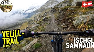
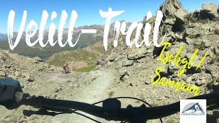
![ISCHGL SAMNAUN Velill-Trail (dry!) FULL / 10km...]()
trail: Velilltrail
27:14 |
531 |
Dec 10, 2022 , Ischgl
youtuber
![ISCHGL SAMNAUN Paznauner Taja Trail top to...]()
trail: Paznauner Taja Trail l
9:41 |
457 |
Dec 4, 2022 , Ischgl
youtuber
![ISCHGL SAMNAUN Velill-Trail (wet!) / flowig...]()
trail: Velilltrail
17:11 |
284 |
Nov 12, 2022 , Ischgl
trail: Velilltrail
21:18 |
213 |
Aug 21, 2022 , Ischgl
trail: Uphill Idalp
40:19 |
178 |
Aug 4, 2022 , Ischgl
trail: Flimjochtrail
9:07 |
318 |
Aug 4, 2022 , Ischgl
Recent Trail Reports
| status | trail | date | condition | info | user |
|---|---|---|---|---|---|
| Paznauner Taja Trail l | Sep 14, 2025 @ 7:13pm (Europe/Vienna) Sep 14, 2025 | Prevalent Mud | AgentDagnamit | ||
| Connector Idalp – Velilltrail | Aug 7, 2025 @ 10:04am Aug 7, 2025 | Ideal | alexsom | ||
| Flimjochtrail | Aug 7, 2025 @ 10:04am Aug 7, 2025 | Ideal | alexsom | ||
| Uphill Idalp | Aug 7, 2025 @ 10:04am Aug 7, 2025 | Ideal | alexsom | ||
| Velilltrail | Aug 3, 2025 @ 11:19am Aug 3, 2025 | Variable | xflowBLN | ||
| Fimbertal Road | Aug 1, 2025 @ 8:59am Aug 1, 2025 | Ideal | xflowBLN | ||
| Fimbertal Road | Aug 1, 2025 @ 8:59am Aug 1, 2025 | Ideal | xflowBLN | ||
| Fimbertal Road | Aug 1, 2025 @ 8:59am Aug 1, 2025 | Ideal | xflowBLN | ||
| Vesil Acces Road | Aug 1, 2025 @ 8:59am Aug 1, 2025 | Ideal | xflowBLN | ||
| Zeblastrail | Aug 1, 2025 @ 8:59am Aug 1, 2025 | Prevalent Mud | xflowBLN |
National Scenic Trails & Official Routes
-
Trans-Altarezia Bike #32
- Mountain Bike
- E-Bike

Activity Feed
| username | action | type | title | date |
|---|---|---|---|---|
| powpowpow | wishlist | route | activity #93064705 | Apr 21, 2026 @ 12:19am Apr 21, 2026 |
| cuzzykev | wishlist | trail | activity #93038922 | Apr 20, 2026 @ 1:56pm Apr 20, 2026 |
| levaca | wishlist | route | activity #93023053 | Apr 20, 2026 @ 9:32am Apr 20, 2026 |
| the00 | wishlist | route | activity #93020429 | Apr 20, 2026 @ 8:47am Apr 20, 2026 |
| lines | wishlist | route | activity #93010315 | Apr 20, 2026 @ 4:38am Apr 20, 2026 |
Recent Comments
| username | type | title | comment | date |
|---|---|---|---|---|
| trail | There’s no love in this trail; the whole... | Sep 6, 2025 @ 10:51am Sep 6, 2025 | ||
| trail | Easy peasy natural trail, through lots of... | Sep 2, 2025 @ 11:26pm Sep 2, 2025 | ||
| trail | No chance to ride this one fully, as - coming... | Sep 2, 2025 @ 11:23pm Sep 2, 2025 | ||
| trail | Well, it's ok, but a bit boring to ride. | Sep 2, 2025 @ 11:16pm Sep 2, 2025 | ||
| trail | Definitely the only "demanding" trail in the... | Sep 2, 2025 @ 11:15pm Sep 2, 2025 |
Local Badges
-

Epic Ride Descent 2k96 awarded -

Descent 10k Badge12 awarded -

Descent 100k Badge0 awarded -

Epic Mountain Bike Climb 2k19 awarded -

Climbing 10k Badge1 awarded -

Mountain Biking 100k Badge0 awarded
Activity Type Stats
| activitytype | trails | distance | descent | descent distance | total vertical | rating | global rank | state rank | photos | reports | routes | ridelogs |
|---|---|---|---|---|---|---|---|---|---|---|---|---|
| Mountain Bike | 45 | 39 miles | 14,249 ft | 20 miles | 4,915 ft | #3,047 | #28 | 40 | 50 | 3 | 912 | |
| E-Bike | 44 | 37 miles | 12,854 ft | 19 miles | 4,915 ft | #960 | #15 | 47 | 2 | 177 | ||
| Adaptive Bike | 2 | #187 | #56 | |||||||||
| Hike | 44 | 43 miles | 17,047 ft | 23 miles | 4,915 ft | #1,557 | #24 | 50 | 179 | |||
| Trail Running | 44 | 43 miles | 17,047 ft | 23 miles | 4,915 ft | #1,152 | #14 | 50 | 14 | |||
| Downhill Ski | 30 | 21 miles | 21,650 ft | 20 miles | 4,843 ft | #74 | #6 | 2 | 2,874 | |||
| Backcountry Ski | 50 | 90 miles | 37,877 ft | 37 miles | 6,332 ft | #17 | #7 | 2 | 235 |
Frequently Asked Questions About Ischgl
▼
What are the best places to ride in Ischgl?
Ischgl has 1 areas to explore for mountain biking.
▼
What are the highest rated mountain biking trails in Ischgl?
The highest rated mountain biking trails in Ischgl are:
- Velilltrail (4.2/5)
- Flimjochtrail (3.8/5)
- Dias Trail (3.8/5)
- Paznauner Taja Trail l (3.8/5)
- Val Gronda (0/5)
▼
What is the best time of the year to ride in Ischgl?
Based on ride log data, the most popular months to ride in Ischgl are:
- July (11 activities)
- August (10 activities)
- September (4 activities)
▼
Where can I park to ride in Ischgl?
There are 1 parking locations listed in Ischgl. The most popular parking spots are:
Activities
Trails
- By falla08 & contributors
- Admins: PatrickMeraner
- #6594 - 9,389 views
- ischgl activity log | embed map of Ischgl mountain bike trails | ischgl mountain biking points of interest
Downloading of trail gps tracks in kml & gpx formats is enabled for Ischgl.
You must login to download files.