


more stats
5.0 miles
Distance
67 ft
Climb
-4,449 ft
Descent
00:47:17
Avg time
-4,382 ft
Altitude change
4,583 ft
Altitude min
8,966 ft
Altitude max
8,966 ft
Altitude start
4,583 ft
Altitude end
-16.7%
Grade
-81.2%
Grade max
33%
Grade min
971 ft
Distance climb
5 miles
Distance down
614 ft
Distance flat
00:47:17
Avg time

Velilltrail Details

  • Activities
    • Mountain Bike
    • E-Bike
    • Hike
    • Trail Running
  • Riding Area
  • Ref Number
    #7134
  • Difficulty Rating
  • Local Popularity
    80 in Mountain Biking [+]
    • 90 in E-Biking
    • 5 in Trail Running
    • 5 in Hiking
  • Global Ranking
    #54151 in Mountain Biking [+]
    • #4190 in E-Biking
    • #215362 in Trail Running
    • #206551 in Hiking
  • National Ranking
    #442 in Mountain Biking · Austria [+]
    • #39 in E-Biking
    • #513 in Trail Running
    • #584 in Hiking
  • Trail Type
    Singletrack
  • Bike Type
    DH, AM
  • Physical Rating
    Hard
  • Trail Visibility
    Always easy to follow
  • Alpine Trail
    Yes
  • Dogs Allowed
    Yes
  • eBike Allowed
    Yes up to Class 1
  • TTFs on Trail
    Drop, Jump, Wallride

No community description for Velilltrail trail has been added yet!

AI Generated Description

Velilltrail is a 8 km popular red difficulty alpine singletrack trail located near Ischgl. This mountain bike primary trail and has a hard overall physical rating. It features drop, jump and wallride. Trail visibility is always easy to follow. On average it takes 47 minutes to complete this trail.

Disclaimer

Wearing a helmet is compulsory. Be friendly to hikers. Ride at your own risk.

Tags
AlpineDropsJumpsWallride

Recent Activity on Trail

Past Week
  • 0 rides
  •  
6 Months
  • 22 rides
  • 24 miles avg distance
All
  • 46 rides
  • Last: Oct 3, 2026
c1c2c3c4
January
February
March
April
May
June
July
August
September
October
November
December
update trails status or condition

Velilltrail Trail Reports

statusdatedescription
Jul 8, 2026 @ 10:26am (Europe/Vaduz)
Jul 8, 2026
Aug 3, 2025 @ 11:19am
Aug 3, 2025
Expert section still closed. Perfect grippy conditions for a top-bottom run
Aug 2, 2025 @ 11:43am
Aug 2, 2025
Snow, that has melted again during the day
Aug 1, 2025 @ 8:59am
Aug 1, 2025
Expert section still closed
Jul 31, 2025 @ 8:35am
Jul 31, 2025
Expert section still closed. Last trail section spangled with wet roots, nuff said
more »
Status:
on Jul 8, 2026
Ideal
Avg: 3.96 (23 votes)
Your vote: 0

view (254)
close
      Directions to velilltrail trailhead (46.982420, 10.338500)

      Photos

      24 more »
      mtb
      17 |
      Sep 22, 2026 @ 10:06am
      Sep 22, 2026
      mtb
      536 |
      Oct 4, 2017 @ 11:40am
      Oct 4, 2017
      mtb
      518 |
      Oct 4, 2017 @ 11:39am
      Oct 4, 2017
      mtb
      460 |
      Oct 4, 2017 @ 11:27am
      Oct 4, 2017

      Videos

      5 more »
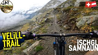
      youtuber ISCHGL SAMNAUN Velill-Trail (wet!) / flowig...
      mtb
      17:11 | 369 | Nov 12, 2022 , Ischgl
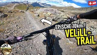
      youtuber ISCHGL SAMNAUN Velill-Trail (dry!) FULL / 10km...
      mtb
      27:14 | 640 | Dec 10, 2022 , Ischgl
      youtuber Deze MTB reisvideo is... anders // Ischgl //...
      mtb
      11:35 | 289 | Mar 24, 2025 , Ischgl
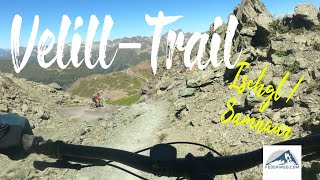
      10 Kilometer auf dem Velill-Trail - der...
      mtb
      21:18 | 382 | Aug 21, 2022 , Ischgl
      4.0 ★★★★★
      22 Ratings
      5 ★ 50%
      4 ★ 18%
      3 ★ 14%
      2 ★ 14%
      1 ★ 5%

      10 Reviews & Comments

      xflowBLN xflowBLN
      Definitely the only "demanding" trail in the Ischgl area, and it's only Vellil's bottom part, that is "challenging". Well, top part has some nice rocky sections, to put suspension to test. Rest is a usual flow trail.
      Hoschl Hoschl
      Probably the best trail in this area. Although the middle section is rather boring with a winding trail through the ski slope. Upper and lower part are quite fun. I liked the bottom more with some tricky steps & roots.
      fekko fekko
      Really good Info here, thanks. I love trailforks, but its unfortunately very often rather unclearly arranged. Such Info should be provided rather prominently...

      We hope you've been enjoying Trailforks!

      Create a FREE account to view all trail reviews and much more.

      • By falla08 & contributors
      • #22337 - 3,855 views

      Frequently Asked Questions

      ▼ Where is Velilltrail located?
      Velilltrail is located in Ischgl, Austria. It is part of the Ischgl trail network. The trailhead is located at coordinates 46.98242, 10.3385.
      ▼ How hard is Velilltrail?
      Velilltrail is rated as Red difficulty. The physical rating is Hard. The average grade is 16.7%.
      ▼ What is the elevation gain for Velilltrail?
      Velilltrail has 67 ft of elevation gain. The trail has 4,449 ft of elevation descent. The elevation ranges from 4,583 ft to 8,966 ft.
      ▼ How long is Velilltrail?
      Velilltrail is 5.0 miles long. The trail type is singletrack.
      ▼ Are dogs allowed on Velilltrail?
      Yes, dogs are allowed on Velilltrail. Please keep dogs on a leash where required and clean up after them.
      ▼ When is the best time of year to ride Velilltrail?
      Based on activity log data, the most popular months to ride Velilltrail are:
      • August (13 activities)
      • July (12 activities)
      • September (9 activities)
      Check the reports page for current trail conditions.
      ▼ How do I access Velilltrail? Where is the closest parking trailhead?
      The closest parking and trailhead locations to Velilltrail are: View all parking locations in the area.
      ▼ How long does it take to ride Velilltrail?
      Based on recorded activities, it takes an average of 47 minutes to ride Velilltrail. The trail is 5.0 miles long. Actual times will vary based on fitness level, conditions, and pace. View recent activity logs for more details.
      ▼ How busy is Velilltrail?
      Velilltrail is a very popular trail. There have been 270 recorded activities on this trail. The trail has received 254 check-ins. View recent activity on this trail.

      Hit the Trail

      Open in App

      Get this trail on your phone instantly.

      open trail in app

      Download Trail

      Save to wishlist, Garmin & download.
      save the trail

      Find Related Routes

      Find routes and users activities that include this trail.
      find routes for this trail

      You must enter a description before submitting.

