close
-
Layers w
- Weather Layers
- Pro
- Pro
- Pro
- Pro
- Pro
- Pro
- More Layers
- Pro
- Pro
- Pro
- Pro
-
Upgrade to

3D
Trail Conditions
- Unknown
- Snow Groomed
- Snow Packed
- Snow Covered
- Snow Cover Partial
- Freeze/thaw Cycle
- Icy
- Prevalent Mud
- Wet
- Variable
- Ideal
- Dry
- Very Dry
Trail Flow (Ridden Direction)
Trailforks scans users ridelogs to determine the most popular direction each trail is ridden. A good flowing trail network will have most trails flowing in a single direction according to their intension.
The colour categories are based on what percentage of riders are riding a trail in its intended direction.
The colour categories are based on what percentage of riders are riding a trail in its intended direction.
- > 96%
- > 90%
- > 80%
- > 70%
- > 50%
- < 50%
- bi-directional trail
- no data
Trail Last Ridden
Trailforks scans ridelogs to determine the last time a trail was ridden.
- < 2 days
- < 1 week
- < 2 weeks
- < 1 month
- < 6 months
- > 6 months
Trail Ridden Direction
The intended direction a trail should be ridden.
- Downhill Only
- Downhill Primary
- Both Directions
- Uphill Primary
- Uphill Only
- One Direction
Contribute Details
Colors indicate trail is missing specified detail.
- Description
- Photos
- Description & Photos
- Videos
Trail Popularity ?
Trailforks scans ridelogs to determine which trails are ridden the most in the last 9 months.
Trails are compared with nearby trails in the same city region with a possible 25 colour shades.
Think of this as a heatmap, more rides = more kinetic energy = warmer colors.
- most popular
- popular
- less popular
- not popular
ATV/ORV/OHV Filter
Max Vehicle Width
inches
US Cell Coverage
Legend

Radar Time
Activity Recordings
Trailforks uses anonymized public activity data.
?
Activity Recordings
Trailforks uses anonymized public activity data.
?
Personal Heatmap
▶
Activity Types
all
/
none
▶
Options
2
Date range
month
–
Winter Trails
Warning
A routing network for winter maps does not exist. Selecting trails using the winter trails layer has been disabled.
Missing Trails
Most Popular
Least Popular
Trails are colored based on popularity. The more popular a trail is, the more red. Less popular trails trend towards green.
Jump Magnitude Heatmap
Heatmap of where riders jump on trails. Zoom in to see individual jumps, click circles to view jump details.
BC Backroad Status
![map legend]()
Service Road Atlas is a free to use, community-driven service for viewing and creating reports on the numerous back-country service roads around B.C. and Alberta.

Slope Aspect
Direction the slope faces
Trails Deemphasized
Trails are shown in grey.
Only show trails with no bike usage.
Suggested Layers
Based on selected activity type
Save the current map location and zoom level as your default home location whenever this page is loaded.
SavePopular Trail Networks
view all areas »
No description for Ithaca has been added yet!
Login or register to submit one.
Activities Click to view
- Mountain Bike
64 trails
- E-Bike
13 trails
- Winter Fat Bike
26 trails
- Horse
1 trails
- Hike
152 trails
- Trail Running
148 trails
- Snowmobile
53 trails
- Snowshoe
8 trails
- Backcountry Ski
1 trails
- Nordic Ski
0 trails
Region Details
- 20
- 1
- 16
- 21
- 6
Region Status
Caution as of May 31, 2026Stats
- Avg Trail Rating
- Trails (view details)
- 204
- Trails Mountain Bike
- 64
- Trails E-Bike
- 13
- Trails Gravel Bike
- 3
- Trails Winter Fat Bike
- 26
- Trails Horse
- 1
- Trails Hike
- 152
- Trails Trail Running
- 148
- Trails Snowmobile
- 53
- Trails Snowshoe
- 8
- Trails Backcountry Ski
- 1
- Total Distance
- 310 miles
- Total Descent Distance
- 132 miles
- Total Descent
- 31,202 ft
- Total Vertical
- 1,488 ft
- Highest Trailhead
- 1,869 ft
- Reports
- 411
- Photos
- 43
- Ridden Counter
- 10,085
Sub Regions
-
Allan H. Treman State Marine Park
-
Monkey Run Natural Area
- 2
- 1
-
Shindagin Hollow State Forest
- 3
- 15
- 6
-
Six Mile Creek Natural Area
- 7
-
South Hill Natural Area South
- 2
- 4
Popular Ithaca Mountain Biking Trails
• 100 ★ 4.8 • 3,002 ft • 12 ft • 405 •
Y1 connects the main Shindagin Hollow parking lot with the Red and Yellow trail networks.
• 100 ★ 3.8 • 3,688 ft • 116 ft • 344 •
Popular blue difficulty singletrack. This multi-use trail can be used both directions. On average it takes 5 minutes to complete this trail.
• 95 ★ 4.6 • 4,068 ft • 39 ft • 323 •
Highly rated popular blue difficulty singletrack. This multi-use trail can be used downhill only. On average it takes 6 minutes to complete this trail.
• 100 ★ 3.7 • 3,809 ft • 86 ft • 320 •
travels along the north end of the red trails, connecting with R4, Y4, and Y1 on the north end, and R3 on the south end.
• 90 ★ 4.4 • 4,367 ft • 92 ft • 310 •
Highly rated popular black diamond difficulty singletrack. This multi-use trail can be used downhill only. On average it takes 10 minutes to complete this trail.
• 90 ★ 3.6 • 3,051 ft • 6 ft • 304 •
Popular blue difficulty singletrack. This multi-use trail can be used both directions. On average it takes 4 minutes to complete this trail.
Ithaca Mountain Bike Routes
23 miles • 2,845 ft • 22 • Loop •
This route is a large series of loops in Shindagin Hollow, covering all the trails. Route starts on the...
8 miles • 848 ft • 6 • Loop •
Easy to Intermediate with nothing that's technically difficult. Hard enough to be a good workout, but easy...
5 miles • 720 ft • 5 • Loop •
Best trails on the north side of Shindagin. Starts with a nice climb but finishes almost entirely downhill...
9 miles • 935 ft • 25 • Loop •
Tour of Red and Yellow trails on West side of Shindagin Hollow State Forest
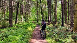
Photos of Ithaca Mountain Bike


Recent Trail Reports
| status | trail | date | condition | info | user |
|---|---|---|---|---|---|
| Red 4 Tariff | May 31, 2026 @ 2:46pm (America/New_York) May 31, 2026 | Unknown | nGOCVb | ||
| B2 Dizzy D | May 29, 2026 @ 2:54pm (America/New_York) May 29, 2026 | Variable | nGOCVb | ||
| B1 | May 18, 2026 @ 7:51am (America/New_York) May 18, 2026 | Variable | RHWNY | ||
| Black Diamond Trail | Oct 22, 2025 @ 5:06pm (America/Toronto) Oct 22, 2025 | Ideal | Mustang289 | ||
| R5 | Oct 21, 2025 @ 2:35pm (America/New_York) Oct 21, 2025 | Ideal | grantrules | ||
| Wash-out | Oct 3, 2025 @ 1:59pm (America/New_York) Oct 3, 2025 | Unknown | dmcbride016 | ||
| Twister | Oct 3, 2025 @ 1:57pm (America/New_York) Oct 3, 2025 | Unknown | dmcbride016 | ||
| Paperboy | Aug 3, 2025 @ 12:48pm Aug 3, 2025 | Variable | Tamling | ||
| Glove trail R6 | Aug 3, 2025 @ 12:48pm Aug 3, 2025 | Ideal | Tamling | ||
| R1 Chair trail | Aug 3, 2025 @ 12:48pm Aug 3, 2025 | Ideal | Tamling |
Activity Feed
| username | action | type | title | date |
|---|---|---|---|---|
| TerryIugqqI | wishlist | region | activity #96736588 | Jun 11, 2026 @ 7:37am Jun 11, 2026 |
| sparchead | add | route | activity #96535312 | Jun 8, 2026 @ 6:30am Jun 8, 2026 |
| nGOCVb | add | report | activity #95991743 | May 31, 2026 @ 6:05pm May 31, 2026 |
| nGOCVb | add | report | activity #95819765 | May 29, 2026 @ 7:45pm May 29, 2026 |
| MrEndo | add | report | activity #95607764 and 1 more | May 26, 2026 @ 7:10pm May 26, 2026 |
Recent Comments
| username | type | title | comment | date |
|---|---|---|---|---|
| trail | Nice climbing trail - consistent grade, jam... | Aug 12, 2025 @ 5:35am Aug 12, 2025 | ||
| trail | Thanks to the consistent grade, this trail... | Aug 12, 2025 @ 5:23am Aug 12, 2025 | ||
| trail | This trail is really fun. It has several small... | Sep 30, 2024 @ 10:40am Sep 30, 2024 | ||
| trail | Avoid. | Sep 30, 2023 @ 11:47am Sep 30, 2023 | ||
| report | Resolved jul 9 | Jul 10, 2023 @ 4:01am Jul 10, 2023 |
Local Badges
-

10 Green Trails69 awarded -

10 Blue Trails184 awarded -

Epic Ride Climb 2k18 awarded -

Climbing 10k Badge49 awarded -

Climbing 100k Badge8 awarded -

Epic Ride Descent 2k19 awarded
Activity Type Stats
| activitytype | trails | distance | descent | descent distance | total vertical | rating | global rank | state rank | photos | reports | routes | ridelogs |
|---|---|---|---|---|---|---|---|---|---|---|---|---|
| Mountain Bike | 64 | 60 miles | 5,167 ft | 27 miles | 1,480 ft | #2,241 | #800 | 27 | 411 | 6 | 11,882 | |
| E-Bike | 13 | 22 miles | 814 ft | 11 miles | 1,398 ft | #4,981 | #1,558 | 327 | 3 | 217 | ||
| Gravel Bike | 3 | 6 miles | 515 ft | 3 miles | 653 ft | #806 | #436 | 25 | ||||
| Winter Fat Bike | 26 | 24 miles | 3,570 ft | 12 miles | 689 ft | #226 | #1,026 | 65 | 5 | |||
| Horse | 1 | 2 miles | 259 ft | 2 miles | 253 ft | #3,070 | #1,744 | 65 | 1 | |||
| Hike | 152 | 123 miles | 12,920 ft | 51 miles | 1,480 ft | #817 | #373 | 12 | 411 | 6 | 1,204 | |
| Trail Running | 148 | 120 miles | 12,812 ft | 51 miles | 1,480 ft | #1,350 | #488 | 4 | 410 | 2 | 791 | |
| Snowmobile | 53 | 189 miles | 18,543 ft | 82 miles | 1,037 ft | #30 | #22 | |||||
| Snowshoe | 8 | 8 miles | 715 ft | 3 miles | 997 ft | #1,119 | #577 | 27 | 2 | 16 | ||
| Backcountry Ski | 1 | 2 miles | 259 ft | 2 miles | 253 ft | #591 | #194 | 3 |
Frequently Asked Questions About Ithaca
▼
What are the best places to ride in Ithaca?
Ithaca has 17 areas to explore for mountain biking. The top rated areas are:
▼
What are the highest rated mountain biking trails in Ithaca?
The highest rated mountain biking trails in Ithaca are:
- B2 Dizzy D (4.4/5)
- Y1 (4.4/5)
- B5 Rim trail (4.2/5)
- Mullet G2 (4.2/5)
- R3 (4.2/5)
▼
What is the best time of the year to ride in Ithaca?
Based on ride log data, the most popular months to ride in Ithaca are:
- July (134 activities)
- June (117 activities)
- August (99 activities)
▼
Where can I park to ride in Ithaca?
There are 52 parking locations listed in Ithaca. The most popular parking spots are: View all parking and trailhead locations on the map to plan your visit.
Activities
Trails
Points of Interest
- By brknspk & contributors
- Admins: apply
- #4388 - 14,034 views
- ithaca activity log | embed map of Ithaca mountain bike trails | ithaca mountain biking points of interest
Downloading of trail gps tracks in kml & gpx formats is enabled for Ithaca.
You must login to download files.