close
-
Layers w
- Weather Layers
- Pro
- Pro
- Pro
- Pro
- Pro
- Pro
- More Layers
- Pro
- Pro
- Pro
- Pro
-
Upgrade to

3D
Trail Conditions
- Unknown
- Snow Groomed
- Snow Packed
- Snow Covered
- Snow Cover Partial
- Freeze/thaw Cycle
- Icy
- Prevalent Mud
- Wet
- Variable
- Ideal
- Dry
- Very Dry
Trail Flow (Ridden Direction)
Trailforks scans users activity logs to determine the most popular direction each trail is ridden. A good flowing trail network will have most trails flowing in a single direction according to their intension.
The colour categories are based on what percentage of users are riding a trail in its intended direction.
The colour categories are based on what percentage of users are riding a trail in its intended direction.
- > 96%
- > 90%
- > 80%
- > 70%
- > 50%
- < 50%
- bi-directional trail
- no data
Trail Last Ridden
Trailforks scans activity logs to determine the last time a trail was ridden.
- < 2 days
- < 1 week
- < 2 weeks
- < 1 month
- < 6 months
- > 6 months
Trail Ridden Direction
The intended direction a trail should be ridden.
- Downhill Only
- Downhill Primary
- Both Directions
- Uphill Primary
- Uphill Only
- One Direction
Contribute Details
Colors indicate trail is missing specified detail.
- Description
- Photos
- Description & Photos
- Videos
Trail Popularity ?
Trailforks scans activity logs to determine which trails are ridden the most in the last 9 months.
Trails are compared with nearby trails in the same city region with a possible 25 colour shades.
Think of this as a heatmap, more activities = more kinetic energy = warmer colors.
- most popular
- popular
- less popular
- not popular
ATV/ORV/OHV Filter
Max Vehicle Width
inches
US Cell Coverage
Legend

Radar Time
Activity Recordings
Trailforks uses anonymized public activity data.
?
Activity Recordings
Trailforks uses anonymized public activity data.
?
Personal Heatmap
▶
Activity Types
all
/
none
▶
Options
2
Date range
month
–
Winter Trails
Warning
A routing network for winter maps does not exist. Selecting trails using the winter trails layer has been disabled.
Missing Trails
Most Popular
Least Popular
Trails are colored based on popularity. The more popular a trail is, the more red. Less popular trails trend towards green.
Jump Magnitude Heatmap
Heatmap of where users jump on trails. Zoom in to see individual jumps, click circles to view jump details.
BC Backroad Status
![map legend]()
Service Road Atlas is a free to use, community-driven service for viewing and creating reports on the numerous back-country service roads around B.C. and Alberta.

Slope Aspect
Direction the slope faces
Trails Deemphasized
Trails are shown in grey.
Only show trails with no bike usage.
Suggested Layers
Based on selected activity type
Save the current map location and zoom level as your default home location whenever this page is loaded.
SavePopular Trail Networks
view all areas »
No description for Jaén has been added yet!
Login or register to submit one.
This region uses the Uk/Euro style trail grading system.
Activities Click to view
- Mountain Bike
428 trails
- E-Bike
404 trails
- Gravel Bike
0 trails
- Adaptive Bike
0 trails
- Horse
38 trails
- Hike
432 trails
- Trail Running
432 trails
Region Details
- 177
- 5
- 26
- 166
- 50
- 4
Region Status
Open as of Mar 4, 2026Stats
- Avg Trail Rating
- Trails (view details)
- 434
- Trails Mountain Bike
- 428
- Trails E-Bike
- 404
- Trails Horse
- 38
- Trails Hike
- 432
- Trails Trail Running
- 432
- Trails Dirtbike/Moto
- 2
- Total Distance
- 454 miles
- Total Descent Distance
- 239 miles
- Total Descent
- 113,707 ft
- Total Vertical
- 5,476 ft
- Highest Trailhead
- 6,161 ft
- Reports
- 280
- Photos
- 206
- Completed Counter
- 3,223
Sub Regions
-
Jaén Noroeste
-
Martos
- 3
- 2
- 1
-
P.N. de Despeñaperros
- 1
- 36
-
Paño Pico
- 17
- 13
-
Sabariego-Los Chopos
- 7
- 3
- 1
-
Sierra Ahillos
- 7
- 2
- 2
-
Sierra Cruzada
-
Sierra de Andújar
- 4
- 7
- 5
-
Sierra de Cazorla-Siles
- 29
- 2
-
Sierra de Segura Cazorla y las Villas -- Sierra de Castril
- 2
- 8
- 3
-
Sierra Jabalcuz
- 1
- 34
- 18
-
Sierras de Cazorla, Segura y las Villas
- 2
- 29
- 4
-
Ubeda
-
Villarrodrigo
Popular Jaén Mountain Biking Trails
• 100 ★ 0.0 • 1,096 ft • 0 ft • 56 •
Popular blue difficulty singletrack. This multi-use trail can be used both directions and has a moderate overall physical rating with a 0 ft black diamond climb. It features drop, rock face and rock garden. Trail visibility is always easy to follow. On average it takes minutes to complete this trail.
• 100 ★ 0.0 • 3,671 ft • 0 ft • 50 •
Popular blue difficulty singletrack. This multi-use trail can be used downhill primary and has a hard overall physical rating with a 0 ft black diamond climb. It features drop and rock garden. Trail visibility is always easy to follow. On average it takes 3 minutes to complete this trail.
• 90 ★ 0.0 • 1 mile • 186 ft • 44 •
Popular blue difficulty singletrack. This multi-use trail can be used downhill primary and has a hard overall physical rating with a 186 ft black diamond climb. It features drop, rock garden and skinny. Trail visibility is always easy to follow. On average it takes 12 minutes to complete this trail.
• 100 ★ 0.0 • 2,172 ft • 50 ft • 40 •
Popular blue difficulty singletrack. This multi-use trail can be used both directions and has a easy overall physical rating with a 50 ft blue climb. It features rock face. Trail visibility is always easy to follow. On average it takes 2 minutes to complete this trail.
• 95 ★ 0.0 • 1 mile • 246 ft • 40 •
Popular blue difficulty singletrack. This multi-use trail can be used both directions and has a moderate overall physical rating with a 246 ft blue climb. It features skinny. Trail visibility is always easy to follow. On average it takes 9 minutes to complete this trail.
• 80 ★ 0.0 • 3 miles • 75 ft • 39 •
El sendero mas famoso de la Ciudad de Jaén (por donde transcurre la ABR) por su longitud y vistas!
• 95 ★ 0.0 • 1,322 ft • 0 ft • 39 •
Popular blue difficulty singletrack. This multi-use trail can be used both directions and has a moderate overall physical rating with a 0 ft black diamond climb. It features drop. Trail visibility is always easy to follow. On average it takes minutes to complete this trail.
• 90 ★ 0.0 • 4,039 ft • 54 ft • 32 •
Popular blue difficulty singletrack. This multi-use trail can be used both directions and has a moderate overall physical rating with a 54 ft blue climb. It features drop. Trail visibility is always easy to follow. On average it takes 4 minutes to complete this trail.
Jaén Mountain Bike Routes
7 miles • 955 ft • 4 • Loop •
Ruta corta que recorre una parte del bosque por los alrededores de Arroyo Frío, y alguna senda paralela...
24 miles • 3,596 ft • 3 • Loop •
Ruta que comienza en Arroyo Frio y acaba en el mismo lugar, la gran mayoria transcurre por pistas por en...
14 miles • 4,441 ft • 2 • Out & Back •
El río Borosa es un pequeño río de la sierra de Cazorla (Jaén). Nace en la laguna de Aguas Negras, y...
34 miles • 1,109 ft • 0 • Point to Point •
Una infinita cobertura de olivos, junto con nueve impresionantes viaductos metálicos del siglo XIX, son...
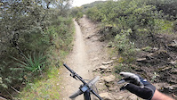
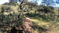
Photos of Jaén Mountain Bike
Videos of Jaén Mountain Bike
trail: San Ginés-Los Caballos
8:51 |
25 |
Mar 20, 2023
trail: Barranco Los Chopos
0:10 |
17 |
Mar 20, 2023
Recent Trail Reports
| status | trail | date | condition | info | user |
|---|---|---|---|---|---|
| Ermita Virgen de la Cabeza-Cortijo Prado Redondo | Mar 4, 2026 @ 10:23pm (Europe/Madrid) Mar 4, 2026 | Ideal | teunvandenbrink | ||
| Hornico Viejo | Oct 12, 2025 @ 9:20am (Europe/Gibraltar) Oct 12, 2025 | Ideal | Jmpozo91 | ||
| Puente de La Sabina | Oct 12, 2025 @ 9:20am (Europe/Gibraltar) Oct 12, 2025 | Dry | Jmpozo91 | ||
| A los Prados de Arredondo | Oct 12, 2025 @ 9:20am (Europe/Gibraltar) Oct 12, 2025 | Dry | Jmpozo91 | ||
| Verea del tejo Milenario | Oct 12, 2025 @ 9:20am (Europe/Gibraltar) Oct 12, 2025 | Ideal | Jmpozo91 | ||
| La Escurridiza a Cuenca | Oct 10, 2025 @ 1:06am (Europe/Madrid) Oct 9, 2025 | Dry | Jmpozo91 | ||
| Pirulo Tropical - Los Helechos | Oct 9, 2025 @ 10:37pm (Europe/Madrid) Oct 9, 2025 | Unknown | Jmpozo91 | ||
| Majahonda | Sep 29, 2025 @ 1:30pm (America/Vancouver) Sep 29, 2025 | Wet | Jmpozo91 | ||
| Torre Caniles Circular | Jul 4, 2025 @ 9:28am Jul 4, 2025 | Unknown | SukyBiker | ||
| El Gerzo | Jul 4, 2025 @ 9:28am Jul 4, 2025 | Unknown | SukyBiker |
Activity Feed
| username | action | type | title | date |
|---|---|---|---|---|
| juanx | update | trail | activity #98834570 | Jul 9, 2026 @ 9:52pm Jul 9, 2026 |
| josemp | add | trail | activity #98834532 and 1 more | Jul 9, 2026 @ 9:51pm Jul 9, 2026 |
| TrailJoe26 | add | photo | activity #96787507 | Jun 11, 2026 @ 11:55pm Jun 11, 2026 |
| TrailJoe26 | add | photo | activity #96658913 and 1 more | Jun 10, 2026 @ 1:28am Jun 10, 2026 |
| Gonzalowrc | add | photo | activity #91754229 and 3 more | Apr 2, 2026 @ 4:52am Apr 2, 2026 |
Recent Comments
| username | type | title | comment | date |
|---|---|---|---|---|
| trail | I used this as a climb to ride ‘Ermita... | Mar 4, 2026 @ 1:21pm Mar 4, 2026 | ||
| trail | More like a blue trail, not challenging nor... | Mar 3, 2026 @ 3:55am Mar 3, 2026 | ||
| trail | Better to use this as descent. | Mar 3, 2026 @ 3:54am Mar 3, 2026 | ||
| trail | Ojo, es una senda muy rápida, y sombria,... | Oct 24, 2024 @ 7:53am Oct 24, 2024 | ||
| trail | Sendero de dificultad Azul clarito, eso sí,... | Oct 24, 2024 @ 7:50am Oct 24, 2024 |
Local Badges
-

Completionist0 awarded -
Completionist0 awarded -
Completionist0 awarded -
Completionist0 awarded -
Completionist0 awarded -
Completionist0 awarded
Bike & Skill Parks
| name | type | city | rating |
|---|---|---|---|
| Jaén motocross | skill park | Jaén | |
| Andújar motocross | skill park | Jaén | |
| Bailén motocross | skill park | Jaén |
Activity Type Stats
| activitytype | trails | distance | descent | descent distance | total vertical | rating | global rank | state rank | photos | reports | routes | activity logs |
|---|---|---|---|---|---|---|---|---|---|---|---|---|
| Mountain Bike | 428 | 450 miles | 112,228 ft | 238 miles | 5,476 ft | #404 | #47 | 162 | 279 | 4 | 8,999 | |
| E-Bike | 404 | 430 miles | 108,635 ft | 229 miles | 5,476 ft | #122 | #61 | 252 | 3 | 1,265 | ||
| Horse | 38 | 17 miles | 2,054 ft | 7 miles | 3,317 ft | #1,087 | #75 | 49 | ||||
| Hike | 432 | 452 miles | 112,398 ft | 238 miles | 5,476 ft | #208 | #47 | 5 | 262 | 60 | 547 | |
| Trail Running | 432 | 451 miles | 112,428 ft | 238 miles | 5,476 ft | #162 | #47 | 262 | 2 | 169 | ||
| Dirtbike/Moto | 2 | 2 miles | 46 ft | 2,320 ft | 394 ft | 47 |
Frequently Asked Questions About Jaén
▼
What are the best places to ride in Jaén?
Jaén has 16 areas to explore for mountain biking. The top rated areas are:
▼
What are the highest rated mountain biking trails in Jaén?
The highest rated mountain biking trails in Jaén are:
- San Ginés-Los Caballos (4.1/5)
- La Guapa (4.1/5)
- Argenflow (4.1/5)
- El Rumblar (4.1/5)
- Peña del Olivar (4.1/5)
▼
What is the best time of the year to ride in Jaén?
Based on activity log data, the most popular months to ride in Jaén are:
- August (8 activities)
- October (7 activities)
- July (7 activities)
▼
Where can I park to ride in Jaén?
There are 2 parking locations listed in Jaén. The most popular parking spots are:
Activities
Trails
- By neonsp & contributors
- Admins: AMG, juanx
- #6093 - 3,377 views
- jaén activity log | embed map of Jaén mountain bike trails | jaén mountain biking points of interest
Downloading of trail gps tracks in kml & gpx formats is enabled for Jaén.
You must login to download files.