close
-
Layers w
- Weather Layers
- Pro
- Pro
- Pro
- Pro
- Pro
- Pro
- More Layers
- Pro
- Pro
- Pro
- Pro
-
Upgrade to

3D
Trail Conditions
- Unknown
- Snow Groomed
- Snow Packed
- Snow Covered
- Snow Cover Partial
- Freeze/thaw Cycle
- Icy
- Prevalent Mud
- Wet
- Variable
- Ideal
- Dry
- Very Dry
Trail Flow (Ridden Direction)
Trailforks scans users ridelogs to determine the most popular direction each trail is ridden. A good flowing trail network will have most trails flowing in a single direction according to their intension.
The colour categories are based on what percentage of riders are riding a trail in its intended direction.
The colour categories are based on what percentage of riders are riding a trail in its intended direction.
- > 96%
- > 90%
- > 80%
- > 70%
- > 50%
- < 50%
- bi-directional trail
- no data
Trail Last Ridden
Trailforks scans ridelogs to determine the last time a trail was ridden.
- < 2 days
- < 1 week
- < 2 weeks
- < 1 month
- < 6 months
- > 6 months
Trail Ridden Direction
The intended direction a trail should be ridden.
- Downhill Only
- Downhill Primary
- Both Directions
- Uphill Primary
- Uphill Only
- One Direction
Contribute Details
Colors indicate trail is missing specified detail.
- Description
- Photos
- Description & Photos
- Videos
Trail Popularity ?
Trailforks scans ridelogs to determine which trails are ridden the most in the last 9 months.
Trails are compared with nearby trails in the same city region with a possible 25 colour shades.
Think of this as a heatmap, more rides = more kinetic energy = warmer colors.
- most popular
- popular
- less popular
- not popular
ATV/ORV/OHV Filter
Max Vehicle Width
inches
US Cell Coverage
Legend

Radar Time
Activity Recordings
Trailforks uses anonymized public activity data.
?
Activity Recordings
Trailforks uses anonymized public activity data.
?
Personal Heatmap
▶
Activity Types
all
/
none
▶
Options
2
Date range
month
–
Winter Trails
Warning
A routing network for winter maps does not exist. Selecting trails using the winter trails layer has been disabled.
Missing Trails
Most Popular
Least Popular
Trails are colored based on popularity. The more popular a trail is, the more red. Less popular trails trend towards green.
Jump Magnitude Heatmap
Heatmap of where riders jump on trails. Zoom in to see individual jumps, click circles to view jump details.
BC Backroad Status
![map legend]()
Service Road Atlas is a free to use, community-driven service for viewing and creating reports on the numerous back-country service roads around B.C. and Alberta.

Slope Aspect
Direction the slope faces
Trails Deemphasized
Trails are shown in grey.
Only show trails with no bike usage.
Suggested Layers
Based on selected activity type
Save the current map location and zoom level as your default home location whenever this page is loaded.
Save
No description for Kantō Region has been added yet!
Login or register to submit one.
Region Details
- 23
- 28
- 59
- 20
- 7
- 6
Stats
- Avg Trail Rating
- Trails (view details)
- 164
- Trails Mountain Bike
- 159
- Trails E-Bike
- 149
- Trails Gravel Bike
- 1
- Trails Horse
- 1
- Trails Hike
- 158
- Trails Trail Running
- 165
- Trails Dirtbike/Moto
- 2
- Trails Observed Trials
- 2
- Trails ATV/ORV/OHV
- 1
- Trails Snowmobile
- 1
- Trails Snowshoe
- 2
- Trails Downhill Ski
- 4
- Trails Backcountry Ski
- 1
- Trails Nordic Ski
- 2
- Total Distance
- 125 miles
- Total Descent Distance
- 72 miles
- Total Descent
- 40,620 ft
- Total Vertical
- 3,733 ft
- Highest Trailhead
- 3,776 ft
- Reports
- 208
- Photos
- 140
- Ridden Counter
- 443
Articles

Tokyo Olympics Confirms July 2021 Start Date
Mar 30, 2020 from pinkbike.com
The Games will now run from 23 July to 8 August 2021 with the Paralympics coming shortly after.

Updated: Canada & Australia Withdraw From 2020 Olympics
Mar 23, 2020 from pinkbike.com
Canada pulls all its athletes from the games as Australia and New Zealand hint they could do the same.
Sub Regions
- Gunma (98)
- Kiryu (71)
- Kiryu Alps (24)
- Kiryu Hishi Recreation Area (45)
- Ota (0)
- Kiryu (71)
- Ibaraki (13)
- Tokyo (0)
- Takamine (0)
- Mt.Tsukuba Trail Area (6)
- Tokyo (0)
- Kanagawa (7)
- Zushi (7)
- Zushi (7)
- Kanagawa Prefecture (29)
- Hakone (7)
- Lake Ashi (7)
- Hyama (18)
- Fugatoyama Area (11)
- Ogusuyama Area (7)
- Yokohoma Community Woods (4)
- Hakone (7)
- Tochigi (10)
- Koto Trail (4)
- Palenasu Offroad Park (0)
- Hikigun (2)
Popular Kantō Region Mountain Biking Trails
• 100 ★ 0.0 • 2,054 ft • 29 ft • 10 •
This is well maintain wide pathway a the east end of the lake
• 80 ★ 0.0 • 3,898 ft • 48 ft • 9 • • hike
Singletrack from the Arden Hills junction down to the the Higashi Zushi area.
• 90 ★ 0.0 • 2 miles • 255 ft • 7 •
Forested trail on the east side of Lake Ashi
• 90 ★ 0.0 • 2,782 ft • 115 ft • 7 •
This trail connect from the Fugatoyama summit road to the Fugato eastern trails via a ridgeline.
• 40 ★ 2.0 • 2 miles • 439 ft • 6 •
This trail is rather easy at the west end, but get more difficult at the upstream end (eastern). It has great scenery and early in the morning paints a good light picture in the woods.
• 85 ★ 0.0 • 3,720 ft • 52 ft • 6 • • hike
Fugato (Upper) connects from the Arden Hills area up to the eastern ridgelines and the connector to to the Fugatoyama Summit.
• 75 ★ 0.0 • 4,757 ft • 35 ft • 5 •
This trail is a wonderful trail starting on the eastern ridge of the area (Sakurayama) descending down into the community above Taura. The trail ends at the top of a large number of concrete stairs for a last bit of "tech" before you...
Kantō Region Mountain Bike Routes
Lake Ashi Loop Featured
12 miles • 1,332 ft • 2 •
This is a counter-clockwise loop around the lake that uses a combination of pathway local streets and...
6 miles • 1,761 ft • 16 • Loop •
Climb to the top of the Hishi Recreation Area summit at over 640m and ride trail all the way to the bottom...
9 miles • 2,394 ft • 4 •
This point to point route starts with a hike a bike up onto the followed by some nice ridgeline riding...
3 miles • 724 ft • 2 • Loop •
A simple loop up a paved rindo road to the Castle Crumble DH course. Exit is still a bit overgrown but...
4 miles • 1,153 ft • 0 • Loop •
Possibly the best trail in the area, this loop takes you up to the forest road 5 way intersection and over...
Photos of Kantō Region Mountain Bike
Videos of Kantō Region Mountain Bike

trail: West Side Lake Ashi Trail
6:17 |
337 |
Aug 10, 2022 , Hakone

trail: Ashinoko Skyline
6:17 |
280 |
Aug 10, 2022 , Hakone
trail: Ikego Perimeter Trail West
5:51 |
219 |
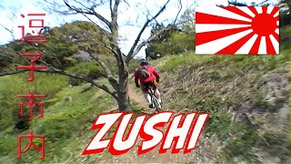
Aug 9, 2022 , Zushi
youtuber
![SMASHING BIKES WITH ROCKS | Racing the Enduro...]()
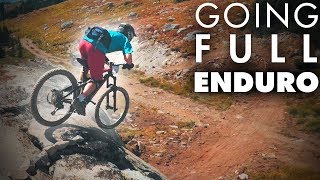
46:31 |
230 |
Dec 1, 2017
youtuber
![SHUTTLING WITH THE JAPANESE JR. DH CHAMP! |...]()

31:44 |
570 |
Jan 26, 2018
youtuber
![HALF-PIPE BIKE TRAIL IN JAPAN!? | Our First...]()

30:43 |
673 |
Jan 19, 2018
Recent Trail Reports
Activity Feed
| username | action | type | title | date |
|---|---|---|---|---|
| N96GhC | wishlist | region | activity #94872696 | May 16, 2026 @ 9:25pm May 16, 2026 |
| Jl39gh | wishlist | trail | activity #94316013 | May 9, 2026 @ 1:02am May 9, 2026 |
| koji526 | update | region | activity #90170213 | Mar 7, 2026 @ 7:11pm Mar 7, 2026 |
| koji526 | add | directory | activity #89800793 | Mar 1, 2026 @ 1:00pm Mar 1, 2026 |
| koji526 | add | trail | activity #89686801 | Feb 28, 2026 @ 6:12am Feb 28, 2026 |
Recent Comments
| username | type | title | comment | date |
|---|---|---|---|---|
| trail | Don't go through the property of the junior... | Jun 25, 2024 @ 10:41am Jun 25, 2024 |
Local Badges
-

Descent 10k Badge2 awarded -

Descent 100k Badge0 awarded -
Descent 10k Badge4 awarded -
Descent 100k Badge0 awarded -
Descent 10k Badge3 awarded -

Epic Ride Descent 2k51 awarded
Local Mountain Biking Directory
-
OverRides
-
The Trail StoreBike Shop
-
Fuma ShinjukuBike Shop
Activity Type Stats
| activitytype | trails | distance | descent | descent distance | total vertical | rating | global rank | state rank | photos | reports | routes | ridelogs |
|---|---|---|---|---|---|---|---|---|---|---|---|---|
| Mountain Bike | 158 | 109 miles | 33,963 ft | 61 miles | 3,734 ft | 127 | 208 | 4 | 12,511 | |||
| E-Bike | 149 | 107 miles | 35,085 ft | 61 miles | 3,698 ft | 187 | 3 | 240 | ||||
| Gravel Bike | 1 | 1 | 12 | |||||||||
| Horse | 1 | 2 miles | 164 ft | 4,662 ft | 141 ft | 3 | ||||||
| Hike | 158 | 123 miles | 39,948 ft | 71 miles | 3,734 ft | 13 | 208 | 1,365 | ||||
| Trail Running | 165 | 123 miles | 39,948 ft | 71 miles | 3,734 ft | 208 | 103 | |||||
| Dirtbike/Moto | 2 | 2 miles | 164 ft | 4,662 ft | 141 ft | 3 | 1 | |||||
| Observed Trials | 2 | 3 miles | 318 ft | 1 mile | 289 ft | 1 | ||||||
| ATV/ORV/OHV | 1 | 2 miles | 164 ft | 4,662 ft | 141 ft | 3 | ||||||
| Snowmobile | 1 | 2 miles | 164 ft | 4,662 ft | 141 ft | |||||||
| Snowshoe | 2 | 3 miles | 318 ft | 1 mile | 289 ft | |||||||
| Downhill Ski | 4 | 3 miles | 735 ft | 2 miles | 397 ft | 6 | ||||||
| Backcountry Ski | 1 | 2 miles | 164 ft | 4,662 ft | 141 ft | 6 | ||||||
| Nordic Ski | 2 | 3 miles | 318 ft | 1 mile | 289 ft | 2 |
Activities
Trails
Points of Interest
- By brenthillier
 NSMBA TRAILFORKS & contributors
 - Admins: KABA, BCpov, robmcm
- #7772 - 2,414 views
- kantō region activity log | embed map of Kantō Region mountain bike trails | kantō region mountain biking points of interest
Downloading of trail gps tracks in kml & gpx formats is enabled for Kantō Region.
You must login to download files.