close
-
Layers w
- Weather Layers
- Pro
- Pro
- Pro
- Pro
- Pro
- Pro
- More Layers
- Pro
- Pro
- Pro
- Pro
-
Upgrade to

3D
Trail Conditions
- Unknown
- Snow Groomed
- Snow Packed
- Snow Covered
- Snow Cover Partial
- Freeze/thaw Cycle
- Icy
- Prevalent Mud
- Wet
- Variable
- Ideal
- Dry
- Very Dry
Trail Flow (Ridden Direction)
Trailforks scans users ridelogs to determine the most popular direction each trail is ridden. A good flowing trail network will have most trails flowing in a single direction according to their intension.
The colour categories are based on what percentage of riders are riding a trail in its intended direction.
The colour categories are based on what percentage of riders are riding a trail in its intended direction.
- > 96%
- > 90%
- > 80%
- > 70%
- > 50%
- < 50%
- bi-directional trail
- no data
Trail Last Ridden
Trailforks scans ridelogs to determine the last time a trail was ridden.
- < 2 days
- < 1 week
- < 2 weeks
- < 1 month
- < 6 months
- > 6 months
Trail Ridden Direction
The intended direction a trail should be ridden.
- Downhill Only
- Downhill Primary
- Both Directions
- Uphill Primary
- Uphill Only
- One Direction
Contribute Details
Colors indicate trail is missing specified detail.
- Description
- Photos
- Description & Photos
- Videos
Trail Popularity ?
Trailforks scans ridelogs to determine which trails are ridden the most in the last 9 months.
Trails are compared with nearby trails in the same city region with a possible 25 colour shades.
Think of this as a heatmap, more rides = more kinetic energy = warmer colors.
- most popular
- popular
- less popular
- not popular
ATV/ORV/OHV Filter
Max Vehicle Width
inches
US Cell Coverage
Legend

Radar Time
Activity Recordings
Trailforks uses anonymized public activity data.
?
Activity Recordings
Trailforks uses anonymized public activity data.
?
Personal Heatmap
▶
Activity Types
all
/
none
▶
Options
2
Date range
month
–
Winter Trails
Warning
A routing network for winter maps does not exist. Selecting trails using the winter trails layer has been disabled.
Missing Trails
Most Popular
Least Popular
Trails are colored based on popularity. The more popular a trail is, the more red. Less popular trails trend towards green.
Jump Magnitude Heatmap
Heatmap of where riders jump on trails. Zoom in to see individual jumps, click circles to view jump details.
BC Backroad Status
![map legend]()
Service Road Atlas is a free to use, community-driven service for viewing and creating reports on the numerous back-country service roads around B.C. and Alberta.

Slope Aspect
Direction the slope faces
Trails Deemphasized
Trails are shown in grey.
Only show trails with no bike usage.
Suggested Layers
Based on selected activity type
Save the current map location and zoom level as your default home location whenever this page is loaded.
Save
No description for Koper has been added yet!
Login or register to submit one.
This region uses the Uk/Euro style trail grading system.
Activities Click to view
- Mountain Bike
49 trails
- E-Bike
21 trails
- Gravel Bike
0 trails
- Adaptive Bike
0 trails
- Winter Fat Bike
0 trails
- Horse
6 trails
- Hike
45 trails
- Trail Running
45 trails
- Dirtbike/Moto
4 trails
Region Details
- 28
- 7
- 12
- 1
- 1
Region Status
Open as of Jun 12, 2026Stats
- Avg Trail Rating
- Trails (view details)
- 50
- Trails Mountain Bike
- 49
- Trails E-Bike
- 21
- Trails Horse
- 6
- Trails Hike
- 45
- Trails Trail Running
- 45
- Trails Dirtbike/Moto
- 4
- Trails ATV/ORV/OHV
- 2
- Total Distance
- 48 miles
- Total Descent
- 6,262 ft
- Total Vertical
- 2,314 ft
- Highest Trailhead
- 2,338 ft
- Reports
- 1,222
- Photos
- 204
- Ridden Counter
- 5,095
Sub Regions
Popular Koper Mountain Biking Trails
• 90 ★ 4.6 • 1 mile • 0 ft • 140 •
Nice trail that start close to the refuge, well marked. Start with few tide and rocky turns and then it get easier and with more flow. In the final part the trail split in two: the one one the left tide and flat bring you to the border...
• 75 ★ 4.8 • 1 mile • 23 ft • 84 •
Nice natural singletrack in an unique environment (the trail pass through a small waterfall!). Start with flow in an oak wood but soon the trail start to mix some steep part, offcamber and fast sections. Halfway the terrain change and...
• 50 ★ 5.0 • 1 mile • 3 ft • 42 •
Easy rocky trail on karst terrain ridge with nice views! 0% MTB built, but super nice for MTB riding. Marked dual purpose path for hikers and bikers, used mainly for hiking activity. Respect the hikers! Rideable in opposite direction...
• 65 ★ 5.0 • 2,835 ft • 81 ft • 42 •
Large trail with roots into a beatiful fir wood
• 40 ★ 4.0 • 2,680 ft • 79 ft • 24 •
Nice XC singletrack path with some rocks and berms. Ends in village Dvori. Marked dual purpose path for hikers and bikers.
• 60 ★ 5.0 • 1 mile • 0 ft • 18 •
Partly rocky trail, mostly down the forest.
Koper Mountain Bike Routes
★ 5.0 • 13 miles • 1,901 ft • 4 • Loop •
First dual purpose path for hikers and mountain bikers in Slovenia, opened avgust 25, 2013. Riding...
15 miles • 2,044 ft • 1 • Loop •
Funded by the European Union. Views and opinions expressed are however those of the author(s) only and do...
19 miles • 2,347 ft • 0 • Loop •
Funded by the European Union. Views and opinions expressed are however those of the author(s) only and do...
17 miles • 1,792 ft • 0 • Loop •
Funded by the European Union. Views and opinions expressed are however those of the author(s) only and do...
10 miles • 1,673 ft • 0 • Loop •
Funded by the European Union. Views and opinions expressed are however those of the author(s) only and do...
13 miles • 2,143 ft • 0 • Loop •
Funded by the European Union. Views and opinions expressed are however those of the author(s) only and do...
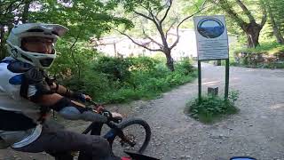
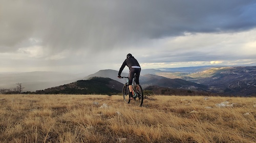
Photos of Koper Mountain Bike
Videos of Koper Mountain Bike
trail: Osp - Tinjan
5:37 |
169 |
Feb 25, 2021
trail: Osp - Črni Kal
0:09 |
195 |
Feb 25, 2021
trail: Osp - Črni Kal
0:07 |
184 |
Feb 25, 2021
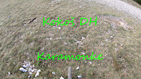
trail: Kokoš DH
7:42 |
136 |
Oct 26, 2020
trail: El Griza
7:56 |
138 |
Jan 28, 2025 , Koper

trail: El Griza
9:00 |
83 |
Jan 28, 2025 , Koper
trail: Downhill run down the forest
5:56 |
196 |
Dec 6, 2024 , Koper
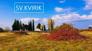
trail: Kvirik
8:03 |
82 |
Dec 6, 2024 , Koper
Recent Trail Reports
| status | trail | date | condition | info | user |
|---|---|---|---|---|---|
| Kokoš DH | Jun 12, 2026 @ 9:49am (Europe/Ljubljana) Jun 12, 2026 | Dry | days-on-trails IGMTBZug | ||
| Kvirik | May 17, 2026 @ 3:49pm (Europe/Ljubljana) May 17, 2026 | Ideal | Istriano | ||
| Osp - Prebeneg | Apr 11, 2026 @ 11:10am (Europe/Ljubljana) Apr 11, 2026 | Ideal | AlfonsoTraverso | ||
| Prebenico - Istralandia | Apr 11, 2026 @ 11:10am (Europe/Ljubljana) Apr 11, 2026 | Dry | AlfonsoTraverso | ||
| Qbed trail | Mar 8, 2026 @ 10:56am (Europe/Ljubljana) Mar 8, 2026 | Variable | Istriano | ||
| Pomjan DH | Mar 7, 2026 @ 11:38am (Europe/Ljubljana) Mar 7, 2026 | Prevalent Mud | Istriano | ||
| Enduro | Mar 7, 2026 @ 11:38am (Europe/Ljubljana) Mar 7, 2026 | Prevalent Mud | Istriano | ||
| Oriente Express | Jan 3, 2026 @ 4:29pm (Europe/Ljubljana) Jan 3, 2026 | Unknown | pogli | ||
| El Griza | Dec 21, 2025 @ 11:29am (Europe/Rome) Dec 21, 2025 | Prevalent Mud | Jernejo | ||
| Lačna | Nov 7, 2025 @ 9:50am (Europe/Ljubljana) Nov 7, 2025 | Ideal | zocknroll TRAILFORKS |
National Scenic Trails & Official Routes
-
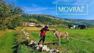
Movraška turnokolesarska pot
- Mountain Bike
- Hike
Activity Feed
| username | action | type | title | date |
|---|---|---|---|---|
| GbAFuSG | comment | trail | activity #97973090 | Jun 28, 2026 @ 3:21am Jun 28, 2026 |
| Nevtro | ridden | trail | activity #97656681 and 1 more | Jun 23, 2026 @ 3:52pm Jun 23, 2026 |
| days-on-trails | add | report | activity #96855090 | Jun 13, 2026 @ 2:02am Jun 13, 2026 |
| leandi | wishlist | trail | activity #96851177 and 1 more | Jun 12, 2026 @ 11:57pm Jun 12, 2026 |
| leandi | wishlist | trail | activity #96851094 and 1 more | Jun 12, 2026 @ 11:55pm Jun 12, 2026 |
Recent Comments
| username | type | title | comment | date |
|---|---|---|---|---|
| trail | na zacetku traila so drevesa cez pot in... | Jun 28, 2026 @ 3:21am Jun 28, 2026 | ||
| trail | Trejl je zaprt. Na sredini je nov oljkin nasad. | Apr 22, 2025 @ 8:09am Apr 22, 2025 | ||
| trail | Trail is closed. | Mar 27, 2025 @ 8:37am Mar 27, 2025 | ||
| trail | A little less than halfway through the trail,... | Mar 11, 2025 @ 4:58am Mar 11, 2025 | ||
| trail | Nice trail, dynamic, not difficult, a bit of... | Jan 22, 2025 @ 4:05am Jan 22, 2025 |
Local Badges
-

Epic Ride Climb 2k105 awarded -

Climbing 10k Badge68 awarded -

Climbing 100k Badge3 awarded -

Epic Ride Descent 2k132 awarded -

Descent 10k Badge67 awarded -

Descent 100k Badge3 awarded
Local Trail Supporters
- Obalna Bike Scena
Activity Type Stats
| activitytype | trails | distance | descent | descent distance | total vertical | rating | global rank | state rank | photos | reports | routes | ridelogs |
|---|---|---|---|---|---|---|---|---|---|---|---|---|
| Mountain Bike | 49 | 48 miles | 6,234 ft | 14 miles | 2,313 ft | #1,098 | #3 | 158 | 1,222 | 8 | 6,524 | |
| E-Bike | 21 | 11 miles | 1,309 ft | 3 miles | 2,201 ft | #1,461 | #11 | 938 | 7 | 1,247 | ||
| Horse | 6 | 3 miles | 755 ft | 1 mile | 1,096 ft | #594 | #5 | 190 | ||||
| Hike | 45 | 48 miles | 6,070 ft | 14 miles | 2,313 ft | #1,647 | #7 | 1,067 | 1 | 318 | ||
| Trail Running | 45 | 48 miles | 6,070 ft | 14 miles | 2,313 ft | #1,235 | #6 | 9 | 1,065 | 1 | 38 | |
| Dirtbike/Moto | 4 | 2 miles | 712 ft | 1 mile | 712 ft | #457 | #3 | 185 | ||||
| ATV/ORV/OHV | 2 | 181 |
Frequently Asked Questions About Koper
▼
What are the best places to ride in Koper?
▼
What are the highest rated mountain biking trails in Koper?
The highest rated mountain biking trails in Koper are:
- Oriente Express (4.5/5)
- El Griza (4.5/5)
- Kokoš DH (4.3/5)
- Veliko Gradišče Fir Wood (4.2/5)
- Downhill run down the forest (4.2/5)
▼
What is the best time of the year to ride in Koper?
Based on ride log data, the most popular months to ride in Koper are:
- May (65 activities)
- June (45 activities)
- July (44 activities)
▼
Where can I park to ride in Koper?
There are 9 parking locations listed in Koper. The most popular parking spots are: View all parking and trailhead locations on the map to plan your visit.
Activities
Trails
- By karampampoli
 & contributors
 - Admins: OBS
- #16752 - 10,576 views
- koper activity log | embed map of Koper mountain bike trails | koper mountain biking points of interest
Downloading of trail gps tracks in kml & gpx formats is enabled for Koper.
You must login to download files.