close
-
Layers w
- Map Content
- More Layers
- Pro
- Pro
- Pro
- Pro
- Pro
- Pro
- Pro
- Pro
-
Upgrade to

3D
Trail Conditions
- Unknown
- Snow Groomed
- Snow Packed
- Snow Covered
- Snow Cover Partial
- Freeze/thaw Cycle
- Icy
- Prevalent Mud
- Wet
- Variable
- Ideal
- Dry
- Very Dry
Trail Flow (Ridden Direction)
Trailforks scans users ridelogs to determine the most popular direction each trail is ridden. A good flowing trail network will have most trails flowing in a single direction according to their intension.
The colour categories are based on what percentage of riders are riding a trail in its intended direction.
The colour categories are based on what percentage of riders are riding a trail in its intended direction.
- > 96%
- > 90%
- > 80%
- > 70%
- > 50%
- < 50%
- bi-directional trail
- no data
Trail Last Ridden
Trailforks scans ridelogs to determine the last time a trail was ridden.
- < 2 days
- < 1 week
- < 2 weeks
- < 1 month
- < 6 months
- > 6 months
Trail Ridden Direction
The intended direction a trail should be ridden.
- Downhill Only
- Downhill Primary
- Both Directions
- Uphill Primary
- Uphill Only
- One Direction
Contribute Details
Colors indicate trail is missing specified detail.
- Description
- Photos
- Description & Photos
- Videos
Trail Popularity ?
Trailforks scans ridelogs to determine which trails are ridden the most in the last 9 months.
Trails are compared with nearby trails in the same city region with a possible 25 colour shades.
Think of this as a heatmap, more rides = more kinetic energy = warmer colors.
- most popular
- popular
- less popular
- not popular
ATV/ORV/OHV Filter
Max Vehicle Width
inches
US Cell Coverage
Legend

Radar Time
x
Activity Recordings
Trailforks users anonymized public ridelogs from the past 6 months.
- mountain biking recent
- mountain biking (>6 month)
- hiking (1 year)
- moto (1 year)
Activity Recordings
Trailforks users anonymized public skilogs from the past 12 months.
- Downhill Ski
- Backcountry Ski
- Nordic Ski
- Snowmobile
Winter Trails
Warning
A routing network for winter maps does not exist. Selecting trails using the winter trails layer has been disabled.
x
Missing Trails
Most Popular
Least Popular
Trails are colored based on popularity. The more popular a trail is, the more red. Less popular trails trend towards green.
Jump Magnitude Heatmap
Heatmap of where riders jump on trails. Zoom in to see individual jumps, click circles to view jump details.
Trails Deemphasized
Trails are shown in grey.
Only show trails with NO bikes.
Save the current map location and zoom level as your default home location whenever this page is loaded.
SaveTinjan is hill with a small village on top in the City Municipality of Koper in the Littoral region of Slovenia.
source: Wikipedia
Primary Trail Type: All-Mountain & Downhill
Shuttleable: YES
Land Status: National Forest
 google parking directions
This region uses the Uk/Euro style trail grading system.
Activities Click to view
- Mountain Bike
16 trails
- E-Bike
4 trails
- Hike
15 trails
- Trail Running
15 trails
Region Details
- 14
- 1
- 1
Region Status
Caution as of May 12, 2024Stats
- Avg Trail Rating
- Trails (view details)
- 16
- Trails Mountain Bike
- 16
- Trails E-Bike
- 4
- Trails Horse
- 1
- Trails Hike
- 15
- Trails Trail Running
- 15
- Total Distance
- 20 miles
- Total Descent
- 1,144 ft
- Total Vertical
- 1,148 ft
- Highest Trailhead
- 1,228 ft
- Reports
- 746
- Photos
- 104
- Ridden Counter
- 2,883
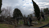
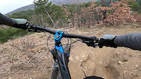
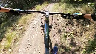
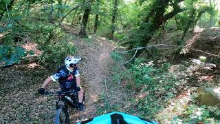
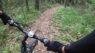
Popular Tinjan Mountain Biking Trails
Photos of Tinjan Mountain Bike
trail: Puding
19 |
May 2, 2023 @ 10:23am
May 2, 2023
trail: Prebenico - Istralandia
54 |
Jan 14, 2022 @ 11:19am
Jan 14, 2022
trail: Osp - Črni Kal
44 |
Jan 14, 2022 @ 11:14am
Jan 14, 2022Videos of Tinjan Mountain Bike
trail: Osp - Tinjan
142 |
Feb 25, 2021
trail: Osp - Črni Kal
160 |
Feb 25, 2021

trail: Osp - Črni Kal
155 |
Feb 25, 2021

trail: Oriente Express
4:44 |
327 |
Sep 13, 2021 , Koper
trail: Puding
4:37 |
455 |
Aug 20, 2021 , Koper
trail: Oriente Express
6:51 |
245 |
Jul 11, 2021 , Koper

trail: Puding
6:02 |
189 |
Jul 1, 2021 , Koper
trail: Oriente Express
6:16 |
224 |
Jun 11, 2021 , Koper
Current Trail Warnings
| status | trail | date | condition | user | info |
|---|---|---|---|---|---|
| Osp - Tinjan | Apr 27, 2024 @ 5:07am Apr 27, 2024 | Unknown | julian-mtb | The climb to Tinjan is prohibited due to... |
Recent Trail Reports
| status | trail | date | condition | info | user |
|---|---|---|---|---|---|
| Predloka - Črni Kal | May 12, 2024 @ 1:55am May 12, 2024 | Dry | DeadKennedy | ||
| Oriente Express | May 12, 2024 @ 1:55am May 12, 2024 | Dry | DeadKennedy | ||
| Osp - Prebeneg | May 10, 2024 @ 2:42am May 10, 2024 | Ideal | AlfonsoTraverso | ||
| Prebenico - Istralandia | May 10, 2024 @ 2:42am May 10, 2024 | Ideal | AlfonsoTraverso | ||
| Istralandia izhod | Mar 16, 2024 @ 6:00am Mar 16, 2024 | Dry | AlfonsoTraverso | ||
| Toboga del Castello Access from Socerb | Jan 28, 2024 @ 5:21am Jan 28, 2024 | Ideal | stasa | ||
| Osp - Lovska | Sep 18, 2023 @ 6:52am Sep 18, 2023 | Dry | Istriano | ||
| Puding | Aug 3, 2023 @ 12:33am Aug 3, 2023 | Variable | DeadKennedy | ||
| Osp - Črni Kal | Jun 25, 2023 @ 2:13am Jun 25, 2023 | Very Dry | GoldMountainBikers | ||
| Tinjan Shortcut | Sep 11, 2021 @ 1:58am Sep 11, 2021 | Dry | AlfonsoTraverso |
Activity Feed
| username | action | type | title | date |
|---|---|---|---|---|
| DeadKennedy | add | report | activity #52471897 and 2 more | May 12, 2024 @ 4:28am May 12, 2024 |
| AlfonsoTraverso | add | report | activity #52374908 and 1 more | May 10, 2024 @ 10:37am May 10, 2024 |
| WernerAfd1C5 | wishlist | trail | activity #51497625 | Apr 21, 2024 @ 1:14pm Apr 21, 2024 |
| samueltono | wishlist | trail | activity #51331012 | Apr 18, 2024 @ 1:49am Apr 18, 2024 |
| AlfonsoTraverso | add | report | activity #51122438 and 1 more | Apr 13, 2024 @ 8:23am Apr 13, 2024 |
Recent Comments
| username | type | title | comment | date |
|---|---|---|---|---|
| trail | Very steep climb. Mostly asphalt road. | Nov 30, 2021 @ 9:43am Nov 30, 2021 | ||
| trail | This route is in use of construction workers... | Aug 15, 2021 @ 6:05am Aug 15, 2021 | ||
| trail | Oriente Express is closer to the actual... | Jan 16, 2020 @ 2:19am Jan 16, 2020 | ||
| trail | Short hi nice trail. starting point directly... | Aug 27, 2019 @ 7:03am Aug 27, 2019 | ||
| trail | Nice Trail. Well done! | Jul 24, 2019 @ 4:00am Jul 24, 2019 |
Nearby Areas
| name | distance | ||||
|---|---|---|---|---|---|
| Bagnoli-Dolina | 8 | 5 | 2.6 km | ||
| Kubed | 3 km | ||||
| 3 Camini - Cascatelle | 5 | 4 | 4.2 km | ||
| Basovìzza - Bazovica | 75 | 6 | 4.8 km | ||
| Parco del Farneto | 9 | 2 | 5.4 km |
Local Badges
-

Completionist2 awarded
Activity Type Stats
| activitytype | trails | distance | descent | descent distance | total vertical | rating | global rank | state rank | photos | reports | routes | ridelogs |
|---|---|---|---|---|---|---|---|---|---|---|---|---|
| Mountain Bike | 16 | 20 miles | 1,145 ft | 3 miles | 1,148 ft | #1,789 | #4 | 95 | 746 | 1,814 | ||
| E-Bike | 4 | 5 miles | 148 ft | 2,825 ft | 1,093 ft | #1,617 | #13 | 578 | 223 | |||
| Horse | 1 | 3,517 ft | 443 ft | 125 | ||||||||
| Hike | 15 | 19 miles | 951 ft | 2 miles | 1,148 ft | #2,052 | #2 | 637 | 24 | |||
| Trail Running | 15 | 19 miles | 951 ft | 2 miles | 1,148 ft | #2,079 | #2 | 9 | 635 | 2 |
- By karampampoli & contributors
- Admins: OBS
- #16596 - 7,586 views
- tinjan activity log | embed map of Tinjan mountain bike trails | tinjan mountain biking points of interest
Downloading of trail gps tracks in kml & gpx formats is enabled for Tinjan.
You must login to download files.