close
-
Layers w
- Weather Layers
- Pro
- Pro
- Pro
- Pro
- Pro
- Pro
- More Layers
- Pro
- Pro
- Pro
- Pro
-
Upgrade to

3D
Trail Conditions
- Unknown
- Snow Groomed
- Snow Packed
- Snow Covered
- Snow Cover Partial
- Freeze/thaw Cycle
- Icy
- Prevalent Mud
- Wet
- Variable
- Ideal
- Dry
- Very Dry
Trail Flow (Ridden Direction)
Trailforks scans users ridelogs to determine the most popular direction each trail is ridden. A good flowing trail network will have most trails flowing in a single direction according to their intension.
The colour categories are based on what percentage of riders are riding a trail in its intended direction.
The colour categories are based on what percentage of riders are riding a trail in its intended direction.
- > 96%
- > 90%
- > 80%
- > 70%
- > 50%
- < 50%
- bi-directional trail
- no data
Trail Last Ridden
Trailforks scans ridelogs to determine the last time a trail was ridden.
- < 2 days
- < 1 week
- < 2 weeks
- < 1 month
- < 6 months
- > 6 months
Trail Ridden Direction
The intended direction a trail should be ridden.
- Downhill Only
- Downhill Primary
- Both Directions
- Uphill Primary
- Uphill Only
- One Direction
Contribute Details
Colors indicate trail is missing specified detail.
- Description
- Photos
- Description & Photos
- Videos
Trail Popularity ?
Trailforks scans ridelogs to determine which trails are ridden the most in the last 9 months.
Trails are compared with nearby trails in the same city region with a possible 25 colour shades.
Think of this as a heatmap, more rides = more kinetic energy = warmer colors.
- most popular
- popular
- less popular
- not popular
ATV/ORV/OHV Filter
Max Vehicle Width
inches
US Cell Coverage
Legend

Radar Time
Activity Recordings
Trailforks uses anonymized public activity data.
?
Activity Recordings
Trailforks uses anonymized public activity data.
?
Personal Heatmap
▶
Activity Types
all
/
none
▶
Options
2
Date range
month
–
Winter Trails
Warning
A routing network for winter maps does not exist. Selecting trails using the winter trails layer has been disabled.
Missing Trails
Most Popular
Least Popular
Trails are colored based on popularity. The more popular a trail is, the more red. Less popular trails trend towards green.
Jump Magnitude Heatmap
Heatmap of where riders jump on trails. Zoom in to see individual jumps, click circles to view jump details.
BC Backroad Status
![map legend]()
Service Road Atlas is a free to use, community-driven service for viewing and creating reports on the numerous back-country service roads around B.C. and Alberta.

Slope Aspect
Direction the slope faces
Trails Deemphasized
Trails are shown in grey.
Only show trails with no bike usage.
Suggested Layers
Based on selected activity type
Save the current map location and zoom level as your default home location whenever this page is loaded.
Save
No description for Kruth has been added yet!
Login or register to submit one.
This region uses the Uk/Euro style trail grading system.
Activities Click to view
- Mountain Bike
14 trails
- E-Bike
10 trails
- Adaptive Bike
0 trails
- Hike
14 trails
- Trail Running
14 trails
Region Details
- 2
- 3
- 4
- 1
Region Status
Open as of May 10, 2026Stats
- Avg Trail Rating
- Trails (view details)
- 13
- Trails Mountain Bike
- 14
- Trails E-Bike
- 10
- Trails Hike
- 14
- Trails Trail Running
- 14
- Total Distance
- 27 miles
- Total Descent
- 11,773 ft
- Total Vertical
- 2,633 ft
- Highest Trailhead
- 4,166 ft
- Reports
- 86
- Photos
- 32
- Ridden Counter
- 449
Popular Kruth Mountain Biking Trails
• 80 ★ 4.4 • 4 miles • 396 ft • 119 •
Traverse from Markstein to Treh, then down to the valley traversing different kind of forest, terrain and type of trail. A good mix to have an overview of what the region has to offer. A little climb in the middle to a viewpoint worth...
• 5 ★ 3.0 • 1 mile • 823 ft • 23 •
Less popular green difficulty mixed. This mountain bike primary trail can be used uphill only and has a hard overall physical rating with a 823 ft green climb. On average it takes 23 minutes to complete this trail.
• 5 ★ 2.8 • 5 miles • 657 ft • 18 • • hike
Less popular green difficulty doubletrack. This hike primary trail and has a easy overall physical rating with a 657 ft green climb. On average it takes 51 minutes to complete this trail.
• 75 ★ 4.4 • 4,613 ft • 0 ft • 18 •
Quelques épingles bien raides sur le haut puis final très technique le long du ruisseau. Avec un très bon niveau tout passe sur le bike mais à éviter par temps humide.
• 5 ★ 1.0 • 5,223 ft • 145 ft • 11 •
Less popular blue difficulty singletrack. This mountain bike primary trail can be used downhill only. On average it takes 15 minutes to complete this trail.
• 50 ★ 0.0 • 1,260 ft • 83 ft • 4 •
Moderately popular black difficulty singletrack. This mountain bike primary trail can be used downhill primary. On average it takes 3 minutes to complete this trail.
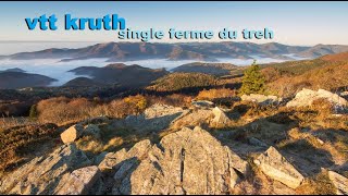
Kruth Mountain Bike Routes
3 miles • 984 ft • 0 •
Départ depuis le col de Bussang suivre GR sur sentier puis chemin 4x4
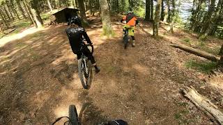
Photos of Kruth Mountain Bike
Videos of Kruth Mountain Bike
trail: Multiworld
27:00 |
373 |
Aug 26, 2023 , Kruth
trail: Multiworld
12:32 |
296 |
Mar 9, 2023 , Kruth
Recent Trail Reports
| status | trail | date | condition | info | user |
|---|---|---|---|---|---|
| Multiworld | May 10, 2026 @ 3:40pm (Europe/Paris) May 10, 2026 | Ideal | Mykimike | ||
| CRAZY ROCKY ST NICOLAS | May 14, 2025 @ 8:45am May 14, 2025 | Dry | sandstreuer | ||
| Access Neuf Bois | Apr 10, 2025 @ 9:48am Apr 10, 2025 | Dry | Pierrer6JnHH | ||
| Mac Academy | Jun 24, 2023 @ 6:53am Jun 24, 2023 | Dry | BaptouM88 | ||
| Les Cretes | May 15, 2023 @ 10:41am May 15, 2023 | Ideal | Odentom |
Activity Feed
| username | action | type | title | date |
|---|---|---|---|---|
| jojo2 | ridden | trail | activity #96354441 | Jun 6, 2026 @ 4:02am Jun 6, 2026 |
| fntms | wishlist | trail | activity #95198572 | May 21, 2026 @ 1:47pm May 21, 2026 |
| Mykimike | add | report | activity #94421456 | May 10, 2026 @ 6:40am May 10, 2026 |
| Mykimike | ridden | trail | activity #94421228 | May 10, 2026 @ 6:36am May 10, 2026 |
| TomtheRock | vote | trail | activity #93940800 | May 3, 2026 @ 6:30am May 3, 2026 |
Recent Comments
| username | type | title | comment | date |
|---|---|---|---|---|
| trail | Nicht empfehlenswert. | Jun 27, 2024 @ 7:21am Jun 27, 2024 | ||
| trail | Not that steep, as expected. Good alpine... | Jun 26, 2024 @ 1:08pm Jun 26, 2024 | ||
| trail | In the upper part along the road you need to... | Jun 25, 2024 @ 9:03am Jun 25, 2024 | ||
| trail | Single sympa mais si vous chercher de... | Sep 26, 2023 @ 12:40pm Sep 26, 2023 | ||
| trail | One of the better trails here. Especially the... | Sep 25, 2023 @ 9:13am Sep 25, 2023 |
Local Badges
-

Epic Ride Climb 2k78 awarded -

Climbing 10k Badge6 awarded -

Climbing 100k Badge0 awarded -

Epic Ride Descent 2k90 awarded -

Descent 10k Badge6 awarded -

Descent 100k Badge0 awarded
Activity Type Stats
| activitytype | trails | distance | descent | descent distance | total vertical | rating | global rank | state rank | photos | reports | routes | ridelogs |
|---|---|---|---|---|---|---|---|---|---|---|---|---|
| Mountain Bike | 14 | 27 miles | 11,772 ft | 15 miles | 2,635 ft | #5,779 | #230 | 32 | 86 | 2 | 610 | |
| E-Bike | 10 | 20 miles | 6,306 ft | 9 miles | 2,635 ft | #4,251 | #249 | 50 | 119 | |||
| Hike | 14 | 27 miles | 11,772 ft | 15 miles | 2,635 ft | #5,718 | #192 | 86 | 102 | |||
| Trail Running | 14 | 27 miles | 11,772 ft | 15 miles | 2,635 ft | #5,387 | #188 | 86 | 9 |
Frequently Asked Questions About Kruth
▼
What are the best places to ride in Kruth?
Kruth has 1 areas to explore for mountain biking.
▼
What are the highest rated mountain biking trails in Kruth?
The highest rated mountain biking trails in Kruth are:
- Multiworld (4.4/5)
- CRAZY ROCKY ST NICOLAS (4.2/5)
- Acces aux Cretes (3.8/5)
- Les Cretes (3.8/5)
- Mac Academy (3.6/5)
▼
What is the best time of the year to ride in Kruth?
Based on ride log data, the most popular months to ride in Kruth are:
- August (11 activities)
- June (5 activities)
- September (5 activities)
▼
Where can I park to ride in Kruth?
Check the Kruth trail map for trailhead and parking information. Community members regularly update access and parking details for trails in the area.
Activities
Trails
Points of Interest
- By loizorider & contributors
- Admins: apply
- #11779 - 3,796 views
- kruth activity log | embed map of Kruth mountain bike trails | kruth mountain biking points of interest
Downloading of trail gps tracks in kml & gpx formats is enabled for Kruth.
You must login to download files.