close
-
Layers w
- Map Content
- More Layers
- Pro
- Pro
- Pro
- Pro
- Pro
- Pro
- Pro
- Pro
-
Upgrade to

3D
Trail Conditions
- Unknown
- Snow Groomed
- Snow Packed
- Snow Covered
- Snow Cover Partial
- Freeze/thaw Cycle
- Icy
- Prevalent Mud
- Wet
- Variable
- Ideal
- Dry
- Very Dry
Trail Flow (Ridden Direction)
Trailforks scans users ridelogs to determine the most popular direction each trail is ridden. A good flowing trail network will have most trails flowing in a single direction according to their intension.
The colour categories are based on what percentage of riders are riding a trail in its intended direction.
The colour categories are based on what percentage of riders are riding a trail in its intended direction.
- > 96%
- > 90%
- > 80%
- > 70%
- > 50%
- < 50%
- bi-directional trail
- no data
Trail Last Ridden
Trailforks scans ridelogs to determine the last time a trail was ridden.
- < 2 days
- < 1 week
- < 2 weeks
- < 1 month
- < 6 months
- > 6 months
Trail Ridden Direction
The intended direction a trail should be ridden.
- Downhill Only
- Downhill Primary
- Both Directions
- Uphill Primary
- Uphill Only
- One Direction
Contribute Details
Colors indicate trail is missing specified detail.
- Description
- Photos
- Description & Photos
- Videos
Trail Popularity ?
Trailforks scans ridelogs to determine which trails are ridden the most in the last 9 months.
Trails are compared with nearby trails in the same city region with a possible 25 colour shades.
Think of this as a heatmap, more rides = more kinetic energy = warmer colors.
- most popular
- popular
- less popular
- not popular
ATV/ORV/OHV Filter
Max Vehicle Width
inches
US Cell Coverage
Legend

Radar Time
x
Activity Recordings
Trailforks users anonymized public ridelogs from the past 6 months.
- mountain biking recent
- mountain biking (>6 month)
- hiking (1 year)
- moto (1 year)
Activity Recordings
Trailforks users anonymized public skilogs from the past 12 months.
- Downhill Ski
- Backcountry Ski
- Nordic Ski
- Snowmobile
Winter Trails
Warning
A routing network for winter maps does not exist. Selecting trails using the winter trails layer has been disabled.
x
Missing Trails
Most Popular
Least Popular
Trails are colored based on popularity. The more popular a trail is, the more red. Less popular trails trend towards green.
Jump Magnitude Heatmap
Heatmap of where riders jump on trails. Zoom in to see individual jumps, click circles to view jump details.
Trails Deemphasized
Trails are shown in grey.
Only show trails with NO bikes.
Save the current map location and zoom level as your default home location whenever this page is loaded.
SaveWhile it is a little bit of a drive, Lacks Creek Management Area offers higher elevation and well-draining rocky, loamy, and loose soils. There’s literally a trail for everyone here. If you want a beginner flow trail, Lacks has that. If you want fast, steep, rocky descents, Lacks has that. If you want a flowy jump run, Lacks has that. In addition to all of that, Lacks also hosts primitive camping. So come camp for the weekend, relax, get eaten by a few mosquitoes, and have a biking adventure.
source: RCMBA Website
Primary Trail Type: Cross-Country
Shuttleable: YES
Land Status: Conservation Reserve
Land Manager: BLM
 google parking directions
 Access Info:
Drive east on Highway 299 for 17.8 miles from Highway 101. Turn left at the Redwood Valley turn off (Bair Road) and travel 3.9 miles. Make a right turn at the sign that reads "Hoopa - 22 miles", and travel 5.9 miles up this windy gravel road. The entrance is a left turn.
Links
Activities Click to view
- Mountain Bike
10 trails
- Hike
9 trails
- Trail Running
9 trails
Stats
- Avg Trail Rating
- Trails (view details)
- 10
- Trails Mountain Bike
- 10
- Trails Hike
- 9
- Trails Trail Running
- 9
- Total Distance
- 9 miles
- Total Descent
- 3,713 ft
- Total Vertical
- 1,129 ft
- Highest Trailhead
- 3,892 ft
- Reports
- 21
- Photos
- 4
- Ridden Counter
- 385
Popular Lacks Creek Management Area Trails
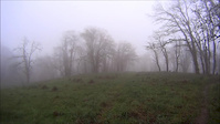
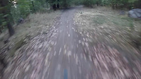
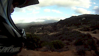
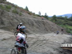
Photos of Lacks Creek Management Area Mountain Bike
trail: Stormy Saddle
14 |
Oct 23, 2023 @ 12:09pm
Oct 23, 2023
trail: Chutes
21 |
Oct 23, 2023 @ 12:08pm
Oct 23, 2023
trail: Ladders
24 |
Oct 23, 2023 @ 11:53am
Oct 23, 2023
trail: Tomfoolery
226 |
Dec 27, 2017 @ 2:33pm
Dec 27, 2017Videos of Lacks Creek Management Area Mountain Bike
trail: Tomfoolery
3:19 |
439 |
May 7, 2017
trail: Jump Line
0:50 |
452 |
Aug 29, 2015
trail: Jump Line
0:51 |
658 |
Jan 27, 2013

trail: Jump Line
0:40 |
333 |
Jul 18, 2011

trail: Chutes
0:05 |
42 |
Oct 23, 2023 , Willow Creek

trail: Chutes
0:08 |
38 |
Oct 23, 2023 , Willow Creek
trail: Chutes
0:05 |
1794 |
Apr 27, 2010
Recent Trail Reports
| status | trail | date | condition | info | user |
|---|---|---|---|---|---|
| Lacks Mountain | Jun 20, 2021 @ 10:09am Jun 20, 2021 | Dry | Taimorgan RCMBA | ||
| Punchbowl | Jun 20, 2021 @ 10:08am Jun 20, 2021 | Dry | Taimorgan RCMBA | ||
| Tomfoolery | Nov 2, 2020 @ 10:18am Nov 2, 2020 | Dry | enbay1 | ||
| Pine Ridge | Nov 2, 2020 @ 10:16am Nov 2, 2020 | Dry | enbay1 | ||
| Stormy Saddle | Nov 2, 2020 @ 8:51am Nov 2, 2020 | Dry | enbay1 | ||
| Jump Line | Oct 10, 2018 @ 9:45am Oct 10, 2018 | Dry | krsbr79 | ||
| Punchbowl Connector | Oct 10, 2018 @ 9:45am Oct 10, 2018 | Dry | krsbr79 |
Activity Feed
| username | action | type | title | date |
|---|---|---|---|---|
| WillieJacobsz | update | region | activity #51855822 | Apr 29, 2024 @ 3:27pm Apr 29, 2024 |
| MelvieD | ridden | trail | activity #45699468 | Oct 28, 2023 @ 6:12pm Oct 28, 2023 |
| yooperjb | add | video | activity #45559233 and 1 more | Oct 23, 2023 @ 12:03pm Oct 23, 2023 |
| yooperjb | add | photo | activity #45559179 and 2 more | Oct 23, 2023 @ 11:53am Oct 23, 2023 |
| yooperjb | add | trail | activity #45559147 | Oct 23, 2023 @ 11:49am Oct 23, 2023 |
Recent Comments
| username | type | title | comment | date |
|---|---|---|---|---|
| trail | A video of a collegiate race on this trail can... | Nov 8, 2017 @ 4:14pm Nov 8, 2017 | ||
| trail | Fun DH trail! This is a legit track! You... | Jun 13, 2017 @ 7:42am Jun 13, 2017 |
Nearby Areas
| name | distance | ||||
|---|---|---|---|---|---|
| Tish Tang | 1 | 9.4 km | |||
| Mactown Bike Trails | 7 | 9 | 3 | 15 km | |
| Hatchery Ridge | 17 | 3 | 15.9 km | ||
| Arcata/Sunny Brae Community Forests | 5 | 24 | 1 | 16.9 km | |
| Hiller Park | 1 | 18 km |
Activity Type Stats
| activitytype | trails | distance | descent | descent distance | total vertical | rating | global rank | state rank | photos | reports | routes | ridelogs |
|---|---|---|---|---|---|---|---|---|---|---|---|---|
| Mountain Bike | 10 | 9 miles | 3,714 ft | 5 miles | 1,129 ft | #8,243 | #3,483 | 4 | 21 | 188 | ||
| Hike | 9 | 9 miles | 3,104 ft | 4 miles | 1,129 ft | #7,741 | #3,550 | 21 | 4 | |||
| Trail Running | 9 | 9 miles | 3,104 ft | 4 miles | 1,129 ft | #7,725 | #3,534 | 21 |
- By digitallcowboy & contributors
- Admins: RCMBA, RCMBA
- #12680 - 6,399 views
- lacks creek management area activity log | embed map of Lacks Creek Management Area mountain bike trails | lacks creek management area mountain biking points of interest
Downloading of trail gps tracks in kml & gpx formats is enabled for Lacks Creek Management Area.
You must login to download files.