close
-
Layers w
- Weather Layers
- Pro
- Pro
- Pro
- Pro
- Pro
- Pro
- More Layers
- Pro
- Pro
- Pro
- Pro
-
Upgrade to

3D
Trail Conditions
- Unknown
- Snow Groomed
- Snow Packed
- Snow Covered
- Snow Cover Partial
- Freeze/thaw Cycle
- Icy
- Prevalent Mud
- Wet
- Variable
- Ideal
- Dry
- Very Dry
Trail Flow (Ridden Direction)
Trailforks scans users ridelogs to determine the most popular direction each trail is ridden. A good flowing trail network will have most trails flowing in a single direction according to their intension.
The colour categories are based on what percentage of riders are riding a trail in its intended direction.
The colour categories are based on what percentage of riders are riding a trail in its intended direction.
- > 96%
- > 90%
- > 80%
- > 70%
- > 50%
- < 50%
- bi-directional trail
- no data
Trail Last Ridden
Trailforks scans ridelogs to determine the last time a trail was ridden.
- < 2 days
- < 1 week
- < 2 weeks
- < 1 month
- < 6 months
- > 6 months
Trail Ridden Direction
The intended direction a trail should be ridden.
- Downhill Only
- Downhill Primary
- Both Directions
- Uphill Primary
- Uphill Only
- One Direction
Contribute Details
Colors indicate trail is missing specified detail.
- Description
- Photos
- Description & Photos
- Videos
Trail Popularity ?
Trailforks scans ridelogs to determine which trails are ridden the most in the last 9 months.
Trails are compared with nearby trails in the same city region with a possible 25 colour shades.
Think of this as a heatmap, more rides = more kinetic energy = warmer colors.
- most popular
- popular
- less popular
- not popular
ATV/ORV/OHV Filter
Max Vehicle Width
inches
US Cell Coverage
Legend

Radar Time
Activity Recordings
Trailforks uses anonymized public activity data.
?
Activity Recordings
Trailforks uses anonymized public activity data.
?
Personal Heatmap
▶
Activity Types
all
/
none
▶
Options
2
Date range
month
–
Winter Trails
Warning
A routing network for winter maps does not exist. Selecting trails using the winter trails layer has been disabled.
Missing Trails
Most Popular
Least Popular
Trails are colored based on popularity. The more popular a trail is, the more red. Less popular trails trend towards green.
Jump Magnitude Heatmap
Heatmap of where riders jump on trails. Zoom in to see individual jumps, click circles to view jump details.
BC Backroad Status
![map legend]()
Service Road Atlas is a free to use, community-driven service for viewing and creating reports on the numerous back-country service roads around B.C. and Alberta.

Slope Aspect
Direction the slope faces
Trails Deemphasized
Trails are shown in grey.
Only show trails with no bike usage.
Suggested Layers
Based on selected activity type
Save the current map location and zoom level as your default home location whenever this page is loaded.
Save
No description for Lenox has been added yet!
Login or register to submit one.
Activities Click to view
- Mountain Bike
78 trails
- Gravel Bike
5 trails
- Adaptive Bike
0 trails
- Winter Fat Bike
0 trails
- Hike
78 trails
- Trail Running
100 trails
- Snowshoe
0 trails
- Downhill Ski
0 trails
- Nordic Ski
0 trails
Region Details
- 1
- 36
- 27
- 6
- 8
Region Status
Open as of Jun 15, 2026Stats
- Avg Trail Rating
- Trails (view details)
- 100
- Trails Mountain Bike
- 78
- Trails E-Bike
- 2
- Trails Gravel Bike
- 5
- Trails Hike
- 78
- Trails Trail Running
- 100
- Total Distance
- 58 miles
- Total Descent
- 10,715 ft
- Total Vertical
- 1,107 ft
- Highest Trailhead
- 2,157 ft
- Reports
- 364
- Photos
- 62
- Ridden Counter
- 10,828
Sub Regions
-
Kennedy Park
- 31
- 13
- 1
- 1
-
Lenox Water Supply Land
- 4
- 7
- 4
- 8
-
Yokun South Ridge Reserve
- 2
- 6
Popular Lenox Mountain Biking Trails
• 95 ★ 3.6 • 2 miles • 348 ft • 322 •
Popular blue difficulty singletrack. This mountain bike primary trail can be used both directions. On average it takes 22 minutes to complete this trail.
• 100 ★ 2.4 • 1 mile • 185 ft • 311 •
Popular blue difficulty singletrack. This multi-use trail can be used both directions. On average it takes 15 minutes to complete this trail.
• 95 ★ 3.0 • 974 ft • 8 ft • 301 •
Popular green difficulty singletrack. This mountain bike primary trail can be used both directions. On average it takes 1 minutes to complete this trail.
• 90 ★ 0.0 • 1,083 ft • 62 ft • 292 •
Popular green difficulty singletrack. This multi-use trail can be used both directions. On average it takes 2 minutes to complete this trail.
• 100 ★ 0.0 • 1,017 ft • 45 ft • 256 •
Popular green difficulty singletrack. This multi-use trail can be used both directions. On average it takes 1 minutes to complete this trail.
• 85 ★ 4.7 • 4,787 ft • 68 ft • 229 •
Popular black diamond difficulty singletrack. This mountain bike primary trail can be used both directions. On average it takes 15 minutes to complete this trail.
• 45 ★ 5.0 • 2 miles • 266 ft • 224 •
Moderately popular green difficulty doubletrack. This multi-use trail can be used both directions. On average it takes 8 minutes to complete this trail.
Lenox Mountain Bike Routes
★ 2.0 • 7 miles • 1,154 ft • 14 •
First ride here. Meant to make it private. I hope its an ok ride!
★ 1.5 • 10 miles • 1,492 ft • 6 •
Introductory loop starting at the Arcadian Shop, through Kennedy Park, and climbing up Lenox Mountain.
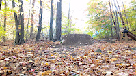
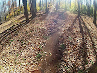
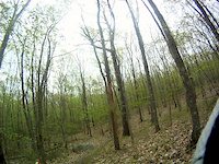
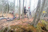
Photos of Lenox Mountain Bike
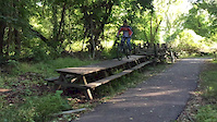
Videos of Lenox Mountain Bike
trail: Nose
0:06 |
427 |
Nov 1, 2016
trail: Bridges
0:45 |
178 |
Aug 7, 2016
trail: Summit
2:05 |
113 |
May 13, 2016
trail: Picnic
0:07 |
80 |
Nov 26, 2015

trail: Wilderness
10:03 |
82 |
Aug 9, 2015

trail: Wilderness
6:08 |
384 |
Jul 4, 2015
trail: Nose
0:12 |
1476 |
Apr 8, 2015

trail: Nose
0:14 |
131 |
Mar 19, 2015
Current Trail Warnings
| status | trail | date | condition | user | info |
|---|---|---|---|---|---|
| Wilderness | Jun 15, 2026 @ 2:19pm (America/New_York) Jun 15, 2026 | Unknown | goarwy | Big ol tree down |
Recent Trail Reports
| status | trail | date | condition | info | user |
|---|---|---|---|---|---|
| Acorn Roll | Jun 13, 2026 @ 8:54am (America/New_York) Jun 13, 2026 | Dry | Kmeister | ||
| Log Hop connector | Jun 13, 2026 @ 8:54am (America/New_York) Jun 13, 2026 | Dry | Kmeister | ||
| Portuguese | Jun 13, 2026 @ 8:54am (America/New_York) Jun 13, 2026 | Dry | Kmeister | ||
| Bob - T | Jun 13, 2026 @ 8:54am (America/New_York) Jun 13, 2026 | Dry | Kmeister | ||
| Bald Spur Trail | Apr 11, 2026 @ 10:15am (America/New_York) Apr 11, 2026 | Dry | Gnarmania | ||
| Broken Thumb Connector | Apr 11, 2026 @ 10:15am (America/New_York) Apr 11, 2026 | Ideal | Gnarmania | ||
| Budder Bawls | Apr 11, 2026 @ 10:15am (America/New_York) Apr 11, 2026 | Ideal | Gnarmania | ||
| Kirchner | Jul 27, 2025 @ 1:02pm Jul 27, 2025 | Icy | adam33howell1 | ||
| Greenfield | Jun 10, 2025 @ 5:01pm Jun 10, 2025 | Variable | Cknowlesmaine | ||
| Unnamed 002 | Jun 10, 2025 @ 5:01pm Jun 10, 2025 | Wet | Cknowlesmaine |
Activity Feed
| username | action | type | title | date |
|---|---|---|---|---|
| goarwy | add | report | activity #97054676 | Jun 15, 2026 @ 11:19am Jun 15, 2026 |
| Kmeister | add | report | activity #96927121 and 1 more | Jun 13, 2026 @ 5:02pm Jun 13, 2026 |
| Kmeister | add | report | activity #96927119 and 1 more | Jun 13, 2026 @ 5:02pm Jun 13, 2026 |
| sbrown7792 | wishlist | route | activity #95981976 and 1 more | May 31, 2026 @ 3:19pm May 31, 2026 |
| RachellmXTli | wishlist | route | activity #95489668 | May 25, 2026 @ 8:09am May 25, 2026 |
Recent Comments
| username | type | title | comment | date |
|---|---|---|---|---|
| trail | Use this as an uphill trail. It is pretty... | Apr 14, 2026 @ 7:10am Apr 14, 2026 | ||
| trail | This a best to ride downhill (reverse). It's... | Apr 14, 2026 @ 7:08am Apr 14, 2026 | ||
| trail | i | Oct 17, 2025 @ 2:29am Oct 17, 2025 | ||
| trail | Need sawed | May 7, 2025 @ 4:24pm May 7, 2025 | ||
| trail | Still more roots until near the top when it... | Apr 14, 2025 @ 7:41pm Apr 14, 2025 |
Local Badges
-

10 Green Trails129 awarded -

10 Blue Trails122 awarded -

Epic Ride Climb 2k20 awarded -

Climbing 10k Badge40 awarded -

Climbing 100k Badge4 awarded -

Epic Ride Descent 2k20 awarded
Activity Type Stats
| activitytype | trails | distance | descent | descent distance | total vertical | rating | global rank | state rank | photos | reports | routes | ridelogs |
|---|---|---|---|---|---|---|---|---|---|---|---|---|
| Mountain Bike | 78 | 47 miles | 7,828 ft | 18 miles | 1,040 ft | #2,872 | #1,016 | 60 | 363 | 2 | 7,815 | |
| E-Bike | 2 | 2 miles | 604 ft | 1 mile | 256 ft | 2 | 240 | 693 | ||||
| Gravel Bike | 5 | 4 miles | 778 ft | 2 miles | 633 ft | #617 | #1,116 | 36 | 76 | |||
| Hike | 78 | 37 miles | 7,352 ft | 16 miles | 1,106 ft | #4,287 | #1,506 | 359 | 986 | |||
| Trail Running | 100 | 58 miles | 10,715 ft | 23 miles | 1,106 ft | #3,273 | #960 | 361 | 1 | 551 |
Frequently Asked Questions About Lenox
▼
What are the best places to ride in Lenox?
Lenox has 5 areas to explore for mountain biking. The top rated areas are:
▼
What are the highest rated mountain biking trails in Lenox?
The highest rated mountain biking trails in Lenox are:
- Broken Thumb (4.2/5)
- Back Way Up (4.1/5)
- The Finger (4.1/5)
- Veda trail (4/5)
- Balance Rock (4/5)
▼
What is the best time of the year to ride in Lenox?
Based on ride log data, the most popular months to ride in Lenox are:
- July (128 activities)
- June (117 activities)
- August (108 activities)
▼
Where can I park to ride in Lenox?
Activities
Trails
- By zachfeuer
 CCMBA & contributors
 - Admins: NEMBAEXEC, BCT, JimBallantyne, brucerioux, pjahnige, mappermook, BERK NEMBA, BikeBerkshires, Lenox
- #16395 - 7,893 views
- lenox activity log | embed map of Lenox mountain bike trails | lenox mountain biking points of interest
Downloading of trail gps tracks in kml & gpx formats is enabled for Lenox.
You must login to download files.