close
-
Layers w
- Weather Layers
- Pro
- Pro
- Pro
- Pro
- Pro
- Pro
- More Layers
- Pro
- Pro
- Pro
- Pro
-
Upgrade to

3D
Trail Conditions
- Unknown
- Snow Groomed
- Snow Packed
- Snow Covered
- Snow Cover Partial
- Freeze/thaw Cycle
- Icy
- Prevalent Mud
- Wet
- Variable
- Ideal
- Dry
- Very Dry
Trail Flow (Ridden Direction)
Trailforks scans users ridelogs to determine the most popular direction each trail is ridden. A good flowing trail network will have most trails flowing in a single direction according to their intension.
The colour categories are based on what percentage of riders are riding a trail in its intended direction.
The colour categories are based on what percentage of riders are riding a trail in its intended direction.
- > 96%
- > 90%
- > 80%
- > 70%
- > 50%
- < 50%
- bi-directional trail
- no data
Trail Last Ridden
Trailforks scans ridelogs to determine the last time a trail was ridden.
- < 2 days
- < 1 week
- < 2 weeks
- < 1 month
- < 6 months
- > 6 months
Trail Ridden Direction
The intended direction a trail should be ridden.
- Downhill Only
- Downhill Primary
- Both Directions
- Uphill Primary
- Uphill Only
- One Direction
Contribute Details
Colors indicate trail is missing specified detail.
- Description
- Photos
- Description & Photos
- Videos
Trail Popularity ?
Trailforks scans ridelogs to determine which trails are ridden the most in the last 9 months.
Trails are compared with nearby trails in the same city region with a possible 25 colour shades.
Think of this as a heatmap, more rides = more kinetic energy = warmer colors.
- most popular
- popular
- less popular
- not popular
ATV/ORV/OHV Filter
Max Vehicle Width
inches
US Cell Coverage
Legend

Radar Time
Activity Recordings
Trailforks uses anonymized public activity data.
?
Activity Recordings
Trailforks uses anonymized public activity data.
?
Personal Heatmap
▶
Activity Types
all
/
none
▶
Options
2
Date range
month
–
Winter Trails
Warning
A routing network for winter maps does not exist. Selecting trails using the winter trails layer has been disabled.
Missing Trails
Most Popular
Least Popular
Trails are colored based on popularity. The more popular a trail is, the more red. Less popular trails trend towards green.
Jump Magnitude Heatmap
Heatmap of where riders jump on trails. Zoom in to see individual jumps, click circles to view jump details.
BC Backroad Status
![map legend]()
Service Road Atlas is a free to use, community-driven service for viewing and creating reports on the numerous back-country service roads around B.C. and Alberta.

Slope Aspect
Direction the slope faces
Trails Deemphasized
Trails are shown in grey.
Only show trails with no bike usage.
Suggested Layers
Based on selected activity type
Save the current map location and zoom level as your default home location whenever this page is loaded.
Save
No description for Linlithgow has been added yet!
Login or register to submit one.
This region uses the Uk/Euro style trail grading system.
Activities Click to view
- Mountain Bike
151 trails
- E-Bike
151 trails
- Gravel Bike
0 trails
- Adaptive Bike
0 trails
- Winter Fat Bike
0 trails
- Hike
129 trails
- Trail Running
129 trails
Region Details
- 41
- 48
- 47
- 10
- 4
- 1
Region Status
Open as of Jun 21, 2026Stats
- Avg Trail Rating
- Trails (view details)
- 152
- Trails Mountain Bike
- 151
- Trails E-Bike
- 151
- Trails Hike
- 129
- Trails Trail Running
- 129
- Total Distance
- 32 miles
- Total Descent
- 3,069 ft
- Total Vertical
- 811 ft
- Highest Trailhead
- 923 ft
- Reports
- 1,857
- Photos
- 267
- Ridden Counter
- 19,724
Sub Regions
-
Avon Lagoon
- 3
-
Beecraigs
- 41
- 45
- 10
- 4
- 1
Popular Linlithgow Mountain Biking Trails
• 100 ★ 4.0 • 587 ft • 0 ft • 448 •
Popular blue difficulty singletrack. This mountain bike primary trail can be used both directions. It features berm and jump. On average it takes 3 minutes to complete this trail.
• 100 ★ 4.8 • 463 ft • 0 ft • 433 •
Skills park , starts with 2 small rollers then 3 larger table top jumps. All features can be rolled so its suitable for progression for all skill levels
• 90 ★ 4.5 • 1,690 ft • 17 ft • 421 •
Popular red difficulty singletrack. This mountain bike primary trail can be used one direction and has a moderate overall physical rating with a 17 ft blue climb. It features berm, bridge, jump, log ride and skinny. Trail visibility is always easy to follow. On average it takes 3 minutes to complete this trail.
• 95 ★ 4.0 • 4,012 ft • 24 ft • 405 •
Popular red difficulty singletrack. This mountain bike primary trail can be used one direction and has a moderate overall physical rating with a 24 ft blue climb. On average it takes 6 minutes to complete this trail.
• 95 ★ 4.0 • 1,158 ft • 3 ft • 402 •
Popular red difficulty singletrack. This mountain bike primary trail can be used downhill primary and has a easy overall physical rating with a 3 ft green climb. Trail visibility is always easy to follow. On average it takes 2 minutes to complete this trail.
Linlithgow Mountain Bike Routes
★ 2.5 • 5 miles • 614 ft • 13 • Loop •
Beecraigs Country Park MTB loop. Along the route, you can find plenty of off-piste trails and features to...
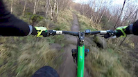
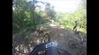
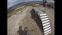
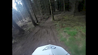
Photos of Linlithgow Mountain Bike
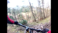
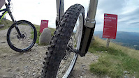
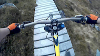
Videos of Linlithgow Mountain Bike
trail: Jump Line
0:21 |
223 |
May 18, 2016
trail: Red Route
11:22 |
184 |
Feb 1, 2016
trail: Jump Line
2:03 |
554 |
Jun 23, 2015
trail: Red Route
4:19 |
151 |
Jun 1, 2015
trail: Jump Line
0:07 |
533 |
Apr 24, 2015
trail: Red Route
4:37 |
125 |
Feb 23, 2015
trail: Red Route
16:44 |
2979 |
Sep 13, 2014
trail: Red Route
0:44 |
1080 |
Sep 10, 2014
Recent Trail Reports
| status | trail | date | condition | info | user |
|---|---|---|---|---|---|
| Car Park | Jun 21, 2026 @ 10:27am (Europe/Isle_of_Man) Jun 21, 2026 | Dry | ShoodNoBetter BCDC | ||
| Path | Jun 21, 2026 @ 10:27am (Europe/Isle_of_Man) Jun 21, 2026 | Dry | ShoodNoBetter BCDC | ||
| Trail | Jun 21, 2026 @ 10:27am (Europe/Isle_of_Man) Jun 21, 2026 | Variable | ShoodNoBetter BCDC | ||
| Forest Track | Jun 21, 2026 @ 10:27am (Europe/Isle_of_Man) Jun 21, 2026 | Variable | ShoodNoBetter BCDC | ||
| Forest Track | Jun 21, 2026 @ 10:27am (Europe/Isle_of_Man) Jun 21, 2026 | Variable | ShoodNoBetter BCDC | ||
| Saw Tooth | Jun 21, 2026 @ 10:27am (Europe/Isle_of_Man) Jun 21, 2026 | Variable | ShoodNoBetter BCDC | ||
| Mawkit Midden | Jun 21, 2026 @ 10:27am (Europe/Isle_of_Man) Jun 21, 2026 | Variable | ShoodNoBetter BCDC | ||
| Guthries Path | Jun 21, 2026 @ 10:27am (Europe/Isle_of_Man) Jun 21, 2026 | Variable | ShoodNoBetter BCDC | ||
| Mini Golf | Jun 21, 2026 @ 10:27am (Europe/Isle_of_Man) Jun 21, 2026 | Dry | ShoodNoBetter BCDC | ||
| Bombhole Middle | Jun 21, 2026 @ 10:27am (Europe/Isle_of_Man) Jun 21, 2026 | Dry | ShoodNoBetter BCDC |
Activity Feed
| username | action | type | title | date |
|---|---|---|---|---|
| ChrisrlgyFx | wishlist | region | activity #98002437 | Jun 28, 2026 @ 10:14am Jun 28, 2026 |
| trailforks | add | video | activity #97717301 | Jun 24, 2026 @ 12:33pm Jun 24, 2026 |
| ShoodNoBetter | add | report | activity #97486094 and 17 more | Jun 21, 2026 @ 8:10am Jun 21, 2026 |
| Mill0491 | wishlist | region | activity #93836180 | May 2, 2026 @ 12:33am May 2, 2026 |
| ftigu30 | vote | route | activity #93069795 | Apr 21, 2026 @ 3:31am Apr 21, 2026 |
Recent Comments
| username | type | title | comment | date |
|---|---|---|---|---|
| trail | Blackish steepness at end. | May 17, 2025 @ 2:37am May 17, 2025 | ||
| trail | Has a few steep sections that aren’t blue. ... | Oct 30, 2022 @ 9:24am Oct 30, 2022 | ||
| trail | I found another way if you drop down onto main... | Sep 25, 2021 @ 7:32am Sep 25, 2021 | ||
| trail | that's the only way to get to the summit from... | Sep 25, 2021 @ 6:53am Sep 25, 2021 | ||
| trail | How do you get here? There's a bridge with a... | Sep 25, 2021 @ 6:49am Sep 25, 2021 |
Local Badges
-

10 Blue Trails154 awarded -

Epic Ride Climb 2k1 awarded -

Climbing 10k Badge29 awarded -

Climbing 100k Badge0 awarded -

Epic Ride Descent 2k1 awarded -

Descent 10k Badge29 awarded
Bike & Skill Parks
| name | type | city | rating |
|---|---|---|---|
| Beecraigs Skills Park | skill park | Linlithgow |
Activity Type Stats
| activitytype | trails | distance | descent | descent distance | total vertical | rating | global rank | state rank | photos | reports | routes | ridelogs |
|---|---|---|---|---|---|---|---|---|---|---|---|---|
| Mountain Bike | 151 | 32 miles | 2,979 ft | 13 miles | 810 ft | #1,349 | #48 | 267 | 1,857 | 1 | 5,634 | |
| E-Bike | 151 | 32 miles | 2,979 ft | 13 miles | 810 ft | #2,143 | #75 | 1,631 | 1 | 422 | ||
| Hike | 129 | 28 miles | 2,431 ft | 11 miles | 810 ft | #2,735 | #58 | 1,827 | 182 | |||
| Trail Running | 129 | 28 miles | 2,431 ft | 11 miles | 810 ft | #3,461 | #74 | 1,827 | 918 |
Frequently Asked Questions About Linlithgow
▼
What are the best places to ride in Linlithgow?
Linlithgow has 2 areas to explore for mountain biking. The top rated areas are:
▼
What are the highest rated mountain biking trails in Linlithgow?
The highest rated mountain biking trails in Linlithgow are:
- Jump Line (4.4/5)
- Root Access (4.2/5)
- Guthries Path (4.2/5)
- Red Route (4.1/5)
- Mawkit Midden (4.1/5)
▼
What is the best time of the year to ride in Linlithgow?
Based on ride log data, the most popular months to ride in Linlithgow are:
- June (36 activities)
- March (29 activities)
- July (27 activities)
▼
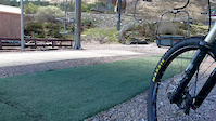
Where can I park to ride in Linlithgow?
Activities
Trails
Points of Interest
- By gav-s
 & contributors
 - Admins: DMBinS, FLS
- #15948 - 2,931 views
- linlithgow activity log | embed map of Linlithgow mountain bike trails | linlithgow mountain biking points of interest polygons
Downloading of trail gps tracks in kml & gpx formats is enabled for Linlithgow.
You must login to download files.