
close
3D
Trail Conditions
- Unknown
- Snow Groomed
- Snow Packed
- Snow Covered
- Snow Cover Partial
- Freeze/thaw Cycle
- Icy
- Prevalent Mud
- Wet
- Variable
- Ideal
- Dry
- Very Dry
Trail Flow (Ridden Direction)
Trailforks scans users activity logs to determine the most popular direction each trail is ridden. A good flowing trail network will have most trails flowing in a single direction according to their intension.
The colour categories are based on what percentage of users are riding a trail in its intended direction.
The colour categories are based on what percentage of users are riding a trail in its intended direction.
- > 96%
- > 90%
- > 80%
- > 70%
- > 50%
- < 50%
- bi-directional trail
- no data
Trail Last Used
Trailforks scans activity logs to determine the last time a trail was ridden.
- < 2 days
- < 1 week
- < 2 weeks
- < 1 month
- < 6 months
- > 6 months
Trail Ridden Direction
The intended direction a trail should be ridden.
- Downhill Only
- Downhill Primary
- Both Directions
- Uphill Primary
- Uphill Only
- One Direction
Contribute Details
Colors indicate trail is missing specified detail.
- Description
- Photos
- Description & Photos
- Videos
Trail Popularity ?
Trailforks scans activity logs to determine which trails are ridden the most in the last 9 months.
Trails are compared with nearby trails in the same city region with a possible 25 colour shades.
Think of this as a heatmap, more activities = more kinetic energy = warmer colors.
- most popular
- popular
- less popular
- not popular
ATV/ORV/OHV Filter
Max Vehicle Width
inches
US Cell Coverage
Legend

Radar Time
Activity Recordings
Trailforks uses anonymized public activity data.
?
Activity Recordings
Trailforks uses anonymized public activity data.
?
Winter Trails
Warning
A routing network for winter maps does not exist. Selecting trails using the winter trails layer has been disabled.
Missing Trails
Most Popular
Least Popular
Trails are colored based on popularity. The more popular a trail is, the more red. Less popular trails trend towards green.
Jump Magnitude Heatmap
Heatmap of where users jump on trails. Zoom in to see individual jumps, click circles to view jump details.
BC Backroad Status
![map legend]()
Service Road Atlas is a free to use, community-driven service for viewing and creating reports on the numerous back-country service roads around B.C. and Alberta.

Slope Aspect
Direction the slope faces
Trails Deemphasized
Trails are shown in grey.
Only show trails with no bike usage.
Suggested Layers
Based on selected activity type
Save the current map location and zoom level as your default home location whenever this page is loaded.
Save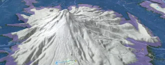
Snow & Rain 3D forecast Pro
See where it will snow, sleet or rain on Loudenvielle hour by hour, on 3D terrain.
View 3D snow forecast
Accueillant depuis 2021 une manche des Enduro World Séries, le village de Loudenvielle a su s'imposer comme un site majeur du VTT en France.
Venez rouler sur les traces des meilleurs pilotes mondiaux : plus de 30 spéciales enduro vous attendent Des estives en montagne jusqu'aux forêts de noisetiers et de sapins préservées, le terrain de jeu saura ravir tous les styles de pilotage.
A cela s'ajoutent le lac et les sommets pour vous offrir un cadre de ride magnifique.
Au-delà de cet espace de ride, vous trouverez dans le village de Loudenvielle tous les services pour passer un superbe séjour : télécabine, magasins spécialisés, pizzeria, station de lavage, pumptracks...
--
Hosting since 2021 a round of the Enduro World Series, the village of Loudenvielle has established itself as a major site for mountain biking in France.
Come and ride in the footsteps of the world's best riders: more than 30 enduro stages await you! From the mountain pastures to the preserved hazelnut forests, the playground will delight all riding styles.
In addition, the lake and the summits offer you a magnificent riding environment.
Beyond this riding area, you will find in the village of Loudenvielle all the services to spend a superb stay: cable car, mtb specialized stores, pizzeria, car wash, pumptracks...
Venez rouler sur les traces des meilleurs pilotes mondiaux : plus de 30 spéciales enduro vous attendent Des estives en montagne jusqu'aux forêts de noisetiers et de sapins préservées, le terrain de jeu saura ravir tous les styles de pilotage.
A cela s'ajoutent le lac et les sommets pour vous offrir un cadre de ride magnifique.
Au-delà de cet espace de ride, vous trouverez dans le village de Loudenvielle tous les services pour passer un superbe séjour : télécabine, magasins spécialisés, pizzeria, station de lavage, pumptracks...
--
Hosting since 2021 a round of the Enduro World Series, the village of Loudenvielle has established itself as a major site for mountain biking in France.
Come and ride in the footsteps of the world's best riders: more than 30 enduro stages await you! From the mountain pastures to the preserved hazelnut forests, the playground will delight all riding styles.
In addition, the lake and the summits offer you a magnificent riding environment.
Beyond this riding area, you will find in the village of Loudenvielle all the services to spend a superb stay: cable car, mtb specialized stores, pizzeria, car wash, pumptracks...
Links
This region uses the Uk/Euro style trail grading system.
Trail info last updated
Activities Click to view
- Mountain Bike
65 trails
- E-Bike
57 trails
- Adaptive Bike
13 trails
- Hike
32 trails
- Trail Running
31 trails
- Downhill Ski
53 trails
Region Details
- 21
- 5
- 16
- 13
- 8
- 1
- 1
Region Status
Open as of Nov 5, 2026
Stats
- Avg Trail Rating
- Trails (view details)
- 119
- Trails Mountain Bike
- 65
- Trails E-Bike
- 57
- Trails Gravel Bike
- 29
- Trails Adaptive Bike
- 13
- Trails Hike
- 32
- Trails Trail Running
- 31
- Trails Downhill Ski
- 53
- Total Distance
- 109 miles
- Total Descent Distance
- 81 miles
- Total Descent
- 75,281 ft
- Total Vertical
- 5,299 ft
- Highest Trailhead
- 7,950 ft
- Reports
- 607
- Photos
- 55
- Completed Counter
- 15,041
Articles

Video: 72 Hours in Loudenvielle | PRT heads to Round 1 of the UCI Enduro World Cup
Jun 3, 2026 from pinkbike.com
The Priority Racing Team silences the critics as Lief Rodgers and Evan Wall storm into the Top 15 on their high-pivot, chainless rigs.

30% Of Racers Hit The Deck | Story Of The Race | Loudenvielle DH World Cup 2026
Jun 1, 2026 from pinkbike.com
Ben Cathro fires up the ghost machine to compare lines, analyze massive mistakes, and break down a historic Round 2 of the Downhill World Cup.

Video: Measuring the Loudenvielle DH Gaps During Track Walk
May 28, 2026 from pinkbike.com
It's time to get the tape measure out.

Tech Video: A Deep Dive into Antidote’s Insane Telemetry-Backed Gearbox DH Bike | Loudenvielle DH World Cup
May 28, 2026 from pinkbike.com
We corner the designers at Antidote Solutions to figure out the methodology behind their telemetry-heavy, high-pivot World Cup downhill monster.
Sub Regions
-
Louron Bike & Trail / Loudenvielle
- 4
- 15
- 12
- 8
- 1
Popular Loudenvielle Mountain Biking Trails
• 100 ★ 3.4 • 1 mile • 35 ft • 649 •
Il est important de proposer des pistes ludiques pour tous. Nous avons donc créé cette nouvelle piste verte, avec peu de pente, en balcon au-dessus du vallon de Germ. Cette piste se révèle aussi être une liaison intéressante pour...
• 100 ★ 4.6 • 1 mile • 53 ft • 512 •
Highly rated popular green difficulty singletrack. This mountain bike primary trail can be used downhill only. Trail visibility is always easy to follow. On average it takes 6 minutes to complete this trail.
• 90 ★ 3.7 • 3 miles • 31 ft • 454 •
Son nom évoque clairement la nouvelle télécabine qui relie Loudenvielle à Peyragudes. Il paraissait inimaginable de ne pas tracer une piste VTT sous ce tracé de la télécabine. Nous l’avons voulue à la fois spectaculaire mais...
• 95 ★ 3.4 • 2,546 ft • 7 ft • 451 •
A travers une belle foret de noisetiers, cet enduro vous conduira du village de Germ à celui de Loudenvielle. Le retour logique de Peyragudes après votre séance sur l’espace ludique. Et si vous démarrez du sommet du télésiège...
• 90 ★ 4.1 • 1 mile • 28 ft • 397 •
Cet enduro offre une trace démarrant au milieu des bruyères avant de plonger au cœur de la forêt. Ce parcours vous permettra de travailler vos trajectoires et votre maîtrise du vélo sur une belle terre : un itinéraire idéal pour...
• 85 ★ 4.6 • 4,354 ft • 0 ft • 367 •
Highly rated popular red difficulty singletrack. This mountain bike primary trail can be used downhill only and has a moderate overall physical rating. Trail visibility is always easy to follow. On average it takes 7 minutes to complete this trail.
• 80 ★ 4.5 • 2 miles • 84 ft • 356 •
Voici le premier parcours enduro bleu créé au départ de la station de Val Louron pour redescendre en fond de vallée. Il allie belles vues sur les montagnes, découverte du hameau de Nabias, et trace fluide au coeur de la forêt.
• 70 ★ 4.4 • 4,469 ft • 0 ft • 335 •
Imaginé autour de la nouvelle télécabine SKYVALL, cet itinéraire enduro se pratiquera en retour de Peyragudes vers Loudenvielle. Il représente une variante plus technique et plus pentue de l’enduro COUMAOU. Certainement une...
Loudenvielle Mountain Bike Routes
33 miles • 9,450 ft • 10 • Loop • Race •
Race route for the EDR2026 Loundenvielle
★ 5.0 • 30 miles • 9,445 ft • 10 • Loop • Race •
ENDURO WORLD CUP Full course: 43 km (riding) 1470 m Ascending+ (pedal climbing) , 2410 m Descending -...
★ 4.5 • 39 miles • 11,789 ft • 8 • Loop • Race •
Race course for the EWS #8 Loudenvielle 2022
31 miles • 10,004 ft • 8 • Loop • Race •
Race course for the EWS2021 Michelin EWS Loudenvielle firs day of race.
32 miles • 10,526 ft • 8 • Loop • Race •
Race course for the UCI Enduro World Cup 2023 #6 Loudenvielle
Photos of Loudenvielle Mountain Bike
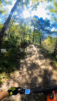
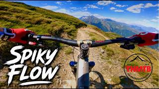
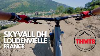
Videos of Loudenvielle Mountain Bike




Recent Trail Reports
| status | trail | date | condition | info | user |
|---|---|---|---|---|---|
| Dolmens | Nov 5, 2026 @ 6:31pm (Europe/Paris) Nov 5, 2026 | Dry | greg002 | ||
| Nabias | Nov 1, 2026 @ 12:52pm (Europe/Paris) Nov 1, 2026 | Dry | greg002 | ||
| Return to Gondola Skyvall | Sep 26, 2026 @ 12:55pm (Europe/Andorra) Sep 26, 2026 | Very Dry | trailforks Trailforks | ||
| Candy Fin Heureuse | Sep 26, 2026 @ 12:55pm (Europe/Andorra) Sep 26, 2026 | Very Dry | trailforks Trailforks | ||
| Candy Inf | Sep 26, 2026 @ 12:55pm (Europe/Andorra) Sep 26, 2026 | Very Dry | trailforks Trailforks | ||
| Coumaou | Sep 26, 2026 @ 12:55pm (Europe/Andorra) Sep 26, 2026 | Very Dry | trailforks Trailforks | ||
| Candy Int-2 | Sep 26, 2026 @ 12:55pm (Europe/Andorra) Sep 26, 2026 | Very Dry | trailforks Trailforks | ||
| Access Candy-Comadou | Sep 26, 2026 @ 12:55pm (Europe/Andorra) Sep 26, 2026 | Very Dry | trailforks Trailforks | ||
| Candy Int | Sep 26, 2026 @ 12:55pm (Europe/Andorra) Sep 26, 2026 | Very Dry | trailforks Trailforks | ||
| Candy Sup | Sep 26, 2026 @ 12:55pm (Europe/Andorra) Sep 26, 2026 | Ideal | trailforks Trailforks |
Activity Feed
| username | action | type | title | date |
|---|---|---|---|---|
| greg002 | add | report | activity #107244256 | Nov 5, 2026 @ 9:36am Nov 5, 2026 |
| greg002 | add | report | activity #106992090 | Nov 1, 2026 @ 3:55am Nov 1, 2026 |
| amostrainer2012 | vote | trail | activity #106623014 | Oct 26, 2026 @ 4:26am Oct 26, 2026 |
| amostrainer2012 | vote | trail | activity #106622933 and 23 more | Oct 26, 2026 @ 4:23am Oct 26, 2026 |
| amostrainer2012 | add | photo | activity #106622621 | Oct 26, 2026 @ 4:12am Oct 26, 2026 |
Recent Comments
| username | type | title | comment | date |
|---|---|---|---|---|
| trail | Top. Super in Schuss. Tolle Linien Führung.... | Sep 26, 2026 @ 5:48am Sep 26, 2026 | ||
| trail | Tecnical and in some parts fast trail. No jumpline | Aug 29, 2026 @ 3:04pm Aug 29, 2026 | ||
| report | Manque d’entretien avec de grosse hornières... | Aug 10, 2026 @ 11:33am Aug 10, 2026 | ||
| report | Bonne condition generale, terrain parfait, on... | Aug 10, 2026 @ 11:10am Aug 10, 2026 | ||
| trail | Sûrement le meilleur trail des environs... | Aug 7, 2026 @ 5:11am Aug 7, 2026 |
Local Badges
-

Completionist0 awarded -

Epic Mountain Bike Climb 2k799 awarded -

Climbing 10k Badge113 awarded -

Mountain Biking 100k Badge0 awarded -

Epic Ride Descent 2k799 awarded -

Descent 10k Badge189 awarded
Bike & Skill Parks
| name | type | city | rating |
|---|---|---|---|
| pumptrack Loudenvielle | skill park | Loudenvielle |

Activity Type Stats
| activitytype | trails | distance | descent | descent distance | total vertical | rating | global rank | state rank | photos | reports | routes | activity logs |
|---|---|---|---|---|---|---|---|---|---|---|---|---|
| Mountain Bike | 65 | 76 miles | 43,783 ft | 52 miles | 4,659 ft | #1,344 | #25 | 49 | 607 | 10 | 5,098 | |
| E-Bike | 57 | 63 miles | 37,398 ft | 45 miles | 4,659 ft | #549 | #39 | 4 | 589 | 4 | 779 | |
| Gravel Bike | 29 | 28 miles | 5,584 ft | 11 miles | 4,544 ft | #3,499 | #88 | 16 | 19 | |||
| Adaptive Bike | 13 | 18 miles | 781 ft | 3 miles | 4,049 ft | #1,121 | #23 | 115 | ||||
| Hike | 32 | 44 miles | 17,343 ft | 23 miles | 5,299 ft | #3,026 | #75 | 1 | 513 | 319 | ||
| Trail Running | 31 | 41 miles | 14,964 ft | 20 miles | 5,299 ft | #2,726 | #69 | 513 | 47 | |||
| Downhill Ski | 53 | 28 miles | 29,455 ft | 26 miles | 2,782 ft | #177 | #25 | 3 | 222 |
Frequently Asked Questions
▼
What are the best places to ride in Loudenvielle?
Loudenvielle has 3 areas to explore for mountain biking. The top rated areas are:
▼
What are the highest rated mountain biking trails in Loudenvielle?
The highest rated mountain biking trails in Loudenvielle are:
- Dolmens (4.4/5)
- Pourticou (4.4/5)
- Candy Inf (4.3/5)
- Magic Line (4.3/5)
- Goutaou (4.2/5)
▼
What is the best time of the year to ride in Loudenvielle?
Based on activity log data, the most popular months to ride in Loudenvielle are:
- August (208 activities)
- May (127 activities)
- July (107 activities)
▼
Where can I park to ride in Loudenvielle?
There are 4 parking locations listed in Loudenvielle. The most popular parking spots are: View all parking and trailhead locations on the map to plan your visit.
▼
What is the longest trail in Loudenvielle?
The longest trail in Loudenvielle is Candy Sup at 3.5 miles. View all trails sorted by distance.
▼
What are the best & highest rated hiking trails in Loudenvielle?
The best hiking trails in Loudenvielle are:
- Pont de Prat - Puerto de la Pez - Vado Bachimala
- Pla Loudic
- Canal Central Arreau
- Medas-Cazaux-Debat
- Val d'Aube (bottom)
▼
What are the best & highest rated trail running trails in Loudenvielle?
The best trail running trails in Loudenvielle are: View all trail running trails sorted by popularity score.
▼
How many trails are in Loudenvielle?
Loudenvielle has a total of 119 trails. Of those, 65 are designated for mountain biking. Browse top mountain biking trails in Loudenvielle to find detailed information including difficulty ratings, distances, and trail conditions.
▼
Which trail has the most elevation gain in Loudenvielle?
The trail with the most elevation gain in Loudenvielle is Canal Central Arreau with 531 ft of elevation gain. View all trails sorted by elevation gain.
▼
Which trail has the most elevation descent in Loudenvielle?
The trail with the most elevation descent in Loudenvielle is GR10 La Follie with 3,364 ft of elevation descent. View all trails sorted by elevation descent.
▼
What activities are most popular in Loudenvielle?
Loudenvielle supports the following activities: Mountain Biking, E-Biking, Adaptive Biking, Hiking, Trail Running, Skiing.
▼
What bike services are there in Loudenvielle?
The following bike services are available in Loudenvielle:
- Trail Association (1)
▼
What are the steepest mountain biking trails in Loudenvielle?
The steepest mountain biking trail in Loudenvielle is Liaison Dolmens Direct with an average grade of 3.8%. View all trails sorted by grade.
▼
Are the trails open in Loudenvielle?
The overall region status for Loudenvielle is Clear / Green. Out of 53 trails:
- Clear / Green: 45
- Minor Issue / Yellow: 5
- Closed: 3
▼
Can I ride an ebike in Loudenvielle?
Yes, Loudenvielle supports e-bike riding. There are 57 trails in Loudenvielle that allow e-bikes. Check the e-bike trails listing for specific trail access details and any local regulations.
▼
What are the most popular mountain biking routes in Loudenvielle?
The most popular mountain biking routes in Loudenvielle are: View all mountain biking routes in Loudenvielle.
▼
What type of bike is most common in Loudenvielle?
Based on activity log data, the most common bike types used in Loudenvielle are:
- AM (59 activities)
- DH (5 activities)
- RD (1 activities)
▼
What is the highest summit in Loudenvielle?
The highest summit in Loudenvielle is Pic de Lustou at 9,816 ft elevation.
▼
What are the most popular Strava Segments in Loudenvielle?
The most popular Strava segments in Loudenvielle are:
- Chemin De Rioutor Climb (10,057 athletes)
- Prairies De Balestas Climb (9,328 athletes)
- Courbes sous les oeufs Skyvall (2,867 athletes)
▼
What trails are closed in Loudenvielle?
There are currently 3 closed trails in Loudenvielle. The breakdown of all trail statuses is:
- Clear / Green: 45
- Minor Issue / Yellow: 5
- Closed: 3
▼
Are there accessible or adaptive trails in Loudenvielle?
Yes, there are 15 accessible/adaptive trails in Loudenvielle. View all adaptive trails in Loudenvielle for specific accessibility information.
▼
Are there local clubs or events in Loudenvielle?
There are 1 local clubs or associations listed in the Loudenvielle directory. Browse the local directory for details.
▼
What are the most popular mountain biking trails in Loudenvielle?
The most popular mountain biking trails in Loudenvielle are: View all mountain biking trails sorted by popularity.
▼
What are the best beginner ride trails in Loudenvielle?
The best beginner mountain biking trails in Loudenvielle are: View all beginner mountain biking trails in Loudenvielle.
Activities
Trails
Points of Interest
- By freerider48
 TRAILFORKS TFFRANCE & contributors
- Admins: JackyStyleTom, lcoadik, SIVALouron
- #36877 - 14,225 views
- loudenvielle activity log | embed map of Loudenvielle mountain bike trails | loudenvielle mountain biking points of interest
Downloading of trail gps tracks in kml & gpx formats is enabled for Loudenvielle.
You must login to download files.