close
-
Layers w
- Weather Layers
- Pro
- Pro
- Pro
- Pro
- Pro
- Pro
- More Layers
- Pro
- Pro
- Pro
- Pro
-
Upgrade to

3D
Trail Conditions
- Unknown
- Snow Groomed
- Snow Packed
- Snow Covered
- Snow Cover Partial
- Freeze/thaw Cycle
- Icy
- Prevalent Mud
- Wet
- Variable
- Ideal
- Dry
- Very Dry
Trail Flow (Ridden Direction)
Trailforks scans users ridelogs to determine the most popular direction each trail is ridden. A good flowing trail network will have most trails flowing in a single direction according to their intension.
The colour categories are based on what percentage of riders are riding a trail in its intended direction.
The colour categories are based on what percentage of riders are riding a trail in its intended direction.
- > 96%
- > 90%
- > 80%
- > 70%
- > 50%
- < 50%
- bi-directional trail
- no data
Trail Last Ridden
Trailforks scans ridelogs to determine the last time a trail was ridden.
- < 2 days
- < 1 week
- < 2 weeks
- < 1 month
- < 6 months
- > 6 months
Trail Ridden Direction
The intended direction a trail should be ridden.
- Downhill Only
- Downhill Primary
- Both Directions
- Uphill Primary
- Uphill Only
- One Direction
Contribute Details
Colors indicate trail is missing specified detail.
- Description
- Photos
- Description & Photos
- Videos
Trail Popularity ?
Trailforks scans ridelogs to determine which trails are ridden the most in the last 9 months.
Trails are compared with nearby trails in the same city region with a possible 25 colour shades.
Think of this as a heatmap, more rides = more kinetic energy = warmer colors.
- most popular
- popular
- less popular
- not popular
ATV/ORV/OHV Filter
Max Vehicle Width
inches
US Cell Coverage
Legend

Radar Time
Activity Recordings
Trailforks uses anonymized public activity data.
?
Activity Recordings
Trailforks uses anonymized public activity data.
?
Personal Heatmap
▶
Activity Types
all
/
none
▶
Options
2
Date range
month
–
Winter Trails
Warning
A routing network for winter maps does not exist. Selecting trails using the winter trails layer has been disabled.
Missing Trails
Most Popular
Least Popular
Trails are colored based on popularity. The more popular a trail is, the more red. Less popular trails trend towards green.
Jump Magnitude Heatmap
Heatmap of where riders jump on trails. Zoom in to see individual jumps, click circles to view jump details.
BC Backroad Status
![map legend]()
Service Road Atlas is a free to use, community-driven service for viewing and creating reports on the numerous back-country service roads around B.C. and Alberta.

Slope Aspect
Direction the slope faces
Trails Deemphasized
Trails are shown in grey.
Only show trails with no bike usage.
Suggested Layers
Based on selected activity type
Save the current map location and zoom level as your default home location whenever this page is loaded.
Save
No description for Lynn has been added yet!
Login or register to submit one.
Activities Click to view
- Mountain Bike
151 trails
- E-Bike
10 trails
- Gravel Bike
0 trails
- Adaptive Bike
0 trails
- Winter Fat Bike
0 trails
- Hike
151 trails
- Trail Running
150 trails
- Snowshoe
7 trails
Region Details
- 29
- 17
- 63
- 33
- 4
Region Status
Open as of Jul 8, 2026Stats
- Avg Trail Rating
- Trails (view details)
- 147
- Trails Mountain Bike
- 151
- Trails E-Bike
- 10
- Trails Horse
- 1
- Trails Hike
- 151
- Trails Trail Running
- 150
- Trails Snowshoe
- 7
- Total Distance
- 47 miles
- Total Descent
- 4,576 ft
- Total Vertical
- 283 ft
- Highest Trailhead
- 285 ft
- Reports
- 1,047
- Photos
- 126
- Ridden Counter
- 25,370
Sub Regions
-
Lynn Woods
- 17
- 63
- 33
- 3
Popular Lynn Mountain Biking Trails
• 100 ★ 3.0 • 1,255 ft • 2 ft • 573 •
provides a fun descent or easy climb between the Acapulco rock and the Ox Pasture Road - East. Along the way, you can branch out to the exciting "Awesome-Sauce Trail" or just enjoy a mellow singletrack ride. The trail also connects to...
• 100 ★ 5.0 • 1,324 ft • 3 ft • 532 •
An advanced jump line from the top of the hill down to the parking lot. Multiple jumps set up to jump onto and over big boulders. Advanced skills needed.
• 100 ★ 4.0 • 1,188 ft • 0 ft • 516 •
A nice bouldery downhill ride that connects from Boston Rock to the main trail. Looking for a nice drop that doesn't go to flat like all other drops in Lynn? You got it, about mid-way down the trail. However, the entrance is technical...
• 100 ★ 5.0 • 1,069 ft • 7 ft • 497 •
This is a short but fantastic singletrack with roller after roller (some of them are pretty steep). Start near the rocky summit by Acapulco and head down the steep hill and then around the giant roller. Next, take a left up a steep hill...
• 100 ★ 5.0 • 623 ft • 38 ft • 489 •
Popular black diamond difficulty singletrack. This multi-use trail can be used both directions. On average it takes 1 minutes to complete this trail.
• 100 ★ 0.0 • 594 ft • 23 ft • 479 •
Popular blue difficulty singletrack. This mountain bike primary trail can be used both directions. On average it takes 1 minutes to complete this trail.
• 95 ★ 5.0 • 2,346 ft • 25 ft • 477 •
A super iconic ride up major rollers and drops with some very technical riding from boulder to boulder. Connect this trail by doing first, then this one and then Shark's Tooth East to create a fun, long, technical ride. You can also pay...
• 95 ★ 4.0 • 1,369 ft • 87 ft • 467 •
This is a nice trail that connects into the Lynn Woods trail system from the Jeep Kelly parking lot. This line gains entry into the area without having to reach the peak of the hill.
Lynn Mountain Bike Routes
★ 5.0 • 8 miles • 730 ft • 18 • Loop •
A big that ties together as much intermediate terrain as possible on the North, South, and West sides....
★ 1.5 • 6 miles • 512 ft • 5 • Loop •
A good route for an intermediate to advanced rider that has no trouble climbing but also takes a...
★ 1.0 • 5 miles • 636 ft • 10 •
An exploration of northern Lynn Woods from Kelly Jeep. Trying to hit all the hardest trails.
8 miles • 720 ft • 15 • Loop •
A perfect introduction to Lynn Woods MTB, this mini-enduro showcases the park’s signature granite tech,...
★ 3.0 • 7 miles • 851 ft • 25 •
Lynn Loop starting from the Kelly Dodge Parking Lot hitting a number of the best trails both directions.
4 miles • 347 ft • 3 • Loop •
Double track. Gravel. Drains well. Some moderate to challenging elevation.
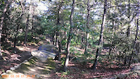
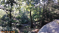
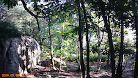
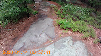
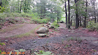
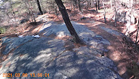
Photos of Lynn Mountain Bike
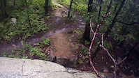
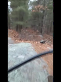
Videos of Lynn Mountain Bike
trail: Kelly High Jump Line
0:08 |
269 |
Jul 25, 2021
trail: Kelly High Jump Line
0:07 |
149 |
Jul 25, 2021
trail: Kelly High Jump Line
0:04 |
179 |
Jul 25, 2021
trail: Kelly High Jump Line
0:04 |
190 |
Jul 25, 2021
trail: Kelly High Jump Line
0:55 |
196 |
Jun 6, 2021
trail: Kelly High Jump Line
0:06 |
117 |
Jun 6, 2021
trail: Kelly High Jump Line
0:30 |
169 |
Mar 10, 2021
trail: Kelly High Jump Line
0:51 |
104 |
Jan 14, 2021
Recent Trail Reports
| status | trail | date | condition | info | user |
|---|---|---|---|---|---|
| Lynn Woods Loop | Jul 8, 2026 @ 3:46pm (America/New_York) Jul 8, 2026 | Unknown | TomH67 | ||
| Boulder Dash | May 31, 2026 @ 12:50pm (America/New_York) May 31, 2026 | Unknown | ChristianS4c7tw | ||
| Shark's Tooth Connector | May 29, 2026 @ 11:58am (America/New_York) May 29, 2026 | Ideal | AndrewHally MRR | ||
| Shark's Tooth East | May 29, 2026 @ 11:58am (America/New_York) May 29, 2026 | Ideal | AndrewHally MRR | ||
| Awesome Sauce Trail | May 29, 2026 @ 11:58am (America/New_York) May 29, 2026 | Ideal | AndrewHally MRR | ||
| Bombshell | May 29, 2026 @ 11:58am (America/New_York) May 29, 2026 | Ideal | AndrewHally MRR | ||
| Tip Top Mega Loop | May 29, 2026 @ 11:58am (America/New_York) May 29, 2026 | Ideal | AndrewHally MRR | ||
| Easy Connector | May 29, 2026 @ 11:58am (America/New_York) May 29, 2026 | Ideal | AndrewHally MRR | ||
| Switchbacks | May 29, 2026 @ 11:58am (America/New_York) May 29, 2026 | Ideal | AndrewHally MRR | ||
| Shark's Tooth West | May 29, 2026 @ 11:58am (America/New_York) May 29, 2026 | Ideal | AndrewHally MRR |
Activity Feed
| username | action | type | title | date |
|---|---|---|---|---|
| TomH67 | add | report | activity #98733058 | Jul 8, 2026 @ 12:46pm Jul 8, 2026 |
| TomH67 | wishlist | route | activity #98729093 | Jul 8, 2026 @ 11:53am Jul 8, 2026 |
| ChristianS4c7tw | wishlist | route | activity #98703141 | Jul 8, 2026 @ 4:34am Jul 8, 2026 |
| MatthewSilvaaIy | ridden | route | activity #98493181 | Jul 5, 2026 @ 6:02am Jul 5, 2026 |
| ebrazell | wishlist | trail | activity #97536722 and 1 more | Jun 21, 2026 @ 6:32pm Jun 21, 2026 |
Recent Comments
| username | type | title | comment | date |
|---|---|---|---|---|
| trail | This is more of black than blue for Lynn... | Dec 7, 2025 @ 4:39pm Dec 7, 2025 | ||
| report | See | Jun 20, 2025 @ 11:13am Jun 20, 2025 | ||
| trail | Short but sweet, some huge rollers here | Feb 12, 2024 @ 2:33pm Feb 12, 2024 | ||
| trail | The double blacks ride better than many of the... | Oct 7, 2023 @ 5:38am Oct 7, 2023 | ||
| trail | I agree that the double blacks here actually... | Oct 7, 2023 @ 5:37am Oct 7, 2023 |
Local Badges
-

10 Blue Trails272 awarded -

Epic Ride Climb 2k0 awarded -

Climbing 10k Badge42 awarded -

Climbing 100k Badge4 awarded -

Epic Ride Descent 2k0 awarded -

Descent 10k Badge43 awarded
Activity Type Stats
| activitytype | trails | distance | descent | descent distance | total vertical | rating | global rank | state rank | photos | reports | routes | ridelogs |
|---|---|---|---|---|---|---|---|---|---|---|---|---|
| Mountain Bike | 151 | 46 miles | 4,541 ft | 18 miles | 282 ft | #857 | #336 | 123 | 1,047 | 6 | 15,755 | |
| E-Bike | 10 | 5 miles | 194 ft | 2 miles | 253 ft | #8,616 | #2,625 | 652 | 1 | 142 | ||
| Horse | 1 | 3,865 ft | 7 ft | 1,056 ft | 30 ft | 202 | 14 | |||||
| Hike | 151 | 47 miles | 4,547 ft | 18 miles | 282 ft | #3,581 | #1,259 | 5 | 1,047 | 1 | 691 | |
| Trail Running | 150 | 46 miles | 4,528 ft | 18 miles | 282 ft | #3,208 | #940 | 1,047 | 1 | 568 | ||
| Snowshoe | 7 | 2 miles | 197 ft | 3,753 ft | 154 ft | #1,279 | #692 | 22 |
Frequently Asked Questions About Lynn
▼
What are the best places to ride in Lynn?
Lynn has 1 areas to explore for mountain biking. The top rated areas are:
▼
What are the highest rated mountain biking trails in Lynn?
The highest rated mountain biking trails in Lynn are:
- Kelly High Jump Line (4.5/5)
- Awesome Sauce Trail (4.4/5)
- Chicken Soup (4.3/5)
- Wicked Hard Trail / Surf City (4.2/5)
- Lynn Woods 6 (4.1/5)
▼
What is the best time of the year to ride in Lynn?
Based on ride log data, the most popular months to ride in Lynn are:
- July (213 activities)
- May (206 activities)
- November (197 activities)
▼
Where can I park to ride in Lynn?
There are 4 parking locations listed in Lynn. The most popular parking spots are: View all parking and trailhead locations on the map to plan your visit.
Activities
Trails
- By Radioface
 & contributors
 - Admins: NS NEMBA, SiamDelightRules
- #10872 - 3,661 views
- lynn activity log | embed map of Lynn mountain bike trails | lynn mountain biking points of interest
Downloading of trail gps tracks in kml & gpx formats is enabled for Lynn.
You must login to download files.