close
-
Layers w
- Weather Layers
- Pro
- Pro
- Pro
- Pro
- Pro
- Pro
- More Layers
- Pro
- Pro
- Pro
- Pro
-
Upgrade to

3D
Trail Conditions
- Unknown
- Snow Groomed
- Snow Packed
- Snow Covered
- Snow Cover Partial
- Freeze/thaw Cycle
- Icy
- Prevalent Mud
- Wet
- Variable
- Ideal
- Dry
- Very Dry
Trail Flow (Ridden Direction)
Trailforks scans users ridelogs to determine the most popular direction each trail is ridden. A good flowing trail network will have most trails flowing in a single direction according to their intension.
The colour categories are based on what percentage of riders are riding a trail in its intended direction.
The colour categories are based on what percentage of riders are riding a trail in its intended direction.
- > 96%
- > 90%
- > 80%
- > 70%
- > 50%
- < 50%
- bi-directional trail
- no data
Trail Last Ridden
Trailforks scans ridelogs to determine the last time a trail was ridden.
- < 2 days
- < 1 week
- < 2 weeks
- < 1 month
- < 6 months
- > 6 months
Trail Ridden Direction
The intended direction a trail should be ridden.
- Downhill Only
- Downhill Primary
- Both Directions
- Uphill Primary
- Uphill Only
- One Direction
Contribute Details
Colors indicate trail is missing specified detail.
- Description
- Photos
- Description & Photos
- Videos
Trail Popularity ?
Trailforks scans ridelogs to determine which trails are ridden the most in the last 9 months.
Trails are compared with nearby trails in the same city region with a possible 25 colour shades.
Think of this as a heatmap, more rides = more kinetic energy = warmer colors.
- most popular
- popular
- less popular
- not popular
ATV/ORV/OHV Filter
Max Vehicle Width
inches
US Cell Coverage
Legend

Radar Time
Activity Recordings
Trailforks uses anonymized public activity data.
?
Activity Recordings
Trailforks uses anonymized public activity data.
?
Personal Heatmap
▶
Activity Types
all
/
none
▶
Options
2
Date range
month
–
Winter Trails
Warning
A routing network for winter maps does not exist. Selecting trails using the winter trails layer has been disabled.
Missing Trails
Most Popular
Least Popular
Trails are colored based on popularity. The more popular a trail is, the more red. Less popular trails trend towards green.
Jump Magnitude Heatmap
Heatmap of where riders jump on trails. Zoom in to see individual jumps, click circles to view jump details.
BC Backroad Status
![map legend]()
Service Road Atlas is a free to use, community-driven service for viewing and creating reports on the numerous back-country service roads around B.C. and Alberta.

Slope Aspect
Direction the slope faces
Trails Deemphasized
Trails are shown in grey.
Only show trails with no bike usage.
Suggested Layers
Based on selected activity type
Save the current map location and zoom level as your default home location whenever this page is loaded.
Save
No description for Manosque has been added yet!
Login or register to submit one.
This region uses the Uk/Euro style trail grading system.
Activities Click to view
- Mountain Bike
71 trails
- E-Bike
65 trails
- Adaptive Bike
0 trails
- Winter Fat Bike
0 trails
- Hike
69 trails
- Trail Running
70 trails
Region Details
- 27
- 5
- 26
- 11
Region Status
Open as of May 29, 2026Stats
- Avg Trail Rating
- Trails (view details)
- 69
- Trails Mountain Bike
- 71
- Trails E-Bike
- 65
- Trails Hike
- 69
- Trails Trail Running
- 70
- Total Distance
- 32 miles
- Total Descent
- 10,857 ft
- Total Vertical
- 1,375 ft
- Highest Trailhead
- 2,583 ft
- Reports
- 28
- Photos
- 2
- Ridden Counter
- 435
Popular Manosque Mountain Biking Trails
• 100 ★ 0.0 • 659 ft • 35 ft • 16 •
Popular green difficulty singletrack. This mountain bike primary trail can be used both directions and has a easy overall physical rating. Trail visibility is always easy to follow. On average it takes minutes to complete this trail.
• 85 ★ 0.0 • 3,753 ft • 0 ft • 15 •
Popular blue difficulty singletrack. This mountain bike primary trail can be used both directions and has a moderate overall physical rating. Trail visibility is always easy to follow. On average it takes 7 minutes to complete this trail.
• 95 ★ 0.0 • 1 mile • 67 ft • 11 •
Popular red difficulty singletrack. This mountain bike primary trail can be used downhill primary and has a moderate overall physical rating with a 67 ft blue climb. Trail visibility is always easy to follow. On average it takes 23 minutes to complete this trail.
• 60 ★ 0.0 • 2 miles • 28 ft • 11 •
Moderately popular red difficulty singletrack. This mountain bike primary trail can be used both directions and has a moderate overall physical rating. Trail visibility is always easy to follow. On average it takes 20 minutes to complete this trail.
• 55 ★ 0.0 • 3,202 ft • 41 ft • 10 •
Moderately popular blue difficulty singletrack. This mountain bike primary trail can be used both directions and has a moderate overall physical rating. Trail visibility is always easy to follow. On average it takes 5 minutes to complete this trail.
• 5 ★ 0.0 • 5,246 ft • 225 ft • 8 •
Less popular blue difficulty singletrack. This mountain bike primary trail can be used both directions. On average it takes 5 minutes to complete this trail.
Manosque Mountain Bike Routes
18 miles • 4,256 ft • 0 • Loop •
La Randuro vous emmène du côté de Volx et de son massif forestier culminant à 800 mètres : panoramas...
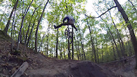
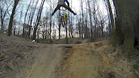
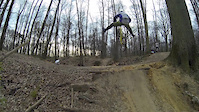
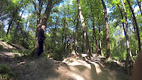
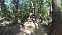
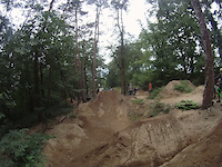
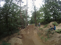
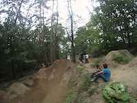
Videos of Manosque Mountain Bike
trail: No Foot
0:08 |
237 |
Oct 21, 2014
trail: No Foot
0:05 |
61 |
May 31, 2014
trail: No Foot
0:05 |
53 |
May 31, 2014
trail: No Foot
0:10 |
58 |
May 31, 2014
trail: No Foot
0:07 |
59 |
May 31, 2014
trail: No Foot
0:10 |
173 |
Sep 18, 2011
trail: No Foot
0:29 |
125 |
Sep 18, 2011
trail: No Foot
0:10 |
128 |
Sep 18, 2011
Recent Trail Reports
| status | trail | date | condition | info | user |
|---|---|---|---|---|---|
| Géosel | Dec 16, 2024 @ 10:34am Dec 16, 2024 | Wet | yves-clara | ||
| Les Crêtes | Jul 23, 2024 @ 9:42pm Jul 23, 2024 | Dry | DD04 | ||
| La Jupe | Jul 23, 2024 @ 9:42pm Jul 23, 2024 | Dry | DD04 | ||
| La Jupe Exit | Jul 23, 2024 @ 9:42pm Jul 23, 2024 | Dry | DD04 | ||
| No Foot | Jul 1, 2024 @ 1:26am Jul 1, 2024 | Dry | jmarcvtt | ||
| La Sèze | Apr 25, 2024 @ 6:52am Apr 25, 2024 | Dry | Petrus3888 | ||
| Fontamaurri | Apr 25, 2024 @ 6:52am Apr 25, 2024 | Dry | Petrus3888 | ||
| Belair | Feb 18, 2024 @ 5:21am Feb 18, 2024 | Variable | DD04 | ||
| DFCI 529 | Jan 28, 2024 @ 5:36am Jan 28, 2024 | Variable | DD04 | ||
| La Peiroue | Sep 18, 2022 @ 7:09am Sep 18, 2022 | Ideal | DD04 |
Activity Feed
| username | action | type | title | date |
|---|---|---|---|---|
| hpman83 | add | trail | activity #85263176 and 2 more | Dec 9, 2025 @ 5:49am Dec 9, 2025 |
| Damedos | ridden | trail | activity #79782226 and 3 more | Sep 6, 2025 @ 1:17pm Sep 6, 2025 |
| freerider48 | update | poi | activity #78590933 | Aug 20, 2025 @ 10:18pm Aug 20, 2025 |
| jeanlucandre | wishlist | route | activity #64959445 | Jan 21, 2025 @ 8:49am Jan 21, 2025 |
| yves-clara | add | poi | activity #63230354 | Dec 16, 2024 @ 10:19pm Dec 16, 2024 |
Local Badges
-

10 Blue Trails6 awarded -

Epic Ride Climb 2k36 awarded -

Climbing 10k Badge6 awarded -

Climbing 100k Badge2 awarded -

Epic Ride Descent 2k36 awarded -

Descent 10k Badge6 awarded
Activity Type Stats
| activitytype | trails | distance | descent | descent distance | total vertical | rating | global rank | state rank | photos | reports | routes | ridelogs |
|---|---|---|---|---|---|---|---|---|---|---|---|---|
| Mountain Bike | 71 | 32 miles | 10,856 ft | 18 miles | 1,375 ft | #6,075 | #253 | 2 | 28 | 2 | 702 | |
| E-Bike | 65 | 27 miles | 7,605 ft | 13 miles | 1,375 ft | #3,534 | #206 | 28 | 2 | 101 | ||
| Hike | 69 | 31 miles | 9,669 ft | 17 miles | 1,375 ft | #5,308 | #172 | 28 | 17 | |||
| Trail Running | 70 | 32 miles | 10,531 ft | 17 miles | 1,375 ft | #4,645 | #166 | 28 | 50 |
Frequently Asked Questions About Manosque
▼
What are the highest rated mountain biking trails in Manosque?
The highest rated mountain biking trails in Manosque are:
- La Sèze (4/5)
- Geosel Access (0/5)
- Roustagne (0/5)
- Géosel (0/5)
- Down And Up (0/5)
▼
What is the best time of the year to ride in Manosque?
Based on ride log data, the most popular months to ride in Manosque are:
- November (21 activities)
- May (18 activities)
- April (14 activities)
▼
Where can I park to ride in Manosque?
There are 3 parking locations listed in Manosque. The most popular parking spots are: View all parking and trailhead locations on the map to plan your visit.
▼
What is the longest trail in Manosque?
The longest trail in Manosque is Fontamaurri at 1.6 miles. View all trails sorted by distance.
Activities
Trails
Points of Interest
- By tomzaniroli
 TRAILFORKS TFFRANCE & contributors
 - Admins: tomzaniroli, provencemb
- #26149 - 2,196 views
- manosque activity log | embed map of Manosque mountain bike trails | manosque mountain biking points of interest
Downloading of trail gps tracks in kml & gpx formats is enabled for Manosque.
You must login to download files.