close
-
Layers w
- Weather Layers
- Pro
- Pro
- Pro
- Pro
- Pro
- Pro
- More Layers
- Pro
- Pro
- Pro
- Pro
-
Upgrade to

3D
Trail Conditions
- Unknown
- Snow Groomed
- Snow Packed
- Snow Covered
- Snow Cover Partial
- Freeze/thaw Cycle
- Icy
- Prevalent Mud
- Wet
- Variable
- Ideal
- Dry
- Very Dry
Trail Flow (Ridden Direction)
Trailforks scans users ridelogs to determine the most popular direction each trail is ridden. A good flowing trail network will have most trails flowing in a single direction according to their intension.
The colour categories are based on what percentage of riders are riding a trail in its intended direction.
The colour categories are based on what percentage of riders are riding a trail in its intended direction.
- > 96%
- > 90%
- > 80%
- > 70%
- > 50%
- < 50%
- bi-directional trail
- no data
Trail Last Ridden
Trailforks scans ridelogs to determine the last time a trail was ridden.
- < 2 days
- < 1 week
- < 2 weeks
- < 1 month
- < 6 months
- > 6 months
Trail Ridden Direction
The intended direction a trail should be ridden.
- Downhill Only
- Downhill Primary
- Both Directions
- Uphill Primary
- Uphill Only
- One Direction
Contribute Details
Colors indicate trail is missing specified detail.
- Description
- Photos
- Description & Photos
- Videos
Trail Popularity ?
Trailforks scans ridelogs to determine which trails are ridden the most in the last 9 months.
Trails are compared with nearby trails in the same city region with a possible 25 colour shades.
Think of this as a heatmap, more rides = more kinetic energy = warmer colors.
- most popular
- popular
- less popular
- not popular
ATV/ORV/OHV Filter
Max Vehicle Width
inches
US Cell Coverage
Legend

Radar Time
Activity Recordings
Trailforks uses anonymized public activity data.
?
Activity Recordings
Trailforks uses anonymized public activity data.
?
Personal Heatmap
▶
Activity Types
all
/
none
▶
Options
2
Date range
month
–
Winter Trails
Warning
A routing network for winter maps does not exist. Selecting trails using the winter trails layer has been disabled.
Missing Trails
Most Popular
Least Popular
Trails are colored based on popularity. The more popular a trail is, the more red. Less popular trails trend towards green.
Jump Magnitude Heatmap
Heatmap of where riders jump on trails. Zoom in to see individual jumps, click circles to view jump details.
BC Backroad Status
![map legend]()
Service Road Atlas is a free to use, community-driven service for viewing and creating reports on the numerous back-country service roads around B.C. and Alberta.

Slope Aspect
Direction the slope faces
Trails Deemphasized
Trails are shown in grey.
Only show trails with no bike usage.
Suggested Layers
Based on selected activity type
Save the current map location and zoom level as your default home location whenever this page is loaded.
Save
No description for Matane has been added yet!
Login or register to submit one.
Activities Click to view
- Mountain Bike
37 trails
- E-Bike
23 trails
- Gravel Bike
0 trails
- Adaptive Bike
0 trails
- Winter Fat Bike
0 trails
- Hike
0 trails
- Trail Running
0 trails
- ATV/ORV/OHV
2 trails
- Snowshoe
0 trails
- Nordic Ski
5 trails
Region Details
- 2
- 8
- 12
- 15
Region Status
Open as of 1 dayLocal Trail Association
Stats
- Avg Trail Rating
- Trails (view details)
- 38
- Trails Mountain Bike
- 37
- Trails E-Bike
- 23
- Trails ATV/ORV/OHV
- 2
- Trails Nordic Ski
- 5
- Total Distance
- 19 miles
- Total Descent Distance
- 7 miles
- Total Descent
- 2,818 ft
- Total Vertical
- 414 ft
- Highest Trailhead
- 588 ft
- Reports
- 2,550
- Photos
- 71
- Ridden Counter
- 4,641
Sub Regions
-
Les Sentiers de l'Igloo
- 9
- 12
- 15
Popular Matane Mountain Biking Trails
• 95 ★ 4.2 • 2 miles • 58 ft • 331 •
Highly rated popular blue difficulty singletrack. This mountain bike primary trail can be used downhill primary and has a moderate overall physical rating with a 58 ft blue climb. On average it takes 15 minutes to complete this trail.
• 90 ★ 4.5 • 1,247 ft • 0 ft • 236 •
Highly rated popular black diamond difficulty singletrack. This mountain bike primary trail can be used downhill only and has a hard overall physical rating with a 0 ft black diamond climb. It features berm, drop and roller coaster. On average it takes 2 minutes to complete this trail.
• 100 ★ 4.0 • 3,054 ft • 212 ft • 227 •
Popular blue difficulty singletrack. This mountain bike primary trail can be used uphill only and has a hard overall physical rating with a 212 ft black diamond climb. On average it takes 7 minutes to complete this trail.
• 100 ★ 4.9 • 2,126 ft • 0 ft • 225 •
Highly rated popular black diamond difficulty singletrack. This mountain bike primary trail can be used downhill only and has a hard overall physical rating with a 0 ft black diamond climb. It features berm and drop. On average it takes 7 minutes to complete this trail.
• 90 ★ 4.8 • 1,716 ft • 0 ft • 189 •
Popular black diamond difficulty singletrack. This mountain bike primary trail can be used downhill only and has a hard overall physical rating with a 0 ft black diamond climb. It features berm, drop and jump. On average it takes 8 minutes to complete this trail.
• 80 ★ 4.4 • 1,273 ft • 3 ft • 188 •
Popular black diamond difficulty singletrack. This mountain bike primary trail can be used downhill only and has a hard overall physical rating with a 3 ft black diamond climb. It features berm, drop and jump. On average it takes 3 minutes to complete this trail.
• 85 ★ 0.0 • 1,926 ft • 0 ft • 158 •
Popular black diamond difficulty singletrack. This mountain bike primary trail can be used downhill primary and has a hard overall physical rating with a 0 ft black diamond climb. It features berm and drop. On average it takes 2 minutes to complete this trail.
• 95 ★ 0.0 • 3,455 ft • 268 ft • 156 •
Popular blue difficulty singletrack. This mountain bike primary trail can be used both directions. On average it takes 9 minutes to complete this trail.
Matane Mountain Bike Routes
26 miles • 1,255 ft • 0 • Loop •
Gravel 42km Boucle Grotte des Fées St-Damase Lac des Îles
• 8 miles • 1,374 ft • 16 •
• 9 miles • 1,390 ft • 20 •
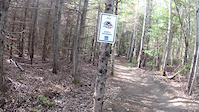
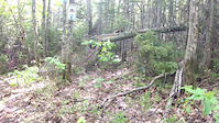
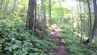
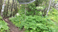
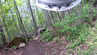
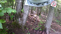
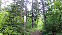
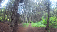
Photos of Matane Mountain Bike
Videos of Matane Mountain Bike
trail: Éole
5:14 |
287 |
Jul 12, 2019
trail: Rafale
3:43 |
101 |
Jul 12, 2019
trail: U-Bolt
0:23 |
181 |
Jul 12, 2019
trail: Big Horn
5:23 |
96 |
Jul 12, 2019
trail: Cyclone
2:36 |
181 |
Jul 12, 2019
trail: Cyclone
5:57 |
84 |
Jul 12, 2019
trail: Alizée
7:15 |
104 |
Jul 12, 2019
trail: Chevreuil
6:25 |
110 |
Jul 12, 2019
Recent Trail Reports
| status | trail | date | condition | info | user |
|---|---|---|---|---|---|
| Old School | Jul 12, 2023 @ 10:20am Jul 12, 2023 | Dry | fboubou | ||
| Éole | Jul 24, 2022 @ 6:30am Jul 24, 2022 | Variable | Silvercooper | ||
| Banjo | Jul 24, 2022 @ 6:30am Jul 24, 2022 | Ideal | Silvercooper | ||
| Bolt | Jul 24, 2022 @ 6:30am Jul 24, 2022 | Ideal | Silvercooper | ||
| Bourrasque | Jul 24, 2022 @ 6:30am Jul 24, 2022 | Variable | Silvercooper | ||
| Cyclone | Jul 24, 2022 @ 6:30am Jul 24, 2022 | Ideal | Silvercooper | ||
| Grosse Gorgée | Jul 24, 2022 @ 6:30am Jul 24, 2022 | Ideal | Silvercooper | ||
| U-Bolt | Jul 24, 2022 @ 6:30am Jul 24, 2022 | Ideal | Silvercooper | ||
| M&M | Jul 24, 2022 @ 6:30am Jul 24, 2022 | Ideal | Silvercooper | ||
| P'tit R'montant | Jul 24, 2022 @ 6:30am Jul 24, 2022 | Ideal | Silvercooper |
Activity Feed
| username | action | type | title | date |
|---|---|---|---|---|
| paultremblay | add | photo | activity #95937721 and 10 more | May 31, 2026 @ 7:26am May 31, 2026 |
| Pluck28 | wishlist | region | activity #95456217 | May 24, 2026 @ 5:04pm May 24, 2026 |
| pumpupthetrack | add | video | activity #86570109 | Jan 3, 2026 @ 8:38am Jan 3, 2026 |
| pumpupthetrack | add | video | activity #85041822 | Dec 1, 2025 @ 9:13pm Dec 1, 2025 |
| ArthurlAventurier | wishlist | region | activity #80628170 | Sep 18, 2025 @ 4:05pm Sep 18, 2025 |
Recent Comments
| username | type | title | comment | date |
|---|---|---|---|---|
| trail | Semblable à Sidewinder dans Kingdom Trails... | Sep 4, 2023 @ 2:23pm Sep 4, 2023 | ||
| trail | Vraiment beaucoup de racines, une grande... | Sep 4, 2023 @ 10:24am Sep 4, 2023 | ||
| trail | Ma piste préféré là-bas, oldschool, slow... | Sep 21, 2022 @ 2:05pm Sep 21, 2022 | ||
| trail | 5* | Jul 27, 2021 @ 11:05am Jul 27, 2021 | ||
| report | Super ! | Jul 17, 2020 @ 6:19am Jul 17, 2020 |
Local Badges
-

10 Blue Trails34 awarded -

10 Black Trails46 awarded -

Epic Ride Climb 2k2 awarded -

Climbing 10k Badge3 awarded -

Climbing 100k Badge0 awarded -

Epic Ride Descent 2k2 awarded
Bike & Skill Parks
| name | type | city | rating |
|---|---|---|---|
| Pump Track Matane | skill park | Matane |
Activity Type Stats
| activitytype | trails | distance | descent | descent distance | total vertical | rating | global rank | state rank | photos | reports | routes | ridelogs |
|---|---|---|---|---|---|---|---|---|---|---|---|---|
| Mountain Bike | 37 | 18 miles | 2,680 ft | 7 miles | 413 ft | #3,928 | #59 | 71 | 2,548 | 1 | 1,386 | |
| E-Bike | 23 | 10 miles | 1,490 ft | 4 miles | 413 ft | #5,268 | #52 | 2,492 | 1 | 80 | ||
| ATV/ORV/OHV | 2 | 2 miles | 39 ft | 2,582 ft | 285 ft | #873 | #2 | 56 | ||||
| Nordic Ski | 5 | 4 miles | 282 ft | 2 miles | 285 ft | #892 | #40 | 94 |
Frequently Asked Questions About Matane
▼
What are the best places to ride in Matane?
Matane has 1 areas to explore for mountain biking. The top rated areas are:
▼
What are the highest rated mountain biking trails in Matane?
▼
What is the best time of the year to ride in Matane?
Based on ride log data, the most popular months to ride in Matane are:
- July (54 activities)
- August (42 activities)
- June (27 activities)
▼
Where can I park to ride in Matane?
There are 1 parking locations listed in Matane. The most popular parking spots are:
Trails
Points of Interest
- By G1Q1Q9 & contributors
- Admins: VQ, bigjay, StephaneMarceau, Canadmos, Velo Eolien
- #6670 - 8,324 views
- matane activity log | embed map of Matane mountain bike trails | matane mountain biking points of interest
Downloading of trail gps tracks in kml & gpx formats is enabled for Matane.
You must login to download files.