close
-
Layers w
- Weather Layers
- Pro
- Pro
- Pro
- Pro
- Pro
- Pro
- More Layers
- Pro
- Pro
- Pro
- Pro
-
Upgrade to

3D
Trail Conditions
- Unknown
- Snow Groomed
- Snow Packed
- Snow Covered
- Snow Cover Partial
- Freeze/thaw Cycle
- Icy
- Prevalent Mud
- Wet
- Variable
- Ideal
- Dry
- Very Dry
Trail Flow (Ridden Direction)
Trailforks scans users ridelogs to determine the most popular direction each trail is ridden. A good flowing trail network will have most trails flowing in a single direction according to their intension.
The colour categories are based on what percentage of riders are riding a trail in its intended direction.
The colour categories are based on what percentage of riders are riding a trail in its intended direction.
- > 96%
- > 90%
- > 80%
- > 70%
- > 50%
- < 50%
- bi-directional trail
- no data
Trail Last Ridden
Trailforks scans ridelogs to determine the last time a trail was ridden.
- < 2 days
- < 1 week
- < 2 weeks
- < 1 month
- < 6 months
- > 6 months
Trail Ridden Direction
The intended direction a trail should be ridden.
- Downhill Only
- Downhill Primary
- Both Directions
- Uphill Primary
- Uphill Only
- One Direction
Contribute Details
Colors indicate trail is missing specified detail.
- Description
- Photos
- Description & Photos
- Videos
Trail Popularity ?
Trailforks scans ridelogs to determine which trails are ridden the most in the last 9 months.
Trails are compared with nearby trails in the same city region with a possible 25 colour shades.
Think of this as a heatmap, more rides = more kinetic energy = warmer colors.
- most popular
- popular
- less popular
- not popular
ATV/ORV/OHV Filter
Max Vehicle Width
inches
US Cell Coverage
Legend

Radar Time
Activity Recordings
Trailforks uses anonymized public activity data.
?
Activity Recordings
Trailforks uses anonymized public activity data.
?
Personal Heatmap
▶
Activity Types
all
/
none
▶
Options
2
Date range
month
–
Winter Trails
Warning
A routing network for winter maps does not exist. Selecting trails using the winter trails layer has been disabled.
Missing Trails
Most Popular
Least Popular
Trails are colored based on popularity. The more popular a trail is, the more red. Less popular trails trend towards green.
Jump Magnitude Heatmap
Heatmap of where riders jump on trails. Zoom in to see individual jumps, click circles to view jump details.
BC Backroad Status
![map legend]()
Service Road Atlas is a free to use, community-driven service for viewing and creating reports on the numerous back-country service roads around B.C. and Alberta.

Slope Aspect
Direction the slope faces
Trails Deemphasized
Trails are shown in grey.
Only show trails with no bike usage.
Suggested Layers
Based on selected activity type
Save the current map location and zoom level as your default home location whenever this page is loaded.
Save
No description for Mentone has been added yet!
Login or register to submit one.
Activities Click to view
- Mountain Bike
7 trails
- Adaptive Bike
0 trails
- Hike
8 trails
- Trail Running
8 trails
Region Details
- 2
- 1
- 1
- 3
Region Status
Open as of Feb 21, 2026Stats
- Avg Trail Rating
- Trails (view details)
- 8
- Trails Mountain Bike
- 7
- Trails Hike
- 8
- Trails Trail Running
- 8
- Total Distance
- 24 miles
- Total Descent Distance
- 15 miles
- Total Descent
- 5,037 ft
- Total Vertical
- 2,834 ft
- Highest Trailhead
- 4,404 ft
- Reports
- 18
- Photos
- 15
- Ridden Counter
- 241
Popular Mentone Mountain Biking Trails
• 100 ★ 2.0 • 2 miles • 0 ft • 71 •
Popular white difficulty asphalt/tarmac road. This multi-use trail can be used both directions. On average it takes 5 minutes to complete this trail.
• 30 ★ 0.0 • 5 miles • 508 ft • 22 •
Trail runs down the mountain from Old City Creek Road (1N02) to the water tower on the hill above Van Leuven Ln in Highland.
• 60 ★ 0.0 • 3 miles • 2 ft • 12 •
Moderately popular green difficulty mixed. This mountain bike primary trail can be used both directions. On average it takes 18 minutes to complete this trail.
• 45 ★ 0.0 • 2 miles • 135 ft • 5 •
The climb route at the top of the ridge. Intersects the end of the Santa Ana River Trail (2E03) - Morton Peak Section.
Mentone Mountain Bike Routes
55 miles • 9,297 ft • 9 • Loop •
this route has not been ridden yet, In the planning stage, hoping to tackle it before summer heat sets in....
25 miles • 1,331 ft • 0 •
Section 9 of a series of mountain biking trails connecting from Southern California to Canada, similar to...
Photos of Mentone Mountain Bike
Videos of Mentone Mountain Bike
22:43 |
149 |
Aug 27, 2024 , Mentone
Recent Trail Reports
| status | trail | date | condition | info | user |
|---|---|---|---|---|---|
| Santa Ana River Trail (East Mill Creek Wash) | Feb 21, 2026 @ 6:59am (America/Los_Angeles) Feb 21, 2026 | Ideal | TedStoddardrwx | ||
| Upper Workout | Dec 21, 2025 @ 5:10pm (America/Los_Angeles) Dec 21, 2025 | Dry | martiiiin11 | ||
| Lower Workout | Oct 21, 2025 @ 12:04pm (America/Los_Angeles) Oct 21, 2025 | Dry | ev-dog SDMBA | ||
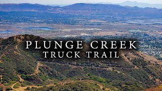
| Plunge Creek Truck Trail (1N21) | Aug 27, 2024 @ 7:34pm Aug 27, 2024 | Dry | pmikuljan | ||
| Van Leuven Water Tower | Nov 26, 2023 @ 9:39am Nov 26, 2023 | Dry | 1OBCPOT | ||
| West Old City Creek Road (1N09) | Apr 29, 2022 @ 8:00am Apr 29, 2022 | Unknown | TedStoddardrwx |
Activity Feed
| username | action | type | title | date |
|---|---|---|---|---|
| TedStoddardrwx | add | report | activity #89326913 | Feb 21, 2026 @ 6:58pm Feb 21, 2026 |
| martiiiin11 | add | report | activity #85875988 | Dec 21, 2025 @ 5:10pm Dec 21, 2025 |
| ev-dog | add | report | activity #82775222 | Oct 21, 2025 @ 12:05pm Oct 21, 2025 |
| ev-dog | add | photo | activity #82775146 and 1 more | Oct 21, 2025 @ 12:03pm Oct 21, 2025 |
| ev-dog | comment | trail | activity #82775096 | Oct 21, 2025 @ 12:02pm Oct 21, 2025 |
Recent Comments
| username | type | title | comment | date |
|---|---|---|---|---|
| trail | Part singletrack, part doubletrack. | Oct 21, 2025 @ 12:02pm Oct 21, 2025 | ||
| trail | Asphalt gravel path along a ~7 foot flood... | May 14, 2023 @ 12:47pm May 14, 2023 |
Activity Type Stats
| activitytype | trails | distance | descent | descent distance | total vertical | rating | global rank | state rank | photos | reports | routes | ridelogs |
|---|---|---|---|---|---|---|---|---|---|---|---|---|
| Mountain Bike | 7 | 22 miles | 4,957 ft | 15 miles | 2,835 ft | #9,710 | #3,040 | 15 | 18 | 2 | 393 | |
| Hike | 8 | 24 miles | 5,036 ft | 15 miles | 2,835 ft | #7,951 | #2,808 | 15 | 19 | |||
| Trail Running | 8 | 24 miles | 5,036 ft | 15 miles | 2,835 ft | #7,503 | #2,480 | 15 | 13 |
Frequently Asked Questions About Mentone
▼
What are the highest rated mountain biking trails in Mentone?
The highest rated mountain biking trails in Mentone are:
- Santa Ana River Trail (East Mill Creek Wash) (3.7/5)
- Lower Workout (0/5)
- Santa Ana River Trail (West Mill Creek Wash) (0/5)
- Upper Workout (0/5)
- Plunge Creek Truck Trail (1N21) (0/5)
▼
What is the best time of the year to ride in Mentone?
Based on ride log data, the most popular months to ride in Mentone are:
- November (2 activities)
- August (2 activities)
- May (1 activities)
▼
Where can I park to ride in Mentone?
Check the Mentone trail map for trailhead and parking information. Community members regularly update access and parking details for trails in the area.
▼
What is the longest trail in Mentone?
The longest trail in Mentone is Plunge Creek Truck Trail (1N21) at 5.3 miles. View all trails sorted by distance.
Trails
Points of Interest
- By jdmtb2000 & contributors
- Admins: apply
- #39301 - 1,345 views
- mentone activity log | embed map of Mentone mountain bike trails |
Downloading of trail gps tracks in kml & gpx formats is enabled for Mentone.
You must login to download files.