close
-
Layers w
- Weather Layers
- Pro
- Pro
- Pro
- Pro
- Pro
- Pro
- More Layers
- Pro
- Pro
- Pro
- Pro
-
Upgrade to

3D
Trail Conditions
- Unknown
- Snow Groomed
- Snow Packed
- Snow Covered
- Snow Cover Partial
- Freeze/thaw Cycle
- Icy
- Prevalent Mud
- Wet
- Variable
- Ideal
- Dry
- Very Dry
Trail Flow (Ridden Direction)
Trailforks scans users ridelogs to determine the most popular direction each trail is ridden. A good flowing trail network will have most trails flowing in a single direction according to their intension.
The colour categories are based on what percentage of riders are riding a trail in its intended direction.
The colour categories are based on what percentage of riders are riding a trail in its intended direction.
- > 96%
- > 90%
- > 80%
- > 70%
- > 50%
- < 50%
- bi-directional trail
- no data
Trail Last Ridden
Trailforks scans ridelogs to determine the last time a trail was ridden.
- < 2 days
- < 1 week
- < 2 weeks
- < 1 month
- < 6 months
- > 6 months
Trail Ridden Direction
The intended direction a trail should be ridden.
- Downhill Only
- Downhill Primary
- Both Directions
- Uphill Primary
- Uphill Only
- One Direction
Contribute Details
Colors indicate trail is missing specified detail.
- Description
- Photos
- Description & Photos
- Videos
Trail Popularity ?
Trailforks scans ridelogs to determine which trails are ridden the most in the last 9 months.
Trails are compared with nearby trails in the same city region with a possible 25 colour shades.
Think of this as a heatmap, more rides = more kinetic energy = warmer colors.
- most popular
- popular
- less popular
- not popular
ATV/ORV/OHV Filter
Max Vehicle Width
inches
US Cell Coverage
Legend

Radar Time
Activity Recordings
Trailforks uses anonymized public activity data.
?
Activity Recordings
Trailforks uses anonymized public activity data.
?
Personal Heatmap
▶
Activity Types
all
/
none
▶
Options
2
Date range
month
–
Winter Trails
Warning
A routing network for winter maps does not exist. Selecting trails using the winter trails layer has been disabled.
Missing Trails
Most Popular
Least Popular
Trails are colored based on popularity. The more popular a trail is, the more red. Less popular trails trend towards green.
Jump Magnitude Heatmap
Heatmap of where riders jump on trails. Zoom in to see individual jumps, click circles to view jump details.
BC Backroad Status
![map legend]()
Service Road Atlas is a free to use, community-driven service for viewing and creating reports on the numerous back-country service roads around B.C. and Alberta.

Slope Aspect
Direction the slope faces
Trails Deemphasized
Trails are shown in grey.
Only show trails with no bike usage.
Suggested Layers
Based on selected activity type
Save the current map location and zoom level as your default home location whenever this page is loaded.
Save
No description for Merced has been added yet!
Login or register to submit one.
Activities Click to view
- Mountain Bike
24 trails
- E-Bike
2 trails
- Gravel Bike
0 trails
- Adaptive Bike
0 trails
- Hike
0 trails
- Trail Running
0 trails
Region Details
- 8
- 8
- 5
- 2
- 1
Region Status
Open as of Jul 2, 2026Stats
- Avg Trail Rating
- Trails (view details)
- 24
- Trails Mountain Bike
- 29
- Trails E-Bike
- 2
- Total Distance
- 25 miles
- Total Descent
- 4,518 ft
- Total Vertical
- 853 ft
- Highest Trailhead
- 1,713 ft
- Reports
- 323
- Photos
- 141
- Ridden Counter
- 8,387
Sub Regions
-
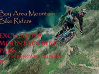
Exchequer Mountain Bike Park
- 8
- 5
- 2
- 1
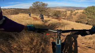
Popular Merced Mountain Biking Trails
• 100 ★ 3.0 • 1,036 ft • 41 ft • 712 •
Popular green difficulty singletrack. This mountain bike primary trail can be used both directions. On average it takes 2 minutes to complete this trail.
• 85 ★ 4.0 • 1 mile • 12 ft • 578 •
Great views as you start the gradual initial descent off the crest of the hill. Top section is mostly flowy, fast dirt with some berms. Middle section gets steeper and rockier. Bottom section is straighter and flatter but still plenty...
• 80 ★ 4.5 • 2 miles • 6 ft • 545 •
Highly rated popular black diamond difficulty singletrack. This mountain bike primary trail can be used downhill only. It features berm, drop, jump, ladder bridge and rock garden. On average it takes 19 minutes to complete this trail.
• 75 ★ 3.5 • 2,904 ft • 7 ft • 399 •
Falling berms, bar-drop g-outs and flowy rock zones.
• 95 ★ 3.0 • 1 mile • 123 ft • 369 •
Connection from the Cabin area of the Campground to either Trail or I Loop.
• 90 ★ 4.3 • 2,687 ft • 0 ft • 332 •
Last section of the 2020 NICA Loop. Designed to come downhill from the water tower to the cabins but can be pedaled up also.
• 90 ★ 3.6 • 2 miles • 206 ft • 303 •
This trail is designed to be Adaptive Mountain Bike Friendly, Our current problem is that we have yet to complete the Family Trail that will connect to this to allow users to get into the park. Once that is completed then we will assign...
Merced Mountain Bike Routes
3 miles • 332 ft • 10 •
XC race course for the 2019 WCCC Mountain bike race at Exchequer Bike park.
• 15 miles • 1,856 ft • 11 •
• 15 miles • 2,667 ft • 12 •
• 15 miles • 3,556 ft • 11 •
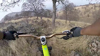
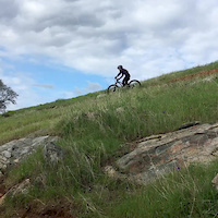
Photos of Merced Mountain Bike
Videos of Merced Mountain Bike
trail: Down and Out
0:16 |
744 |
Jul 27, 2018
trail: Dirtsurfer
0:20 |
312 |
Apr 13, 2018

trail: Gnarnia
4:14 |
591 |
Jan 29, 2017

trail: Gnarnia
3:07 |
281 |
Jan 15, 2017
trail: Flying Squirrel
5:07 |
554 |
Oct 17, 2015
trail: Roadrunner
0:27 |
448 |
Mar 17, 2014
3:48 |
177 |
Oct 30, 2023
trail: Dirtsurfer
3:54 |
238 |
Nov 4, 2022 , Merced
Recent Trail Reports
| status | trail | date | condition | info | user |
|---|---|---|---|---|---|
| Wild Turkey | Oct 16, 2023 @ 10:42am Oct 16, 2023 | Dry | WillieJacobsz Trailforks | ||
| Valley Rail | Oct 16, 2023 @ 10:42am Oct 16, 2023 | Dry | WillieJacobsz Trailforks | ||
| Upper Cabin | Oct 16, 2023 @ 10:42am Oct 16, 2023 | Dry | WillieJacobsz Trailforks | ||
| Two Track | Oct 16, 2023 @ 10:42am Oct 16, 2023 | Dry | WillieJacobsz Trailforks | ||
| Sidewinder | Oct 16, 2023 @ 10:42am Oct 16, 2023 | Dry | WillieJacobsz Trailforks | ||
| Roads End | Oct 16, 2023 @ 10:42am Oct 16, 2023 | Dry | WillieJacobsz Trailforks | ||
| Pleasant Valley | Oct 16, 2023 @ 10:42am Oct 16, 2023 | Dry | WillieJacobsz Trailforks | ||
| Parking Loop Access | Oct 16, 2023 @ 10:42am Oct 16, 2023 | Dry | WillieJacobsz Trailforks | ||
| Hekeke | Oct 16, 2023 @ 10:42am Oct 16, 2023 | Dry | WillieJacobsz Trailforks | ||
| Forty-nine | Oct 16, 2023 @ 10:42am Oct 16, 2023 | Dry | WillieJacobsz Trailforks |
Activity Feed
| username | action | type | title | date |
|---|---|---|---|---|
| nfluxx | wishlist | region | activity #97874706 | Jun 26, 2026 @ 8:44pm Jun 26, 2026 |
| HillbillyPro | wishlist | region | activity #96717888 | Jun 10, 2026 @ 9:33pm Jun 10, 2026 |
| Jmlascala71 | vote | trail | activity #92968322 and 3 more | Apr 19, 2026 @ 11:48am Apr 19, 2026 |
| Jmlascala71 | vote | trail | activity #92914049 and 1 more | Apr 18, 2026 @ 7:10pm Apr 18, 2026 |
| AUMbike | like | directory | activity #92766110 | Apr 16, 2026 @ 7:46pm Apr 16, 2026 |
Recent Comments
| username | type | title | comment | date |
|---|---|---|---|---|
| trail | Looking great today! | Oct 25, 2025 @ 2:31pm Oct 25, 2025 | ||
| trail | Looking good! | Oct 25, 2025 @ 2:30pm Oct 25, 2025 | ||
| trail | Looking good! | Oct 25, 2025 @ 2:30pm Oct 25, 2025 | ||
| trail | Looking really really nice - thank you to the... | Oct 25, 2025 @ 2:29pm Oct 25, 2025 | ||
| trail | Overgrown | Aug 2, 2025 @ 6:34pm Aug 2, 2025 |
Local Badges
-

Epic Ride Climb 2k14 awarded -

Climbing 10k Badge11 awarded -

Climbing 100k Badge0 awarded -

Epic Ride Descent 2k14 awarded -

Descent 10k Badge11 awarded -

Descent 100k Badge0 awarded
Activity Type Stats
| activitytype | trails | distance | descent | descent distance | total vertical | rating | global rank | state rank | photos | reports | routes | ridelogs |
|---|---|---|---|---|---|---|---|---|---|---|---|---|
| Mountain Bike | 24 | 25 miles | 4,518 ft | 11 miles | 853 ft | #3,391 | #1,163 | 140 | 323 | 3 | 4,442 | |
| E-Bike | 2 | 3 miles | 217 ft | 3,570 ft | 764 ft | #8,916 | #2,727 | 212 | 1 | 522 |
Frequently Asked Questions About Merced
▼
What are the best places to ride in Merced?
Merced has 1 areas to explore for mountain biking. The top rated areas are:
▼
What are the highest rated mountain biking trails in Merced?
The highest rated mountain biking trails in Merced are:
- Down and Out (4.3/5)
- Deer Run (4.2/5)
- Wild Turkey (4.1/5)
- Roadrunner (4.1/5)
- Buck Brush (4.1/5)
▼
What is the best time of the year to ride in Merced?
Based on ride log data, the most popular months to ride in Merced are:
- April (60 activities)
- March (48 activities)
- February (46 activities)
▼
Where can I park to ride in Merced?
There are 1 parking locations listed in Merced. The most popular parking spots are:
- By aoneal & contributors
- Admins: ERC
- #8231 - 6,496 views
- merced activity log | embed map of Merced mountain bike trails | merced mountain biking points of interest
Downloading of trail gps tracks in kml & gpx formats is enabled for Merced.
You must login to download files.