close
-
Layers w
- Weather Layers
- Pro
- Pro
- Pro
- Pro
- Pro
- Pro
- More Layers
- Pro
- Pro
- Pro
- Pro
-
Upgrade to

3D
Trail Conditions
- Unknown
- Snow Groomed
- Snow Packed
- Snow Covered
- Snow Cover Partial
- Freeze/thaw Cycle
- Icy
- Prevalent Mud
- Wet
- Variable
- Ideal
- Dry
- Very Dry
Trail Flow (Ridden Direction)
Trailforks scans users ridelogs to determine the most popular direction each trail is ridden. A good flowing trail network will have most trails flowing in a single direction according to their intension.
The colour categories are based on what percentage of riders are riding a trail in its intended direction.
The colour categories are based on what percentage of riders are riding a trail in its intended direction.
- > 96%
- > 90%
- > 80%
- > 70%
- > 50%
- < 50%
- bi-directional trail
- no data
Trail Last Ridden
Trailforks scans ridelogs to determine the last time a trail was ridden.
- < 2 days
- < 1 week
- < 2 weeks
- < 1 month
- < 6 months
- > 6 months
Trail Ridden Direction
The intended direction a trail should be ridden.
- Downhill Only
- Downhill Primary
- Both Directions
- Uphill Primary
- Uphill Only
- One Direction
Contribute Details
Colors indicate trail is missing specified detail.
- Description
- Photos
- Description & Photos
- Videos
Trail Popularity ?
Trailforks scans ridelogs to determine which trails are ridden the most in the last 9 months.
Trails are compared with nearby trails in the same city region with a possible 25 colour shades.
Think of this as a heatmap, more rides = more kinetic energy = warmer colors.
- most popular
- popular
- less popular
- not popular
ATV/ORV/OHV Filter
Max Vehicle Width
inches
US Cell Coverage
Legend

Radar Time
Activity Recordings
Trailforks uses anonymized public activity data.
?
Activity Recordings
Trailforks uses anonymized public activity data.
?
Personal Heatmap
▶
Activity Types
all
/
none
▶
Options
2
Date range
month
–
Winter Trails
Warning
A routing network for winter maps does not exist. Selecting trails using the winter trails layer has been disabled.
Missing Trails
Most Popular
Least Popular
Trails are colored based on popularity. The more popular a trail is, the more red. Less popular trails trend towards green.
Jump Magnitude Heatmap
Heatmap of where riders jump on trails. Zoom in to see individual jumps, click circles to view jump details.
BC Backroad Status
![map legend]()
Service Road Atlas is a free to use, community-driven service for viewing and creating reports on the numerous back-country service roads around B.C. and Alberta.

Slope Aspect
Direction the slope faces
Trails Deemphasized
Trails are shown in grey.
Only show trails with no bike usage.
Suggested Layers
Based on selected activity type
Save the current map location and zoom level as your default home location whenever this page is loaded.
Save
No description for Millbrook has been added yet!
Login or register to submit one.
Activities Click to view
- Mountain Bike
20 trails
- E-Bike
4 trails
- Gravel Bike
0 trails
- Winter Fat Bike
0 trails
- Hike
24 trails
- Trail Running
24 trails
Region Details
- 2
- 1
- 5
- 10
- 2
Region Status
Open as of 13 hoursLocal Trail Association
Stats
- Avg Trail Rating
- Trails (view details)
- 24
- Trails Mountain Bike
- 20
- Trails E-Bike
- 4
- Trails Horse
- 1
- Trails Hike
- 24
- Trails Trail Running
- 24
- Trails Snowshoe
- 1
- Trails Backcountry Ski
- 2
- Total Distance
- 13 miles
- Total Descent
- 1,200 ft
- Total Vertical
- 377 ft
- Highest Trailhead
- 1,080 ft
- Reports
- 1,515
- Photos
- 139
- Ridden Counter
- 5,412
Sub Regions
-
Millbrook Valley Trails
- 1
- 5
- 10
- 2
Popular Millbrook Mountain Biking Trails
• 85 ★ 4.7 • 3,530 ft • 3 ft • 430 •
Fast rolling single-track with numerous quick ups, downs, and arounds. Some small trail features to pop off or ride around, depending on your mood. Ride it as a down and this trail will take you past ancient oaks before flowing down...
• 80 ★ 4.8 • 4,157 ft • 34 ft • 430 •
A fast and very flowy singletrack trail. Rolling terrain with berms and fast chicanes. Mostly smooth packed dirt through hardwood forest with some small rock gardens. Best ridden as a downhill but rideable in both directions. A few...
• 55 ★ 4.5 • 925 ft • 6 ft • 396 •
A revived rooty loamy trail running through a forest. Rolling terrain without a huge amount of elevation change but just enough to keep things interesting.
• 95 ★ 4.5 • 1,188 ft • 0 ft • 386 •
Wind through pine plantations on this short but fun connector trail. Formerly known for being a hotbed of poison ivy - it has since been treated and is noticeably less itchy these days.
• 65 ★ 5.0 • 1,895 ft • 99 ft • 386 •
A mix of tight trees in the upper section followed by a more open flowy zone leading down to Elgar Dr.
• 60 ★ 4.2 • 2,812 ft • 139 ft • 373 •
A double-track trail with a good sustained climbing section that leads you up past to the top of hill.
• 100 ★ 5.0 • 4,259 ft • 125 ft • 321 •
The easiest way up the hill but also a fun way to go down it.
• 30 ★ 4.5 • 2,116 ft • 21 ft • 285 •
A nice piece of trail in either direction. Fast and fun descents. The hills are most challenging when ridden in the direction of the (opposite to the map above). Watch for slippery bridges and boardwalks in wet weather.
Millbrook Mountain Bike Routes
11 miles • 890 ft • 14 • Out & Back •
Ride it like a local! Park at the trout ponds (MNR property) and head approximately 10km out towards the...
8 miles • 662 ft • 14 • Loop • Race •
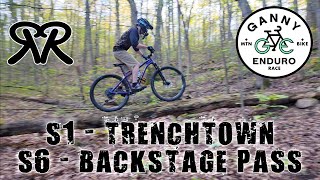
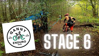
2025 Marin Bikes Ganny Enduro - Kids course Stage 1 - Stage 2 -
17 miles • 1,195 ft • 16 • Race •
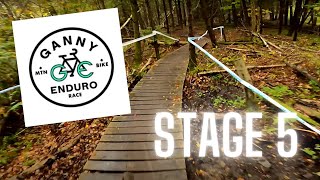
2025 Ganny Enduro - Short course Stage 1 - Stage 2 - Stage 3 - Lower GT Stage 4 -
25 miles • 2,092 ft • 32 • Race •
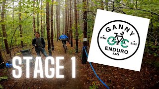
2025 Marin Bikes Ganny Enduro - Long Course Provincial Enduro Championships course Stage 1 - Stage 2 -...
★ 3.0 • 19 miles • 1,710 ft • 14 • Race •
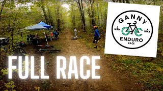
The 9Point8 Ganny Enduro Short Course: Stage 1 - Trench Town Stage 2 - Chaga Stage 3 - Creekie Stage 4 -...
13 miles • 942 ft • 10 • Loop • Race •
Ganny Enduro 2022 morning loop. Stage 1 - Stage 2 - Lower GT Stage 3 -
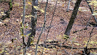
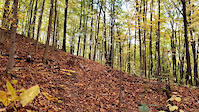
Photos of Millbrook Mountain Bike
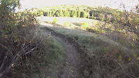
Videos of Millbrook Mountain Bike
trail: Backstage Pass
0:14 |
91 |
Oct 14, 2020
trail: Backstage Pass
0:08 |
49 |
Oct 14, 2020
trail: Backstage Pass
13:16 |
291 |
Oct 30, 2015
trail: Roots Revival
14:34 |
209 |
Sep 18, 2022 , Millbrook
trail: Backstage Pass
7:45 |
440 |
Oct 13, 2021 , Millbrook
trail: Ganny Transit
3:54 |
321 |
Oct 13, 2021 , Millbrook
trail: Trench Town
3:56 |
307 |
Oct 13, 2021 , Millbrook
37:41 |
244 |
Oct 13, 2021
Recent Trail Reports
| status | trail | date | condition | info | user |
|---|---|---|---|---|---|
| Meadow Trail | Jun 1, 2026 @ 2:17pm (America/Toronto) 3 days | Ideal | turfjon | ||
| Grand Trunk Pathway | Jun 1, 2026 @ 2:17pm (America/Toronto) 3 days | Ideal | turfjon | ||
| Founders Keepers | Jun 1, 2026 @ 2:17pm (America/Toronto) 3 days | Ideal | turfjon | ||
| Cedar Trail | Jun 1, 2026 @ 2:17pm (America/Toronto) 3 days | Ideal | turfjon | ||
| Milly Vanilly | Jun 1, 2026 @ 2:17pm (America/Toronto) 3 days | Ideal | turfjon | ||
| Roots Rock Riot | Jun 1, 2026 @ 2:17pm (America/Toronto) 3 days | Ideal | turfjon | ||
| Roots Revival | Jun 1, 2026 @ 2:17pm (America/Toronto) 3 days | Ideal | turfjon | ||
| Backstage Pass | Jun 1, 2026 @ 2:17pm (America/Toronto) 3 days | Ideal | turfjon | ||
| The Itch | Jun 1, 2026 @ 2:17pm (America/Toronto) 3 days | Ideal | turfjon | ||
| High Plains Drifter | Jun 1, 2026 @ 2:17pm (America/Toronto) 3 days | Ideal | turfjon |
Activity Feed
| username | action | type | title | date |
|---|---|---|---|---|
| turfjon | add | report | activity #96046447 and 11 more | Jun 1, 2026 @ 4:04pm 3 days |
| davidsheaff | add | photo | activity #95997874 | May 31, 2026 @ 9:06pm May 31, 2026 |
| davidsheaff | add | photo | activity #95981795 and 2 more | May 31, 2026 @ 3:16pm May 31, 2026 |
| TacocaTatat | wishlist | route | activity #95936959 | May 31, 2026 @ 7:17am May 31, 2026 |
| bike4adventure | add | report | activity #95284012 and 8 more | May 22, 2026 @ 6:58pm May 22, 2026 |
Recent Comments
| username | type | title | comment | date |
|---|---|---|---|---|
| report | No issues - trail is open and shreddy | Nov 25, 2023 @ 7:25pm Nov 25, 2023 | ||
| report | Sounds like a good time | Sep 19, 2023 @ 4:06pm Sep 19, 2023 | ||
| trail | This is a superb trail. Up or down, doenst... | Jun 11, 2023 @ 10:00am Jun 11, 2023 | ||
| report | Groomed but snow is still very soft climbs are... | Mar 10, 2023 @ 3:02pm Mar 10, 2023 | ||
| report | Groomed but snow is still very soft climbs are... | Mar 10, 2023 @ 3:01pm Mar 10, 2023 |
Local Badges
-

Epic Ride Climb 2k1 awarded -

Climbing 10k Badge22 awarded -

Climbing 100k Badge0 awarded -

Epic Ride Descent 2k1 awarded -

Descent 10k Badge23 awarded -

Descent 100k Badge0 awarded
Activity Type Stats
| activitytype | trails | distance | descent | descent distance | total vertical | rating | global rank | state rank | photos | reports | routes | ridelogs |
|---|---|---|---|---|---|---|---|---|---|---|---|---|
| Mountain Bike | 20 | 11 miles | 1,086 ft | 6 miles | 371 ft | #2,470 | #49 | 138 | 1,513 | 13 | 4,760 | |
| E-Bike | 4 | 1 mile | 46 ft | 2,743 ft | 331 ft | #6,698 | #108 | 1,282 | 106 | |||
| Horse | 1 | 2,005 ft | 7 ft | 1,486 ft | 7 ft | 241 | 2 | |||||
| Hike | 24 | 13 miles | 1,201 ft | 6 miles | 377 ft | #7,121 | #131 | 1,529 | 137 | |||
| Trail Running | 24 | 13 miles | 1,201 ft | 6 miles | 377 ft | #6,900 | #119 | 1,529 | 2 | 75 | ||
| Snowshoe | 1 | 2,005 ft | 7 ft | 1,486 ft | 7 ft | 1 | 14 | 16 | ||||
| Backcountry Ski | 2 | 2,005 ft | 7 ft | 1,486 ft | 7 ft | 7 | 5 |
Frequently Asked Questions About Millbrook
▼
What are the best places to ride in Millbrook?
Millbrook has 2 areas to explore for mountain biking. The top rated areas are:
▼
What are the highest rated mountain biking trails in Millbrook?
The highest rated mountain biking trails in Millbrook are:
- Backstage Pass (4.6/5)
- Ganny Transit (4.5/5)
- Meadow Trail Extension (4.4/5)
- Trench Town (4.3/5)
- High Plains Drifter (4.3/5)
▼
What is the best time of the year to ride in Millbrook?
Based on ride log data, the most popular months to ride in Millbrook are:
- August (106 activities)
- July (100 activities)
- September (75 activities)
▼
Where can I park to ride in Millbrook?
There are 4 parking locations listed in Millbrook. The most popular parking spots are:
- Main Lot - MNR Fishing and Recreation Area (aka Trout Ponds)
- Alternate Parking - End of Elgar Drive
- Parking
- Parking
Trails
Points of Interest
- By TguzDH
 & contributors
 - Admins: MMTB, MVTC, PTA
- #4197 - 23,875 views
- millbrook activity log | embed map of Millbrook mountain bike trails | millbrook mountain biking points of interest polygons
Downloading of trail gps tracks in kml & gpx formats is enabled for Millbrook.
You must login to download files.