close
-
Layers w
- Weather Layers
- Pro
- Pro
- Pro
- Pro
- Pro
- Pro
- More Layers
- Pro
- Pro
- Pro
- Pro
-
Upgrade to

3D
Trail Conditions
- Unknown
- Snow Groomed
- Snow Packed
- Snow Covered
- Snow Cover Partial
- Freeze/thaw Cycle
- Icy
- Prevalent Mud
- Wet
- Variable
- Ideal
- Dry
- Very Dry
Trail Flow (Ridden Direction)
Trailforks scans users ridelogs to determine the most popular direction each trail is ridden. A good flowing trail network will have most trails flowing in a single direction according to their intension.
The colour categories are based on what percentage of riders are riding a trail in its intended direction.
The colour categories are based on what percentage of riders are riding a trail in its intended direction.
- > 96%
- > 90%
- > 80%
- > 70%
- > 50%
- < 50%
- bi-directional trail
- no data
Trail Last Ridden
Trailforks scans ridelogs to determine the last time a trail was ridden.
- < 2 days
- < 1 week
- < 2 weeks
- < 1 month
- < 6 months
- > 6 months
Trail Ridden Direction
The intended direction a trail should be ridden.
- Downhill Only
- Downhill Primary
- Both Directions
- Uphill Primary
- Uphill Only
- One Direction
Contribute Details
Colors indicate trail is missing specified detail.
- Description
- Photos
- Description & Photos
- Videos
Trail Popularity ?
Trailforks scans ridelogs to determine which trails are ridden the most in the last 9 months.
Trails are compared with nearby trails in the same city region with a possible 25 colour shades.
Think of this as a heatmap, more rides = more kinetic energy = warmer colors.
- most popular
- popular
- less popular
- not popular
ATV/ORV/OHV Filter
Max Vehicle Width
inches
US Cell Coverage
Legend

Radar Time
Activity Recordings
Trailforks uses anonymized public activity data.
?
Activity Recordings
Trailforks uses anonymized public activity data.
?
Personal Heatmap
▶
Activity Types
all
/
none
▶
Options
2
Date range
month
–
Winter Trails
Warning
A routing network for winter maps does not exist. Selecting trails using the winter trails layer has been disabled.
Missing Trails
Most Popular
Least Popular
Trails are colored based on popularity. The more popular a trail is, the more red. Less popular trails trend towards green.
Jump Magnitude Heatmap
Heatmap of where riders jump on trails. Zoom in to see individual jumps, click circles to view jump details.
BC Backroad Status
![map legend]()
Service Road Atlas is a free to use, community-driven service for viewing and creating reports on the numerous back-country service roads around B.C. and Alberta.

Slope Aspect
Direction the slope faces
Trails Deemphasized
Trails are shown in grey.
Only show trails with no bike usage.
Suggested Layers
Based on selected activity type
Save the current map location and zoom level as your default home location whenever this page is loaded.
SaveMillinocket is the gateway to Baxter State Park and the Maine North Woods. The town and its immediate area are quickly becoming an outdoor mecca of Maine. Downtown has a few restuarants and bars and the New England Outdoor Center is quickly developing miles of nordic skiing and mountain biking (non-motorized multiuse). Come here to experience great 4 season outdoor recreation.
Activities Click to view
- Mountain Bike
53 trails
- E-Bike
19 trails
- Adaptive Bike
0 trails
- Winter Fat Bike
1 trails
- Hike
49 trails
- Trail Running
49 trails
- ATV/ORV/OHV
4 trails
- Snowmobile
5 trails
- Snowshoe
48 trails
- Backcountry Ski
17 trails
- Nordic Ski
37 trails
Region Details
- 18
- 3
- 11
- 15
Region Status
Open as of Mar 29, 2026Stats
- Avg Trail Rating
- Trails (view details)
- 50
- Trails Mountain Bike
- 53
- Trails E-Bike
- 19
- Trails Winter Fat Bike
- 1
- Trails Hike
- 49
- Trails Trail Running
- 49
- Trails ATV/ORV/OHV
- 4
- Trails Snowmobile
- 5
- Trails Snowshoe
- 48
- Trails Backcountry Ski
- 17
- Trails Nordic Ski
- 37
- Total Distance
- 52 miles
- Total Descent Distance
- 21 miles
- Total Descent
- 4,177 ft
- Total Vertical
- 701 ft
- Highest Trailhead
- 1,050 ft
- Reports
- 63
- Photos
- 56
- Ridden Counter
- 2,566
Sub Regions
-
Bait Hole
- 1
-
Hammond Ridge
- 7
- 10
-
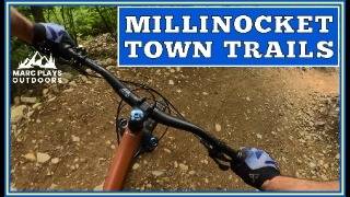
Millinocket Town Trails
- 3
- 3
- 5
-
Northern Timber Cruisers Clubhouse
Popular Millinocket Mountain Biking Trails
• 100 ★ 5.0 • 771 ft • 0 ft • 191 •
is the short connector from the River Drivers trailhead to and into the entire trail system. uses the ski trail then jumps onto singletrack before coming the loop and intersection.
• 85 ★ 4.5 • 4 miles • 240 ft • 177 •
A mellow 4ish mile loop with easy climbs and descents. Mostly a wide bluestone single track trail with a few rocks, rollers and side features if you know where to look. Great for all abilities. Gravel in many places make this an easy...
• 95 ★ 5.0 • 3,074 ft • 0 ft • 176 •
A fun flowing downhill for the any rider. Geared towards beginners, this downhill bike-only trail starts below the NEOC Event Center. Use and the access trail to reach the start of . Enjoy views of Katahdin before dropping in for...
• 90 ★ 4.7 • 4,715 ft • 18 ft • 144 •
This is a dark blue, intermediate trail. A step up from Lower Rip, Upper Rip includes numerous dynamic moves and unique features. Most riders can roll everything, but shredders can find plenty of air. Look for creative use of glacial...
• 80 ★ 2.0 • 3,599 ft • 25 ft • 142 •
Intermediate level trail with a few alternate lines. A few tight turns and some rock features. Rides well in both directions. Fairly all-weather. Blue Ox provides some great blue singletrack close to the bottom/Twin Pines.
• 90 ★ 4.0 • 1,552 ft • 39 ft • 136 •
The upper portion of , part of the eventual climbing singletrack that connects to . A nice example of the blue cross-country trails at Hammond Ridge. Currently used to access . begins a short distance up the gravel road from the end of...
• 100 ★ 5.0 • 2,559 ft • 93 ft • 121 •
connects from to , Access and is a beginner trail that offers a gentle singletrack climb to . Riders can access all the gravity trails on singletrack without using any roads, just follow the Timber Hauls up!
Photos of Millinocket Mountain Bike
Videos of Millinocket Mountain Bike
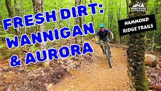
trail: Aurora
9:06 |
0 |
Jun 19, 2026 , Millinocket

trail: Wannigan
9:06 |
77 |
Sep 10, 2025 , Millinocket
trail: Flowage
15:02 |
80 |
Oct 17, 2024 , Millinocket
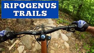
trail: Upper Ripogenus
12:51 |
142 |
Jun 23, 2024 , Millinocket
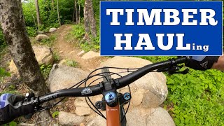
trail: Middle Timber Haul
11:07 |
172 |
Jun 20, 2024 , Millinocket

trail: Blue Ox
8:17 |
189 |
Mar 16, 2024 , Millinocket
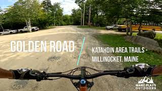
trail: Golden Road
11:43 |
125 |
Mar 10, 2024 , Millinocket
youtuber
![IMBA Trail Solutions Builds: Upper Ripogenus...]()

trail: Upper Ripogenus
0:31 |
465 |
Nov 4, 2021 , Millinocket
Recent Trail Reports
| status | trail | date | condition | info | user |
|---|---|---|---|---|---|
| Golden Road | Mar 29, 2026 @ 11:27am (America/New_York) Mar 29, 2026 | Snow Covered | btmspox | ||
| Lower Ripogenus | Oct 18, 2025 @ 11:31am (America/Moncton) Oct 18, 2025 | Ideal | Brownbear3333 | ||
| Middle Timber Haul | Oct 18, 2025 @ 11:31am (America/Moncton) Oct 18, 2025 | Ideal | Brownbear3333 | ||
| Upper Ripogenus | Oct 18, 2025 @ 11:31am (America/Moncton) Oct 18, 2025 | Dry | Brownbear3333 | ||
| Upper Timber Haul | Oct 18, 2025 @ 11:31am (America/Moncton) Oct 18, 2025 | Ideal | Brownbear3333 | ||
| Middle Timber Haul | Oct 18, 2025 @ 11:31am (America/Moncton) Oct 18, 2025 | Ideal | Brownbear3333 | ||
| Lower Timber Haul | Oct 18, 2025 @ 11:31am (America/Moncton) Oct 18, 2025 | Ideal | Brownbear3333 | ||
| Wannigan | Jul 28, 2025 @ 10:39am Jul 28, 2025 | Ideal | Cknowlesmaine | ||
| Chopped Tots | Jul 28, 2025 @ 10:39am Jul 28, 2025 | Dry | Cknowlesmaine | ||
| Blue Ox | Jul 28, 2025 @ 10:39am Jul 28, 2025 | Dry | Cknowlesmaine |
Activity Feed
| username | action | type | title | date |
|---|---|---|---|---|
| MarcPlaysOutdoors | add | video | activity #97306070 | Jun 19, 2026 @ 3:42am 11 hours |
| kstew311 | update | trail | activity #92591614 | Apr 14, 2026 @ 5:50am Apr 14, 2026 |
| kstew311 | add | trail | activity #92553374 | Apr 13, 2026 @ 12:35pm Apr 13, 2026 |
| kstew311 | update | trail | activity #92545411 | Apr 13, 2026 @ 10:08am Apr 13, 2026 |
| kstew311 | update | trail | activity #92332828 and 8 more | Apr 10, 2026 @ 11:16am Apr 10, 2026 |
Recent Comments
| username | type | title | comment | date |
|---|---|---|---|---|
| trail | Thanks Tony! The crew is working on the... | Sep 14, 2025 @ 11:37am Sep 14, 2025 | ||
| trail | Tree down 1/2 way poiny | Sep 14, 2025 @ 10:33am Sep 14, 2025 | ||
| trail | Trees down large branches scattered | Jun 25, 2025 @ 11:24am Jun 25, 2025 | ||
| report | Trail was dry with moderate climbs and a few... | Jul 3, 2024 @ 9:02am Jul 3, 2024 | ||
| trail | Fun & challenging downhill run. Fast!!! | Sep 5, 2023 @ 5:51am Sep 5, 2023 |
Local Badges
-

Epic Mountain Bike Climb 2k3 awarded -

Climbing 10k Badge2 awarded -

Mountain Biking 100k Badge0 awarded -

Epic Ride Descent 2k3 awarded -

Descent 10k Badge2 awarded -

Descent 100k Badge0 awarded
Local Trail Supporters
- Maine Trail Builders
Activity Type Stats
| activitytype | trails | distance | descent | descent distance | total vertical | rating | global rank | state rank | photos | reports | routes | ridelogs |
|---|---|---|---|---|---|---|---|---|---|---|---|---|
| Mountain Bike | 53 | 44 miles | 3,862 ft | 19 miles | 702 ft | #3,601 | #1,224 | 56 | 62 | 1,278 | ||
| E-Bike | 19 | 10 miles | 633 ft | 4 miles | 171 ft | #6,857 | #2,061 | 47 | 55 | |||
| Winter Fat Bike | 1 | #386 | #1,159 | 1 | ||||||||
| Hike | 49 | 42 miles | 3,327 ft | 17 miles | 689 ft | #5,475 | #1,933 | 62 | 172 | |||
| Trail Running | 49 | 42 miles | 3,327 ft | 17 miles | 689 ft | #4,892 | #1,527 | 62 | 6 | |||
| ATV/ORV/OHV | 4 | 4 miles | 259 ft | 2 miles | 144 ft | #930 | #429 | 2 | ||||
| Snowmobile | 5 | 6 miles | 354 ft | 2 miles | 171 ft | #336 | #175 | 1 | ||||
| Snowshoe | 48 | 42 miles | 3,327 ft | 17 miles | 689 ft | #560 | #210 | 17 | 11 | |||
| Backcountry Ski | 17 | 13 miles | 784 ft | 5 miles | 276 ft | #559 | #168 | 2 | 35 | |||
| Nordic Ski | 37 | 43 miles | 3,281 ft | 17 miles | 689 ft | #600 | #200 | 16 | 138 |
Frequently Asked Questions About Millinocket
▼
What are the best places to ride in Millinocket?
Millinocket has 4 areas to explore for mountain biking. The top rated areas are:
▼
What are the highest rated mountain biking trails in Millinocket?
The highest rated mountain biking trails in Millinocket are:
- MillBilly (4.3/5)
- Lower Ripogenus (4.2/5)
- Chopped Tots (4.2/5)
- Golden Road (4.2/5)
- Upper Ripogenus (4.2/5)
▼
What is the best time of the year to ride in Millinocket?
Based on ride log data, the most popular months to ride in Millinocket are:
- August (29 activities)
- September (21 activities)
- July (18 activities)
▼
Where can I park to ride in Millinocket?
There are 5 parking locations listed in Millinocket. The most popular parking spots are: View all parking and trailhead locations on the map to plan your visit.
Activities
Trails
- By brenthillier
 NSMBA TRAILFORKS & contributors
 - Admins: NEMBAEXEC, KAT, OSI
- #20941 - 8,040 views
- millinocket activity log | embed map of Millinocket mountain bike trails | millinocket mountain biking points of interest
Downloading of trail gps tracks in kml & gpx formats is enabled for Millinocket.
You must login to download files.