close
-
Layers w
- Weather Layers
- Pro
- Pro
- Pro
- Pro
- Pro
- Pro
- More Layers
- Pro
- Pro
- Pro
- Pro
-
Upgrade to

3D
Trail Conditions
- Unknown
- Snow Groomed
- Snow Packed
- Snow Covered
- Snow Cover Partial
- Freeze/thaw Cycle
- Icy
- Prevalent Mud
- Wet
- Variable
- Ideal
- Dry
- Very Dry
Trail Flow (Ridden Direction)
Trailforks scans users ridelogs to determine the most popular direction each trail is ridden. A good flowing trail network will have most trails flowing in a single direction according to their intension.
The colour categories are based on what percentage of riders are riding a trail in its intended direction.
The colour categories are based on what percentage of riders are riding a trail in its intended direction.
- > 96%
- > 90%
- > 80%
- > 70%
- > 50%
- < 50%
- bi-directional trail
- no data
Trail Last Ridden
Trailforks scans ridelogs to determine the last time a trail was ridden.
- < 2 days
- < 1 week
- < 2 weeks
- < 1 month
- < 6 months
- > 6 months
Trail Ridden Direction
The intended direction a trail should be ridden.
- Downhill Only
- Downhill Primary
- Both Directions
- Uphill Primary
- Uphill Only
- One Direction
Contribute Details
Colors indicate trail is missing specified detail.
- Description
- Photos
- Description & Photos
- Videos
Trail Popularity ?
Trailforks scans ridelogs to determine which trails are ridden the most in the last 9 months.
Trails are compared with nearby trails in the same city region with a possible 25 colour shades.
Think of this as a heatmap, more rides = more kinetic energy = warmer colors.
- most popular
- popular
- less popular
- not popular
ATV/ORV/OHV Filter
Max Vehicle Width
inches
US Cell Coverage
Legend

Radar Time
Activity Recordings
Trailforks uses anonymized public activity data.
?
Activity Recordings
Trailforks uses anonymized public activity data.
?
Personal Heatmap
▶
Activity Types
all
/
none
▶
Options
2
Date range
month
–
Winter Trails
Warning
A routing network for winter maps does not exist. Selecting trails using the winter trails layer has been disabled.
Missing Trails
Most Popular
Least Popular
Trails are colored based on popularity. The more popular a trail is, the more red. Less popular trails trend towards green.
Jump Magnitude Heatmap
Heatmap of where riders jump on trails. Zoom in to see individual jumps, click circles to view jump details.
BC Backroad Status
![map legend]()
Service Road Atlas is a free to use, community-driven service for viewing and creating reports on the numerous back-country service roads around B.C. and Alberta.

Slope Aspect
Direction the slope faces
Trails Deemphasized
Trails are shown in grey.
Only show trails with no bike usage.
Suggested Layers
Based on selected activity type
Save the current map location and zoom level as your default home location whenever this page is loaded.
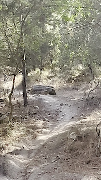
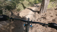
SaveThe Misgav area in the western Galilee has long been a sweet riding spot for local riders. A few years back the national forestry commission (loose translation from Hebrew there) built an official singletrack which makes a really nice loop of the area, and if you wonder about or catch up with local riders, you'll find a lot more to do. Perfect for technical XC \ All Mountain or mini-DH sessions.
Primary Trail Type: All-Mountain & Downhill
Shuttleable: YES
AKA: מישגב
Land Status: National Forest
 google parking directions
This region uses the Uk/Euro style trail grading system.
Activities Click to view
- Mountain Bike
60 trails
- E-Bike
59 trails
- Hike
51 trails
- Trail Running
51 trails
Region Details
- 12
- 5
- 28
- 10
- 2
Region Status
Caution as of 2 daysStats
- Avg Trail Rating
- Trails (view details)
- 57
- Trails Mountain Bike
- 60
- Trails E-Bike
- 59
- Trails Hike
- 51
- Trails Trail Running
- 51
- Total Distance
- 30 miles
- Total Descent
- 10,200 ft
- Total Vertical
- 859 ft
- Highest Trailhead
- 1,033 ft
- Reports
- 1,993
- Photos
- 55
- Ridden Counter
- 6,997
Popular Misgav Mountain Biking Trails
• 100 ★ 5.0 • 1,888 ft • 59 ft • 202 •
Popular blue difficulty singletrack. This mountain bike primary trail can be used both directions. On average it takes 1 minutes to complete this trail.
• 80 ★ 4.7 • 799 ft • 1 ft • 171 •
An infamous piece of singletrack in Misgav. Starts with a fast, loose, open section and them into the woods for some berms and flow.
• 95 ★ 5.0 • 1,142 ft • 0 ft • 171 •
Popular blue difficulty singletrack. This mountain bike primary trail can be used downhill only. It features drop. On average it takes 1 minutes to complete this trail.
• 95 ★ 5.0 • 528 ft • 0 ft • 158 •
Popular green difficulty singletrack. This mountain bike primary trail can be used downhill primary. It features jump. On average it takes minutes to complete this trail.
Misgav Mountain Bike Routes
★ 4.0 • 9 miles • 1,011 ft • 20 • Loop •
The Misgav area has a network of unofficial singletrack, this specific trail is the only official MTB...
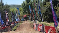
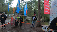
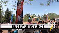
16 miles • 3,147 ft • 8 • Loop • Race •
Race course for the 2022 Israel Enduro Series National Championships
• 5 miles • 3,885 ft • 11 •
• 3 miles • 3,352 ft • 5 •
• 9 miles • 3,842 ft • 21 •
• 11 miles • 1,694 ft • 11 •
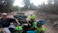
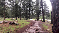
Photos of Misgav Mountain Bike
Videos of Misgav Mountain Bike
trail: Misgav KKL 04
0:11 |
|
Aug 30, 2024
trail: Kapara
0:16 |
98 |
Sep 17, 2023
trail: Be'orot
0:43 |
393 |
Apr 23, 2022
trail: Misgav KKL 12
0:06 |
168 |
Dec 19, 2021
trail: Be'orot
2:43 |
306 |
May 17, 2021
trail: Mini Enduro
4:02 |
47 |
Sep 8, 2020
trail: Yaad DH
2:42 |
420 |
Aug 27, 2020
trail: Misgav KKL 01
0:32 |
32 |
Jan 24, 2020
Recent Trail Reports
| status | trail | date | condition | info | user |
|---|---|---|---|---|---|
| Misgav KKL 09 | Jul 6, 2026 @ 6:46am (Asia/Jerusalem) 2 days | Dry | Yakioz | ||
| Misgav KKL 03 | Jul 6, 2026 @ 6:46am (Asia/Jerusalem) 2 days | Dry | Yakioz | ||
| Forest Road | Jul 6, 2026 @ 6:46am (Asia/Jerusalem) 2 days | Dry | Yakioz | ||
| Misgav KKL 08 | Jul 6, 2026 @ 6:46am (Asia/Jerusalem) 2 days | Dry | Yakioz | ||
| Donut | Jul 6, 2026 @ 6:46am (Asia/Jerusalem) 2 days | Dry | Yakioz | ||
| Eliot | Jul 6, 2026 @ 6:46am (Asia/Jerusalem) 2 days | Dry | Yakioz | ||
| Knafa | Jul 6, 2026 @ 6:46am (Asia/Jerusalem) 2 days | Dry | Yakioz | ||
| Alon | Jul 6, 2026 @ 6:46am (Asia/Jerusalem) 2 days | Dry | Yakioz | ||
| Flat Tyre | Jul 6, 2026 @ 6:46am (Asia/Jerusalem) 2 days | Dry | Yakioz | ||
| Kabush | Jul 6, 2026 @ 6:46am (Asia/Jerusalem) 2 days | Dry | Yakioz |
Activity Feed
| username | action | type | title | date |
|---|---|---|---|---|
| Yakioz | add | report | activity #98578366 and 12 more | Jul 6, 2026 @ 8:58am 1 day |
| Yakioz | add | report | activity #98397289 and 11 more | Jul 4, 2026 @ 3:07am Jul 4, 2026 |
| Yakioz | add | report | activity #98330839 and 1 more | Jul 3, 2026 @ 6:53am Jul 3, 2026 |
| Yakioz | add | report | activity #97706227 and 7 more | Jun 24, 2026 @ 10:04am Jun 24, 2026 |
| Yakioz | add | report | activity #97125854 and 9 more | Jun 16, 2026 @ 11:21am Jun 16, 2026 |
Recent Comments
| username | type | title | comment | date |
|---|---|---|---|---|
| trail | Nice! | Sep 6, 2025 @ 12:28am Sep 6, 2025 | ||
| trail | תודה על העידכון - המידע ... | May 14, 2020 @ 4:22am May 14, 2020 | ||
| trail | אני לא יודע מי עשה את... | May 11, 2020 @ 11:28pm May 11, 2020 | ||
| trail | great flow in trail. several berms and kickers | Jan 28, 2019 @ 1:25am Jan 28, 2019 |
Nearby Areas
| name | distance | ||||
|---|---|---|---|---|---|
| Ahihud Forest | 3 | 2 | 4.3 km | ||
| Kiryat Ata Forest | 6 | 2 | 7.5 km | ||
| Alon HaGalil | 22 | 1 | 9.2 km | ||
| Kiryat Tivon | 31 | 19 | 11.5 km | ||
| Kfar HaHoresh | 4 | 15 | 11.9 km |
Local Badges
-

Completionist1 awarded
Bike & Skill Parks
| name | type | city | rating |
|---|---|---|---|
| Misgav skillpark | skill park |
Local Products
Activity Type Stats
| activitytype | trails | distance | descent | descent distance | total vertical | rating | global rank | state rank | photos | reports | routes | ridelogs |
|---|---|---|---|---|---|---|---|---|---|---|---|---|
| Mountain Bike | 60 | 30 miles | 10,200 ft | 19 miles | 860 ft | #499 | #1 | 53 | 1,993 | 4 | 8,478 | |
| E-Bike | 59 | 30 miles | 10,095 ft | 18 miles | 860 ft | #515 | #6 | 2 | 1,992 | 2 | 2,387 | |
| Hike | 51 | 25 miles | 6,699 ft | 14 miles | 850 ft | #1,306 | #9 | 1,999 | 131 | |||
| Trail Running | 51 | 25 miles | 6,699 ft | 14 miles | 850 ft | #712 | 1,999 | 176 |
Frequently Asked Questions About Misgav
▼
What are the highest rated mountain biking trails in Misgav?
The highest rated mountain biking trails in Misgav are:
- Mini Enduro (4.4/5)
- Be'orot (4.4/5)
- Dreamer 3 (4.2/5)
- Cappuccino & Zuta (4.2/5)
- Aurora (4.2/5)
▼
What is the best time of the year to ride in Misgav?
Based on ride log data, the most popular months to ride in Misgav are:
- May (9 activities)
- April (8 activities)
- August (7 activities)
▼
Where can I park to ride in Misgav?
There are 3 parking locations listed in Misgav. The most popular parking spots are: View all parking and trailhead locations on the map to plan your visit.
▼
What is the longest trail in Misgav?
The longest trail in Misgav is T Line at 1.8 miles. View all trails sorted by distance.
Activities
Trails
Points of Interest
- By Sababike & contributors
- Admins: ziv2102
- #4439 - 6,905 views
- misgav activity log | embed map of Misgav mountain bike trails | misgav mountain biking points of interest
Downloading of trail gps tracks in kml & gpx formats is enabled for Misgav.
You must login to download files.