close
-
Layers w
- Map Content
- More Layers
- Pro
- Pro
- Pro
- Pro
- Pro
- Pro
- Pro
- Pro
-
Upgrade to

3D
Trail Conditions
- Unknown
- Snow Groomed
- Snow Packed
- Snow Covered
- Snow Cover Partial
- Freeze/thaw Cycle
- Icy
- Prevalent Mud
- Wet
- Variable
- Ideal
- Dry
- Very Dry
Trail Flow (Ridden Direction)
Trailforks scans users ridelogs to determine the most popular direction each trail is ridden. A good flowing trail network will have most trails flowing in a single direction according to their intension.
The colour categories are based on what percentage of riders are riding a trail in its intended direction.
The colour categories are based on what percentage of riders are riding a trail in its intended direction.
- > 96%
- > 90%
- > 80%
- > 70%
- > 50%
- < 50%
- bi-directional trail
- no data
Trail Last Ridden
Trailforks scans ridelogs to determine the last time a trail was ridden.
- < 2 days
- < 1 week
- < 2 weeks
- < 1 month
- < 6 months
- > 6 months
Trail Ridden Direction
The intended direction a trail should be ridden.
- Downhill Only
- Downhill Primary
- Both Directions
- Uphill Primary
- Uphill Only
- One Direction
Contribute Details
Colors indicate trail is missing specified detail.
- Description
- Photos
- Description & Photos
- Videos
Trail Popularity ?
Trailforks scans ridelogs to determine which trails are ridden the most in the last 9 months.
Trails are compared with nearby trails in the same city region with a possible 25 colour shades.
Think of this as a heatmap, more rides = more kinetic energy = warmer colors.
- most popular
- popular
- less popular
- not popular
ATV/ORV/OHV Filter
Max Vehicle Width
inches
US Cell Coverage
Legend

Radar Time
x
Activity Recordings
Trailforks users anonymized public ridelogs from the past 6 months.
- mountain biking recent
- mountain biking (>6 month)
- hiking (1 year)
- moto (1 year)
Activity Recordings
Trailforks users anonymized public skilogs from the past 12 months.
- Downhill Ski
- Backcountry Ski
- Nordic Ski
- Snowmobile
Winter Trails
Warning
A routing network for winter maps does not exist. Selecting trails using the winter trails layer has been disabled.
x
Missing Trails
Most Popular
Least Popular
Trails are colored based on popularity. The more popular a trail is, the more red. Less popular trails trend towards green.
Jump Magnitude Heatmap
Heatmap of where riders jump on trails. Zoom in to see individual jumps, click circles to view jump details.
Trails Deemphasized
Trails are shown in grey.
Only show trails with NO bikes.
Save the current map location and zoom level as your default home location whenever this page is loaded.
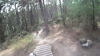
SaveExcellent network of single tracks rideable 365 days a year
Diverse topography, suits XC & AM.
Diverse topography, suits XC & AM.
Primary Trail Type: All-Mountain & Downhill
Shuttleable: YES
AKA: משמר העמק
Land Status: Community Forest
 google parking directions
 Access Info:
In Kibutz Mishmar HaEmek, park at the PALMACH cave
This region uses the Uk/Euro style trail grading system.
Activities Click to view
- Mountain Bike
71 trails
- E-Bike
71 trails
- Hike
59 trails
- Trail Running
59 trails
Region Details
- 21
- 11
- 23
- 15
- 1
Region Status
Open as of Feb 26, 2024Stats
- Avg Trail Rating
- Trails (view details)
- 71
- Trails Mountain Bike
- 71
- Trails E-Bike
- 71
- Trails Hike
- 59
- Trails Trail Running
- 59
- Total Distance
- 35 miles
- Total Descent
- 8,960 ft
- Total Vertical
- 810 ft
- Highest Trailhead
- 1,211 ft
- Reports
- 607
- Photos
- 32
- Ridden Counter
- 7,438
Popular Mishmar HaEmek Mountain Biking Trails
Mishmar HaEmek Mountain Bike Routes
| title | rating | distance |
|---|---|---|
| Israel Enduro Serie (22/3) Race #2 race | 12 miles | |
| תחרות אנדורו #3 2022 race | 14 miles | |
| Israeli XCM Championship 2019 Mishmar Haemek race | 14 miles | |
| תחרות #2 - אנדורו/ספרינט משמר העמק race | 8 miles | |
| race | 8 miles | |
| 15 mile Mishmar HaEmek Ride | popular ridelog | 15 miles |
| 14 mile Mishmar HaEmek All-Mountain Ride | popular ridelog | 14 miles |
| 15 mile Mishmar HaEmek Ride | popular ridelog | 15 miles |
| 8 mile Mishmar HaEmek Ride | popular ridelog | 8 miles |
| 12 mile Mishmar HaEmek Ride | popular ridelog | 12 miles |
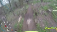
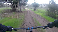
Photos of Mishmar HaEmek Mountain Bike
trail: R.I.P Willy
43 |
Dec 5, 2022 @ 5:54am
Dec 5, 2022
trail: Down the Rock
28 |
Mar 22, 2022 @ 6:10am
Mar 22, 2022
trail: The Brain
59 |
Apr 14, 2021 @ 8:26am
Apr 14, 2021
trail: The Brain
70 |
Apr 14, 2021 @ 8:25am
Apr 14, 2021
trail: The Brain
57 |
Apr 14, 2021 @ 8:24am
Apr 14, 2021
trail: The Brain
50 |
Apr 14, 2021 @ 8:23am
Apr 14, 2021
trail: The Brain
53 |
Apr 14, 2021 @ 8:21am
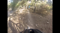
Apr 14, 2021Videos of Mishmar HaEmek Mountain Bike
trail: Aristo
2:34 |
189 |
Mar 23, 2017

trail: Yossi #2
3:19 |
130 |
Jan 9, 2017
2:21 |
306 |
Oct 14, 2016

2:32 |
143 |
Mar 15, 2016
trail: Hir'bat beit rosh / Yossi #1
3:57 |
39 |
Jan 5, 2016
5:38 |
16 |
Jan 4, 2016

0:58 |
229 |
Apr 9, 2015
2:13 |
360 |
Oct 19, 2013
Recent Trail Reports
| status | trail | date | condition | info | user |
|---|---|---|---|---|---|
| Bones | Feb 26, 2024 @ 11:34pm Feb 26, 2024 | Variable | kanawasaki | ||
| The Brain | Feb 26, 2024 @ 11:34pm Feb 26, 2024 | Variable | kanawasaki | ||
| Pinky | Feb 26, 2024 @ 11:34pm Feb 26, 2024 | Ideal | kanawasaki | ||
| Hir'bat beit rosh / Yossi #1 | Feb 22, 2024 @ 3:19am Feb 22, 2024 | Wet | MicDrop | ||
| Bera'le | Feb 22, 2024 @ 3:19am Feb 22, 2024 | Ideal | MicDrop | ||
| Roots | Feb 22, 2024 @ 3:19am Feb 22, 2024 | Ideal | MicDrop | ||
| Carobs | Feb 22, 2024 @ 3:19am Feb 22, 2024 | Ideal | MicDrop | ||
| Butterflies | Feb 22, 2024 @ 3:19am Feb 22, 2024 | Ideal | MicDrop | ||
| Access trail | Dec 11, 2023 @ 11:15pm Dec 11, 2023 | Wet | ShaiFriedman | ||
| Yossi #2 | Nov 19, 2023 @ 12:00am Nov 19, 2023 | Wet | endurointern |
Activity Feed
| username | action | type | title | date |
|---|---|---|---|---|
| kanawasaki | add | report | activity #49580123 and 2 more | Feb 27, 2024 @ 2:57am Feb 27, 2024 |
| yotam2210 | add | report | activity #49481822 | Feb 24, 2024 @ 8:48am Feb 24, 2024 |
| yotam2210 | ridden | trail | activity #49481792 and 4 more | Feb 24, 2024 @ 8:45am Feb 24, 2024 |
| MicDrop | add | report | activity #49412293 and 5 more | Feb 22, 2024 @ 4:08am Feb 22, 2024 |
| Eitan1 | wishlist | trail | activity #46662208 and 1 more | Nov 25, 2023 @ 11:39am Nov 25, 2023 |
Recent Comments
| username | type | title | comment | date |
|---|---|---|---|---|
| trail | יש קיקר מעץ בהתחלה ו2... | May 17, 2020 @ 9:55am May 17, 2020 | ||
| trail | מסלול נהדר עם... | May 17, 2020 @ 9:55am May 17, 2020 | ||
| trail | מאוד זורם יש כמה מקפצות... | May 17, 2020 @ 9:53am May 17, 2020 | ||
| trail | סינגל מעולה לקולקצייה של... | Jul 12, 2019 @ 3:24pm Jul 12, 2019 | ||
| trail | מאתגר עם קפיצות וירידות... | Jul 7, 2019 @ 9:26am Jul 7, 2019 |
Nearby Areas
| name | distance | ||||
|---|---|---|---|---|---|
| Ramot Menashe | 15 | 5 | 2.5 km | ||
| Horeshan | 22 | 20 | 7.4 km | ||
| Kfar Glikson | 6 | 7 | 9.3 km | ||
| Kiryat Tivon | 31 | 19 | 9.5 km | ||
| Shfeya | 10 km |
Local Badges
-

Completionist0 awarded
Local Mountain Biking Directory
-
SababikeGuides & Tours
![Sababike]()
Local Products
Activity Type Stats
| activitytype | trails | distance | descent | descent distance | total vertical | rating | global rank | state rank | photos | reports | routes | ridelogs |
|---|---|---|---|---|---|---|---|---|---|---|---|---|
| Mountain Bike | 71 | 35 miles | 8,960 ft | 19 miles | 810 ft | #1,089 | #5 | 32 | 607 | 6 | 4,873 | |
| E-Bike | 71 | 35 miles | 8,960 ft | 19 miles | 810 ft | #383 | #5 | 571 | 2 | 1,325 | ||
| Hike | 59 | 31 miles | 6,447 ft | 15 miles | 797 ft | #1,044 | #5 | 596 | 8 | |||
| Trail Running | 59 | 31 miles | 6,447 ft | 15 miles | 797 ft | #1,050 | #5 | 596 | 26 |
- By ziv2102
 TRAILFORKS & contributors
 - Admins: ziv2102
- #4395 - 7,571 views
- mishmar haemek activity log | embed map of Mishmar HaEmek mountain bike trails | mishmar haemek mountain biking points of interest
Downloading of trail gps tracks in kml & gpx formats is enabled for Mishmar HaEmek.
You must login to download files.