close
-
Layers w
- Weather Layers
- Pro
- Pro
- Pro
- Pro
- Pro
- Pro
- More Layers
- Pro
- Pro
- Pro
- Pro
-
Upgrade to

3D
Trail Conditions
- Unknown
- Snow Groomed
- Snow Packed
- Snow Covered
- Snow Cover Partial
- Freeze/thaw Cycle
- Icy
- Prevalent Mud
- Wet
- Variable
- Ideal
- Dry
- Very Dry
Trail Flow (Ridden Direction)
Trailforks scans users ridelogs to determine the most popular direction each trail is ridden. A good flowing trail network will have most trails flowing in a single direction according to their intension.
The colour categories are based on what percentage of riders are riding a trail in its intended direction.
The colour categories are based on what percentage of riders are riding a trail in its intended direction.
- > 96%
- > 90%
- > 80%
- > 70%
- > 50%
- < 50%
- bi-directional trail
- no data
Trail Last Ridden
Trailforks scans ridelogs to determine the last time a trail was ridden.
- < 2 days
- < 1 week
- < 2 weeks
- < 1 month
- < 6 months
- > 6 months
Trail Ridden Direction
The intended direction a trail should be ridden.
- Downhill Only
- Downhill Primary
- Both Directions
- Uphill Primary
- Uphill Only
- One Direction
Contribute Details
Colors indicate trail is missing specified detail.
- Description
- Photos
- Description & Photos
- Videos
Trail Popularity ?
Trailforks scans ridelogs to determine which trails are ridden the most in the last 9 months.
Trails are compared with nearby trails in the same city region with a possible 25 colour shades.
Think of this as a heatmap, more rides = more kinetic energy = warmer colors.
- most popular
- popular
- less popular
- not popular
ATV/ORV/OHV Filter
Max Vehicle Width
inches
US Cell Coverage
Legend

Radar Time
Activity Recordings
Trailforks uses anonymized public activity data.
?
Activity Recordings
Trailforks uses anonymized public activity data.
?
Personal Heatmap
▶
Activity Types
all
/
none
▶
Options
2
Date range
month
–
Winter Trails
Warning
A routing network for winter maps does not exist. Selecting trails using the winter trails layer has been disabled.
Missing Trails
Most Popular
Least Popular
Trails are colored based on popularity. The more popular a trail is, the more red. Less popular trails trend towards green.
Jump Magnitude Heatmap
Heatmap of where riders jump on trails. Zoom in to see individual jumps, click circles to view jump details.
BC Backroad Status
![map legend]()
Service Road Atlas is a free to use, community-driven service for viewing and creating reports on the numerous back-country service roads around B.C. and Alberta.

Slope Aspect
Direction the slope faces
Trails Deemphasized
Trails are shown in grey.
Only show trails with no bike usage.
Suggested Layers
Based on selected activity type
Save the current map location and zoom level as your default home location whenever this page is loaded.
Save
No description for Mono has been added yet!
Login or register to submit one.
Activities Click to view
- Mountain Bike
51 trails
- E-Bike
32 trails
- Gravel Bike
26 trails
- Adaptive Bike
0 trails
- Winter Fat Bike
20 trails
- Horse
20 trails
- Hike
68 trails
- Trail Running
68 trails
- Snowmobile
10 trails
- Snowshoe
62 trails
- Backcountry Ski
2 trails
- Nordic Ski
24 trails
Region Details
- 11
- 1
- 23
- 13
Region Status
Open as of May 16, 2026Local Trail Association
Stats
- Avg Trail Rating
- Trails (view details)
- 69
- Trails Mountain Bike
- 51
- Trails E-Bike
- 32
- Trails Gravel Bike
- 26
- Trails Winter Fat Bike
- 20
- Trails Horse
- 20
- Trails Hike
- 68
- Trails Trail Running
- 68
- Trails Snowmobile
- 10
- Trails Snowshoe
- 62
- Trails Backcountry Ski
- 2
- Trails Nordic Ski
- 24
- Total Distance
- 46 miles
- Total Descent Distance
- 18 miles
- Total Descent
- 4,608 ft
- Total Vertical
- 627 ft
- Highest Trailhead
- 1,680 ft
- Reports
- 587
- Photos
- 115
- Ridden Counter
- 7,519
Sub Regions
-
1926 Tract - Town of Mono
- 1
- 1
-
Anderson Tract - Town of Mono
- 1
- 3
-
Dufferin County Forest - Mono Tract
- 9
- 8
-
Hockley Valley Resort
- 1
- 1
-
Mono Cliffs Provincial Park
- 1
- 10
- 4
Popular Mono Mountain Biking Trails
• 95 ★ 4.5 • 1,532 ft • 35 ft • 280 •
Popular green difficulty family friendly singletrack. This multi-use trail can be used both directions and has a easy overall physical rating with a 35 ft green climb. Winter use: Backcountry snow grooming. Trail visibility is always easy to follow. On average it takes 3 minutes to complete this trail.
• 100 ★ 5.0 • 436 ft • 6 ft • 269 •
Popular green difficulty family friendly singletrack. This multi-use trail can be used both directions and has a easy overall physical rating with a 6 ft green climb. Trail visibility is always easy to follow. On average it takes minutes to complete this trail.
• 100 ★ 4.0 • 843 ft • 0 ft • 269 •
Popular blue difficulty singletrack. This multi-use trail can be used both directions and has a moderate overall physical rating with a 0 ft blue climb. On average it takes 1 minutes to complete this trail.
• 85 ★ 5.0 • 2 miles • 129 ft • 263 •
Popular blue difficulty family friendly singletrack. This multi-use trail and has a moderate overall physical rating with a 129 ft blue climb. Winter use: Backcountry snow grooming. Trail visibility is always easy to follow. On average it takes 13 minutes to complete this trail.
• 95 ★ 4.7 • 2 miles • 116 ft • 260 •
Highly rated popular green difficulty family friendly singletrack. This multi-use trail can be used both directions and has a moderate overall physical rating with a 116 ft blue climb. Winter use: Backcountry snow grooming. Trail visibility is always easy to follow. On average it takes 12 minutes to complete this trail.
• 100 ★ 0.0 • 423 ft • 14 ft • 251 •
Popular green difficulty family friendly singletrack. This multi-use trail can be used both directions. On average it takes minutes to complete this trail.
• 95 ★ 4.3 • 1 mile • 82 ft • 240 •
Popular blue difficulty singletrack. This mountain bike primary trail can be used downhill primary and has a moderate overall physical rating with a 82 ft green climb. It features a-frame and other. On average it takes 10 minutes to complete this trail.
• 80 ★ 3.0 • 1,995 ft • 63 ft • 228 •
Popular white difficulty family friendly mixed. This multi-use trail can be used both directions and has a easy overall physical rating with a 63 ft green climb. On average it takes 2 minutes to complete this trail.
Mono Mountain Bike Routes
★ 5.0 • 8 miles • 503 ft • 6 • Out & Back •
Route created from Fat Bike ride recorded on January 2, 2021
4 miles • 87 ft • 3 • Loop •
Vicki Barron Lakeside Trail Distance – 8.3 km loop In 2001, the first 2.5 kilometers of the opened with...
• 12 miles • 1,060 ft • 17 •
• 13 miles • 980 ft • 24 •
• 15 miles • 1,302 ft • 22 •
• 14 miles • 1,075 ft • 22 •
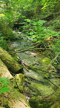
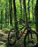
Photos of Mono Mountain Bike
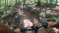
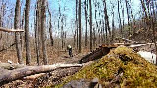
Videos of Mono Mountain Bike
trail: Bruce Trail - Hockley
0:06 |
11 |
Jul 2, 2025
0:30 |
14 |
Jun 30, 2025
0:09 |
166 |
Apr 12, 2022
youtuber
![Ontario's Newest MTB Trails! | Bike Trails...]()

10:44 |
565 |
Aug 18, 2022 , Mono
trail: Maple Ridge
0:15 |
625 |
Apr 27, 2021 , Mono

trail: Cliff-Top Trail
3:47 |
549 |
Dec 14, 2019 , Mono

4:06 |
636 |
Nov 13, 2019 , Mono
trail: Cliff-Top Trail
3:45 |
516 |
Nov 13, 2019 , Mono
Recent Trail Reports
| status | trail | date | condition | info | user |
|---|---|---|---|---|---|
| Central Park North | May 16, 2026 @ 10:06am (America/Toronto) May 16, 2026 | Ideal | bmkcbrxx | ||
| Redline | May 16, 2026 @ 10:06am (America/Toronto) May 16, 2026 | Ideal | bmkcbrxx | ||
| Maple Ridge | May 16, 2026 @ 10:06am (America/Toronto) May 16, 2026 | Ideal | bmkcbrxx | ||
| Monochrome | May 16, 2026 @ 10:06am (America/Toronto) May 16, 2026 | Ideal | bmkcbrxx | ||
| Euro Trash | May 16, 2026 @ 10:06am (America/Toronto) May 16, 2026 | Ideal | bmkcbrxx | ||
| Euro Trash Connector | May 16, 2026 @ 10:06am (America/Toronto) May 16, 2026 | Ideal | bmkcbrxx | ||
| Central Park Middle Trail | May 16, 2026 @ 10:06am (America/Toronto) May 16, 2026 | Ideal | bmkcbrxx | ||
| Central Park Connector | May 16, 2026 @ 10:06am (America/Toronto) May 16, 2026 | Ideal | bmkcbrxx | ||
| South Boundary Trail | Apr 30, 2026 @ 5:24pm (America/Toronto) Apr 30, 2026 | Ideal | bmkcbrxx | ||
| Single Track | Apr 30, 2026 @ 5:24pm (America/Toronto) Apr 30, 2026 | Ideal | bmkcbrxx |
Activity Feed
| username | action | type | title | date |
|---|---|---|---|---|
| StephaniefHYsVm | wishlist | region | activity #96839639 | Jun 12, 2026 @ 5:50pm Jun 12, 2026 |
| desmondo | wishlist | region | activity #95852075 | May 30, 2026 @ 7:55am May 30, 2026 |
| naadiia | ridden | trail | activity #94908903 and 2 more | May 17, 2026 @ 8:52am May 17, 2026 |
| bmkcbrxx | add | report | activity #94852943 and 7 more | May 16, 2026 @ 2:36pm May 16, 2026 |
| Kirwil | wishlist | region | activity #94607252 | May 12, 2026 @ 8:40pm May 12, 2026 |
Recent Comments
| username | type | title | comment | date |
|---|---|---|---|---|
| trail | There are a lot of punji sticks from cut off... | Feb 16, 2026 @ 3:02pm Feb 16, 2026 | ||
| trail | Lots more property boundary markers on this... | Dec 24, 2025 @ 4:19pm Dec 24, 2025 | ||
| report | Perfect. Fine dusting of snow. Dec. 22. Going... | Dec 22, 2025 @ 11:32am Dec 22, 2025 | ||
| report | Would love to go clear these trees that trail... | Nov 1, 2025 @ 5:20pm Nov 1, 2025 | ||
| trail | Is there a proper name for this trail? | Oct 1, 2025 @ 7:03am Oct 1, 2025 |
Local Badges
-

Epic Mountain Bike Climb 2k20 awarded -

Climbing 10k Badge13 awarded -

Mountain Biking 100k Badge0 awarded -

Epic Ride Descent 2k20 awarded -

Descent 10k Badge13 awarded -

Descent 100k Badge0 awarded
Activity Type Stats
| activitytype | trails | distance | descent | descent distance | total vertical | rating | global rank | state rank | photos | reports | routes | ridelogs |
|---|---|---|---|---|---|---|---|---|---|---|---|---|
| Mountain Bike | 51 | 31 miles | 2,618 ft | 11 miles | 591 ft | #2,610 | #51 | 97 | 576 | 2 | 4,893 | |
| E-Bike | 32 | 8 miles | 869 ft | 3 miles | 571 ft | #5,770 | #93 | 480 | 118 | |||
| Gravel Bike | 26 | #542 | #60 | 8 | 47 | |||||||
| Winter Fat Bike | 20 | #345 | #79 | 8 | 4 | |||||||
| Horse | 20 | 10 miles | 528 ft | 3 miles | 259 ft | #2,143 | #38 | 49 | 3 | |||
| Hike | 68 | 40 miles | 3,914 ft | 16 miles | 627 ft | #1,872 | #45 | 21 | 565 | 1 | 750 | |
| Trail Running | 68 | 40 miles | 3,914 ft | 16 miles | 627 ft | #3,398 | #55 | 565 | 1 | 283 | ||
| Snowmobile | 10 | 7 miles | 308 ft | 2 miles | 95 ft | #363 | #33 | 9 | 1 | |||
| Snowshoe | 62 | 38 miles | 3,675 ft | 15 miles | 627 ft | #471 | #49 | 127 | 68 | |||
| Backcountry Ski | 2 | 4,806 ft | 79 ft | 1,486 ft | 171 ft | #691 | #18 | 3 | 26 | |||
| Nordic Ski | 24 | 14 miles | 830 ft | 5 miles | 187 ft | #624 | #40 | 61 | 414 |
Frequently Asked Questions About Mono
▼
What are the best places to ride in Mono?
Mono has 6 areas to explore for mountain biking. The top rated areas are:
▼
What are the highest rated mountain biking trails in Mono?
The highest rated mountain biking trails in Mono are:
- Central Park Trail (4.4/5)
- Central Park North (4.3/5)
- Monochrome (4.1/5)
- Maple Ridge South (4.1/5)
- Single Track (4.1/5)
▼
What is the best time of the year to ride in Mono?
Based on ride log data, the most popular months to ride in Mono are:
- August (95 activities)
- June (90 activities)
- September (83 activities)
▼
Where can I park to ride in Mono?
Activities
Trails
- By peterlikesscissors & contributors
- Admins: apply
- #8940 - 6,748 views
- mono activity log | embed map of Mono mountain bike trails | mono mountain biking points of interest
Downloading of trail gps tracks in kml & gpx formats is enabled for Mono.
You must login to download files.