close
-
Layers w
- Weather Layers
- Pro
- Pro
- Pro
- Pro
- Pro
- Pro
- More Layers
- Pro
- Pro
- Pro
- Pro
-
Upgrade to

3D
Trail Conditions
- Unknown
- Snow Groomed
- Snow Packed
- Snow Covered
- Snow Cover Partial
- Freeze/thaw Cycle
- Icy
- Prevalent Mud
- Wet
- Variable
- Ideal
- Dry
- Very Dry
Trail Flow (Ridden Direction)
Trailforks scans users ridelogs to determine the most popular direction each trail is ridden. A good flowing trail network will have most trails flowing in a single direction according to their intension.
The colour categories are based on what percentage of riders are riding a trail in its intended direction.
The colour categories are based on what percentage of riders are riding a trail in its intended direction.
- > 96%
- > 90%
- > 80%
- > 70%
- > 50%
- < 50%
- bi-directional trail
- no data
Trail Last Ridden
Trailforks scans ridelogs to determine the last time a trail was ridden.
- < 2 days
- < 1 week
- < 2 weeks
- < 1 month
- < 6 months
- > 6 months
Trail Ridden Direction
The intended direction a trail should be ridden.
- Downhill Only
- Downhill Primary
- Both Directions
- Uphill Primary
- Uphill Only
- One Direction
Contribute Details
Colors indicate trail is missing specified detail.
- Description
- Photos
- Description & Photos
- Videos
Trail Popularity ?
Trailforks scans ridelogs to determine which trails are ridden the most in the last 9 months.
Trails are compared with nearby trails in the same city region with a possible 25 colour shades.
Think of this as a heatmap, more rides = more kinetic energy = warmer colors.
- most popular
- popular
- less popular
- not popular
ATV/ORV/OHV Filter
Max Vehicle Width
inches
US Cell Coverage
Legend

Radar Time
Activity Recordings
Trailforks uses anonymized public activity data.
?
Activity Recordings
Trailforks uses anonymized public activity data.
?
Personal Heatmap
▶
Activity Types
all
/
none
▶
Options
2
Date range
month
–
Winter Trails
Warning
A routing network for winter maps does not exist. Selecting trails using the winter trails layer has been disabled.
Missing Trails
Most Popular
Least Popular
Trails are colored based on popularity. The more popular a trail is, the more red. Less popular trails trend towards green.
Jump Magnitude Heatmap
Heatmap of where riders jump on trails. Zoom in to see individual jumps, click circles to view jump details.
BC Backroad Status
![map legend]()
Service Road Atlas is a free to use, community-driven service for viewing and creating reports on the numerous back-country service roads around B.C. and Alberta.

Slope Aspect
Direction the slope faces
Trails Deemphasized
Trails are shown in grey.
Only show trails with no bike usage.
Suggested Layers
Based on selected activity type
Save the current map location and zoom level as your default home location whenever this page is loaded.
Save
No description for Mount Werner has been added yet!
Login or register to submit one.

IMBA Ride Center
Steamboat Bike Town
Activities Click to view
- Mountain Bike
31 trails
- Hike
30 trails
- Trail Running
30 trails
Region Details
- 17
- 1
- 6
- 6
Region Status
Open as of 1 dayStats
- Avg Trail Rating
- Trails (view details)
- 31
- Trails Mountain Bike
- 31
- Trails E-Bike
- 1
- Trails Hike
- 30
- Trails Trail Running
- 30
- Trails Snowshoe
- 1
- Trails Nordic Ski
- 1
- Total Distance
- 42 miles
- Total Descent
- 10,834 ft
- Total Vertical
- 3,504 ft
- Highest Trailhead
- 10,413 ft
- Reports
- 173
- Photos
- 28
- Ridden Counter
- 6,239
Popular Mount Werner Mountain Biking Trails
• 85 ★ 4.4 • 3 miles • 1,433 ft • 576 •
Beautiful rolling singletrack through the high altitude aspens Multi-Use/Multi-Directional trails are: · Open to the public 24hrs as conditions permit · Free to public and do not require a waiver · Are USFS trails and are subject to...
• 65 ★ 3.7 • 2,817 ft • 0 ft • 366 •
Multi-Use/Multi-Directional trails are: · Open to the public 24hrs as conditions permit · Free to public and do not require a waiver · Are USFS trails and are subject to federal regulations https://www.bike.steamboat.com/ Bike Park...
• 60 ★ 3.5 • 6 miles • 710 ft • 344 •
Moderately popular black diamond difficulty singletrack. This mountain bike primary trail can be used both directions. On average it takes 54 minutes to complete this trail.
• 60 ★ 4.0 • 3 miles • 260 ft • 280 •
Multi-Use/Multi-Directional trail open to the public 24hrs as conditions permit and do not require a waiver. This trail can be access from the top, but riders will be coming up it. The trail does require some pedalling in both...
• 75 ★ 4.0 • 3 miles • 571 ft • 202 •
Fairly smooth singletrack with some big embedded rocks to keep things interesting. Multi-Use/Multi-Directional trails are: · Open to the public 24hrs as conditions permit · Free to public and do not require a waiver · Are USFS trails...
• 50 ★ 0.0 • 3,806 ft • 26 ft • 186 •
Not really sure why this is labeled as a black diamond, it is pretty easy to roll down. Going up would be a bit on the steep side and couple loose sections and turns, but not really that expert. It is a nice trail to roll down, the...
• 55 ★ 0.0 • 1 mile • 149 ft • 128 •
This a multi-use trail open to the public (no waiver required). This loop is half double track road and half singletrack. The south side that connects to Trail is singletrack. It is mostly pretty easy, but there is one gnarly rock...
Photos of Mount Werner Mountain Bike
Videos of Mount Werner Mountain Bike
trail: Creekside
4:03 |
323 |
Aug 1, 2014

trail: Creekside
3:46 |
280 |
Apr 18, 2011
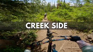
trail: Creekside
0:30 |
207 |
Jul 10, 2023 , Steamboat Springs

trail: Valley View
12:16 |
344 |
Nov 3, 2020 , Steamboat Springs

trail: Sunshine
12:16 |
253 |
Nov 3, 2020 , Steamboat Springs
trail: Mountain View
12:16 |
588 |
Nov 3, 2020 , Steamboat Springs
youtuber
![CO MTB | Backcountry trails at Steamboat Bike...]()
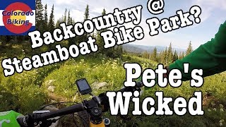
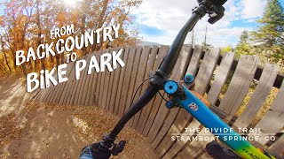
trail: Petes Wicked Trail
10:48 |
576 |
Aug 29, 2018 , Steamboat Springs
trail: Short Cut
0:12 |
425 |
Jan 19, 2008
Recent Trail Reports
| status | trail | date | condition | info | user |
|---|---|---|---|---|---|
| Cabin View Trail | Mar 17, 2026 @ 4:10pm (America/Denver) Mar 17, 2026 | Snow Cover Partial | lwinslow RCR | ||
| Short Cut | Aug 19, 2025 @ 11:11am Aug 19, 2025 | Dry | ChelseyKjRCWX | ||
| Cathys Cutoff | Aug 3, 2025 @ 10:08am Aug 3, 2025 | Dry | FelixN5EuuT | ||
| Mountain View | Aug 3, 2025 @ 10:08am Aug 3, 2025 | Dry | FelixN5EuuT | ||
| Vista Nature Trail (Hike) | Jul 23, 2025 @ 11:49am Jul 23, 2025 | Dry | AviF2KZiq | ||
| Creekside | Oct 18, 2024 @ 4:12pm Oct 18, 2024 | Ideal | tomoconnor15 | ||
| Duster | Aug 19, 2024 @ 10:28am Aug 19, 2024 | Dry | bdog8675 | ||
| Petes Wicked Trail | Aug 19, 2024 @ 10:28am Aug 19, 2024 | Ideal | bdog8675 | ||
| Storm Peak Challenge | Aug 19, 2024 @ 10:28am Aug 19, 2024 | Dry | bdog8675 | ||
| Chisolm | Aug 19, 2024 @ 10:28am Aug 19, 2024 | Ideal | bdog8675 |
Activity Feed
| username | action | type | title | date |
|---|---|---|---|---|
| C34 | ridden | trail | activity #97068672 | Jun 15, 2026 @ 3:21pm 11 hours |
| matthewmMEXLD | wishlist | trail | activity #94788981 | May 15, 2026 @ 9:17pm May 15, 2026 |
| lwinslow | add | report | activity #90777140 | Mar 17, 2026 @ 7:04pm Mar 17, 2026 |
| racecase | add | photo | activity #87895982 | Jan 27, 2026 @ 9:14am Jan 27, 2026 |
| comtneer | vote | trail | activity #82012966 | Oct 9, 2025 @ 10:15am Oct 9, 2025 |
Recent Comments
| username | type | title | comment | date |
|---|---|---|---|---|
| trail | I wish this trail was longer | Aug 18, 2025 @ 4:27pm Aug 18, 2025 | ||
| trail | This trail is the perfect example of how... | Oct 5, 2021 @ 5:24am Oct 5, 2021 | ||
| trail | Still a few trees down. Not enough to avoid... | Sep 19, 2020 @ 9:35am Sep 19, 2020 | ||
| trail | Rode pioneer and creekside. Creekside has a... | Jun 28, 2020 @ 3:09pm Jun 28, 2020 | ||
| report | Thanks for the report Tara. USFS and... | Jul 23, 2017 @ 7:01am Jul 23, 2017 |
Nearby Areas
| name | distance | ||||
|---|---|---|---|---|---|
| Steamboat Bike Park | 6 | 10 | 3 | 2.5 km | |
| Rabbit Ears Pass | 1 | 3 | 3.9 km | ||
| In Town Trails | 6 | 1 | 5.1 km | ||
| Emerald Mountain | 3 | 35 | 6 | 5.6 km | |
| Buffalo Pass | 6 | 10 | 9 | 6.5 km |
Local Badges
-

Completionist0 awarded
Local Products
Activity Type Stats
| activitytype | trails | distance | descent | descent distance | total vertical | rating | global rank | state rank | photos | reports | routes | ridelogs |
|---|---|---|---|---|---|---|---|---|---|---|---|---|
| Mountain Bike | 31 | 39 miles | 8,451 ft | 18 miles | 3,474 ft | #3,864 | #1,343 | 28 | 173 | 2,216 | ||
| E-Bike | 1 | 152 | 16 | |||||||||
| Hike | 30 | 41 miles | 10,820 ft | 20 miles | 3,504 ft | #5,212 | #1,888 | 173 | 1 | 174 | ||
| Trail Running | 30 | 41 miles | 10,820 ft | 20 miles | 3,504 ft | #4,340 | #1,245 | 173 | 1 | 121 | ||
| Snowshoe | 1 | 4,938 ft | 112 ft | 3,084 ft | 102 ft | 4 | ||||||
| Nordic Ski | 1 | 4,938 ft | 112 ft | 3,084 ft | 102 ft | 12 |
Frequently Asked Questions About Mount Werner
▼
What are the highest rated mountain biking trails in Mount Werner?
The highest rated mountain biking trails in Mount Werner are:
- Creekside (4.4/5)
- Pioneer (4.1/5)
- Sunshine (4/5)
- Valley View (4/5)
- Cathys Cutoff (3.9/5)
▼
What is the best time of the year to ride in Mount Werner?
Based on ride log data, the most popular months to ride in Mount Werner are:
- July (56 activities)
- August (42 activities)
- September (29 activities)
▼
Where can I park to ride in Mount Werner?
Check the Mount Werner trail map for trailhead and parking information. Community members regularly update access and parking details for trails in the area.
▼
What is the longest trail in Mount Werner?
The longest trail in Mount Werner is Mountain View at 6.2 miles. View all trails sorted by distance.
- By brenthillier
 NSMBA TRAILFORKS & contributors
 - Admins: RCR, COSS, RCR, RCR
- #7960 - 6,091 views
- mount werner activity log | embed map of Mount Werner mountain bike trails |
Downloading of trail gps tracks in kml & gpx formats is enabled for Mount Werner.
You must login to download files.