more stats
2.6 miles
Distance
571 ft
Climb
-655 ft
Descent
00:30:14
Avg time
-84 ft
Altitude change
9,240 ft
Altitude min
9,756 ft
Altitude max
9,324 ft
Altitude start
9,240 ft
Altitude end
-0.601%
Grade
-46.086%
Grade max
43.312%
Grade min
1 mile
Distance climb
1 mile
Distance down
623 ft
Distance flat
00:30:14
Avg time

Sunshine Details

  • Activities
    • Mountain Bike
    • Hike
    • Trail Running
  • Riding Area
    Mount Werner
    Steamboat Springs, Colorado
  • Difficulty Rating
  • Local Popularity
    75 in Mountain Biking [+]
    • 5 in Trail Running
    • 75 in Hiking
  • Global Ranking
    #82463 in Mountain Biking [+]
    • #119798 in Trail Running
    • #80378 in Hiking
  • Trail Type
    Singletrack
  • Direction
    Both Directions
    Popular Direction Shown
  • Dogs Allowed
    Yes
  • Land Owner

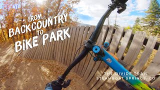
Fairly smooth singletrack with some big embedded rocks to keep things interesting.

Multi-Use/Multi-Directional trails are:
· Open to the public 24hrs as conditions permit
· Free to public and do not require a waiver
· Are USFS trails and are subject to federal regulations

https://www.bike.steamboat.com/
Bike Park trails are:
· Directional downhill only bike trails
· Require a Bike Park pass to access
· Require a current waiver to be signed
· Require a helmet
· Are not USFS trails and are restricted to operating hours and season (a big one our public don’t understand or dismiss)
· Repeated offenders may be subject to revoked ski area privileges(access/passes), both summer and winter

Trail Supporters

  • USFS
    Land Manager
Local Trail Association
Traditionally Indigenous Territory

Recent Activity on Trail

Past Week
  • 0 rides
  •  
6 Months
  • 0 rides
  •  
All
  • 92 rides
  • Last: Oct 8, 2025
c1c2c3c4
January
February
March
April
May
June
July
August
September
October
November
December
update trails status or condition

Sunshine Trail Reports

Status:
on Jul 7, 2023
Ideal
Avg: 3.99 (4 votes)
Your vote: 0

view (533)
close
3D
Trail Conditions
  • Unknown
  • Snow Groomed
  • Snow Packed
  • Snow Covered
  • Snow Cover Partial
  • Freeze/thaw Cycle
  • Icy
  • Prevalent Mud
  • Wet
  • Variable
  • Ideal
  • Dry
  • Very Dry
Trail Flow (Ridden Direction)
Trailforks scans users ridelogs to determine the most popular direction each trail is ridden. A good flowing trail network will have most trails flowing in a single direction according to their intension.
The colour categories are based on what percentage of riders are riding a trail in its intended direction.
  • > 96%
  • > 90%
  • > 80%
  • > 70%
  • > 50%
  • < 50%
  • bi-directional trail
  • no data
Trail Last Ridden
Trailforks scans ridelogs to determine the last time a trail was ridden.
  • < 2 days
  • < 1 week
  • < 2 weeks
  • < 1 month
  • < 6 months
  • > 6 months
Trail Ridden Direction
The intended direction a trail should be ridden.
  • Downhill Only
  • Downhill Primary
  • Both Directions
  • Uphill Primary
  • Uphill Only
  • One Direction
Contribute Details
Colors indicate trail is missing specified detail.
  • Description
  • Photos
  • Description & Photos
  • Videos
Trail Popularity ?
Trailforks scans ridelogs to determine which trails are ridden the most in the last 9 months. Trails are compared with nearby trails in the same city region with a possible 25 colour shades. Think of this as a heatmap, more rides = more kinetic energy = warmer colors.
  • most popular
  • popular
  • less popular
  • not popular
ATV/ORV/OHV Filter
Max Vehicle Width
inches
US Cell Coverage
Legend
cell carrier legend

Radar Time
Activity Recordings
Trailforks uses anonymized public activity data. ?
Activity Recordings
Trailforks uses anonymized public activity data. ?
Personal Heatmap
Activity Types
all / none
Options
2
Date range month
Winter Trails
Warning A routing network for winter maps does not exist. Selecting trails using the winter trails layer has been disabled.
Missing Trails
Most Popular
Least Popular
Trails are colored based on popularity. The more popular a trail is, the more red. Less popular trails trend towards green.
Jump Magnitude Heatmap
Heatmap of where riders jump on trails. Zoom in to see individual jumps, click circles to view jump details.
BC Backroad Status

Service Road Atlas is a free to use, community-driven service for viewing and creating reports on the numerous back-country service roads around B.C. and Alberta.

map legend
Slope Aspect
Direction the slope faces
Flat N NE E SE S SW W NW
Trails Deemphasized
Trails are shown in grey.
disable
Only show trails with no bike usage.
Enable
Suggested Layers
Based on selected activity type

    Save the current map location and zoom level as your default home location whenever this page is loaded.

    Save
        Directions to sunshine trailhead (40.438610, -106.759010)

        Photos

        2 more »
        343 |
        Jan 23, 2018 @ 8:00pm
        Jan 23, 2018
        280 |
        Jan 23, 2018 @ 8:00pm
        Jan 23, 2018

        Videos

        1 more »
        The Divide Trail | Rabbit Ears Pass to...
        12:16 | 252 | Nov 3, 2020 , Steamboat Springs

        Routes with this trail

        5.0 9 miles 3,597 ft 8
        Town Challenge mount Werner July 12
        22 miles 1,506 ft 11 Point to Point
        Point to point from Buff Pass down into the Steamboat Base Area.
        9 miles 3,601 ft 11
        Town Challenge mount Werner Hill Climb pro/expert course July 12

        Reviews / Comments

        No reviews yet, be the first to write a review or ask a question.
        Use trail reports to comment on trail conditions.


        We hope you've been enjoying Trailforks!

        Create a FREE account to view trail comments and much more.

        • By toddTF Pro Trailforks & contributors
        • #12504 - 1,746 views

        Frequently Asked Questions About Sunshine

        Where is Sunshine located?
        Sunshine is located in Mount Werner, Steamboat Springs, Colorado, United States. It is part of the Mount Werner trail network. The trailhead is located at coordinates 40.43861, -106.75901.
        How hard is Sunshine?
        Sunshine is rated as Blue difficulty. The average grade is 0.601%.
        What is the elevation gain for Sunshine?
        Sunshine has 571 ft of elevation gain. The trail has 655 ft of elevation descent. The elevation ranges from 9,240 ft to 9,756 ft.
        Is Sunshine a point to point trail?
        Sunshine is not a point to point trail. The direction is Both Directions. The trail type is singletrack.

        Hit the Trail

        Open in App

        Get this trail on your phone instantly.
        open trail in app

        Download Trail

        Save to wishlist, Garmin & download.
        save the trail

        Find Related Routes

        Find routes and users activities that include this trail.
        find routes for this trail

        You must enter a description before submitting.