close
-
Layers w
- Weather Layers
- Pro
- Pro
- Pro
- Pro
- Pro
- Pro
- More Layers
- Pro
- Pro
- Pro
- Pro
-
Upgrade to

3D
Trail Conditions
- Unknown
- Snow Groomed
- Snow Packed
- Snow Covered
- Snow Cover Partial
- Freeze/thaw Cycle
- Icy
- Prevalent Mud
- Wet
- Variable
- Ideal
- Dry
- Very Dry
Trail Flow (Ridden Direction)
Trailforks scans users ridelogs to determine the most popular direction each trail is ridden. A good flowing trail network will have most trails flowing in a single direction according to their intension.
The colour categories are based on what percentage of riders are riding a trail in its intended direction.
The colour categories are based on what percentage of riders are riding a trail in its intended direction.
- > 96%
- > 90%
- > 80%
- > 70%
- > 50%
- < 50%
- bi-directional trail
- no data
Trail Last Ridden
Trailforks scans ridelogs to determine the last time a trail was ridden.
- < 2 days
- < 1 week
- < 2 weeks
- < 1 month
- < 6 months
- > 6 months
Trail Ridden Direction
The intended direction a trail should be ridden.
- Downhill Only
- Downhill Primary
- Both Directions
- Uphill Primary
- Uphill Only
- One Direction
Contribute Details
Colors indicate trail is missing specified detail.
- Description
- Photos
- Description & Photos
- Videos
Trail Popularity ?
Trailforks scans ridelogs to determine which trails are ridden the most in the last 9 months.
Trails are compared with nearby trails in the same city region with a possible 25 colour shades.
Think of this as a heatmap, more rides = more kinetic energy = warmer colors.
- most popular
- popular
- less popular
- not popular
ATV/ORV/OHV Filter
Max Vehicle Width
inches
US Cell Coverage
Legend

Radar Time
Activity Recordings
Trailforks uses anonymized public activity data.
?
Activity Recordings
Trailforks uses anonymized public activity data.
?
Personal Heatmap
▶
Activity Types
all
/
none
▶
Options
2
Date range
month
–
Winter Trails
Warning
A routing network for winter maps does not exist. Selecting trails using the winter trails layer has been disabled.
Missing Trails
Most Popular
Least Popular
Trails are colored based on popularity. The more popular a trail is, the more red. Less popular trails trend towards green.
Jump Magnitude Heatmap
Heatmap of where riders jump on trails. Zoom in to see individual jumps, click circles to view jump details.
BC Backroad Status
![map legend]()
Service Road Atlas is a free to use, community-driven service for viewing and creating reports on the numerous back-country service roads around B.C. and Alberta.

Slope Aspect
Direction the slope faces
Trails Deemphasized
Trails are shown in grey.
Only show trails with no bike usage.
Suggested Layers
Based on selected activity type
Save the current map location and zoom level as your default home location whenever this page is loaded.
Save
No description for Munising has been added yet!
Login or register to submit one.
Activities Click to view
- Mountain Bike
84 trails
- E-Bike
10 trails
- Gravel Bike
0 trails
- Adaptive Bike
0 trails
- Winter Fat Bike
0 trails
- Horse
36 trails
- Hike
138 trails
- Trail Running
136 trails
- Snowshoe
35 trails
- Backcountry Ski
7 trails
- Nordic Ski
37 trails
Region Details
- 17
- 2
- 30
- 29
- 3
- 1
Region Status
Open as of Dec 21, 2025Stats
- Avg Trail Rating
- Trails (view details)
- 142
- Trails Mountain Bike
- 85
- Trails E-Bike
- 10
- Trails Horse
- 36
- Trails Hike
- 139
- Trails Trail Running
- 136
- Trails Dirtbike/Moto
- 1
- Trails ATV/ORV/OHV
- 3
- Trails Snowmobile
- 3
- Trails Snowshoe
- 35
- Trails Backcountry Ski
- 7
- Trails Nordic Ski
- 37
- Total Distance
- 484 miles
- Total Descent
- 20,118 ft
- Total Vertical
- 445 ft
- Highest Trailhead
- 1,048 ft
- Reports
- 230
- Photos
- 122
- Ridden Counter
- 9,427
Sub Regions
-
Bay de Noc to Grand Island
- 2
- 2
-
Bruno's Run
- 3
-
Hiawatha National Forest
- 1
- 2
-
Munising Bay Trails
- 3
- 8
- 3
- 1
-
Pine Marten
- 15
-
Valley Spur
- 5
- 5
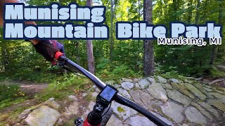
Popular Munising Mountain Biking Trails
• 100 ★ 4.0 • 574 ft • 0 ft • 423 •
A rock armored trail with gaps, berms, rolls and jumps. Not for beginners.
• 90 ★ 4.0 • 1 mile • 367 ft • 377 •
is a 1.3 mile one-way universal accessible trail. The trail is built into a steep hillside and is capped with aggregate to maintain a smooth surface. It is not groomed but packed by snowshoers in the winter months.
• 100 ★ 5.0 • 525 ft • 28 ft • 371 •
Popular green difficulty singletrack. This mountain bike primary trail can be used both directions. On average it takes minutes to complete this trail.
• 100 ★ 4.2 • 1,391 ft • 0 ft • 370 •
One of the best jump trails in the Yoop. 11 tabletop jumps and 5 high speed berms. You will have a hard time finding a better trail for learning jumping fundamentals that is also so easy to lap. One of a kind.
• 100 ★ 5.0 • 1,211 ft • 14 ft • 358 •
Feature trail with wood skinnies, rock skinnies, rock rolls/gardens, a teeter toter, wood rolls. Very lap-able. A must for every trip through the bike park.
• 90 ★ 0.0 • 811 ft • 40 ft • 353 •
Popular blue difficulty singletrack. This mountain bike primary trail can be used both directions. On average it takes 1 minutes to complete this trail.
• 90 ★ 5.0 • 10 miles • 554 ft • 331 •
Great flow trail with multiple flavors throughout the trail. Rolling terrain and many nice berms.
• 90 ★ 4.2 • 1 mile • 149 ft • 292 •
Highly rated popular blue difficulty singletrack. This mountain bike primary trail. On average it takes 23 minutes to complete this trail.
Munising Mountain Bike Routes
20 miles • 909 ft • 0 •
14 miles • 803 ft • 0 •
Photos of Munising Mountain Bike
Videos of Munising Mountain Bike
trail: Munising Bay Loop
4:55 |
280 |
Jul 20, 2020
trail: Munising Bay Loop
5:22 |
67 |
Dec 11, 2024 , Munising
Recent Trail Reports
| status | trail | date | condition | info | user |
|---|---|---|---|---|---|
| Wyman Pines (Winter Fat Bike) | Dec 21, 2025 @ 2:24pm (America/Menominee) Dec 21, 2025 | Snow Groomed | storktorq | ||
| Wyman Pines (Winter Fat Bike) | Dec 21, 2025 @ 2:24pm (America/Menominee) Dec 21, 2025 | Snow Groomed | storktorq | ||
| Wyman Pines (Winter Fat Bike) | Dec 21, 2025 @ 2:24pm (America/Menominee) Dec 21, 2025 | Snow Groomed | storktorq | ||
| Wyman Pines (Winter Fat Bike) | Dec 21, 2025 @ 2:24pm (America/Menominee) Dec 21, 2025 | Snow Groomed | storktorq | ||
| Hemlock Valley | Oct 17, 2025 @ 6:16pm (America/Detroit) Oct 17, 2025 | Unknown | rhondalassila MBTN | ||
| Mountain Goat | Sep 20, 2025 @ 2:19pm (America/Menominee) Sep 20, 2025 | Ideal | tmarkoliver | ||
| Superior Air | Aug 26, 2025 @ 5:17am Aug 26, 2025 | Ideal | crankmasterflex | ||
| Return to trailhead | Aug 10, 2025 @ 10:13am Aug 10, 2025 | Ideal | Schoppkeeper | ||
| Just Beechy | Aug 10, 2025 @ 10:13am Aug 10, 2025 | Ideal | Schoppkeeper | ||
| Bruno's Run | Jul 11, 2025 @ 2:23pm Jul 11, 2025 | Ideal | Mdsantini |
Activity Feed
| username | action | type | title | date |
|---|---|---|---|---|
| ChrystalnNteUc | wishlist | region | activity #95727728 | May 28, 2026 @ 12:51pm May 28, 2026 |
| rhondalassila | update | trail | activity #94168939 | May 6, 2026 @ 11:37am May 6, 2026 |
| DonIWQt9g | wishlist | region | activity #92981170 | Apr 19, 2026 @ 2:26pm Apr 19, 2026 |
| DonIWQt9g | wishlist | region | activity #92981132 | Apr 19, 2026 @ 2:25pm Apr 19, 2026 |
| Joboo1967 | wishlist | region | activity #92875171 | Apr 18, 2026 @ 10:36am Apr 18, 2026 |
Recent Comments
| username | type | title | comment | date |
|---|---|---|---|---|
| trail | Riding this trail was quite possibly the most... | Oct 5, 2025 @ 8:43am Oct 5, 2025 | ||
| trail | Best trail in munising worth the climb up for it | Aug 29, 2025 @ 6:16am Aug 29, 2025 | ||
| trail | This trail is a blue, not black as this app... | Aug 26, 2025 @ 5:20am Aug 26, 2025 | ||
| trail | There is a new climb trail (FIRst Ascent,... | Aug 12, 2025 @ 6:43am Aug 12, 2025 | ||
| trail | I rode this trail today and loved it. It’s a... | Jul 31, 2025 @ 7:17pm Jul 31, 2025 |
Local Badges
-

10 Blue Trails154 awarded -

Epic Ride Climb 2k6 awarded -

Climbing 10k Badge9 awarded -

Climbing 100k Badge1 awarded -

Epic Ride Descent 2k5 awarded -

Descent 10k Badge9 awarded
Bike & Skill Parks
| name | type | city | rating |
|---|---|---|---|
| Da Play Zone | skill park | Munising |
Activity Type Stats
| activitytype | trails | distance | descent | descent distance | total vertical | rating | global rank | state rank | photos | reports | routes | ridelogs |
|---|---|---|---|---|---|---|---|---|---|---|---|---|
| Mountain Bike | 84 | 311 miles | 11,696 ft | 65 miles | 440 ft | #768 | #297 | 123 | 218 | 2 | 5,758 | |
| E-Bike | 10 | 74 miles | 837 ft | 12 miles | 404 ft | #2,723 | #1,061 | 167 | 42 | |||
| Horse | 36 | 248 miles | 6,673 ft | 44 miles | 400 ft | #88 | #362 | 51 | 29 | |||
| Hike | 138 | 480 miles | 19,751 ft | 119 miles | 446 ft | #263 | #131 | 206 | 3 | 1,581 | ||
| Trail Running | 136 | 447 miles | 16,854 ft | 109 miles | 446 ft | #267 | #110 | 206 | 72 | |||
| Dirtbike/Moto | 1 | 25 miles | 410 ft | 5 miles | 243 ft | 50 | 4 | |||||
| ATV/ORV/OHV | 3 | 68 miles | 663 ft | 11 miles | 404 ft | 50 | 2 | |||||
| Snowmobile | 3 | 58 miles | 554 ft | 9 miles | 400 ft | 12 | ||||||
| Snowshoe | 35 | 182 miles | 6,050 ft | 36 miles | 430 ft | #71 | #21 | 22 | 321 | |||
| Backcountry Ski | 7 | 13 miles | 748 ft | 4 miles | 262 ft | #514 | #142 | 13 | 263 | |||
| Nordic Ski | 37 | 197 miles | 6,158 ft | 37 miles | 443 ft | #118 | #28 | 13 | 760 |
Frequently Asked Questions About Munising
▼
What are the best places to ride in Munising?
Munising has 8 areas to explore for mountain biking. The top rated areas are:
▼
What are the highest rated mountain biking trails in Munising?
The highest rated mountain biking trails in Munising are:
- Just Beechy (4.5/5)
- Da Play Zone (4.4/5)
- Bruno's Run (4.3/5)
- Munising Bay Loop (4.1/5)
- Connector (4.1/5)
▼
What is the best time of the year to ride in Munising?
Based on ride log data, the most popular months to ride in Munising are:
- August (77 activities)
- July (64 activities)
- September (48 activities)
▼
Where can I park to ride in Munising?
There are 25 parking locations listed in Munising. The most popular parking spots are: View all parking and trailhead locations on the map to plan your visit.
Activities
Trails
- By brenthillier
 NSMBA TRAILFORKS & contributors
 - Admins: MBTN, Zjeckert, NCT-PWC
- #10832 - 8,649 views
- munising activity log | embed map of Munising mountain bike trails | munising mountain biking points of interest
Downloading of trail gps tracks in kml & gpx formats is enabled for Munising.
You must login to download files.