close
-
Layers w
- Weather Layers
- Pro
- Pro
- Pro
- Pro
- Pro
- Pro
- More Layers
- Pro
- Pro
- Pro
- Pro
-
Upgrade to

3D
Trail Conditions
- Unknown
- Snow Groomed
- Snow Packed
- Snow Covered
- Snow Cover Partial
- Freeze/thaw Cycle
- Icy
- Prevalent Mud
- Wet
- Variable
- Ideal
- Dry
- Very Dry
Trail Flow (Ridden Direction)
Trailforks scans users ridelogs to determine the most popular direction each trail is ridden. A good flowing trail network will have most trails flowing in a single direction according to their intension.
The colour categories are based on what percentage of riders are riding a trail in its intended direction.
The colour categories are based on what percentage of riders are riding a trail in its intended direction.
- > 96%
- > 90%
- > 80%
- > 70%
- > 50%
- < 50%
- bi-directional trail
- no data
Trail Last Ridden
Trailforks scans ridelogs to determine the last time a trail was ridden.
- < 2 days
- < 1 week
- < 2 weeks
- < 1 month
- < 6 months
- > 6 months
Trail Ridden Direction
The intended direction a trail should be ridden.
- Downhill Only
- Downhill Primary
- Both Directions
- Uphill Primary
- Uphill Only
- One Direction
Contribute Details
Colors indicate trail is missing specified detail.
- Description
- Photos
- Description & Photos
- Videos
Trail Popularity ?
Trailforks scans ridelogs to determine which trails are ridden the most in the last 9 months.
Trails are compared with nearby trails in the same city region with a possible 25 colour shades.
Think of this as a heatmap, more rides = more kinetic energy = warmer colors.
- most popular
- popular
- less popular
- not popular
ATV/ORV/OHV Filter
Max Vehicle Width
inches
US Cell Coverage
Legend

Radar Time
Activity Recordings
Trailforks uses anonymized public activity data.
?
Activity Recordings
Trailforks uses anonymized public activity data.
?
Personal Heatmap
▶
Activity Types
all
/
none
▶
Options
2
Date range
month
–
Winter Trails
Warning
A routing network for winter maps does not exist. Selecting trails using the winter trails layer has been disabled.
Missing Trails
Most Popular
Least Popular
Trails are colored based on popularity. The more popular a trail is, the more red. Less popular trails trend towards green.
Jump Magnitude Heatmap
Heatmap of where riders jump on trails. Zoom in to see individual jumps, click circles to view jump details.
BC Backroad Status
![map legend]()
Service Road Atlas is a free to use, community-driven service for viewing and creating reports on the numerous back-country service roads around B.C. and Alberta.

Slope Aspect
Direction the slope faces
Trails Deemphasized
Trails are shown in grey.
Only show trails with no bike usage.
Suggested Layers
Based on selected activity type
Save the current map location and zoom level as your default home location whenever this page is loaded.
Save
No description for Murça has been added yet!
Login or register to submit one.
This region uses the Uk/Euro style trail grading system.
Activities Click to view
- Mountain Bike
12 trails
- Hike
10 trails
- Trail Running
12 trails
Region Details
- 5
- 3
Region Status
Open as of Nov 23, 2024Stats
- Avg Trail Rating
- Trails (view details)
- 8
- Trails Mountain Bike
- 12
- Trails E-Bike
- 2
- Trails Hike
- 10
- Trails Trail Running
- 12
- Total Distance
- 7 miles
- Total Descent
- 4,087 ft
- Total Vertical
- 1,297 ft
- Highest Trailhead
- 2,881 ft
- Reports
- 1
- Photos
- 381
- Ridden Counter
- 123
Popular Murça Mountain Biking Trails
• 85 ★ 3.0 • 4,968 ft • 62 ft • 29 •
Popular blue difficulty singletrack. This mountain bike primary trail can be used downhill primary and has a hard overall physical rating with a 62 ft black diamond climb. It features berm, drop, jump, gap jump, rock face and rock garden. On average it takes 5 minutes to complete this trail.
• 70 ★ 3.0 • 1 mile • 14 ft • 24 •
Popular blue difficulty singletrack. This mountain bike primary trail and has a hard overall physical rating with a 14 ft black diamond climb. It features berm, drop, jump, rock face and rock garden. On average it takes 16 minutes to complete this trail.
• 100 ★ 4.0 • 4,544 ft • 0 ft • 21 •
Popular blue difficulty singletrack. This mountain bike primary trail and has a moderate overall physical rating with a 0 ft black diamond climb. It features berm, drop, jump and gap jump. On average it takes 4 minutes to complete this trail.
• 5 ★ 3.0 • 4,685 ft • 0 ft • 13 •
Less popular blue difficulty singletrack. This mountain bike primary trail and has a hard overall physical rating with a 0 ft black diamond climb. It features berm, drop, jump, rock face, rock garden and roller coaster. On average it takes 5 minutes to complete this trail.
• 5 ★ 3.0 • 2 miles • 37 ft • 12 •
Less popular blue difficulty singletrack. This mountain bike primary trail can be used downhill primary and has a hard overall physical rating with a 37 ft black diamond climb. It features berm, drop, jump and gap jump. On average it takes 7 minutes to complete this trail.
• 5 ★ 0.0 • 3,717 ft • 7 ft • 6 •
Less popular red difficulty singletrack. This mountain bike primary trail and has a hard overall physical rating with a 7 ft black diamond climb. It features berm, drop, jump, gap jump, rock face and rock garden. On average it takes 4 minutes to complete this trail.
• ★ 0.0 • 2 miles • 18 ft • 1 •
Trilho com inicio duro em fraga. Parte do meio mais simples e fase final novamente mais agressiva e com bastante inclinação.
• ★ 0.0 • 3,009 ft • 0 ft • 1 •
Red difficulty singletrack. This multi-use trail can be used downhill only. It features drop, jump and gap jump. Trail visibility is always easy to follow.
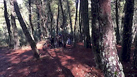
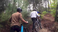
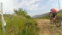
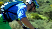
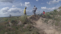
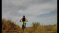
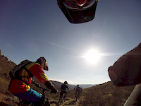
Photos of Murça Mountain Bike
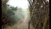
Videos of Murça Mountain Bike
trail: Guarda
3:56 |
95 |
Nov 7, 2016
trail: Guarda
2:19 |
121 |
Nov 3, 2016
trail: Guarda
3:20 |
42 |
Jul 20, 2016
trail: Guarda
4:02 |
158 |
Jun 22, 2016
trail: Guarda
0:00 |
47 |
May 29, 2016
trail: Guarda
0:19 |
34 |
Aug 27, 2015
trail: Guarda
0:05 |
53 |
Jun 4, 2015
trail: Guarda
2:14 |
151 |
Mar 17, 2015
Recent Trail Reports
no previous reports, add one now!
Activity Feed
| username | action | type | title | date |
|---|---|---|---|---|
| MauroAlves | add | video | activity #94370813 | May 9, 2026 @ 12:51pm May 9, 2026 |
| allbikexperience | add | trail | activity #92660784 | Apr 15, 2026 @ 8:09am Apr 15, 2026 |
| ikendothis | update | trail | activity #92652365 | Apr 15, 2026 @ 4:54am Apr 15, 2026 |
| AMG | update | trail | activity #92581680 | Apr 14, 2026 @ 12:23am Apr 14, 2026 |
| allbikexperience | add | trail | activity #92581660 | Apr 14, 2026 @ 12:22am Apr 14, 2026 |
Activity Type Stats
| activitytype | trails | distance | descent | descent distance | total vertical | rating | global rank | state rank | photos | reports | routes | ridelogs |
|---|---|---|---|---|---|---|---|---|---|---|---|---|
| Mountain Bike | 12 | 7 miles | 4,088 ft | 6 miles | 1,296 ft | #6,433 | #64 | 381 | 1 | 670 | ||
| E-Bike | 2 | 1 | 36 | |||||||||
| Hike | 10 | 7 miles | 4,088 ft | 6 miles | 1,296 ft | #6,739 | #62 | 1 | 52 | |||
| Trail Running | 12 | 7 miles | 4,088 ft | 6 miles | 1,296 ft | #6,143 | #59 | 1 |
Frequently Asked Questions About Murça
▼
What are the highest rated mountain biking trails in Murça?
The highest rated mountain biking trails in Murça are:
- Trilho do lago (4/5)
- Racha (3.8/5)
- Santo Domingos (3.8/5)
- Guarda (3.8/5)
- Vala (3.8/5)
▼
What is the best time of the year to ride in Murça?
Based on ride log data, the most popular months to ride in Murça are:
- August (5 activities)
- February (3 activities)
- April (3 activities)
▼
Where can I park to ride in Murça?
Check the Murça trail map for trailhead and parking information. Community members regularly update access and parking details for trails in the area.
▼
What is the longest trail in Murça?
The longest trail in Murça is Trilho do Vigia at 1.6 miles. View all trails sorted by distance.
Trails
Points of Interest
- By enduroMurca & contributors
- Admins: elyari, AMG, marcossantamaria
- #13084 - 2,119 views
- murça activity log | embed map of Murça mountain bike trails | murça mountain biking points of interest
Downloading of trail gps tracks in kml & gpx formats is enabled for Murça.
You must login to download files.