close
-
Layers w
- Weather Layers
- Pro
- Pro
- Pro
- Pro
- Pro
- Pro
- More Layers
- Pro
- Pro
- Pro
- Pro
-
Upgrade to

3D
Trail Conditions
- Unknown
- Snow Groomed
- Snow Packed
- Snow Covered
- Snow Cover Partial
- Freeze/thaw Cycle
- Icy
- Prevalent Mud
- Wet
- Variable
- Ideal
- Dry
- Very Dry
Trail Flow (Ridden Direction)
Trailforks scans users ridelogs to determine the most popular direction each trail is ridden. A good flowing trail network will have most trails flowing in a single direction according to their intension.
The colour categories are based on what percentage of riders are riding a trail in its intended direction.
The colour categories are based on what percentage of riders are riding a trail in its intended direction.
- > 96%
- > 90%
- > 80%
- > 70%
- > 50%
- < 50%
- bi-directional trail
- no data
Trail Last Ridden
Trailforks scans ridelogs to determine the last time a trail was ridden.
- < 2 days
- < 1 week
- < 2 weeks
- < 1 month
- < 6 months
- > 6 months
Trail Ridden Direction
The intended direction a trail should be ridden.
- Downhill Only
- Downhill Primary
- Both Directions
- Uphill Primary
- Uphill Only
- One Direction
Contribute Details
Colors indicate trail is missing specified detail.
- Description
- Photos
- Description & Photos
- Videos
Trail Popularity ?
Trailforks scans ridelogs to determine which trails are ridden the most in the last 9 months.
Trails are compared with nearby trails in the same city region with a possible 25 colour shades.
Think of this as a heatmap, more rides = more kinetic energy = warmer colors.
- most popular
- popular
- less popular
- not popular
ATV/ORV/OHV Filter
Max Vehicle Width
inches
US Cell Coverage
Legend

Radar Time
Activity Recordings
Trailforks uses anonymized public activity data.
?
Activity Recordings
Trailforks uses anonymized public activity data.
?
Personal Heatmap
▶
Activity Types
all
/
none
▶
Options
2
Date range
month
–
Winter Trails
Warning
A routing network for winter maps does not exist. Selecting trails using the winter trails layer has been disabled.
Missing Trails
Most Popular
Least Popular
Trails are colored based on popularity. The more popular a trail is, the more red. Less popular trails trend towards green.
Jump Magnitude Heatmap
Heatmap of where riders jump on trails. Zoom in to see individual jumps, click circles to view jump details.
BC Backroad Status
![map legend]()
Service Road Atlas is a free to use, community-driven service for viewing and creating reports on the numerous back-country service roads around B.C. and Alberta.

Slope Aspect
Direction the slope faces
Trails Deemphasized
Trails are shown in grey.
Only show trails with no bike usage.
Suggested Layers
Based on selected activity type
Save the current map location and zoom level as your default home location whenever this page is loaded.
SaveThis region is Unsanctioned, Ride at your own Risk!
Some of the main tourist attractions in the county are:
The old city of Târgu Mureș
The medieval city of Sighișoara
Sovata resort
The city of Reghin
The medieval fortified church of Saschiz
Călimani Mountains - Gurghiu Mountains
Peninsula / Félsziget Festival - Romania's biggest music festival
The old city of Târgu Mureș
The medieval city of Sighișoara
Sovata resort
The city of Reghin
The medieval fortified church of Saschiz
Călimani Mountains - Gurghiu Mountains
Peninsula / Félsziget Festival - Romania's biggest music festival
This region uses the Uk/Euro style trail grading system.
Region Details
- 9
- 9
- 6
Stats
- Avg Trail Rating
- Trails (view details)
- 25
- Trails Mountain Bike
- 24
- Trails E-Bike
- 19
- Trails Horse
- 7
- Trails Hike
- 21
- Trails Trail Running
- 23
- Trails Dirtbike/Moto
- 5
- Trails Observed Trials
- 1
- Trails ATV/ORV/OHV
- 4
- Total Distance
- 80 miles
- Total Descent
- 16,714 ft
- Total Vertical
- 3,589 ft
- Highest Trailhead
- 4,705 ft
- Reports
- 3,552
- Photos
- 65
- Ridden Counter
- 236
Sub Regions
- Acatari (1)
- Danes (1)
- Deda (5)
- Saschiz (5)
- Sighisoara (3)
- Târgu-Mures (8)
- Vărgata (1)
- Vătava (1)
Popular Mures Mountain Biking Trails
• 100 ★ 0.0 • 10 miles • 816 ft • 37 •
Popular green difficulty singletrack. This mountain bike primary trail can be used both directions and has a easy overall physical rating with a 816 ft green climb. Trail visibility is always easy to follow. On average it takes 1 hour18 minutes to complete this trail.
• 80 ★ 0.0 • 2,287 ft • 171 ft • 29 •
Popular green difficulty singletrack. This mountain bike primary trail can be used downhill primary and has a easy overall physical rating with a 171 ft green climb. Trail visibility is sometimes hard to follow.
• 90 ★ 0.0 • 3,094 ft • 0 ft • 7 •
Popular blue difficulty singletrack. This mountain bike primary trail can be used both directions. It features berm, drop and jump. Adaptive MTB rating: amtb blue.
• 5 ★ 4.5 • 5 miles • 195 ft • 6 •
This is the perfect trail for beginners. You climb on a road for about 10 km, after that you have to push the bike for a short distance and then it’s by bike again. The view from the top is priceless. The descent begins a bit hard...
• 5 ★ 5.0 • 2 miles • 0 ft • 5 •
The perfect trail for a short autumn day. It starts with a challenging 12 km uphill cycling (blue cross marking, from Bistra Muresului in Poiana Stegii direction), followed by push-bike alongside the river and the final section again on...
• 100 ★ 0.0 • 1,030 ft • 11 ft • 5 •
Popular green difficulty singletrack. This mountain bike primary trail can be used both directions and has a easy overall physical rating with a 11 ft green climb. It features berm, drop, jump, gap jump and skinny. Adaptive MTB rating: amtb green. Trail visibility is always easy to follow.
• 5 ★ 5.0 • 2,347 ft • 10 ft • 4 •
Less popular blue difficulty singletrack. This mountain bike primary trail can be used downhill primary.
Mures Mountain Bike Routes
8 miles • 1,020 ft • 0 • Loop •
Through the Targu-Mures town forest , from Corunca to Vazman, looping back to Belvedere district.
Photos of Mures Mountain Bike
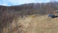
Videos of Mures Mountain Bike

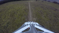
trail: Jobbagyfalva DH FR trail
0:06 |
105 |
May 9, 2016
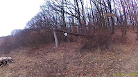
trail: Jobbagyfalva DH FR trail
0:05 |
70 |
Dec 29, 2015
trail: Jobbagyfalva DH FR trail
0:06 |
98 |
Dec 23, 2015
trail: Jobbagyfalva DH FR trail
0:40 |
12 |
Dec 11, 2015

trail: Jobbagyfalva DH FR trail
2:10 |
74 |
Oct 24, 2015
trail: Jobbagyfalva DH FR trail
6:42 |
143 |
May 8, 2015
trail: Jobbagyfalva DH FR trail
0:10 |
42 |
Feb 23, 2015
trail: Jobbagyfalva DH FR trail
0:10 |
33 |
Feb 22, 2015
Recent Trail Reports
| status | trail | date | condition | info | user |
|---|---|---|---|---|---|
| TBT Saschiz - Mesendorf Saschiz | Nov 3, 2024 @ 10:22am Nov 3, 2024 | Dry | 3sixtee | ||
| Cloasterf - Saschiz Saschiz | Aug 26, 2023 @ 9:47am Aug 26, 2023 | Very Dry | 3sixtee | ||
| Scaunul Domnului Deda | Jul 1, 2023 @ 8:10am Jul 1, 2023 | Variable | zbangee | ||
| Jobbagyfalva DH FR trail Vărgata | Dec 5, 2015 @ 8:16am Dec 5, 2015 | Unknown | gtdhirace2001 |
Activity Feed
| username | action | type | title | date |
|---|---|---|---|---|
| Pams | add | photo | activity #95297473 | May 23, 2026 @ 2:18am May 23, 2026 |
| SebastianYE3YaE | ridden | trail | activity #81727264 | Oct 4, 2025 @ 11:17pm Oct 4, 2025 |
| pufalot | update | region | activity #80048891 | Sep 10, 2025 @ 8:20am Sep 10, 2025 |
| pufalot | update | region | activity #80048883 | Sep 10, 2025 @ 8:19am Sep 10, 2025 |
| pufalot | update | region | activity #80048877 | Sep 10, 2025 @ 8:19am Sep 10, 2025 |
Recent Comments
| username | type | title | comment | date |
|---|---|---|---|---|
| report | Cool ! | Dec 5, 2015 @ 8:17am Dec 5, 2015 |
Local Mountain Biking Directory
-
BiketradeBike Shop
Activity Type Stats
| activitytype | trails | distance | descent | descent distance | total vertical | rating | global rank | state rank | photos | reports | routes | ridelogs |
|---|---|---|---|---|---|---|---|---|---|---|---|---|
| Mountain Bike | 24 | 80 miles | 16,690 ft | 42 miles | 3,589 ft | 65 | 3,552 | 1 | 1,399 | |||
| E-Bike | 19 | 63 miles | 14,029 ft | 32 miles | 3,553 ft | 1,194 | 1 | 202 | ||||
| Horse | 7 | 24 miles | 2,936 ft | 10 miles | 1,076 ft | 9 | 1 | |||||
| Hike | 21 | 63 miles | 14,278 ft | 33 miles | 3,553 ft | 3,552 | 1 | 61 | ||||
| Trail Running | 23 | 65 miles | 14,383 ft | 33 miles | 3,589 ft | 3,552 | 1 | 76 | ||||
| Dirtbike/Moto | 5 | 7 miles | 1,247 ft | 4 miles | 1,076 ft | 9 | 1 | |||||
| Observed Trials | 1 | 3 miles | 236 ft | 1 mile | 223 ft | 1 | ||||||
| ATV/ORV/OHV | 4 | 7 miles | 1,247 ft | 4 miles | 1,076 ft | 193 | 1 | 2 |
Activities
Trails
Points of Interest
- By punksovereign & contributors
- Admins: pufalot
- #6357 - 2,145 views
- mures activity log | embed map of Mures mountain bike trails | mures mountain biking points of interest
Downloading of trail gps tracks in kml & gpx formats is enabled for Mures.
You must login to download files.