close
-
Layers w
- Weather Layers
- Pro
- Pro
- Pro
- Pro
- Pro
- Pro
- More Layers
- Pro
- Pro
- Pro
- Pro
-
Upgrade to

3D
Trail Conditions
- Unknown
- Snow Groomed
- Snow Packed
- Snow Covered
- Snow Cover Partial
- Freeze/thaw Cycle
- Icy
- Prevalent Mud
- Wet
- Variable
- Ideal
- Dry
- Very Dry
Trail Flow (Ridden Direction)
Trailforks scans users ridelogs to determine the most popular direction each trail is ridden. A good flowing trail network will have most trails flowing in a single direction according to their intension.
The colour categories are based on what percentage of riders are riding a trail in its intended direction.
The colour categories are based on what percentage of riders are riding a trail in its intended direction.
- > 96%
- > 90%
- > 80%
- > 70%
- > 50%
- < 50%
- bi-directional trail
- no data
Trail Last Ridden
Trailforks scans ridelogs to determine the last time a trail was ridden.
- < 2 days
- < 1 week
- < 2 weeks
- < 1 month
- < 6 months
- > 6 months
Trail Ridden Direction
The intended direction a trail should be ridden.
- Downhill Only
- Downhill Primary
- Both Directions
- Uphill Primary
- Uphill Only
- One Direction
Contribute Details
Colors indicate trail is missing specified detail.
- Description
- Photos
- Description & Photos
- Videos
Trail Popularity ?
Trailforks scans ridelogs to determine which trails are ridden the most in the last 9 months.
Trails are compared with nearby trails in the same city region with a possible 25 colour shades.
Think of this as a heatmap, more rides = more kinetic energy = warmer colors.
- most popular
- popular
- less popular
- not popular
ATV/ORV/OHV Filter
Max Vehicle Width
inches
US Cell Coverage
Legend

Radar Time
Activity Recordings
Trailforks uses anonymized public activity data.
?
Activity Recordings
Trailforks uses anonymized public activity data.
?
Personal Heatmap
▶
Activity Types
all
/
none
▶
Options
2
Date range
month
–
Winter Trails
Warning
A routing network for winter maps does not exist. Selecting trails using the winter trails layer has been disabled.
Missing Trails
Most Popular
Least Popular
Trails are colored based on popularity. The more popular a trail is, the more red. Less popular trails trend towards green.
Jump Magnitude Heatmap
Heatmap of where riders jump on trails. Zoom in to see individual jumps, click circles to view jump details.
BC Backroad Status
![map legend]()
Service Road Atlas is a free to use, community-driven service for viewing and creating reports on the numerous back-country service roads around B.C. and Alberta.

Slope Aspect
Direction the slope faces
Trails Deemphasized
Trails are shown in grey.
Only show trails with no bike usage.
Suggested Layers
Based on selected activity type
Save the current map location and zoom level as your default home location whenever this page is loaded.
Save
No description for Nannup has been added yet!
Login or register to submit one.
Activities Click to view
- Mountain Bike
62 trails
- E-Bike
54 trails
- Gravel Bike
3 trails
- Adaptive Bike
7 trails
- Hike
6 trails
- Trail Running
6 trails
Region Details
- 2
- 1
- 8
- 17
- 23
- 10
Region Status
Open as of May 11, 2026Stats
- Avg Trail Rating
- Trails (view details)
- 61
- Trails Mountain Bike
- 62
- Trails E-Bike
- 54
- Trails Gravel Bike
- 3
- Trails Adaptive Bike
- 7
- Trails Winter Fat Bike
- 4
- Trails Horse
- 1
- Trails Hike
- 6
- Trails Trail Running
- 6
- Trails ATV/ORV/OHV
- 1
- Total Distance
- 56 miles
- Total Descent
- 19,252 ft
- Total Vertical
- 816 ft
- Highest Trailhead
- 1,065 ft
- Reports
- 459
- Photos
- 88
- Ridden Counter
- 12,513
Sub Regions
-
Linga Longa Bike Park
- 2
- 4
- 14
- 8
-
Nannup Downhill
- 2
-
Tank 7
- 6
- 12
- 6
- 2
Popular Nannup Mountain Biking Trails
• 70 ★ 4.8 • 3,133 ft • 4 ft • 421 •
Popular blue difficulty singletrack. This mountain bike primary trail can be used downhill only and has a easy overall physical rating. It features berm, drop, jump and gap jump. On average it takes 2 minutes to complete this trail.
• 90 ★ 4.5 • 1 mile • 408 ft • 420 •
Lots of switchbacks down low. Gets easier the higher you go.
• 100 ★ 4.0 • 3,993 ft • 18 ft • 391 •
Popular blue difficulty family friendly machine groomed. This mountain bike primary trail can be used downhill only and has a easy overall physical rating. Trail visibility is always easy to follow. On average it takes 4 minutes to complete this trail.
• 95 ★ 4.7 • 3,684 ft • 0 ft • 390 •
Popular blue difficulty singletrack. This mountain bike primary trail can be used downhill only. On average it takes 4 minutes to complete this trail.
• 75 ★ 4.8 • 4,350 ft • 0 ft • 388 •
Popular blue difficulty singletrack. This mountain bike primary trail can be used downhill only and has a moderate overall physical rating. It features berm, jump and rock garden. On average it takes 6 minutes to complete this trail.
• 75 ★ 4.6 • 2,431 ft • 0 ft • 382 •
Black off-shoot from Folly's. Tech singletrack with more rockgardens, drops and gaps than Folly's
• 85 ★ 5.0 • 1,614 ft • 96 ft • 370 •
Popular blue difficulty machine groomed. This mountain bike primary trail can be used uphill only. On average it takes 3 minutes to complete this trail.
Nannup Mountain Bike Routes
8 miles • 1,358 ft • 11 • Loop •
An introduction to the Tank 7 mtb Park. This side of the park is known locally as "Tank 8". This route...
4 miles • 696 ft • 5 • Loop •
Start at the Brockman Trailhead heading up Elevator to the Tank 8 Trailhead. Continue climbing on Roo Beds...
★ 1.0 • 5 miles • 746 ft • 7 • Loop •
Start at Brockman Trailhead, head up Tiger Cub onto Tiger King. Climb to the Blackwood Trailhead. Descend...
4 miles • 680 ft • 5 • Loop •
Starting at the Brockman Trailhead explore six trails, a mix of Green and Blue with climbing switchbacks,...
6 miles • 1,060 ft • 6 • Loop •
Explore the Tank 7 trails riding up to the furthest sections of the mountain bike park. Some great vistas,...
2 miles • 416 ft • 4 • Loop •
Ride climbing switchbacks up to Blackwood Trailhead and head back down on open flowy descending trail.
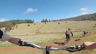
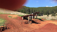
Photos of Nannup Mountain Bike
Videos of Nannup Mountain Bike

trail: The Local (Upper)
3:21 |
75 |
Dec 21, 2024

trail: The Green Mile
4:33 |
70 |
Dec 21, 2024

trail: Blindside
4:01 |
69 |
Dec 21, 2024

trail: Flylacine
0:56 |
54 |
Dec 21, 2024

trail: Easy Tiger
2:06 |
30 |
Dec 21, 2024

trail: Mirkwood
0:17 |
|
Sep 4, 2021
trail: Mirkwood
0:12 |
354 |
Aug 24, 2021
trail: Mirkwood
0:17 |
|
Aug 24, 2021
Recent Trail Reports
| status | trail | date | condition | info | user |
|---|---|---|---|---|---|
| Flylacine | May 12, 2026 @ 8:30am (Australia/Perth) May 11, 2026 | Unknown | kimberleefasa | ||
| Blindside | May 12, 2026 @ 8:28am (Australia/Perth) May 11, 2026 | Unknown | kimberleefasa | ||
| Outlaws | Apr 24, 2026 @ 11:33am (Australia/Perth) Apr 23, 2026 | Ideal | shortcut-western-australia | ||
| Training Wheels | Apr 24, 2026 @ 11:33am (Australia/Perth) Apr 23, 2026 | Ideal | shortcut-western-australia | ||
| Easy Tiger | Apr 24, 2026 @ 11:33am (Australia/Perth) Apr 23, 2026 | Ideal | shortcut-western-australia | ||
| Tank to Tank | Apr 24, 2026 @ 11:33am (Australia/Perth) Apr 23, 2026 | Ideal | shortcut-western-australia | ||
| Blackwood | Apr 24, 2026 @ 11:33am (Australia/Perth) Apr 23, 2026 | Ideal | shortcut-western-australia | ||
| Folly Farmer | Apr 24, 2026 @ 11:33am (Australia/Perth) Apr 23, 2026 | Ideal | shortcut-western-australia | ||
| Tiger King | Apr 24, 2026 @ 11:33am (Australia/Perth) Apr 23, 2026 | Ideal | shortcut-western-australia | ||
| Eagle Eye | Apr 24, 2026 @ 11:33am (Australia/Perth) Apr 23, 2026 | Ideal | shortcut-western-australia |
Activity Feed
| username | action | type | title | date |
|---|---|---|---|---|
| sweatytechie | update | directory | activity #96740084 | Jun 11, 2026 @ 8:38am Jun 11, 2026 |
| SkaterBoy58 | wishlist | route | activity #95702007 | May 28, 2026 @ 6:15am May 28, 2026 |
| ArronMelville | ridden | trail | activity #95623612 | May 27, 2026 @ 3:57am May 27, 2026 |
| ArronMelville | ridden | trail | activity #95375112 and 2 more | May 23, 2026 @ 7:48pm May 23, 2026 |
| anthonyGaunt | wishlist | region | activity #94865906 | May 16, 2026 @ 6:00pm May 16, 2026 |
Recent Comments
| username | type | title | comment | date |
|---|---|---|---|---|
| trail | Bottom after the bridge is closed, should have... | May 11, 2026 @ 1:05am May 11, 2026 | ||
| trail | Good little climb. Muddy in sections. | Aug 29, 2025 @ 11:28pm Aug 29, 2025 | ||
| trail | Love this trail. Super flowy and ability to... | Oct 25, 2024 @ 8:29pm Oct 25, 2024 | ||
| trail | Fun little up. Was in pretty good condition... | Oct 25, 2024 @ 8:28pm Oct 25, 2024 | ||
| trail | Great trail that works you hard. In good condition | Oct 25, 2024 @ 8:26pm Oct 25, 2024 |
Local Badges
-

Top 10 Trails1 awarded -

Completionist0 awarded -

10 Blue Trails130 awarded -

10 Expert Trails16 awarded -

Epic Ride 50k846 awarded -
Completionist0 awarded
Bike & Skill Parks
| name | type | city | rating |
|---|---|---|---|
| Linga Longa Bike Park | bike park | Nannup |
Local Trail Supporters
- Nannup Mountain Bike Club
- Shire of Nannup
Activity Type Stats
| activitytype | trails | distance | descent | descent distance | total vertical | rating | global rank | state rank | photos | reports | routes | ridelogs |
|---|---|---|---|---|---|---|---|---|---|---|---|---|
| Mountain Bike | 62 | 56 miles | 19,252 ft | 34 miles | 817 ft | #1,234 | #69 | 85 | 459 | 20 | 7,096 | |
| E-Bike | 54 | 38 miles | 17,598 ft | 28 miles | 810 ft | #1,859 | #95 | 446 | 13 | 800 | ||
| Gravel Bike | 3 | 14 miles | 456 ft | 4 miles | 318 ft | #130 | #88 | 19 | 7 | 62 | ||
| Adaptive Bike | 7 | 16 miles | 518 ft | 5 miles | 764 ft | #95 | #128 | 22 | ||||
| Winter Fat Bike | 4 | 2 miles | 243 ft | 4,334 ft | 522 ft | #1,455 | #98 | 19 | ||||
| Horse | 1 | 4,275 ft | 20 ft | 1,089 ft | 85 ft | 40 | ||||||
| Hike | 6 | 17 miles | 433 ft | 5 miles | 712 ft | #4,800 | #144 | 3 | 405 | 60 | ||
| Trail Running | 6 | 17 miles | 433 ft | 5 miles | 712 ft | #4,282 | #128 | 402 | 3 | 54 | ||
| ATV/ORV/OHV | 1 | 2 miles | 20 ft | 1,145 ft | 561 ft | 38 | 2 |
Frequently Asked Questions About Nannup
▼
What are the best places to ride in Nannup?
Nannup has 3 areas to explore for mountain biking. The top rated areas are:
▼
What are the highest rated mountain biking trails in Nannup?
The highest rated mountain biking trails in Nannup are:
- Devin's Descent into Madness (4.5/5)
- Huggies (4.4/5)
- Fun Guy (4.4/5)
- Edge of the World (4.4/5)
- Boxer's Blast (4.4/5)
▼
What is the best time of the year to ride in Nannup?
Based on ride log data, the most popular months to ride in Nannup are:
- April (91 activities)
- September (71 activities)
- December (51 activities)
▼
Where can I park to ride in Nannup?
There are 1 parking locations listed in Nannup. The most popular parking spots are:
Activities
Trails
Points of Interest
- By Jake-Hannah
 MPTA & contributors
 - Admins: MTBWA
- #6265 - 22,332 views
- nannup activity log | embed map of Nannup mountain bike trails | nannup mountain biking points of interest
Downloading of trail gps tracks in kml & gpx formats is enabled for Nannup.
You must login to download files.