close
-
Layers w
- Weather Layers
- Pro
- Pro
- Pro
- Pro
- Pro
- Pro
- More Layers
- Pro
- Pro
- Pro
- Pro
-
Upgrade to

3D
Trail Conditions
- Unknown
- Snow Groomed
- Snow Packed
- Snow Covered
- Snow Cover Partial
- Freeze/thaw Cycle
- Icy
- Prevalent Mud
- Wet
- Variable
- Ideal
- Dry
- Very Dry
Trail Flow (Ridden Direction)
Trailforks scans users ridelogs to determine the most popular direction each trail is ridden. A good flowing trail network will have most trails flowing in a single direction according to their intension.
The colour categories are based on what percentage of riders are riding a trail in its intended direction.
The colour categories are based on what percentage of riders are riding a trail in its intended direction.
- > 96%
- > 90%
- > 80%
- > 70%
- > 50%
- < 50%
- bi-directional trail
- no data
Trail Last Ridden
Trailforks scans ridelogs to determine the last time a trail was ridden.
- < 2 days
- < 1 week
- < 2 weeks
- < 1 month
- < 6 months
- > 6 months
Trail Ridden Direction
The intended direction a trail should be ridden.
- Downhill Only
- Downhill Primary
- Both Directions
- Uphill Primary
- Uphill Only
- One Direction
Contribute Details
Colors indicate trail is missing specified detail.
- Description
- Photos
- Description & Photos
- Videos
Trail Popularity ?
Trailforks scans ridelogs to determine which trails are ridden the most in the last 9 months.
Trails are compared with nearby trails in the same city region with a possible 25 colour shades.
Think of this as a heatmap, more rides = more kinetic energy = warmer colors.
- most popular
- popular
- less popular
- not popular
ATV/ORV/OHV Filter
Max Vehicle Width
inches
US Cell Coverage
Legend

Radar Time
Activity Recordings
Trailforks uses anonymized public activity data.
?
Activity Recordings
Trailforks uses anonymized public activity data.
?
Personal Heatmap
▶
Activity Types
all
/
none
▶
Options
2
Date range
month
–
Winter Trails
Warning
A routing network for winter maps does not exist. Selecting trails using the winter trails layer has been disabled.
Missing Trails
Most Popular
Least Popular
Trails are colored based on popularity. The more popular a trail is, the more red. Less popular trails trend towards green.
Jump Magnitude Heatmap
Heatmap of where riders jump on trails. Zoom in to see individual jumps, click circles to view jump details.
BC Backroad Status
![map legend]()
Service Road Atlas is a free to use, community-driven service for viewing and creating reports on the numerous back-country service roads around B.C. and Alberta.

Slope Aspect
Direction the slope faces
Trails Deemphasized
Trails are shown in grey.
Only show trails with no bike usage.
Suggested Layers
Based on selected activity type
Save the current map location and zoom level as your default home location whenever this page is loaded.
Save
No description for Oberstenfeld has been added yet!
Login or register to submit one.
This region uses the Uk/Euro style trail grading system.
Activities Click to view
- Mountain Bike
14 trails
- E-Bike
14 trails
- Winter Fat Bike
0 trails
- Hike
8 trails
- Trail Running
8 trails
Region Details
- 4
- 6
Region Status
Caution as of Apr 14, 2026Stats
- Avg Trail Rating
- Trails (view details)
- 10
- Trails Mountain Bike
- 14
- Trails E-Bike
- 14
- Trails Hike
- 8
- Trails Trail Running
- 8
- Total Distance
- 3 miles
- Total Descent
- 1,538 ft
- Total Vertical
- 419 ft
- Highest Trailhead
- 1,306 ft
- Reports
- 274
- Photos
- 8
- Ridden Counter
- 1,318
Popular Oberstenfeld Mountain Biking Trails
• 100 ★ 4.9 • 1,827 ft • 0 ft • 190 •
Ist Bestandteil der MTB Runde Oberstenfeld welches eine offizielle MTB Tour ist
• 90 ★ 4.5 • 1,581 ft • 0 ft • 178 •
Bestandteil der offiziellen Tour "MTB Runde Oberstenfeld"
• 95 ★ 4.9 • 1,030 ft • 0 ft • 169 •
Highly rated popular blue difficulty singletrack. This mountain bike primary trail can be used downhill only and has a moderate overall physical rating. Trail visibility is always easy to follow. On average it takes 1 minutes to complete this trail.
• 65 ★ 4.0 • 1,325 ft • 13 ft • 150 •
Moderately popular green difficulty singletrack. This mountain bike primary trail can be used downhill primary. On average it takes 1 minutes to complete this trail.
• 60 ★ 3.2 • 2,549 ft • 83 ft • 136 •
Moderately popular green difficulty singletrack. This mountain bike primary trail can be used uphill primary and has a moderate overall physical rating with a 83 ft green climb. On average it takes 3 minutes to complete this trail.
• 75 ★ 4.0 • 1,020 ft • 0 ft • 59 •
Popular blue difficulty singletrack. This mountain bike primary trail and has a easy overall physical rating with a 0 ft green climb. It features jump, wallride and other. Trail visibility is always easy to follow. On average it takes 1 minutes to complete this trail.
• 80 ★ 4.0 • 702 ft • 0 ft • 54 •
Popular blue difficulty singletrack. This mountain bike primary trail can be used downhill only and has a moderate overall physical rating. Trail visibility is always easy to follow. On average it takes 2 minutes to complete this trail.
• 30 ★ 2.0 • 1,884 ft • 17 ft • 22 •
Less popular green difficulty singletrack. This mountain bike primary trail can be used downhill primary. On average it takes 4 minutes to complete this trail.
Oberstenfeld Mountain Bike Routes
★ 5.0 • 7 miles • 899 ft • 0 • Loop •
Nach der Hoch hinaus Tour die zweite von den Trailsurfers gebaute Runde. Kurz aber sehr sehr geil
Photos of Oberstenfeld Mountain Bike
Videos of Oberstenfeld Mountain Bike
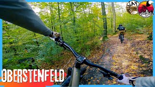
trail: Gronautrail
3:48 |
74 |
Feb 28, 2021
youtuber
![OBERSTENFELD Trails: Gronau, Wild West,...]()

trail: Gronautrail
12:31 |
133 |
Nov 8, 2024 , Oberstenfeld
youtuber
![Oberstenfeld - A Late Autumn Shred // with...]()
trail: Gronautrail
4:32 |
92 |
Oct 26, 2024 , Oberstenfeld
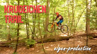
trail: Krugeichentrail
2:38 |
160 |
Dec 13, 2023 , Oberstenfeld
Recent Trail Reports
| status | trail | date | condition | info | user |
|---|---|---|---|---|---|
| Gronautrail | Apr 14, 2026 @ 6:15pm (Europe/Busingen) Apr 14, 2026 | Variable | JJOOEEHUNT | ||
| Wild West | Jan 15, 2026 @ 2:57pm (Europe/Busingen) Jan 15, 2026 | Wet | JJOOEEHUNT | ||
| Krugeichentrail | Nov 22, 2025 @ 2:08pm (Europe/Busingen) Nov 22, 2025 | Freeze/thaw Cycle | Bikeboerny | ||
| Krugeiche Grenzweg | Aug 7, 2025 @ 5:59pm Aug 7, 2025 | Ideal | Bikeboerny | ||
| Wild West 2 | May 24, 2025 @ 1:05pm May 24, 2025 | Dry | Bikeboerny | ||
| Gronautrail Transfer | Mar 30, 2025 @ 12:26pm Mar 30, 2025 | Ideal | ShinyRivers | ||
| Schmalheckentrail | Jul 9, 2023 @ 3:57am Jul 9, 2023 | Ideal | drdentz | ||
| Forstberg Trail | May 13, 2023 @ 7:02am May 13, 2023 | Prevalent Mud | frankb0815 |
Activity Feed
| username | action | type | title | date |
|---|---|---|---|---|
| mFwDXp | wishlist | trail | activity #95960779 and 2 more | May 31, 2026 @ 11:17am May 31, 2026 |
| mFwDXp | ridden | trail | activity #95960623 | May 31, 2026 @ 11:15am May 31, 2026 |
| TrailforkerRalf | ridden | trail | activity #95578544 and 1 more | May 26, 2026 @ 11:24am May 26, 2026 |
| TrailforkerRalf | vote | trail | activity #95578543 and 1 more | May 26, 2026 @ 11:24am May 26, 2026 |
| Freeathletix | checkin | trail | activity #93474704 | Apr 26, 2026 @ 1:39pm Apr 26, 2026 |
Recent Comments
| username | type | title | comment | date |
|---|---|---|---|---|
| trail | Bester Trail im Bereich der Krugeiche. Alle... | Apr 24, 2022 @ 7:16am Apr 24, 2022 | ||
| trail | gute, nicht allzu große Sprünge | Jul 10, 2020 @ 10:30am Jul 10, 2020 | ||
| trail | Schöner Trail mit ein paar Sprüngen im... | Jul 10, 2020 @ 10:29am Jul 10, 2020 | ||
| trail | Third and final trail that is part of the... | Aug 4, 2019 @ 7:38am Aug 4, 2019 | ||
| trail | Second trail that is part of the official... | Aug 4, 2019 @ 7:34am Aug 4, 2019 |
Local Badges
-

Epic Ride Climb 2k13 awarded -

Climbing 10k Badge3 awarded -

Climbing 100k Badge0 awarded -

Epic Ride Descent 2k13 awarded -

Descent 10k Badge3 awarded -

Descent 100k Badge0 awarded
Activity Type Stats
| activitytype | trails | distance | descent | descent distance | total vertical | rating | global rank | state rank | photos | reports | routes | ridelogs |
|---|---|---|---|---|---|---|---|---|---|---|---|---|
| Mountain Bike | 14 | 3 miles | 1,539 ft | 2 miles | 420 ft | #8,676 | #419 | 8 | 274 | 1 | 723 | |
| E-Bike | 14 | 3 miles | 1,539 ft | 2 miles | 420 ft | #6,409 | #254 | 264 | 1 | 119 | ||
| Hike | 8 | 3 miles | 1,253 ft | 2 miles | 420 ft | #10,958 | #298 | 273 | 11 | |||
| Trail Running | 8 | 3 miles | 1,253 ft | 2 miles | 420 ft | #10,450 | #291 | 273 | 4 |
Frequently Asked Questions About Oberstenfeld
▼
What are the highest rated mountain biking trails in Oberstenfeld?
The highest rated mountain biking trails in Oberstenfeld are:
- Gronautrail (4.6/5)
- Birktrail (4.4/5)
- Krugeichentrail (4.3/5)
- Gronautrail Transfer (4/5)
- Wild West (4/5)
▼
What is the best time of the year to ride in Oberstenfeld?
Based on ride log data, the most popular months to ride in Oberstenfeld are:
- June (10 activities)
- April (10 activities)
- October (7 activities)
▼
Where can I park to ride in Oberstenfeld?
There are 1 parking locations listed in Oberstenfeld. The most popular parking spots are:
▼
What is the longest trail in Oberstenfeld?
The longest trail in Oberstenfeld is Krugeiche Grenzweg at 2,549 ft. View all trails sorted by distance.
Activities
- By Sasse82
 TRAILFORKS & contributors
 - Admins: HDRiders, Sasse82, sp00n82, martywis, Trailfürsorge, TrailfürsorgH
- #17835 - 2,896 views
- oberstenfeld activity log | embed map of Oberstenfeld mountain bike trails | oberstenfeld mountain biking points of interest
Downloading of trail gps tracks in kml & gpx formats is enabled for Oberstenfeld.
You must login to download files.