close
-
Layers w
- Weather Layers
- Pro
- Pro
- Pro
- Pro
- Pro
- Pro
- More Layers
- Pro
- Pro
- Pro
- Pro
-
Upgrade to

3D
Trail Conditions
- Unknown
- Snow Groomed
- Snow Packed
- Snow Covered
- Snow Cover Partial
- Freeze/thaw Cycle
- Icy
- Prevalent Mud
- Wet
- Variable
- Ideal
- Dry
- Very Dry
Trail Flow (Ridden Direction)
Trailforks scans users ridelogs to determine the most popular direction each trail is ridden. A good flowing trail network will have most trails flowing in a single direction according to their intension.
The colour categories are based on what percentage of riders are riding a trail in its intended direction.
The colour categories are based on what percentage of riders are riding a trail in its intended direction.
- > 96%
- > 90%
- > 80%
- > 70%
- > 50%
- < 50%
- bi-directional trail
- no data
Trail Last Ridden
Trailforks scans ridelogs to determine the last time a trail was ridden.
- < 2 days
- < 1 week
- < 2 weeks
- < 1 month
- < 6 months
- > 6 months
Trail Ridden Direction
The intended direction a trail should be ridden.
- Downhill Only
- Downhill Primary
- Both Directions
- Uphill Primary
- Uphill Only
- One Direction
Contribute Details
Colors indicate trail is missing specified detail.
- Description
- Photos
- Description & Photos
- Videos
Trail Popularity ?
Trailforks scans ridelogs to determine which trails are ridden the most in the last 9 months.
Trails are compared with nearby trails in the same city region with a possible 25 colour shades.
Think of this as a heatmap, more rides = more kinetic energy = warmer colors.
- most popular
- popular
- less popular
- not popular
ATV/ORV/OHV Filter
Max Vehicle Width
inches
US Cell Coverage
Legend

Radar Time
Activity Recordings
Trailforks uses anonymized public activity data.
?
Activity Recordings
Trailforks uses anonymized public activity data.
?
Personal Heatmap
▶
Activity Types
all
/
none
▶
Options
2
Date range
month
–
Winter Trails
Warning
A routing network for winter maps does not exist. Selecting trails using the winter trails layer has been disabled.
Missing Trails
Most Popular
Least Popular
Trails are colored based on popularity. The more popular a trail is, the more red. Less popular trails trend towards green.
Jump Magnitude Heatmap
Heatmap of where riders jump on trails. Zoom in to see individual jumps, click circles to view jump details.
BC Backroad Status
![map legend]()
Service Road Atlas is a free to use, community-driven service for viewing and creating reports on the numerous back-country service roads around B.C. and Alberta.

Slope Aspect
Direction the slope faces
Trails Deemphasized
Trails are shown in grey.
Only show trails with no bike usage.
Suggested Layers
Based on selected activity type
Save the current map location and zoom level as your default home location whenever this page is loaded.
Save
No description for Oslo has been added yet!
Login or register to submit one.
This region uses the Uk/Euro style trail grading system.
Activities Click to view
- Mountain Bike
370 trails
- E-Bike
130 trails
- Gravel Bike
6 trails
- Adaptive Bike
63 trails
- Winter Fat Bike
202 trails
- Horse
19 trails
- Hike
373 trails
- Trail Running
376 trails
- Nordic Ski
143 trails
Region Details
- 112
- 37
- 156
- 44
- 14
Region Status
Open as of 2 daysStats
- Avg Trail Rating
- Trails (view details)
- 411
- Trails Mountain Bike
- 370
- Trails E-Bike
- 130
- Trails Gravel Bike
- 6
- Trails Adaptive Bike
- 63
- Trails Winter Fat Bike
- 202
- Trails Horse
- 19
- Trails Hike
- 373
- Trails Trail Running
- 376
- Trails Snowshoe
- 4
- Trails Backcountry Ski
- 4
- Trails Nordic Ski
- 143
- Total Distance
- 266 miles
- Total Descent
- 49,207 ft
- Total Vertical
- 1,752 ft
- Highest Trailhead
- 1,755 ft
- Reports
- 837
- Photos
- 62
- Ridden Counter
- 10,750
Sub Regions
-
Frognerseteren
- 10
- 16
-
Grefsenkollen
- 2
- 2
- 1
-
Lillomarka
- 19
- 108
- 34
- 10
-
Østmarka Vest
- 3
- 15
- 8
- 4
Popular Oslo Mountain Biking Trails
• 80 ★ 2.5 • 4 miles • 454 ft • 110 •
A fantastic trail created for MTB enthusiasts. Norsk/Norwegian En fantastisk sti laget for MTB-entusiaster.
• 100 ★ 0.0 • 1,316 ft • 0 ft • 109 •
Popular blue difficulty singletrack. This multi-use trail can be used both directions. It features rock garden. On average it takes 2 minutes to complete this trail.
• 100 ★ 0.0 • 620 ft • 0 ft • 98 •
Popular blue difficulty singletrack. This mountain bike primary trail can be used both directions. It features rock garden. On average it takes 1 minutes to complete this trail.
• 90 ★ 4.0 • 4,094 ft • 7 ft • 84 •
Popular blue difficulty singletrack. This multi-use trail can be used downhill primary and has a moderate overall physical rating with a 7 ft blue climb. Trail visibility is always easy to follow. On average it takes 5 minutes to complete this trail.
• 100 ★ 0.0 • 5,207 ft • 215 ft • 82 •
Easy "wide" singletrack, suitable for beginners. Jernbanestien can be linked with dorullstien for going all up to Sandermosen stasjon. Then you do not take the the uphill path to the road but go straight ahead. Can also be linked with...
• 75 ★ 4.5 • 1,430 ft • 0 ft • 81 •
Popular blue difficulty gravel path. This mountain bike primary trail can be used downhill only. It features berm, drop, jump and wallride. On average it takes 1 minutes to complete this trail.
• 95 ★ 0.0 • 1,434 ft • 77 ft • 71 •
Popular green difficulty doubletrack. This multi-use trail can be used both directions. On average it takes 3 minutes to complete this trail.
Oslo Mountain Bike Routes
19 miles • 2,158 ft • 4 • Loop •
ca 32km loop trail and enduro route used for Terrengsykkelrittet 2022
18 miles • 3,018 ft • 10 • Loop •
Lillomarka rundt. Passerer Lilloseter, Sørskogen og Sinober.
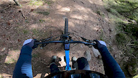
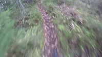
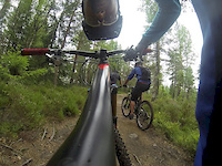
Photos of Oslo Mountain Bike
Videos of Oslo Mountain Bike
trail: Roadeo
0:16 |
198 |
Oct 11, 2021
trail: Mord i Skogen
0:16 |
114 |
Apr 20, 2020
trail: Ringfinger
8:49 |
116 |
Dec 18, 2018

trail: Papa T
0:17 |
7210 |
Jun 24, 2016

trail: Overgrown
0:36 |
24490 |
May 7, 2015
trail: Aurevann
2:23 |
212 |
Aug 5, 2014

trail: Roots
2:59 |
1122 |
Aug 3, 2014
trail: Eastside
2:29 |
567 |
Jul 7, 2013
Recent Trail Reports
| status | trail | date | condition | info | user |
|---|---|---|---|---|---|
| IMBA-stien | Jun 15, 2026 @ 2:41pm (Europe/Oslo) 2 days | Wet | oyviaase | ||
| Rundtjernveien | Jun 15, 2026 @ 2:41pm (Europe/Oslo) 2 days | Ideal | oyviaase | ||
| Ankerveien | Jun 13, 2026 @ 10:07am (Europe/Oslo) Jun 13, 2026 | Wet | zzdenek | ||
| Bro Over Holmenkollveien | Jun 13, 2026 @ 10:07am (Europe/Oslo) Jun 13, 2026 | Wet | zzdenek | ||
| Akebakken til Grefsenkollen | Jun 11, 2026 @ 11:09am (Europe/Oslo) Jun 11, 2026 | Dry | thevids | ||
| Akebakken til toppen av Oslo Skisenter | Jun 11, 2026 @ 11:09am (Europe/Oslo) Jun 11, 2026 | Dry | thevids | ||
| Papa T | Jun 7, 2026 @ 2:12pm (Europe/Oslo) Jun 7, 2026 | Variable | anderslindqvist74 | ||
| Gjelleraasen - Svingele | May 22, 2026 @ 2:40pm (Europe/Oslo) May 22, 2026 | Ideal | oyviaase | ||
| Gjelleraasen Nord | May 22, 2026 @ 2:40pm (Europe/Oslo) May 22, 2026 | Ideal | oyviaase | ||
| Bånkallstubben | May 22, 2026 @ 2:40pm (Europe/Oslo) May 22, 2026 | Ideal | oyviaase |
Activity Feed
| username | action | type | title | date |
|---|---|---|---|---|
| oyviaase | add | report | activity #97047504 and 1 more | Jun 15, 2026 @ 9:37am 2 days |
| Geilo | wishlist | trail | activity #97025613 | Jun 14, 2026 @ 11:52pm 2 days |
| Trymh6zHtv | wishlist | region | activity #96954394 | Jun 14, 2026 @ 4:29am 3 days |
| zzdenek | add | report | activity #96941968 and 1 more | Jun 14, 2026 @ 12:14am Jun 14, 2026 |
| thevids | add | report | activity #96730376 and 1 more | Jun 11, 2026 @ 5:23am Jun 11, 2026 |
Recent Comments
| username | type | title | comment | date |
|---|---|---|---|---|
| trail | The upper two thirds of the trail are one... | May 20, 2026 @ 10:34am May 20, 2026 | ||
| trail | Attempted the trail on 20/07/25, but after... | Jul 21, 2025 @ 5:52am Jul 21, 2025 | ||
| trail | MTB trail or hiking trail?? Definitely not... | Aug 15, 2022 @ 3:06pm Aug 15, 2022 | ||
| trail | Nice trail, but play nice when wet. It’s... | Jun 12, 2019 @ 11:24am Jun 12, 2019 |
Local Badges
-

Completionist0 awarded -

10 Blue Trails106 awarded -
Completionist0 awarded -

Top 10 Trails0 awarded -

Epic Ride 50k1,117 awarded -
Completionist0 awarded
Bike & Skill Parks
| name | type | city | rating |
|---|---|---|---|
| Disenjordet BMX-bane | skill park | Oslo | |
| Rognebærlia Sykkelpark | skill park | Oslo | |
| Ammerud Pumptrack | skill park | Oslo | |
| Bjørndal pumptrack | skill park | Oslo |
Activity Type Stats
| activitytype | trails | distance | descent | descent distance | total vertical | rating | global rank | state rank | photos | reports | routes | ridelogs |
|---|---|---|---|---|---|---|---|---|---|---|---|---|
| Mountain Bike | 370 | 237 miles | 47,028 ft | 124 miles | 1,391 ft | #397 | #3 | 62 | 823 | 2 | 36,651 | |
| E-Bike | 130 | 111 miles | 15,840 ft | 51 miles | 1,325 ft | #460 | #11 | 754 | 2 | 3,246 | ||
| Gravel Bike | 6 | 7 miles | 663 ft | 2 miles | 1,135 ft | #82 | #9 | 12 | 219 | |||
| Adaptive Bike | 63 | 53 miles | 7,651 ft | 25 miles | 1,391 ft | #31 | #12 | 192 | ||||
| Winter Fat Bike | 202 | 124 miles | 23,038 ft | 65 miles | 1,102 ft | #7 | #9 | 159 | ||||
| Horse | 19 | 15 miles | 1,572 ft | 6 miles | 919 ft | #281 | #6 | 28 | ||||
| Hike | 373 | 239 miles | 45,827 ft | 124 miles | 1,752 ft | #296 | #4 | 821 | 2,253 | |||
| Trail Running | 376 | 240 miles | 45,935 ft | 125 miles | 1,752 ft | #230 | #4 | 823 | 2,338 | |||
| Snowshoe | 4 | 4 miles | 489 ft | 2 miles | 371 ft | 14 | 11 | |||||
| Backcountry Ski | 4 | 2 miles | 259 ft | 4,390 ft | 318 ft | 14 | 47 | |||||
| Nordic Ski | 143 | 125 miles | 12,028 ft | 52 miles | 1,716 ft | #20 | #1 | 15 | 3,861 |
Frequently Asked Questions About Oslo
▼
What are the best places to ride in Oslo?
Oslo has 4 areas to explore for mountain biking. The top rated areas are:
▼
What are the highest rated mountain biking trails in Oslo?
The highest rated mountain biking trails in Oslo are:
- Papa T (4.3/5)
- Årvollåsen ryggen (4.2/5)
- Roadeo (4.2/5)
- Moonshine (4.2/5)
- Grefsen Cabin (4.1/5)
▼
What is the best time of the year to ride in Oslo?
Based on ride log data, the most popular months to ride in Oslo are:
- August (109 activities)
- September (105 activities)
- May (76 activities)
▼
Where can I park to ride in Oslo?
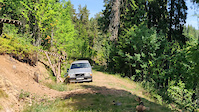
There are 37 parking locations listed in Oslo. The most popular parking spots are:
- Utfartsparkering Grefsenkollen
- Parking
- Parking
- Utfartsparkering Solemskogen
- Frognerseteren Restaurant Parking
Activities
Trails
Points of Interest
- By beerandbikes
 & contributors
 - Admins: mtbboy1993, Cykeljohan, LRGA, pnyberg
- #4451 - 26,786 views
- oslo activity log | embed map of Oslo mountain bike trails | oslo mountain biking points of interest
Downloading of trail gps tracks in kml & gpx formats is enabled for Oslo.
You must login to download files.