close
-
Layers w
- Weather Layers
- Pro
- Pro
- Pro
- Pro
- Pro
- Pro
- More Layers
- Pro
- Pro
- Pro
- Pro
-
Upgrade to

3D
Trail Conditions
- Unknown
- Snow Groomed
- Snow Packed
- Snow Covered
- Snow Cover Partial
- Freeze/thaw Cycle
- Icy
- Prevalent Mud
- Wet
- Variable
- Ideal
- Dry
- Very Dry
Trail Flow (Ridden Direction)
Trailforks scans users ridelogs to determine the most popular direction each trail is ridden. A good flowing trail network will have most trails flowing in a single direction according to their intension.
The colour categories are based on what percentage of riders are riding a trail in its intended direction.
The colour categories are based on what percentage of riders are riding a trail in its intended direction.
- > 96%
- > 90%
- > 80%
- > 70%
- > 50%
- < 50%
- bi-directional trail
- no data
Trail Last Ridden
Trailforks scans ridelogs to determine the last time a trail was ridden.
- < 2 days
- < 1 week
- < 2 weeks
- < 1 month
- < 6 months
- > 6 months
Trail Ridden Direction
The intended direction a trail should be ridden.
- Downhill Only
- Downhill Primary
- Both Directions
- Uphill Primary
- Uphill Only
- One Direction
Contribute Details
Colors indicate trail is missing specified detail.
- Description
- Photos
- Description & Photos
- Videos
Trail Popularity ?
Trailforks scans ridelogs to determine which trails are ridden the most in the last 9 months.
Trails are compared with nearby trails in the same city region with a possible 25 colour shades.
Think of this as a heatmap, more rides = more kinetic energy = warmer colors.
- most popular
- popular
- less popular
- not popular
ATV/ORV/OHV Filter
Max Vehicle Width
inches
US Cell Coverage
Legend

Radar Time
Activity Recordings
Trailforks uses anonymized public activity data.
?
Activity Recordings
Trailforks uses anonymized public activity data.
?
Personal Heatmap
▶
Activity Types
all
/
none
▶
Options
2
Date range
month
–
Winter Trails
Warning
A routing network for winter maps does not exist. Selecting trails using the winter trails layer has been disabled.
Missing Trails
Most Popular
Least Popular
Trails are colored based on popularity. The more popular a trail is, the more red. Less popular trails trend towards green.
Jump Magnitude Heatmap
Heatmap of where riders jump on trails. Zoom in to see individual jumps, click circles to view jump details.
BC Backroad Status
![map legend]()
Service Road Atlas is a free to use, community-driven service for viewing and creating reports on the numerous back-country service roads around B.C. and Alberta.

Slope Aspect
Direction the slope faces
Trails Deemphasized
Trails are shown in grey.
Only show trails with no bike usage.
Suggested Layers
Based on selected activity type
Save the current map location and zoom level as your default home location whenever this page is loaded.
Save
No description for Otocac has been added yet!
Login or register to submit one.
This region uses the Uk/Euro style trail grading system.
Activities Click to view
- E-Bike
2 trails
- Mountain Bike
8 trails
- Gravel Bike
- Adaptive Bike
- Winter Fat Bike
0 trails
- Hike
7 trails
- Trail Running
7 trails
Region Details
- 3
- 2
- 2
- 1
Region Status
Open as of Apr 7, 2026Stats
- Avg Trail Rating
- Trails (view details)
- 8
- Trails Mountain Bike
- 8
- Trails E-Bike
- 2
- Trails Hike
- 7
- Trails Trail Running
- 7
- Trails Dirtbike/Moto
- 1
- Trails ATV/ORV/OHV
- 1
- Total Distance
- 11 miles
- Total Descent
- 3,212 ft
- Total Vertical
- 3,304 ft
- Highest Trailhead
- 3,357 ft
- Reports
- 62
- Photos
- 12
- Ridden Counter
- 138
Popular Otocac Mountain Biking Trails
• ★ 4.0 • 1,860 ft • 7 ft • 58 •
Blue difficulty wilderness trail. This mountain bike primary trail can be used downhill only and has a moderate overall physical rating. On average it takes 7 minutes to complete this trail.
• 100 ★ 4.4 • 3,002 ft • 0 ft • 55 •
A well-maintained local trail for a casual ride. It has the same starting point as the old trail Vepar - hence the goofy name Nepar (understandable by Croatians). The trail has small jumps and a couple of berms. If you decide to...
• ★ 4.4 • 4,510 ft • 36 ft • 51 •
Green difficulty singletrack. This mountain bike primary trail can be used downhill primary and has a easy overall physical rating. On average it takes 8 minutes to complete this trail.
• ★ 0.0 • 1,674 ft • 30 ft • 45 •
Green difficulty singletrack. This mountain bike primary trail can be used downhill primary and has a easy overall physical rating. It features drop, jump and pump track. On average it takes 2 minutes to complete this trail.
• ★ 0.0 • 1,171 ft • 4 ft • 13 •
Blue difficulty singletrack. This mountain bike primary trail can be used downhill only and has a moderate overall physical rating. On average it takes 3 minutes to complete this trail.
Photos of Otocac Mountain Bike
Videos of Otocac Mountain Bike

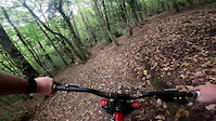
trail: Nepar
7:53 |
15 |
Jul 12, 2025
trail: Nepar
0:10 |
61 |
Oct 10, 2024
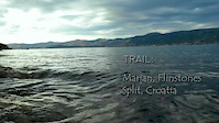
trail: Flinstones
2:19 |
1106 |
Apr 22, 2014

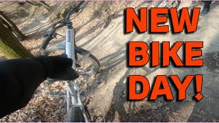
trail: Nepar
18:38 |
347 |
Jul 3, 2024 , Otocac
trail: Nepar
10:44 |
74 |
Jul 3, 2024 , Otocac
Recent Trail Reports
| status | trail | date | condition | info | user |
|---|---|---|---|---|---|
| Nepar | Apr 7, 2026 @ 4:13pm (Europe/Zagreb) Apr 7, 2026 | Dry | GrandmastaSho | ||
| Flinstones | Mar 8, 2026 @ 3:49pm (Europe/Zagreb) Mar 8, 2026 | Dry | TomaCube | ||
| Oltari - Krasno Polje | May 16, 2025 @ 8:09am May 16, 2025 | Dry | UeliOtto | ||
| Šaban trail | Sep 28, 2024 @ 11:00am Sep 28, 2024 | Wet | Kmich23 | ||
| Vatrogasni | Sep 25, 2024 @ 9:29am Sep 25, 2024 | Wet | jeffnelson19784 | ||
| Labirint | Oct 5, 2022 @ 12:53am Oct 5, 2022 | Ideal | Flow-24 | ||
| Južna | Oct 5, 2022 @ 12:53am Oct 5, 2022 | Ideal | Flow-24 | ||
| Institut | Aug 22, 2022 @ 3:18am Aug 22, 2022 | Dry | vichivano | ||
| Sedlo-Vidilica | Apr 15, 2022 @ 4:39am Apr 15, 2022 | Ideal | milanZg |
Activity Feed
| username | action | type | title | date |
|---|---|---|---|---|
| GrandmastaSho | add | report | activity #92173300 and 3 more | Apr 8, 2026 @ 3:44am Apr 8, 2026 |
| KerstinwSBVA1 | vote | trail | activity #91580957 | Mar 30, 2026 @ 5:45am Mar 30, 2026 |
| GrandmastaSho | add | report | activity #90985781 and 1 more | Mar 21, 2026 @ 7:27am Mar 21, 2026 |
| TomaCube | add | report | activity #90197401 | Mar 8, 2026 @ 7:49am Mar 8, 2026 |
| GrandmastaSho | add | report | activity #89697584 and 3 more | Feb 28, 2026 @ 8:29am Feb 28, 2026 |
Recent Comments
| username | type | title | comment | date |
|---|---|---|---|---|
| trail | Dirty Road | Aug 10, 2025 @ 9:25am Aug 10, 2025 | ||
| trail | Mega grip sinoc i preksinoc, north shore na... | Jul 12, 2025 @ 1:24pm Jul 12, 2025 | ||
| trail | Nice trail, Rocky, downhill only. Some steep... | Aug 11, 2020 @ 2:53pm Aug 11, 2020 |
Activity Type Stats
| activitytype | trails | distance | descent | descent distance | total vertical | rating | global rank | state rank | photos | reports | routes | ridelogs |
|---|---|---|---|---|---|---|---|---|---|---|---|---|
| Mountain Bike | 8 | 11 miles | 3,212 ft | 8 miles | 3,304 ft | #6,462 | #39 | 11 | 61 | 1,225 | ||
| E-Bike | 2 | 6 miles | 1,391 ft | 4 miles | 2,362 ft | #6,619 | #40 | 1 | 56 | 181 | ||
| Hike | 7 | 10 miles | 2,703 ft | 7 miles | 3,304 ft | #9,147 | #55 | 50 | 475 | |||
| Trail Running | 7 | 10 miles | 2,703 ft | 7 miles | 3,304 ft | #8,619 | #53 | 50 | ||||
| Dirtbike/Moto | 1 | 5 miles | 883 ft | 4 miles | 755 ft | 6 | ||||||
| ATV/ORV/OHV | 1 | 5 miles | 883 ft | 4 miles | 755 ft | 6 |
Frequently Asked Questions About Otocac
▼
What are the best places to ride in Otocac?
Otocac has 5 areas to explore for mountain biking.
▼
What are the highest rated mountain biking trails in Otocac?
The highest rated mountain biking trails in Otocac are:
- Institut (4.1/5)
- Nepar (4.1/5)
- Flinstones (4/5)
- Južna (0/5)
- Labirint (0/5)
▼
What is the best time of the year to ride in Otocac?
Based on ride log data, the most popular months to ride in Otocac are:
- September (1 activities)
- August (1 activities)
- March (1 activities)
▼
Where can I park to ride in Otocac?
There are 1 parking locations listed in Otocac. The most popular parking spots are:
- By chax-zg & contributors
- Admins: VjekoslavKrsanac
- #68275 - 321 views
- otocac activity log | embed map of Otocac mountain bike trails | otocac mountain biking points of interest
Downloading of trail gps tracks in kml & gpx formats is enabled for Otocac.
You must login to download files.