
close
3D
Trail Conditions
- Unknown
- Snow Groomed
- Snow Packed
- Snow Covered
- Snow Cover Partial
- Freeze/thaw Cycle
- Icy
- Prevalent Mud
- Wet
- Variable
- Ideal
- Dry
- Very Dry
Trail Flow (Ridden Direction)
Trailforks scans users activity logs to determine the most popular direction each trail is ridden. A good flowing trail network will have most trails flowing in a single direction according to their intension.
The colour categories are based on what percentage of users are riding a trail in its intended direction.
The colour categories are based on what percentage of users are riding a trail in its intended direction.
- > 96%
- > 90%
- > 80%
- > 70%
- > 50%
- < 50%
- bi-directional trail
- no data
Trail Last Used
Trailforks scans activity logs to determine the last time a trail was ridden.
- < 2 days
- < 1 week
- < 2 weeks
- < 1 month
- < 6 months
- > 6 months
Trail Ridden Direction
The intended direction a trail should be ridden.
- Downhill Only
- Downhill Primary
- Both Directions
- Uphill Primary
- Uphill Only
- One Direction
Contribute Details
Colors indicate trail is missing specified detail.
- Description
- Photos
- Description & Photos
- Videos
Trail Popularity ?
Trailforks scans activity logs to determine which trails are ridden the most in the last 9 months.
Trails are compared with nearby trails in the same city region with a possible 25 colour shades.
Think of this as a heatmap, more activities = more kinetic energy = warmer colors.
- most popular
- popular
- less popular
- not popular
ATV/ORV/OHV Filter
Max Vehicle Width
inches
US Cell Coverage
Legend

Radar Time
Activity Recordings
Trailforks uses anonymized public activity data.
?
Activity Recordings
Trailforks uses anonymized public activity data.
?
Winter Trails
Warning
A routing network for winter maps does not exist. Selecting trails using the winter trails layer has been disabled.
Missing Trails
Most Popular
Least Popular
Trails are colored based on popularity. The more popular a trail is, the more red. Less popular trails trend towards green.
Jump Magnitude Heatmap
Heatmap of where users jump on trails. Zoom in to see individual jumps, click circles to view jump details.
BC Backroad Status
![map legend]()
Service Road Atlas is a free to use, community-driven service for viewing and creating reports on the numerous back-country service roads around B.C. and Alberta.

Slope Aspect
Direction the slope faces
Trails Deemphasized
Trails are shown in grey.
Only show trails with no bike usage.
Suggested Layers
Based on selected activity type
Save the current map location and zoom level as your default home location whenever this page is loaded.
Save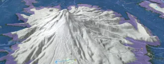
Snow & Rain 3D forecast Pro
See where it will snow, sleet or rain on Pardubický hour by hour, on 3D terrain.
View 3D snow forecast
This region is Unsanctioned, Ride at your own Risk!
Pardubický trails and routes are listed on Trailforks with interactive trail maps, difficulty ratings, photos, and user-reported trail conditions. The Trailforks community has shared hundreds of photos from this region. Supported activity types include Mountain Biking, E-Biking, Hiking, Trail Running, Gravel Biking, Adaptive Biking, Winter Fat Biking, Snowshoeing, Backcountry Skiing and Nordic Skiing. Trails here are often faint trail and flowy. Scenery includes views. Common trail features include jumps, drops and rock gardens. Many trails are family friendly. Popular destinations include Ústí nad Orlicí, Bike Resort Peklák and Singltrek Suchák.
This is an auto-generated description of Pardubický.
Login or register to submit a custom description.
AKA: Pardubice
This region uses the Uk/Euro style trail grading system.
Trail info last updated
Region Details
- 2
- 1
- 1
Winter Fat Bike Stats
- Trails (view details)
- 4
- Trails Mountain Bike
- 57
- Trails E-Bike
- 21
- Trails Gravel Bike
- 10
- Trails Adaptive Bike
- 7
- Trails Winter Fat Bike
- 4
- Trails Hike
- 16
- Trails Trail Running
- 15
- Trails Snowshoe
- 1
- Trails Backcountry Ski
- 1
- Trails Nordic Ski
- 1
- Total Distance
- 10 miles
- Total Descent Distance
- 3 miles
- Total Descent
- 915 ft
- Total Vertical
- 2,572 ft
- Reports
- 21
Articles

Video: Czechia’s Dolní Morava Bikepark Debuts Unreal New Black Jump Line in 'FACTION'
Sep 17, 2025 from pinkbike.com
So much metal. So good. Jakub Vencl, Sebastian Podgórski, and crew showcase the Czech park’s biggest line yet.

Video: Elbow to Elbow Downhill Racing at the Czech Republic's Dropdown Mass Start Race
Jun 24, 2020 from pinkbike.com
Mass start racing in the Czech Republic to shake off the lockdown blues.
Sub Regions
- Chrudim (1)
- Ústí nad Orlicí (3)
Popular Pardubický Winter Fat Biking Trails
• 5 ★ 4.4 • 2 miles • 41 ft •
Less popular blue difficulty singletrack. This mountain bike primary trail can be used downhill only and has a moderate overall physical rating. Trail visibility is sometimes hard to follow. On average it takes 39 minutes to complete this trail.
• 100 ★ 0.0 • 4,984 ft • 41 ft • 7 •
Popular green difficulty family friendly singletrack. This mountain bike primary trail can be used one direction and has a easy overall physical rating with a 41 ft green climb. It features pump track. Trail visibility is always easy to follow. On average it takes 8 minutes to complete this trail.
Photos of Pardubický
Videos of Pardubický


Recent Trail Reports
| status | trail | date | condition | info | user |
|---|---|---|---|---|---|
| Smolkáč Trail Park Dolní Morava | Jun 10, 2023 @ 10:01am Jun 10, 2023 | Ideal | MichalxzDMLh | ||
| Stamichmanova stezka Trail Park Dolní Morava | Jul 18, 2021 @ 11:39pm Jul 18, 2021 | Ideal | Mondekkarel |
Recent Comments
| username | type | title | comment | date |
|---|---|---|---|---|
| trail | *skokem | Mar 12, 2025 @ 9:42am Mar 12, 2025 | ||
| trail | Neprůjezdné, nahoře kácí. Pod posledním... | Mar 12, 2025 @ 9:42am Mar 12, 2025 | ||
| trail | Sníh, v horní části od asfaltky těžba.... | Dec 23, 2023 @ 6:28am Dec 23, 2023 | ||
| trail | Super, diky, že se o to staráte. | Jun 18, 2023 @ 12:57pm Jun 18, 2023 | ||
| trail | Good uphill with nice panoramas | Aug 19, 2022 @ 8:04am Aug 19, 2022 |
Activity Type Stats
| activitytype | trails | distance | descent | descent distance | total vertical | rating | global rank | state rank | photos | reports | routes | activity logs |
|---|---|---|---|---|---|---|---|---|---|---|---|---|
| Mountain Bike | 57 | 81 miles | 17,602 ft | 44 miles | 2,940 ft | 126 | 400 | 16,317 | ||||
| E-Bike | 21 | 33 miles | 5,161 ft | 12 miles | 2,818 ft | 347 | 614 | |||||
| Gravel Bike | 10 | 33 miles | 2,320 ft | 10 miles | 2,635 ft | 14 | 70 | |||||
| Adaptive Bike | 7 | 25 miles | 1,129 ft | 6 miles | 2,818 ft | 10 | ||||||
| Winter Fat Bike | 4 | 10 miles | 915 ft | 3 miles | 2,572 ft | 21 | ||||||
| Hike | 16 | 36 miles | 2,726 ft | 12 miles | 2,940 ft | 339 | 517 | |||||
| Trail Running | 15 | 35 miles | 2,726 ft | 12 miles | 2,940 ft | 339 | 59 | |||||
| Snowshoe | 1 | 1 mile | 1,010 ft | 8 | ||||||||
| Backcountry Ski | 1 | 1 mile | 1,010 ft | 8 | 61 | |||||||
| Nordic Ski | 1 | 1 mile | 1,010 ft | 8 | 145 |
Activities
Trails
- By brenthillier
 NSMBA TRAILFORKS & contributors
- Admins: ČeMBA, ČeMBA, ČeMBA, ČeMBA, ČeMBA, ČeMBA, ČeMBA, ČeMBA, ČeMBA, ČeMBA
- #9750 - 5,068 views
- pardubický activity log | embed map of Pardubický mountain bike trails | pardubický mountain biking points of interest
Downloading of trail gps tracks in kml & gpx formats is enabled for Pardubický.
You must login to download files.
