
close
3D
Trail Conditions
- Unknown
- Snow Groomed
- Snow Packed
- Snow Covered
- Snow Cover Partial
- Freeze/thaw Cycle
- Icy
- Prevalent Mud
- Wet
- Variable
- Ideal
- Dry
- Very Dry
Trail Flow (Ridden Direction)
Trailforks scans users activity logs to determine the most popular direction each trail is ridden. A good flowing trail network will have most trails flowing in a single direction according to their intension.
The colour categories are based on what percentage of users are riding a trail in its intended direction.
The colour categories are based on what percentage of users are riding a trail in its intended direction.
- > 96%
- > 90%
- > 80%
- > 70%
- > 50%
- < 50%
- bi-directional trail
- no data
Trail Last Used
Trailforks scans activity logs to determine the last time a trail was ridden.
- < 2 days
- < 1 week
- < 2 weeks
- < 1 month
- < 6 months
- > 6 months
Trail Ridden Direction
The intended direction a trail should be ridden.
- Downhill Only
- Downhill Primary
- Both Directions
- Uphill Primary
- Uphill Only
- One Direction
Contribute Details
Colors indicate trail is missing specified detail.
- Description
- Photos
- Description & Photos
- Videos
Trail Popularity ?
Trailforks scans activity logs to determine which trails are ridden the most in the last 9 months.
Trails are compared with nearby trails in the same city region with a possible 25 colour shades.
Think of this as a heatmap, more activities = more kinetic energy = warmer colors.
- most popular
- popular
- less popular
- not popular
ATV/ORV/OHV Filter
Max Vehicle Width
inches
US Cell Coverage
Legend

Radar Time
Activity Recordings
Trailforks uses anonymized public activity data.
?
Activity Recordings
Trailforks uses anonymized public activity data.
?
Winter Trails
Warning
A routing network for winter maps does not exist. Selecting trails using the winter trails layer has been disabled.
Missing Trails
Most Popular
Least Popular
Trails are colored based on popularity. The more popular a trail is, the more red. Less popular trails trend towards green.
Jump Magnitude Heatmap
Heatmap of where users jump on trails. Zoom in to see individual jumps, click circles to view jump details.
BC Backroad Status
![map legend]()
Service Road Atlas is a free to use, community-driven service for viewing and creating reports on the numerous back-country service roads around B.C. and Alberta.

Slope Aspect
Direction the slope faces
Trails Deemphasized
Trails are shown in grey.
Only show trails with no bike usage.
Suggested Layers
Based on selected activity type
Save the current map location and zoom level as your default home location whenever this page is loaded.
Save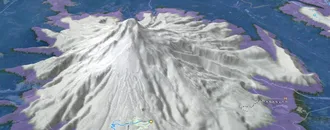
Snow & Rain 3D forecast Pro
See where it will snow, sleet or rain on Phillipsburg hour by hour, on 3D terrain.
View 3D snow forecast
Phillipsburg trails and routes are listed on Trailforks with interactive trail maps, difficulty ratings, photos, and user-reported trail conditions. The Trailforks community has mapped hundreds of trails in this region. Supported activity types include Skiing, Mountain Biking, Hiking, Trail Running, Nordic Skiing, Gravel Biking, E-Biking, Dirtbiking, ATVing/Offroading, Winter Fat Biking, Horseback and Adaptive Biking. Trails here are often faint trail and flowy. Scenery includes lakes, views and ridgelines. Common trail features include berms, jumps and drops. Amenities include water sources. Popular destinations include Discovery Ski Area, Echo Lake and Discovery Bike Park.
This is an auto-generated description of Phillipsburg.
Login or register to submit a custom description.
Trail info last updated
Activities Click to view
- Mountain Bike
57 trails
- E-Bike
16 trails
- Gravel Bike
17 trails
- Adaptive Bike
6 trails
- Winter Fat Bike
8 trails
- Horse
7 trails
- Hike
50 trails
- Trail Running
50 trails
- Dirtbike/Moto
16 trails
- ATV/ORV/OHV
14 trails
- Downhill Ski
66 trails
- Nordic Ski
27 trails
Region Details
- 14
- 12
- 15
- 14
- 2
Region Status
Open as of Aug 12, 2026

Stats
- Avg Trail Rating
- Trails (view details)
- 160
- Trails Mountain Bike
- 57
- Trails E-Bike
- 16
- Trails Gravel Bike
- 17
- Trails Adaptive Bike
- 6
- Trails Winter Fat Bike
- 8
- Trails Horse
- 7
- Trails Hike
- 50
- Trails Trail Running
- 50
- Trails Dirtbike/Moto
- 16
- Trails ATV/ORV/OHV
- 14
- Trails Snowmobile
- 3
- Trails Downhill Ski
- 66
- Trails Backcountry Ski
- 18
- Trails Nordic Ski
- 27
- Total Distance
- 210 miles
- Total Descent
- 59,983 ft
- Total Vertical
- 5,388 ft
- Highest Trailhead
- 10,034 ft
- Reports
- 116
- Photos
- 38
- Completed Counter
- 7,517
Sub Regions
-
Discovery Bike Park
- 3
- 7
- 3
- 1
-
Echo Lake
- 7
- 2
- 2
-
Flint Creek Range - Philipsburg
- 8
- 1
Popular Phillipsburg Mountain Biking Trails
• 85 ★ 4.1 • 3,327 ft • 3 ft • 312 •
Starts as single track then transforms into a mellow, fun flow line with just enough berms to keep the rhythm going.
• 80 ★ 4.7 • 758 ft • 0 ft • 305 •
Rock rolls, arched wood bridge, double wood road gaps...Bring out the big guns!
• 75 ★ 4.7 • 3,301 ft • 3 ft • 301 •
A progression line with berms, rollers, optional wood features and optional jumps. Always a good ride!
• 90 ★ 4.2 • 2,966 ft • 4 ft • 296 •
Great for novice and advanced riders alike as an introduction to flow style riding. Big smiles everytime!
• 65 ★ 4.4 • 3,337 ft • 0 ft • 261 •
Advanced jump line with berm-lip-step-downs, tables, kickers and a huge dirt wall ride. Get ready for some airtime!
• 50 ★ 4.8 • 1,939 ft • 0 ft • 172 •
Moderately popular black diamond difficulty machine groomed. This mountain bike primary trail can be used downhill only. It features berm, jump, gap jump and ladder bridge. On average it takes 2 minutes to complete this trail.
• 30 ★ 4.5 • 4,091 ft • 0 ft • 159 •
New for 2019- Spicy Brown is an old-school, hold onto the brakes and drift, fall-line trail.
Phillipsburg Mountain Bike Routes
48 miles • 5,352 ft • 0 • Shuttled • Race •
The Philipsburg 46 is back in 2017. Last year's fan favorite stop on the Western Montana Trail Series...
• 17 miles • 9,215 ft • 32 •
• 15 miles • 5,283 ft • 26 •
• 17 miles • 7,999 ft • 34 •
• 10 miles • 3,875 ft • 17 •
• 12 miles • 4,120 ft • 14 •
Photos of Phillipsburg Mountain Bike
Videos of Phillipsburg Mountain Bike



Recent Trail Reports
| status | trail | date | condition | info | user |
|---|---|---|---|---|---|
| Gold Coin Rd. #1501 | Aug 12, 2026 @ 10:22am (America/Denver) Aug 12, 2026 | Unknown | hcwaC26t | ||
| Jack Pine | Jul 21, 2026 @ 11:12am (America/Boise) Jul 21, 2026 | Unknown | Pcsdpolsen | ||
| Echo Lake | Jul 21, 2026 @ 11:12am (America/Boise) Jul 21, 2026 | Wet | Pcsdpolsen | ||
| Flossie's Flurry | Jul 21, 2026 @ 11:12am (America/Boise) Jul 21, 2026 | Ideal | Pcsdpolsen | ||
| Discovery Basin Rd | Jul 21, 2026 @ 11:12am (America/Boise) Jul 21, 2026 | Unknown | Pcsdpolsen | ||
| Pintler Vista | Jul 21, 2026 @ 11:12am (America/Boise) Jul 21, 2026 | Ideal | Pcsdpolsen | ||
| Fun K | Jul 21, 2026 @ 11:12am (America/Boise) Jul 21, 2026 | Ideal | Pcsdpolsen | ||
| Cable Run | Jul 4, 2026 @ 11:22am (America/Boise) Jul 4, 2026 | Dry | Pcsdpolsen | ||
| Midway | Jul 4, 2026 @ 11:22am (America/Boise) Jul 4, 2026 | Ideal | Pcsdpolsen | ||
| Queen Jane | Jul 5, 2025 @ 1:04pm Jul 5, 2025 | Ideal | RockyMTrider MBG |
Activity Feed
| username | action | type | title | date |
|---|---|---|---|---|
| ZackaryJ | ridden | trail | activity #106227556 | Oct 19, 2026 @ 2:47pm Oct 19, 2026 |
| ZackaryJ | vote | trail | activity #106227504 and 5 more | Oct 19, 2026 @ 2:46pm Oct 19, 2026 |
| ZackaryJ | ridden | trail | activity #106173244 and 4 more | Oct 18, 2026 @ 3:21pm Oct 18, 2026 |
| TheHudson | difficultyvote | trail | activity #103285256 | Sep 7, 2026 @ 12:11pm Sep 7, 2026 |
| Hamdam | wishlist | region | activity #103084030 | Sep 5, 2026 @ 5:39am Sep 5, 2026 |
Recent Comments
| username | type | title | comment | date |
|---|---|---|---|---|
| trail | Mostly two track with a small section of... | Jul 25, 2026 @ 2:12pm Jul 25, 2026 | ||
| trail | Easy ride through tall grass but can be very... | Jul 25, 2026 @ 2:08pm Jul 25, 2026 | ||
| trail | This trail is single track, unlike most in... | Jul 25, 2026 @ 2:05pm Jul 25, 2026 | ||
| trail | Gnarly 4x4 road. It was slowing going for me... | Jul 7, 2026 @ 9:02am Jul 7, 2026 | ||
| trail | Cool trail if you can find it lol. Exit at... | Aug 20, 2024 @ 7:14pm Aug 20, 2024 |
Local Badges
-

Epic Ride Climb 2k117 awarded -

Climbing 10k Badge14 awarded -

Climbing 100k Badge0 awarded -

Epic Ride Descent 2k233 awarded -

Descent 10k Badge23 awarded -

Descent 100k Badge0 awarded
Bike & Skill Parks
| name | type | city | rating |
|---|---|---|---|
| Discovery Bike Park | bike park | Phillipsburg |

Activity Type Stats
| activitytype | trails | distance | descent | descent distance | total vertical | rating | global rank | state rank | photos | reports | routes | activity logs |
|---|---|---|---|---|---|---|---|---|---|---|---|---|
| Mountain Bike | 57 | 141 miles | 20,827 ft | 54 miles | 3,675 ft | #1,646 | #19 | 36 | 114 | 2 | 2,299 | |
| E-Bike | 16 | 89 miles | 9,150 ft | 30 miles | 3,287 ft | #2,498 | #22 | 90 | 37 | |||
| Gravel Bike | 17 | 73 miles | 6,942 ft | 22 miles | 3,465 ft | #1,364 | #22 | 9 | 9 | |||
| Adaptive Bike | 6 | 40 miles | 2,989 ft | 9 miles | 3,143 ft | #2,021 | #17 | 9 | ||||
| Winter Fat Bike | 8 | 56 miles | 5,728 ft | 18 miles | 3,143 ft | #1,124 | #25 | 16 | ||||
| Horse | 7 | 24 miles | 1,762 ft | 6 miles | 2,224 ft | #1,734 | #52 | 14 | 1 | |||
| Hike | 50 | 148 miles | 18,163 ft | 50 miles | 5,387 ft | #1,847 | #37 | 2 | 114 | 248 | ||
| Trail Running | 50 | 148 miles | 18,163 ft | 50 miles | 5,387 ft | #1,416 | #29 | 114 | 19 | |||
| Dirtbike/Moto | 16 | 89 miles | 9,150 ft | 30 miles | 3,287 ft | #559 | #20 | 14 | 4 | |||
| ATV/ORV/OHV | 14 | 75 miles | 6,522 ft | 23 miles | 3,287 ft | #421 | #15 | 14 | 1 | |||
| Snowmobile | 3 | 13 miles | 735 ft | 3 miles | 1,565 ft | 4 | 3 | |||||
| Downhill Ski | 66 | 30 miles | 32,769 ft | 28 miles | 2,438 ft | #122 | #3 | 2 | 931 | |||
| Backcountry Ski | 18 | 4 miles | 7,244 ft | 4 miles | 1,001 ft | 2 | 94 | |||||
| Nordic Ski | 27 | 24 miles | 2,618 ft | 11 miles | 699 ft | #609 | #17 | 2 | 359 |
Frequently Asked Questions
▼
What are the best places to ride in Phillipsburg?
Phillipsburg has 4 areas to explore for mountain biking. The top rated areas are:
▼
What are the highest rated mountain biking trails in Phillipsburg?
The highest rated mountain biking trails in Phillipsburg are:
- S-Line (4.5/5)
- Upper Bandolero (4.4/5)
- Roller Girl (4.4/5)
- Ender Sender (4.2/5)
- Bandolero (4.2/5)
▼
Where can I park to ride in Phillipsburg?
There are 12 parking locations listed in Phillipsburg. The most popular parking spots are: View all parking and trailhead locations on the map to plan your visit.
▼
What is the longest trail in Phillipsburg?
The longest trail in Phillipsburg is Black Pine Ridge at 13.0 miles. View all trails sorted by distance.
▼
What are the best & highest rated hiking trails in Phillipsburg?
The best hiking trails in Phillipsburg are: View all hiking trails sorted by popularity score.
▼
What are the best & highest rated trail running trails in Phillipsburg?
The best trail running trails in Phillipsburg are: View all trail running trails sorted by popularity score.
▼
What are the best & highest rated dirtbiking trails in Phillipsburg?
The best dirtbiking trails in Phillipsburg are: View all dirtbiking trails sorted by popularity score.
▼
How many trails are in Phillipsburg?
Phillipsburg has a total of 160 trails. Of those, 57 are designated for mountain biking. Browse top mountain biking trails in Phillipsburg to find detailed information including difficulty ratings, distances, and trail conditions.
▼
Which trail has the most elevation gain in Phillipsburg?
The trail with the most elevation gain in Phillipsburg is Black Pine Ridge with 1,823 ft of elevation gain. View all trails sorted by elevation gain.
▼
Which trail has the most elevation descent in Phillipsburg?
The trail with the most elevation descent in Phillipsburg is Black Pine Ridge with 2,616 ft of elevation descent. View all trails sorted by elevation descent.
▼
What activities are most popular in Phillipsburg?
Phillipsburg supports the following activities: Mountain Biking, E-Biking, Gravel Biking, Adaptive Biking, Winter Fat Biking, Horseback, Hiking, Trail Running, Dirtbiking, ATVing/Offroading, Skiing, Nordic Skiing.
▼
What bike services are there in Phillipsburg?
The following bike services are available in Phillipsburg:
- Trail Association (2)
▼
What are the steepest mountain biking trails in Phillipsburg?
The steepest mountain biking trail in Phillipsburg is Huff Puff with an average grade of 15.7%. View all trails sorted by grade.
▼
Are there any trails with scenic viewpoints in Phillipsburg?
Yes, there are 3 scenic viewpoints marked along trails in Phillipsburg. Some popular viewpoints include: Explore more points of interest to find trails with the best views.
▼
Are the trails open in Phillipsburg?
The overall region status for Phillipsburg is Clear / Green. Out of 39 trails:
- Clear / Green: 36
- Minor Issue / Yellow: 2
- Significant Issue / Amber: 1
▼
Can I ride an ebike in Phillipsburg?
Yes, Phillipsburg supports e-bike riding. There are 11 trails in Phillipsburg that allow e-bikes. Check the e-bike trails listing for specific trail access details and any local regulations.
▼
What is the highest summit in Phillipsburg?
The highest summit in Phillipsburg is Twin Peaks at 9,039 ft elevation.
▼
What are the top sights to see in Phillipsburg?
There are 2 notable sights in Phillipsburg. Some of the top sights include: Explore all points of interest in Phillipsburg.
▼
What are the most popular Strava Segments in Phillipsburg?
The most popular Strava segments in Phillipsburg are:
- S line first drop down (839 athletes)
- Queen Jane (826 athletes)
- Roller Girl 2023 (705 athletes)
▼
What are some popular technical trail features in Phillipsburg?
There are 2 technical trail features (TTFs) in Phillipsburg. Some popular features include: View all technical trail features in Phillipsburg.
▼
Are there accessible or adaptive trails in Phillipsburg?
Yes, there are 6 accessible/adaptive trails in Phillipsburg. View all adaptive trails in Phillipsburg for specific accessibility information.
▼
Are there local clubs or events in Phillipsburg?
There are 2 local clubs or associations listed in the Phillipsburg directory. Browse the local directory for details.
▼
What are the most popular mountain biking trails in Phillipsburg?
The most popular mountain biking trails in Phillipsburg are: View all mountain biking trails sorted by popularity.
▼
What are the best beginner ride trails in Phillipsburg?
The best beginner mountain biking trails in Phillipsburg are:
- Echo Lake (5/5)
- Queen Jane (4.2/5)
- Disco Cutoff (0/5)
Activities
- Phillipsburg Mountain Biking Trails
- Phillipsburg E-Biking Trails
- Phillipsburg Gravel Biking Trails
- Phillipsburg Adaptive Biking Trails
- Phillipsburg Winter Fat Biking Trails
- Phillipsburg Horseback Trails
- Phillipsburg Hiking Trails
- Phillipsburg Trail Running Trails
- Phillipsburg Dirtbiking Trails
- Phillipsburg ATVing/Offroading Trails
- Phillipsburg Skiing Trails
- Phillipsburg Nordic Skiing Trails
Trails
Points of Interest
- Ticket Sales Information
- Drop TTF
- Drop TTF
- Granite Ghost Town Sight
- Granite Ghost Town Sight
- Cable Mountain Campground Camping
- Little Racetrack Lake Viewpoint
- Racetrack Lake Viewpoint
- Racetrack Lake Viewpoint
- Beaverhead Mountain Summit
- Twin Peaks (9,039 ft)
- Red Lion Mountain (8,734 ft)
- Quigg Peak (8,330 ft)
- By chuktA
 TRAILFORKS NFTA NBBC & contributors
- Admins: HCC
- #6523 - 8,211 views
- phillipsburg activity log | embed map of Phillipsburg mountain bike trails | phillipsburg mountain biking points of interest
Downloading of trail gps tracks in kml & gpx formats is enabled for Phillipsburg.
You must login to download files.
