
close
3D
Trail Conditions
- Unknown
- Snow Groomed
- Snow Packed
- Snow Covered
- Snow Cover Partial
- Freeze/thaw Cycle
- Icy
- Prevalent Mud
- Wet
- Variable
- Ideal
- Dry
- Very Dry
Trail Flow (Ridden Direction)
Trailforks scans users activity logs to determine the most popular direction each trail is ridden. A good flowing trail network will have most trails flowing in a single direction according to their intension.
The colour categories are based on what percentage of users are riding a trail in its intended direction.
The colour categories are based on what percentage of users are riding a trail in its intended direction.
- > 96%
- > 90%
- > 80%
- > 70%
- > 50%
- < 50%
- bi-directional trail
- no data
Trail Last Used
Trailforks scans activity logs to determine the last time a trail was ridden.
- < 2 days
- < 1 week
- < 2 weeks
- < 1 month
- < 6 months
- > 6 months
Trail Ridden Direction
The intended direction a trail should be ridden.
- Downhill Only
- Downhill Primary
- Both Directions
- Uphill Primary
- Uphill Only
- One Direction
Contribute Details
Colors indicate trail is missing specified detail.
- Description
- Photos
- Description & Photos
- Videos
Trail Popularity ?
Trailforks scans activity logs to determine which trails are ridden the most in the last 9 months.
Trails are compared with nearby trails in the same city region with a possible 25 colour shades.
Think of this as a heatmap, more activities = more kinetic energy = warmer colors.
- most popular
- popular
- less popular
- not popular
ATV/ORV/OHV Filter
Max Vehicle Width
inches
US Cell Coverage
Legend

Radar Time
Activity Recordings
Trailforks uses anonymized public activity data.
?
Activity Recordings
Trailforks uses anonymized public activity data.
?
Winter Trails
Warning
A routing network for winter maps does not exist. Selecting trails using the winter trails layer has been disabled.
Missing Trails
Most Popular
Least Popular
Trails are colored based on popularity. The more popular a trail is, the more red. Less popular trails trend towards green.
Jump Magnitude Heatmap
Heatmap of where users jump on trails. Zoom in to see individual jumps, click circles to view jump details.
BC Backroad Status
![map legend]()
Service Road Atlas is a free to use, community-driven service for viewing and creating reports on the numerous back-country service roads around B.C. and Alberta.

Slope Aspect
Direction the slope faces
Trails Deemphasized
Trails are shown in grey.
Only show trails with no bike usage.
Suggested Layers
Based on selected activity type
Save the current map location and zoom level as your default home location whenever this page is loaded.
SaveThis region is Unsanctioned, Ride at your own Risk!
Pine Hills is an unsanctioned riding area so please ride at your own risk.
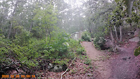
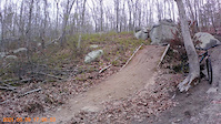
The Pine Hills in Plymouth offers a different experience from most of the riding south of Boston and on Cape Cod. The trails, which are mostly singletracks, claw their way through the woods dodging large rocks as they make their way up and down a series of short hills bisected by Route 3A.
Parking is at the Cleft Rock Parking lot located almost directly across the street from Serious Cycles. I'll divide this report into two parts as the trails on either side of the road differ greatly.
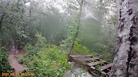
North of 3A the trails are commonly referred to as the 'Nuclear Trails'. That's because they are located behind the Pilgrim Nuclear Power Plant. The trails are on power plant property and exist as a public service of the power plant. Some of these trails are quite difficult. Occasionally you'll encounter structures that will add to your riding experience. While the trails are enjoyable they rarely meet the 'buffed singletrack' description so common in Plymouth and on the Cape. After a couple of rides, you'll learn which direction of travel is the most fun. North of Route 3A you can expect to find about 12 miles of trails.
South of 3A, the trails are more difficult. Branching off from fire roads, you find an extensive network of dirtbike trails. These singletracks seemingly go up and down every short hill in the woods. Occasionally they are too sandy or steep to ride, necessitating a few very short walks, but for the most part, they are negotiable. Most riders will follow these trails in a westerly direction. That is to stay descending, mostly, until they encounter Beaver Dam or Old Sandwich Road from where they will choose to ride back to the top on pavement or one of the fire roads.
The Pine Hills in Plymouth offers a different experience from most of the riding south of Boston and on Cape Cod. The trails, which are mostly singletracks, claw their way through the woods dodging large rocks as they make their way up and down a series of short hills bisected by Route 3A.
Parking is at the Cleft Rock Parking lot located almost directly across the street from Serious Cycles. I'll divide this report into two parts as the trails on either side of the road differ greatly.
North of 3A the trails are commonly referred to as the 'Nuclear Trails'. That's because they are located behind the Pilgrim Nuclear Power Plant. The trails are on power plant property and exist as a public service of the power plant. Some of these trails are quite difficult. Occasionally you'll encounter structures that will add to your riding experience. While the trails are enjoyable they rarely meet the 'buffed singletrack' description so common in Plymouth and on the Cape. After a couple of rides, you'll learn which direction of travel is the most fun. North of Route 3A you can expect to find about 12 miles of trails.
South of 3A, the trails are more difficult. Branching off from fire roads, you find an extensive network of dirtbike trails. These singletracks seemingly go up and down every short hill in the woods. Occasionally they are too sandy or steep to ride, necessitating a few very short walks, but for the most part, they are negotiable. Most riders will follow these trails in a westerly direction. That is to stay descending, mostly, until they encounter Beaver Dam or Old Sandwich Road from where they will choose to ride back to the top on pavement or one of the fire roads.
source: Bike Barn Racing
Primary Trail Type: All-Mountain & Downhill
eBikes Allowed:
No
Shuttleable: YES
AKA: Nuclear Trails
Land Status: Private Property
Land Manager: Holtec
 google parking directions plan a road trip here
 Access Info:
The main parking lot for Pine Hills is right across from Serious Cycles off of State Rd in Plymouth. You can also look up Pine Hills MTB on google maps to help you find the parking lot.
For easier access to the southern side of Pine Hills, you can park near the powerlines off of "Long Ridge Road".
There are three smaller parking areas off of State Road.
For easier access to the southern side of Pine Hills, you can park near the powerlines off of "Long Ridge Road".
There are three smaller parking areas off of State Road.
Disclaimer:
This riding area is UNSANCTIONED so ride at your own risk.
Trail info last updated
Region Supporters & Maintainers
- Maintained and built by the hard working locals that ride here
trail builderBuilder
Activities Click to view
- Mountain Bike
177 trails
- Horse
6 trails
- Hike
164 trails
- Trail Running
164 trails
- Dirtbike/Moto
73 trails
- Snowshoe
164 trails
Region Details
- 51
- 51
- 40
- 27
- 8
Region Status
Open as of Sep 15, 2026Stats
- Avg Trail Rating
- Trails (view details)
- 177
- Trails Mountain Bike
- 177
- Trails Gravel Bike
- 60
- Trails Winter Fat Bike
- 120
- Trails Horse
- 6
- Trails Hike
- 164
- Trails Trail Running
- 164
- Trails Dirtbike/Moto
- 73
- Trails Snowshoe
- 164
- Total Distance
- 74 miles
- Total Descent Distance
- 33 miles
- Total Descent
- 11,340 ft
- Total Vertical
- 364 ft
- Highest Trailhead
- 392 ft
- Reports
- 590
- Photos
- 234
- Completed Counter
- 36,829
Popular Pine Hills Mountain Biking Trails
• 100 ★ 4.3 • 1,306 ft • 6 ft • 858 •
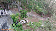
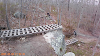
A newer feature trail located right off the parking lot. Packed with different moves including skinnies, ladders, rock rolls, and a teeter. All features are optional and many of the skinnies are low consequence. Scope all features...
• 100 ★ 3.5 • 1,558 ft • 9 ft • 839 •
Popular green difficulty singletrack. This multi-use trail can be used both directions and has a easy overall physical rating with a 9 ft green climb. Trail visibility is always easy to follow. On average it takes 2 minutes to complete this trail.
• 95 ★ 3.9 • 4,370 ft • 3 ft • 795 •
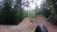
One of the main descents on the power plant side of the network. Recent trail work has added a number of berms, bridge work and a large gap jump to start. Most of the features are built out of non pressure-treated wood. Check features...
• 100 ★ 4.0 • 853 ft • 8 ft • 761 •
Popular green difficulty family friendly singletrack. This multi-use trail can be used both directions and has a easy overall physical rating with a 8 ft green climb. Trail visibility is always easy to follow. On average it takes 1 minutes to complete this trail.
• 100 ★ 4.3 • 630 ft • 0 ft • 743 •
Popular blue difficulty singletrack. This mountain bike primary trail can be used downhill only and has a moderate overall physical rating. It features berm, jump and gap jump. Trail visibility is always easy to follow. On average it takes 1 minutes to complete this trail.
• 100 ★ 2.0 • 663 ft • 52 ft • 741 •
Popular green difficulty singletrack. This multi-use trail can be used uphill only and has a easy overall physical rating with a 52 ft green climb. Trail visibility is always easy to follow. On average it takes 1 minutes to complete this trail.
• 100 ★ 4.0 • 577 ft • 0 ft • 734 •
Popular blue difficulty singletrack. This mountain bike primary trail can be used downhill only and has a moderate overall physical rating. It features berm, jump and gap jump. Trail visibility is always easy to follow. On average it takes 1 minutes to complete this trail.
• 100 ★ 4.5 • 2,684 ft • 126 ft • 731 •
This trail is the more mellow of the two descents from the Cleft Rock parking lot but still can be fun if you maintain your speed. A few rock lines have been added off to the sides of the trail recently to add some variety. Trail...
Pine Hills Mountain Bike Routes
★ 5.0 • 4,636 ft • 229 ft • 2 • Shuttled •
This is the fastest and most direct way we have found to shuttle the 'One Up' DH trail in PineHills. This...
★ 4.0 • 7 miles • 538 ft • 12 •
Similar to Nuclear Blues, but avoids the very steep climbing at the end and adds in the excellent black...
1 mile • 226 ft • 1 • Shuttled •
This is the fastest way to shuttle one of the best DH flow trails in MA. Special thanks to all the builders.
7 miles • 563 ft • 13 •
Don't let the blue trails fool you! This is a challenging route that only avoids the most difficult riding...
2 miles • 286 ft • 2 • Shuttled •
Shuttle 'The Good Part' a handbuilt flowey trail with mellow jumps and berms. One of the longest and only...
Photos of Pine Hills Mountain Bike
Videos of Pine Hills Mountain Bike
Recent Trail Reports
Activity Feed
| username | action | type | title | date |
|---|---|---|---|---|
| Jpitman | add | report | activity #103499538 | Sep 10, 2026 @ 2:10pm Sep 10, 2026 |
| Chris7xbUUJ | ridden | trail | activity #103341401 | Sep 8, 2026 @ 7:34am Sep 8, 2026 |
| capecolin | comment | report | activity #102966379 | Sep 3, 2026 @ 9:50am Sep 3, 2026 |
| capecolin | add | trail | activity #102966236 | Sep 3, 2026 @ 9:47am Sep 3, 2026 |
| mcsmtb | add | report | activity #102922059 and 4 more | Sep 2, 2026 @ 3:19pm Sep 2, 2026 |
Recent Comments
| username | type | title | comment | date |
|---|---|---|---|---|
| report | Updated, thank you | Sep 3, 2026 @ 9:50am Sep 3, 2026 | ||
| trail | it's e-mtb not e-dirtbikes | Jun 20, 2026 @ 11:18am Jun 20, 2026 | ||
| trail | This is a fun descent too! | Jun 17, 2026 @ 3:43am Jun 17, 2026 | ||
| trail | This trail has recently as last fall was... | May 8, 2026 @ 6:06pm May 8, 2026 | ||
| trail | In rough shape, very hard to follow trail with... | Apr 24, 2026 @ 4:35am Apr 24, 2026 |
Nearby Areas
| name | distance | ||||
|---|---|---|---|---|---|
| Tidmarsh Wildlife Sanctuary | 3 | 1 | 1.6 km | ||
| Beaver Dam Conservation Area | 4 | 2 | 2 | 2.4 km | |
| Russell Mill Pond Trail System | 9 | 7 | 3 km | ||
| Plymouth Town Forest | 7 | 2 | 4 km | ||
| Plymouth Pine Hill Wildlife Conservation Easement | 2 | 6 | 3 | 4.1 km |
Local Badges
-

Completionist1 awarded
Activity Type Stats
| activitytype | trails | distance | descent | descent distance | total vertical | rating | global rank | state rank | photos | reports | routes | activity logs |
|---|---|---|---|---|---|---|---|---|---|---|---|---|
| Mountain Bike | 177 | 74 miles | 11,339 ft | 33 miles | 364 ft | #420 | #12 | 233 | 590 | 7 | 10,446 | |
| Gravel Bike | 61 | 32 miles | 2,789 ft | 11 miles | 364 ft | #285 | #127 | 10 | 14 | |||
| Winter Fat Bike | 121 | 54 miles | 7,382 ft | 23 miles | 364 ft | #285 | #127 | 17 | ||||
| Horse | 6 | 3 miles | 269 ft | 1 mile | 213 ft | #2,552 | #40 | 15 | ||||
| Hike | 164 | 71 miles | 10,640 ft | 31 miles | 364 ft | #2,451 | #18 | 559 | 331 | |||
| Trail Running | 164 | 71 miles | 10,640 ft | 31 miles | 364 ft | #1,767 | #12 | 1 | 559 | 124 | ||
| Dirtbike/Moto | 73 | 41 miles | 5,840 ft | 17 miles | 364 ft | #466 | #3 | 50 | 14 | |||
| Snowshoe | 164 | 71 miles | 10,640 ft | 31 miles | 364 ft | #74 | #4 | 125 | 2 |
Frequently Asked Questions
▼
What are the highest rated mountain biking trails in Pine Hills?
The highest rated mountain biking trails in Pine Hills are:
- The Good Part (4.6/5)
- Man Eater (4.3/5)
- Tug of War (4.3/5)
- Pine Barrens (4.2/5)
- Scorcher (4.2/5)
▼
Where can I park to ride in Pine Hills?
There are 5 parking locations listed in Pine Hills. The most popular parking spots are: View all parking and trailhead locations on the map to plan your visit.
▼
What is the longest trail in Pine Hills?
The longest trail in Pine Hills is Plimoth Backcountry Trail at 1.9 miles. View all trails sorted by distance.
▼
What are the best & highest rated hiking trails in Pine Hills?
The best hiking trails in Pine Hills are: View all hiking trails sorted by popularity score.
▼
What are the best & highest rated trail running trails in Pine Hills?
The best trail running trails in Pine Hills are: View all trail running trails sorted by popularity score.
▼
What are the best & highest rated dirtbiking trails in Pine Hills?
The best dirtbiking trails in Pine Hills are: View all dirtbiking trails sorted by popularity score.
▼
How many trails are in Pine Hills?
Pine Hills has a total of 177 trails. Browse top mountain biking trails in Pine Hills to find detailed information including difficulty ratings, distances, and trail conditions.
▼
Which trail has the most elevation gain in Pine Hills?
The trail with the most elevation gain in Pine Hills is Plimoth Backcountry Trail with 260 ft of elevation gain. View all trails sorted by elevation gain.
▼
Which trail has the most elevation descent in Pine Hills?
The trail with the most elevation descent in Pine Hills is Dawn's Light with 478 ft of elevation descent. View all trails sorted by elevation descent.
▼
What activities are most popular in Pine Hills?
Pine Hills supports the following activities: Mountain Biking, Horseback, Hiking, Trail Running, Dirtbiking, Snowshoeing.
▼
What are the steepest mountain biking trails in Pine Hills?
The steepest mountain biking trail in Pine Hills is Lookout with an average grade of 9.6%. View all trails sorted by grade.
▼
Are there any trails with scenic viewpoints in Pine Hills?
Yes, there are 5 scenic viewpoints marked along trails in Pine Hills. Some popular viewpoints include:
- Scenic Overlook of Cape Cod Bay And The Power Plant
- Cape Cod Bay
- Manomet Point
- Manomet Hill
- Higher Up Lookout
▼
What trails have the biggest jumps in Pine Hills?
The trails with the biggest jumps in Pine Hills are: Browse all mountain bike trails to find trails with jumps and technical features.
▼
Are the trails open in Pine Hills?
The overall region status for Pine Hills is Clear / Green. Out of 125 trails:
- Clear / Green: 103
- Minor Issue / Yellow: 12
- Significant Issue / Amber: 10
▼
What are the most popular mountain biking routes in Pine Hills?
The most popular mountain biking routes in Pine Hills are: View all mountain biking routes in Pine Hills.
▼
What are the most popular Strava Segments in Pine Hills?
The most popular Strava segments in Pine Hills are:
- Moe and Return climb (1,300 athletes)
- The Good Part (1,277 athletes)
- Shit Climb (1,103 athletes)
▼
What are some popular technical trail features in Pine Hills?
There are 11 technical trail features (TTFs) in Pine Hills. Some popular features include:
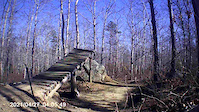
- Ladder Bridge (Ladder Bridge)
- Ladder Bridge on Two Rocks (Ladder Bridge)
- Ladder Bridge Coaster (Ladder Bridge)
- Ladder Bridges to Rock (Ladder Bridge)
- Ladder Bridge on Two Rocks (Ladder Bridge)
▼
What are the most popular mountain biking trails in Pine Hills?
The most popular mountain biking trails in Pine Hills are: View all mountain biking trails sorted by popularity.
▼
What are the best beginner ride trails in Pine Hills?
The best beginner mountain biking trails in Pine Hills are:
- Nuclear Lobster (5/5)
- Chicken to Virgin (4/5)
- Little Blue (4/5)
Activities
Trails
- By waterbooy
 CC NEMBA & contributors
 - Admins: Plymouth, Pine Hills, waterbooy
- #22966 - 40,573 views
- pine hills activity log | embed map of Pine Hills mountain bike trails | pine hills mountain biking points of interest
Downloading of trail gps tracks in kml & gpx formats is enabled for Pine Hills.
You must login to download files.
