close
-
Layers w
- Weather Layers
- Pro
- Pro
- Pro
- Pro
- Pro
- Pro
- More Layers
- Pro
- Pro
- Pro
- Pro
-
Upgrade to

3D
Trail Conditions
- Unknown
- Snow Groomed
- Snow Packed
- Snow Covered
- Snow Cover Partial
- Freeze/thaw Cycle
- Icy
- Prevalent Mud
- Wet
- Variable
- Ideal
- Dry
- Very Dry
Trail Flow (Ridden Direction)
Trailforks scans users activity logs to determine the most popular direction each trail is ridden. A good flowing trail network will have most trails flowing in a single direction according to their intension.
The colour categories are based on what percentage of users are riding a trail in its intended direction.
The colour categories are based on what percentage of users are riding a trail in its intended direction.
- > 96%
- > 90%
- > 80%
- > 70%
- > 50%
- < 50%
- bi-directional trail
- no data
Trail Last Ridden
Trailforks scans activity logs to determine the last time a trail was ridden.
- < 2 days
- < 1 week
- < 2 weeks
- < 1 month
- < 6 months
- > 6 months
Trail Ridden Direction
The intended direction a trail should be ridden.
- Downhill Only
- Downhill Primary
- Both Directions
- Uphill Primary
- Uphill Only
- One Direction
Contribute Details
Colors indicate trail is missing specified detail.
- Description
- Photos
- Description & Photos
- Videos
Trail Popularity ?
Trailforks scans activity logs to determine which trails are ridden the most in the last 9 months.
Trails are compared with nearby trails in the same city region with a possible 25 colour shades.
Think of this as a heatmap, more activities = more kinetic energy = warmer colors.
- most popular
- popular
- less popular
- not popular
ATV/ORV/OHV Filter
Max Vehicle Width
inches
US Cell Coverage
Legend

Radar Time
Activity Recordings
Trailforks uses anonymized public activity data.
?
Activity Recordings
Trailforks uses anonymized public activity data.
?
Personal Heatmap
▶
Activity Types
all
/
none
▶
Options
2
Date range
month
–
Winter Trails
Warning
A routing network for winter maps does not exist. Selecting trails using the winter trails layer has been disabled.
Missing Trails
Most Popular
Least Popular
Trails are colored based on popularity. The more popular a trail is, the more red. Less popular trails trend towards green.
Jump Magnitude Heatmap
Heatmap of where users jump on trails. Zoom in to see individual jumps, click circles to view jump details.
BC Backroad Status
![map legend]()
Service Road Atlas is a free to use, community-driven service for viewing and creating reports on the numerous back-country service roads around B.C. and Alberta.

Slope Aspect
Direction the slope faces
Trails Deemphasized
Trails are shown in grey.
Only show trails with no bike usage.
Suggested Layers
Based on selected activity type
Save the current map location and zoom level as your default home location whenever this page is loaded.
Save
No description for Placerville has been added yet!
Login or register to submit one.
Activities Click to view
- Mountain Bike
25 trails
- E-Bike
4 trails
- Adaptive Bike
0 trails
- Winter Fat Bike
0 trails
- Hike
26 trails
- Trail Running
26 trails
Region Details
- 1
- 2
- 16
- 5
- 1
Region Status
Open as of Jun 20, 2026Stats
- Avg Trail Rating
- Trails (view details)
- 26
- Trails Mountain Bike
- 25
- Trails E-Bike
- 4
- Trails Horse
- 3
- Trails Hike
- 26
- Trails Trail Running
- 26
- Total Distance
- 39 miles
- Total Descent
- 4,078 ft
- Total Vertical
- 1,431 ft
- Highest Trailhead
- 1,876 ft
- Reports
- 57
- Photos
- 56
- Completed Counter
- 2,152
Articles
Mountain Lion Shot & Killed After Stalking Family on California Trail
Jan 14, 2021 from pinkbike.com
The lion is thought to have been not well in this extremely rare incident.
Sub Regions
-
Rasmussen Park
- 10
- 4
- 1
Popular Placerville Mountain Biking Trails
• 100 ★ 0.0 • 2,001 ft • 21 ft • 162 •
Popular green difficulty singletrack. This mountain bike primary trail can be used both directions and has a easy overall physical rating with a 21 ft green climb. Trail visibility is always easy to follow. On average it takes 1 minutes to complete this trail.
• 95 ★ 0.0 • 876 ft • 0 ft • 154 •
Popular green difficulty singletrack. This mountain bike primary trail can be used both directions and has a easy overall physical rating with a 0 ft green climb. Trail visibility is always easy to follow. On average it takes 1 minutes to complete this trail.
• 85 ★ 0.0 • 1,201 ft • 0 ft • 143 •
Popular green difficulty singletrack. This mountain bike primary trail can be used both directions and has a easy overall physical rating with a 0 ft green climb. Trail visibility is always easy to follow. On average it takes 1 minutes to complete this trail.
• 50 ★ 3.0 • 15 miles • 45 ft • 95 •
This trail follows an old railroad track, and is primarily on the old access road, beat in by dirt bikes, although it is a non-motorized trail now. At times, one must get on the rail bed to keep going, but will soon see the dirt trail...
• 30 ★ 3.0 • 13 miles • 185 ft • 71 •
Less popular green difficulty singletrack. This mountain bike primary trail. On average it takes 1 hour22 minutes to complete this trail.
• 75 ★ 0.0 • 3,655 ft • 25 ft • 37 •
This trail is hiding behind an end sign at the top of Connery Dr. It begins as slightly uphill double track with enough rocks to be annoying. It then winds its way through manzanita until it reaches the downhill rock garden. Keep your...
• 60 ★ 0.0 • 1,457 ft • 0 ft • 28 •
Pee Wee is probably the oldest trail out here. It's a pretty fast, easy run down the hill. There are some annoying rocks that can be avoided with proper line choice. Coming from Drummond Rd, take the left path at the first fork and the...
Photos of Placerville Mountain Bike
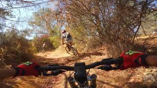
Videos of Placerville Mountain Bike

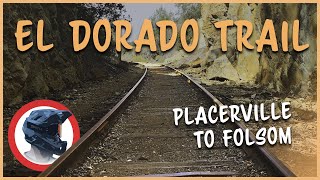
trail: El Dorado Trail
23:27 |
451 |
Nov 3, 2020 , Placerville
trail: El Dorado Trail
23:27 |
680 |
Nov 3, 2020 , Placerville
trail: El Dorado Trail
23:06 |
1123 |
May 19, 2020 , Placerville
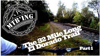
youtuber
![El Dorado Trail - Part 2 (Folsom and...]()

trail: El Dorado Trail
10:19 |
979 |
Dec 24, 2018 , Placerville
youtuber
![El Dorado Trail - Part 2 (Folsom and...]()

trail: El Dorado Trail
10:19 |
1016 |
Dec 23, 2018 , Placerville
youtuber
![El Dorado Trail - Part 1 (Folsom and...]()
trail: El Dorado Trail
12:08 |
1173 |
Dec 21, 2018 , Placerville

trail: El Dorado Trail
1203 |
Apr 13, 2016 , Placerville
Recent Trail Reports
| status | trail | date | condition | info | user |
|---|---|---|---|---|---|
| Island Connector | Jun 20, 2026 @ 10:30am (America/Los_Angeles) Jun 20, 2026 | Very Dry | KSVFitness | ||
| El Dorado Trail | Apr 14, 2026 @ 10:19pm (America/Los_Angeles) Apr 14, 2026 | Unknown | JeffreyI98iS1 | ||
| Star Thistle Trail | Nov 25, 2025 @ 10:37am (America/Los_Angeles) Nov 25, 2025 | Wet | roldog27 | ||
| Minty Fresh | Nov 25, 2025 @ 10:22am (America/Los_Angeles) Nov 25, 2025 | Wet | roldog27 | ||
| Pee Wee | Nov 25, 2025 @ 10:10am (America/Los_Angeles) Nov 25, 2025 | Wet | roldog27 | ||
| The Bruin Hayden Trail | Nov 25, 2025 @ 9:51am (America/Los_Angeles) Nov 25, 2025 | Wet | roldog27 | ||
| El Dorado Trail | Aug 21, 2025 @ 2:54pm Aug 21, 2025 | Very Dry | GTB88 | ||
| Rock N Roll | Jun 14, 2025 @ 9:13pm Jun 14, 2025 | Variable | KarterK6KMQv | ||
| Thornhill Dam | Nov 8, 2024 @ 1:48pm Nov 8, 2024 | Ideal | dolittle63 | ||
| El Dorado Trail | Aug 18, 2024 @ 7:31am Aug 18, 2024 | Very Dry | KSVFitness |
Activity Feed
| username | action | type | title | date |
|---|---|---|---|---|
| OG_Jace | ridden | trail | activity #99623238 | Jul 20, 2026 @ 11:33am 2 days |
| ikendothis | add | trail | activity #98807171 and 2 more | Jul 9, 2026 @ 12:55pm Jul 9, 2026 |
| aaronec91 | wishlist | trail | activity #98441768 and 1 more | Jul 4, 2026 @ 11:59am Jul 4, 2026 |
| Paul834 | wishlist | region | activity #98175467 | Jun 30, 2026 @ 8:02pm Jun 30, 2026 |
| KSVFitness | add | report | activity #97622461 | Jun 23, 2026 @ 6:31am Jun 23, 2026 |
Recent Comments
| username | type | title | comment | date |
|---|---|---|---|---|
| report | Carefully, yes. | Mar 15, 2026 @ 4:45pm Mar 15, 2026 | ||
| trail | Closed for construction on the dam | Jun 18, 2025 @ 8:51am Jun 18, 2025 | ||
| report | Is it crossable? | May 29, 2025 @ 8:48am May 29, 2025 | ||
| trail | Great trail to get a little fast elevation in. | Jan 10, 2025 @ 7:42pm Jan 10, 2025 | ||
| trail | The sign says no motorized vehicles but... | Apr 2, 2024 @ 1:23pm Apr 2, 2024 |
Local Badges
-

10 Green Trails20 awarded -

10 Blue Trails7 awarded -

Epic Ride Climb 2k24 awarded -

Climbing 10k Badge18 awarded -

Climbing 100k Badge1 awarded -

Epic Ride Descent 2k24 awarded
Bike & Skill Parks
| name | type | city | rating |
|---|---|---|---|
| El Dorado MX | skill park | Placerville |
Activity Type Stats
| activitytype | trails | distance | descent | descent distance | total vertical | rating | global rank | state rank | photos | reports | routes | activity logs |
|---|---|---|---|---|---|---|---|---|---|---|---|---|
| Mountain Bike | 25 | 38 miles | 4,029 ft | 23 miles | 1,430 ft | #5,183 | #1,749 | 56 | 57 | 4,163 | ||
| E-Bike | 4 | 2 miles | 75 ft | 2,162 ft | 46 ft | #7,700 | #2,321 | 27 | 251 | |||
| Horse | 3 | 3 miles | 105 ft | 3,084 ft | 1,024 ft | 7 | ||||||
| Hike | 26 | 39 miles | 4,078 ft | 23 miles | 1,430 ft | #5,512 | #1,947 | 57 | 250 | |||
| Trail Running | 26 | 39 miles | 4,078 ft | 23 miles | 1,430 ft | #4,965 | #1,549 | 57 | 169 |
Frequently Asked Questions About Placerville
▼
What are the best places to ride in Placerville?
Placerville has 1 areas to explore for mountain biking. The top rated areas are:
▼
What are the highest rated mountain biking trails in Placerville?
The highest rated mountain biking trails in Placerville are:
- The Bruin Hayden Trail (4.1/5)
- Royal Park (4.1/5)
- Red Shack Trail (4/5)
- Corner Trail (3.8/5)
- Ditch Trail (3.8/5)
▼
What is the best time of the year to ride in Placerville?
Based on ride log data, the most popular months to ride in Placerville are:
- October (26 activities)
- May (19 activities)
- April (16 activities)
▼
Where can I park to ride in Placerville?
There are 1 parking locations listed in Placerville. The most popular parking spots are:
Activities
Trails
Points of Interest
- By brenthillier
 NSMBA TRAILFORKS & contributors
 - Admins: TheAngryTomato, FATRAC, RAMBO, MLTS
- #8276 - 7,550 views
- placerville activity log | embed map of Placerville mountain bike trails | placerville mountain biking points of interest
Downloading of trail gps tracks in kml & gpx formats is enabled for Placerville.
You must login to download files.