close
-
Layers w
- Weather Layers
- Pro
- Pro
- Pro
- Pro
- Pro
- Pro
- More Layers
- Pro
- Pro
- Pro
- Pro
-
Upgrade to

3D
Trail Conditions
- Unknown
- Snow Groomed
- Snow Packed
- Snow Covered
- Snow Cover Partial
- Freeze/thaw Cycle
- Icy
- Prevalent Mud
- Wet
- Variable
- Ideal
- Dry
- Very Dry
Trail Flow (Ridden Direction)
Trailforks scans users ridelogs to determine the most popular direction each trail is ridden. A good flowing trail network will have most trails flowing in a single direction according to their intension.
The colour categories are based on what percentage of riders are riding a trail in its intended direction.
The colour categories are based on what percentage of riders are riding a trail in its intended direction.
- > 96%
- > 90%
- > 80%
- > 70%
- > 50%
- < 50%
- bi-directional trail
- no data
Trail Last Ridden
Trailforks scans ridelogs to determine the last time a trail was ridden.
- < 2 days
- < 1 week
- < 2 weeks
- < 1 month
- < 6 months
- > 6 months
Trail Ridden Direction
The intended direction a trail should be ridden.
- Downhill Only
- Downhill Primary
- Both Directions
- Uphill Primary
- Uphill Only
- One Direction
Contribute Details
Colors indicate trail is missing specified detail.
- Description
- Photos
- Description & Photos
- Videos
Trail Popularity ?
Trailforks scans ridelogs to determine which trails are ridden the most in the last 9 months.
Trails are compared with nearby trails in the same city region with a possible 25 colour shades.
Think of this as a heatmap, more rides = more kinetic energy = warmer colors.
- most popular
- popular
- less popular
- not popular
ATV/ORV/OHV Filter
Max Vehicle Width
inches
US Cell Coverage
Legend

Radar Time
Activity Recordings
Trailforks uses anonymized public activity data.
?
Activity Recordings
Trailforks uses anonymized public activity data.
?
Personal Heatmap
▶
Activity Types
all
/
none
▶
Options
2
Date range
month
–
Winter Trails
Warning
A routing network for winter maps does not exist. Selecting trails using the winter trails layer has been disabled.
Missing Trails
Most Popular
Least Popular
Trails are colored based on popularity. The more popular a trail is, the more red. Less popular trails trend towards green.
Jump Magnitude Heatmap
Heatmap of where riders jump on trails. Zoom in to see individual jumps, click circles to view jump details.
BC Backroad Status
![map legend]()
Service Road Atlas is a free to use, community-driven service for viewing and creating reports on the numerous back-country service roads around B.C. and Alberta.

Slope Aspect
Direction the slope faces
Trails Deemphasized
Trails are shown in grey.
Only show trails with no bike usage.
Suggested Layers
Based on selected activity type
Save the current map location and zoom level as your default home location whenever this page is loaded.
Save
No description for Podgórzyn has been added yet!
Login or register to submit one.
This region uses the Uk/Euro style trail grading system.
Activities Click to view
- Mountain Bike
38 trails
- E-Bike
38 trails
- Gravel Bike
0 trails
- Winter Fat Bike
0 trails
- Hike
34 trails
- Trail Running
34 trails
Region Details
- 11
- 2
- 10
- 11
Region Status
Caution as of Jun 26, 2026Stats
- Avg Trail Rating
- Trails (view details)
- 35
- Trails Mountain Bike
- 38
- Trails E-Bike
- 38
- Trails Hike
- 34
- Trails Trail Running
- 34
- Total Distance
- 26 miles
- Total Descent
- 8,714 ft
- Total Vertical
- 2,244 ft
- Highest Trailhead
- 3,478 ft
- Reports
- 172
- Photos
- 279
- Ridden Counter
- 1,286
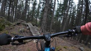
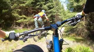
Popular Podgórzyn Mountain Biking Trails
• 95 ★ 3.0 • 2,458 ft • 41 ft • 102 • • hike
Szlak zielony trawersujący Kopę. Przyjazny do jazdy w dwóch kierunkach.
• 65 ★ 3.7 • 883 ft • 0 ft • 72 • • hike
Zjazd zielonym szlakiem do wodospadu Podgórnej. W dolnej części długie schody. Przed remontem szlaku był dużo ciekawszy.
• 100 ★ 5.0 • 2,812 ft • 0 ft • 58 •
Popular red difficulty singletrack. This mountain bike primary trail can be used downhill only and has a moderate overall physical rating. It features drop, jump, ladder bridge and rock garden. Trail visibility is sometimes hard to follow.
• 70 ★ 4.0 • 2,103 ft • 0 ft • 45 • • hike
Ciekawa ścieżka idealna jako kontynuacja jazdy za !wodospadem Podgórnej. Kilka dość wymagających sekcji po kamieniach.
• 75 ★ 0.0 • 1,434 ft • 0 ft • 36 •
Popular blue difficulty singletrack. This mountain bike primary trail can be used both directions. On average it takes 6 minutes to complete this trail.
Podgórzyn Mountain Bike Routes
17 miles • 4,560 ft • 0 • Race •
Trasa zawodów Enduro MTB Series Przesieka 2018.

Recent Trail Reports
Activity Feed
| username | action | type | title | date |
|---|---|---|---|---|
| r2r | add | report | activity #97887619 | Jun 27, 2026 @ 3:15am Jun 27, 2026 |
| piast9 | wishlist | trail | activity #97476036 | Jun 21, 2026 @ 5:54am Jun 21, 2026 |
| piast9 | wishlist | trail | activity #97459729 | Jun 21, 2026 @ 12:45am Jun 21, 2026 |
| freemantpeter | add | report | activity #97301417 | Jun 19, 2026 @ 12:43am Jun 19, 2026 |
| Tom-501 | wishlist | trail | activity #95971506 | May 31, 2026 @ 1:06pm May 31, 2026 |
Recent Comments
| username | type | title | comment | date |
|---|---|---|---|---|
| trail | Tramwaj to wisienka na torcie całego Szlaku... | Dec 14, 2025 @ 6:24am Dec 14, 2025 | ||
| trail | Zapowiada się dobrze i za szybko się... | Dec 14, 2025 @ 6:11am Dec 14, 2025 | ||
| trail | Uwielbiam takie szlaki. Odcinek bardzo... | Dec 14, 2025 @ 6:01am Dec 14, 2025 | ||
| trail | Leśny skrót jakich wiele. Nic, żeby... | Dec 14, 2025 @ 5:53am Dec 14, 2025 | ||
| trail | To aktualnie nie jest singletrack, poza może... | Dec 14, 2025 @ 5:36am Dec 14, 2025 |
Local Badges
-

Epic Ride Climb 2k91 awarded -

Climbing 10k Badge21 awarded -

Climbing 100k Badge0 awarded -

Epic Ride Descent 2k98 awarded -

Descent 10k Badge21 awarded -

Descent 100k Badge0 awarded
Activity Type Stats
| activitytype | trails | distance | descent | descent distance | total vertical | rating | global rank | state rank | photos | reports | routes | ridelogs |
|---|---|---|---|---|---|---|---|---|---|---|---|---|
| Mountain Bike | 38 | 26 miles | 8,435 ft | 14 miles | 2,244 ft | #4,473 | #102 | 274 | 172 | 1 | 507 | |
| E-Bike | 38 | 26 miles | 8,435 ft | 14 miles | 2,244 ft | #3,930 | #329 | 5 | 152 | 69 | ||
| Hike | 34 | 24 miles | 6,896 ft | 12 miles | 2,244 ft | #6,208 | #115 | 161 | 155 | |||
| Trail Running | 34 | 24 miles | 6,896 ft | 12 miles | 2,244 ft | #6,065 | #120 | 161 | 30 |
Frequently Asked Questions About Podgórzyn
▼
What are the highest rated mountain biking trails in Podgórzyn?
The highest rated mountain biking trails in Podgórzyn are:
- Czołowy (4.3/5)
- Sucha (4.2/5)
- Komorebi (4.2/5)
- Planted Rocks (4.2/5)
- Tramwaj (4.1/5)
▼
What is the best time of the year to ride in Podgórzyn?
Based on ride log data, the most popular months to ride in Podgórzyn are:
- July (2 activities)
▼
Where can I park to ride in Podgórzyn?
There are 3 parking locations listed in Podgórzyn. The most popular parking spots are: View all parking and trailhead locations on the map to plan your visit.
▼
What is the longest trail in Podgórzyn?
The longest trail in Podgórzyn is Podgórna at 1.4 miles. View all trails sorted by distance.
Activities
Trails
- By micolai
 TRAILFORKS Poland & contributors
 - Admins: xaoo
- #47225 - 805 views
- podgórzyn activity log | embed map of Podgórzyn mountain bike trails | podgórzyn mountain biking points of interest
Downloading of trail gps tracks in kml & gpx formats is enabled for Podgórzyn.
You must login to download files.