close
-
Layers w
- Weather Layers
- Pro
- Pro
- Pro
- Pro
- Pro
- Pro
- More Layers
- Pro
- Pro
- Pro
- Pro
-
Upgrade to

3D
Trail Conditions
- Unknown
- Snow Groomed
- Snow Packed
- Snow Covered
- Snow Cover Partial
- Freeze/thaw Cycle
- Icy
- Prevalent Mud
- Wet
- Variable
- Ideal
- Dry
- Very Dry
Trail Flow (Ridden Direction)
Trailforks scans users activity logs to determine the most popular direction each trail is ridden. A good flowing trail network will have most trails flowing in a single direction according to their intension.
The colour categories are based on what percentage of users are riding a trail in its intended direction.
The colour categories are based on what percentage of users are riding a trail in its intended direction.
- > 96%
- > 90%
- > 80%
- > 70%
- > 50%
- < 50%
- bi-directional trail
- no data
Trail Last Ridden
Trailforks scans activity logs to determine the last time a trail was ridden.
- < 2 days
- < 1 week
- < 2 weeks
- < 1 month
- < 6 months
- > 6 months
Trail Ridden Direction
The intended direction a trail should be ridden.
- Downhill Only
- Downhill Primary
- Both Directions
- Uphill Primary
- Uphill Only
- One Direction
Contribute Details
Colors indicate trail is missing specified detail.
- Description
- Photos
- Description & Photos
- Videos
Trail Popularity ?
Trailforks scans activity logs to determine which trails are ridden the most in the last 9 months.
Trails are compared with nearby trails in the same city region with a possible 25 colour shades.
Think of this as a heatmap, more activities = more kinetic energy = warmer colors.
- most popular
- popular
- less popular
- not popular
ATV/ORV/OHV Filter
Max Vehicle Width
inches
US Cell Coverage
Legend

Radar Time
Activity Recordings
Trailforks uses anonymized public activity data.
?
Activity Recordings
Trailforks uses anonymized public activity data.
?
Personal Heatmap
▶
Activity Types
all
/
none
▶
Options
2
Date range
month
–
Winter Trails
Warning
A routing network for winter maps does not exist. Selecting trails using the winter trails layer has been disabled.
Missing Trails
Most Popular
Least Popular
Trails are colored based on popularity. The more popular a trail is, the more red. Less popular trails trend towards green.
Jump Magnitude Heatmap
Heatmap of where users jump on trails. Zoom in to see individual jumps, click circles to view jump details.
BC Backroad Status
![map legend]()
Service Road Atlas is a free to use, community-driven service for viewing and creating reports on the numerous back-country service roads around B.C. and Alberta.

Slope Aspect
Direction the slope faces
Trails Deemphasized
Trails are shown in grey.
Only show trails with no bike usage.
Suggested Layers
Based on selected activity type
Save the current map location and zoom level as your default home location whenever this page is loaded.
Save
No description for Ponce has been added yet!
Login or register to submit one.
Activities Click to view
- Mountain Bike
71 trails
- E-Bike
64 trails
- Gravel Bike
7 trails
- Adaptive Bike
0 trails
- Horse
12 trails
- Hike
65 trails
- Trail Running
66 trails
Region Details
- 23
- 2
- 19
- 25
- 2
Region Status
Caution as of Jul 6, 2026Stats
- Avg Trail Rating
- Trails (view details)
- 71
- Trails Mountain Bike
- 71
- Trails E-Bike
- 64
- Trails Gravel Bike
- 7
- Trails Horse
- 12
- Trails Hike
- 65
- Trails Trail Running
- 66
- Trails Observed Trials
- 1
- Total Distance
- 61 miles
- Total Descent
- 4,834 ft
- Total Vertical
- 1,575 ft
- Highest Trailhead
- 1,597 ft
- Reports
- 653
- Photos
- 80
- Completed Counter
- 2,180
Sub Regions
-
Cerrillos Trail Network
- 1
- 4
- 4
-
Comere Trails Network
- 3
- 5
- 1
-
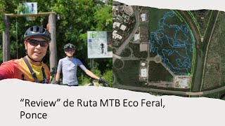
Eco Ferial Trail Network
- 2
-
El Vigia Trail Network
- 3
- 1
-
Jurassic MTB Park
- 1
-
Los Flamboyanes Trail Network
-
TIBES MTB Park
- 2
- 6
-
Tibes Trail Network
- 4
- 2
-
Tibes Trail Network
- 1
Popular Ponce Mountain Biking Trails
• 95 ★ 5.0 • 3 miles • 17 ft • 201 •
Popular green difficulty family friendly singletrack. This multi-use trail can be used one direction and has a moderate overall physical rating with a 17 ft green climb. It features rock garden. Trail visibility is always easy to follow. On average it takes 26 minutes to complete this trail.
• 90 ★ 3.5 • 2,746 ft • 0 ft • 142 •
This is a single track (only Wednesdays you ride uphill) very comfortable to ride, it has quite tight turns but nothing to worry about.
• 100 ★ 0.0 • 2 miles • 0 ft • 126 •
Popular green difficulty family friendly singletrack. This multi-use trail can be used one direction and has a moderate overall physical rating with a 0 ft green climb. Trail visibility is always easy to follow.
• 50 ★ 5.0 • 1,696 ft • 0 ft • 60 •
Cuesta intensa mayormente en piedra. Los miércoles se corre al revés
• 45 ★ 5.0 • 2 miles • 247 ft • 56 •
Ruta de alta intensidad, caminos mayormente de piedra tosca, subidas y bajadas para corredores con experiencia. Se corre de ambos lados
• 40 ★ 0.0 • 4,501 ft • 42 ft • 36 •
Moderately popular green difficulty dirt/gravel road. This multi-use trail can be used both directions and has a moderate overall physical rating with a 42 ft green climb. Trail visibility is always easy to follow. On average it takes 13 minutes to complete this trail.
Ponce Mountain Bike Routes
★ 5.0 • 2 miles • 345 ft • 9 • Point to Point •
Ruta corta se corre los miércoles al revés
30 miles • 1,671 ft • 6 • Loop •
Tour del Norte 3 Ruta Oficial 14 de noviembre de 2021 Por: Rafy Vega
★ 5.0 • 29 miles • 369 ft • 2 • Race •
Carrera de 50 kilómetros de MTB. Mezcla de trails y calles.
2 miles • 181 ft • 2 • Point to Point • Race •
Ruta Corta se corre en sentido contrario los miércoles.
Photos of Ponce Mountain Bike
Videos of Ponce Mountain Bike
trail: Ruta Larga
13:08 |
232 |
Dec 14, 2022 , Ponce
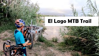
trail: El Lago MTB
13:53 |
456 |
Jun 21, 2020 , Ponce
Current Trail Warnings
| status | trail | date | condition | user | info |
|---|---|---|---|---|---|
| Lineal Riberas del Bucana | Jul 6, 2026 @ 6:15pm (America/Puerto_Rico) Jul 6, 2026 | Very Dry | MichaelDescartes TRAILFORKS | Precaución co los fuegos forestales ! | |
| Conector Los Flamboyanes | Jul 6, 2026 @ 6:15pm (America/Puerto_Rico) Jul 6, 2026 | Very Dry | MichaelDescartes TRAILFORKS | Precaución co los fuegos forestales ! | |
| Los Flamboyanes Short Track | Jul 6, 2026 @ 6:15pm (America/Puerto_Rico) Jul 6, 2026 | Very Dry | MichaelDescartes TRAILFORKS | Precaución co los fuegos forestales ! |
Recent Trail Reports
Activity Feed
| username | action | type | title | date |
|---|---|---|---|---|
| MichaelDescartes | rsvp | event | activity #100350856 | Jul 30, 2026 @ 9:49am 2 days |
| MichaelDescartes | add | event | activity #100346559 | Jul 30, 2026 @ 8:43am 2 days |
| MichaelDescartes | add | report | activity #98601435 and 2 more | Jul 6, 2026 @ 3:16pm Jul 6, 2026 |
| MichaelDescartes | add | report | activity #98601434 and 1 more | Jul 6, 2026 @ 3:16pm Jul 6, 2026 |
| MichaelDescartes | add | report | activity #96828825 and 6 more | Jun 12, 2026 @ 2:40pm Jun 12, 2026 |
Recent Comments
| username | type | title | comment | date |
|---|---|---|---|---|
| trail | Esta Ruta está bajo Construccion, se... | Jul 21, 2025 @ 4:29am Jul 21, 2025 | ||
| report | Conector esta limpio | Mar 2, 2025 @ 5:48am Mar 2, 2025 | ||
| report | Entrada por debajo del puente de la Carr 10 | Feb 9, 2025 @ 3:00am Feb 9, 2025 | ||
| trail | Just Wednesday | Sep 30, 2024 @ 1:28pm Sep 30, 2024 | ||
| report | Rafy gracias por los reportes …. Ojalá... | Feb 22, 2022 @ 2:40pm Feb 22, 2022 |
Local Badges
-

Epic Ride Climb 2k70 awarded -

Climbing 10k Badge32 awarded -

Climbing 100k Badge4 awarded -

Epic Ride Descent 2k72 awarded -

Descent 10k Badge32 awarded -

Descent 100k Badge4 awarded
Activity Type Stats
| activitytype | trails | distance | descent | descent distance | total vertical | rating | global rank | state rank | photos | reports | routes | activity logs |
|---|---|---|---|---|---|---|---|---|---|---|---|---|
| Mountain Bike | 71 | 61 miles | 4,833 ft | 15 miles | 1,575 ft | #1,308 | #4 | 77 | 653 | 10 | 12,424 | |
| E-Bike | 64 | 48 miles | 2,490 ft | 10 miles | 515 ft | #1,038 | #4 | 620 | 6 | 588 | ||
| Gravel Bike | 7 | 9 miles | 1,752 ft | 4 miles | 787 ft | #190 | #18 | 160 | 2 | 5 | ||
| Horse | 12 | 20 miles | 643 ft | 4 miles | 472 ft | #400 | #1 | 77 | ||||
| Hike | 65 | 55 miles | 4,170 ft | 13 miles | 1,575 ft | #604 | #1 | 3 | 635 | 5 | 195 | |
| Trail Running | 66 | 57 miles | 4,186 ft | 13 miles | 1,575 ft | #1,099 | #3 | 636 | 3 | 404 | ||
| Observed Trials | 1 | 4 miles | 36 ft | 3,376 ft | 1 | 2 |
Frequently Asked Questions About Ponce
▼
What are the best places to ride in Ponce?
Ponce has 10 areas to explore for mountain biking. The top rated areas are:
▼
What are the highest rated mountain biking trails in Ponce?
The highest rated mountain biking trails in Ponce are:
- Ruta Larga (4.2/5)
- Camino a Mansiones (4.1/5)
- La Diabla Trail (4.1/5)
- Ruta Larga (4.1/5)
- Tamarindo Downhill (4.1/5)
▼
What is the best time of the year to ride in Ponce?
Based on activity log data, the most popular months to ride in Ponce are:
- January (33 activities)
- March (33 activities)
- February (33 activities)
▼
Where can I park to ride in Ponce?
There are 7 parking locations listed in Ponce. The most popular parking spots are: View all parking and trailhead locations on the map to plan your visit.
Activities
Trails
Points of Interest
- By MichaelDescartes
 TRAILFORKS MTBRC Puerto Rico & contributors
 - Admins: MTBRC, MTBRC
- #10557 - 7,428 views
- ponce activity log | embed map of Ponce mountain bike trails | ponce mountain biking points of interest
Downloading of trail gps tracks in kml & gpx formats is enabled for Ponce.
You must login to download files.