close
-
Layers w
- Map Content
- More Layers
- Pro
- Pro
- Pro
- Pro
- Pro
- Pro
- Pro
- Pro
-
Upgrade to

3D
Trail Conditions
- Unknown
- Snow Groomed
- Snow Packed
- Snow Covered
- Snow Cover Partial
- Freeze/thaw Cycle
- Icy
- Prevalent Mud
- Wet
- Variable
- Ideal
- Dry
- Very Dry
Trail Flow (Ridden Direction)
Trailforks scans users ridelogs to determine the most popular direction each trail is ridden. A good flowing trail network will have most trails flowing in a single direction according to their intension.
The colour categories are based on what percentage of riders are riding a trail in its intended direction.
The colour categories are based on what percentage of riders are riding a trail in its intended direction.
- > 96%
- > 90%
- > 80%
- > 70%
- > 50%
- < 50%
- bi-directional trail
- no data
Trail Last Ridden
Trailforks scans ridelogs to determine the last time a trail was ridden.
- < 2 days
- < 1 week
- < 2 weeks
- < 1 month
- < 6 months
- > 6 months
Trail Ridden Direction
The intended direction a trail should be ridden.
- Downhill Only
- Downhill Primary
- Both Directions
- Uphill Primary
- Uphill Only
- One Direction
Contribute Details
Colors indicate trail is missing specified detail.
- Description
- Photos
- Description & Photos
- Videos
Trail Popularity ?
Trailforks scans ridelogs to determine which trails are ridden the most in the last 9 months.
Trails are compared with nearby trails in the same city region with a possible 25 colour shades.
Think of this as a heatmap, more rides = more kinetic energy = warmer colors.
- most popular
- popular
- less popular
- not popular
ATV/ORV/OHV Filter
Max Vehicle Width
inches
US Cell Coverage
Legend

Radar Time
x
Activity Recordings
Trailforks users anonymized public ridelogs from the past 6 months.
- mountain biking recent
- mountain biking (>6 month)
- hiking (1 year)
- moto (1 year)
Activity Recordings
Trailforks users anonymized public skilogs from the past 12 months.
- Downhill Ski
- Backcountry Ski
- Nordic Ski
- Snowmobile
Winter Trails
Warning
A routing network for winter maps does not exist. Selecting trails using the winter trails layer has been disabled.
x
Missing Trails
Most Popular
Least Popular
Trails are colored based on popularity. The more popular a trail is, the more red. Less popular trails trend towards green.
Jump Magnitude Heatmap
Heatmap of where riders jump on trails. Zoom in to see individual jumps, click circles to view jump details.
Trails Deemphasized
Trails are shown in grey.
Only show trails with NO bikes.
Save the current map location and zoom level as your default home location whenever this page is loaded.
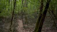
SaveLe colline intorno Caserta: un labirinto di piccoli sentieri che offrono divertimento per ogni tipo di bikers.
Dall'XC all'Enduro ci sarà da divertirsi per tutti i gusti.
Uno scrigno di sentieri incredibili intrisi di storia e panorami incredibili a queste altitudini.
Vi aspettiamo per una bella pedalata, qualche discesa assieme e ovviamente per qualche birra
#NEVERSTOPRIDINGHAVINGFUN
Dall'XC all'Enduro ci sarà da divertirsi per tutti i gusti.
Uno scrigno di sentieri incredibili intrisi di storia e panorami incredibili a queste altitudini.
Vi aspettiamo per una bella pedalata, qualche discesa assieme e ovviamente per qualche birra
#NEVERSTOPRIDINGHAVINGFUN
Primary Trail Type: All-Mountain & Downhill
eBikes Allowed:
Yes
Land Status: City Managed
Access Info:
Caserta - Piazza Dante - Gran Caffè Margherita
San Leucio - Piazza della Seta
San Leucio - Piazza della Seta
Activities Click to view
- Mountain Bike
109 trails
- E-Bike
110 trails
- Hike
86 trails
- Trail Running
79 trails
Region Details
- 6
- 2
- 40
- 39
- 18
- 3
Region Status
Open as of 10 hoursStats
- Avg Trail Rating
- Trails (view details)
- 110
- Trails Mountain Bike
- 109
- Trails E-Bike
- 110
- Trails Horse
- 6
- Trails Hike
- 86
- Trails Trail Running
- 79
- Total Distance
- 65 miles
- Total Descent Distance
- 34 miles
- Total Descent
- 18,650 ft
- Total Vertical
- 1,877 ft
- Highest Trailhead
- 2,000 ft
- Reports
- 408
- Photos
- 14
- Ridden Counter
- 952
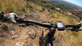
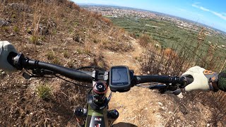
Popular PZ8 Riding Area Mountain Biking Trails
PZ8 Riding Area Mountain Bike Routes
| title | rating | distance |
|---|---|---|
| Singletrails Casertani | 23 miles |
Photos of PZ8 Riding Area Mountain Bike
trail: Boschetto Basso
10 |
Nov 4, 2023 @ 11:14am
Nov 4, 2023
trail: La Sedia Del RE Uphill
25 |
Apr 18, 2023 @ 10:43am
Apr 18, 2023
trail: Boschetto DH
24 |
May 20, 2021 @ 9:57pm
May 20, 2021
trail: Boschetto DH
29 |
May 20, 2021 @ 9:57pm
May 20, 2021
trail: Boschetto per Casola
25 |
May 20, 2021 @ 9:54pm
May 20, 2021Videos of PZ8 Riding Area Mountain Bike
trail: Milky Way
1:28 |
107 |
Sep 13, 2016
3:55 |
49 |
Sep 8, 2023 , Caserta
3:07 |
29 |
Sep 4, 2023 , Caserta
Recent Trail Reports
| status | trail | date | condition | info | user |
|---|---|---|---|---|---|
| Horizon Trail | May 19, 2024 @ 7:36am 10 hours | Ideal | operatoresentiericai-caserta | ||
| Barz8 - Pezzottocicloteam e Briganti Trails | Jan 21, 2024 @ 12:59am Jan 21, 2024 | Ideal | Pezzottocicloteam | ||
| Discesa Antenne | Jan 21, 2024 @ 12:59am Jan 21, 2024 | Ideal | Pezzottocicloteam | ||
| Borgo Rocks | Jan 21, 2024 @ 12:59am Jan 21, 2024 | Ideal | Pezzottocicloteam | ||
| Cess Track | Jan 21, 2024 @ 12:59am Jan 21, 2024 | Ideal | Pezzottocicloteam | ||
| Canalone | Dec 31, 2023 @ 1:46am Dec 31, 2023 | Variable | bikerJak95 | ||
| Variante di cresta | Dec 31, 2023 @ 1:46am Dec 31, 2023 | Ideal | bikerJak95 | ||
| Cinghio Track | Dec 23, 2023 @ 11:59pm Dec 23, 2023 | Ideal | Pezzottocicloteam | ||
| Schiacciasassi | Dec 23, 2023 @ 11:59pm Dec 23, 2023 | Ideal | Pezzottocicloteam | ||
| Tecnico Giubileo | Dec 23, 2023 @ 11:59pm Dec 23, 2023 | Ideal | Pezzottocicloteam |
Activity Feed
| username | action | type | title | date |
|---|---|---|---|---|
| operatoresentiericai-caserta | add | report | activity #52825353 | May 19, 2024 @ 7:42am 10 hours |
| CarminelvQjdd | ridden | trail | activity #52736334 and 6 more | May 17, 2024 @ 1:32pm 2 days |
| Pezzottocicloteam | vote | trail | activity #50763687 and 3 more | Apr 3, 2024 @ 8:19am Apr 3, 2024 |
| bikerJak95 | wishlist | trail | activity #50692844 | Mar 31, 2024 @ 11:55pm Mar 31, 2024 |
| Velardi | vote | trail | activity #50428884 | Mar 24, 2024 @ 10:44pm Mar 24, 2024 |
Recent Comments
| username | type | title | comment | date |
|---|---|---|---|---|
| report | Percorribile fare attenzione ultimo tratto... | Oct 13, 2023 @ 2:17pm Oct 13, 2023 | ||
| trail | sporco.Quasi interamente ricoperto da vegetazione | Jul 5, 2023 @ 7:32am Jul 5, 2023 | ||
| trail | Green???????? | Feb 14, 2023 @ 2:07am Feb 14, 2023 | ||
| trail | Green???? | Feb 14, 2023 @ 2:04am Feb 14, 2023 | ||
| trail | Percorso non più fruibile. | Oct 25, 2020 @ 3:28am Oct 25, 2020 |
Nearby Areas
| name | distance | ||||
|---|---|---|---|---|---|
| Taburno Bike Arena | 17 | 36 | 8 | 14.3 km | |
| Monte Calvello Area | 6 | 7 | 1 | 21.7 km | |
| Montevergine Trail Area | 2 | 1 | 22.6 km | ||
| Matese Riding Area | 22 | 21 | 17 | 2 | 24 km |
| Steve Paradise Area | 3 | 3 | 3 | 1 | 29.8 km |
Local Badges
-

Completionist0 awarded
Local Mountain Biking Directory
-
Evolution Bikes by Giannini
-
Center BikeBike Shop
-
Snoopy SportBike Shop
Activity Type Stats
| activitytype | trails | distance | descent | descent distance | total vertical | rating | global rank | state rank | photos | reports | routes | ridelogs |
|---|---|---|---|---|---|---|---|---|---|---|---|---|
| Mountain Bike | 109 | 63 miles | 18,576 ft | 34 miles | 1,877 ft | #3,318 | #119 | 14 | 408 | 1 | 965 | |
| E-Bike | 110 | 65 miles | 18,642 ft | 34 miles | 1,877 ft | #1,287 | #86 | 406 | 1 | 626 | ||
| Horse | 6 | 3 miles | 525 ft | 1 mile | 1,050 ft | 3 | ||||||
| Hike | 86 | 45 miles | 15,118 ft | 26 miles | 1,877 ft | #3,236 | #114 | 404 | 13 | |||
| Trail Running | 79 | 43 miles | 12,037 ft | 23 miles | 1,877 ft | #3,349 | #119 | 404 | 2 |
- By Pezzottocicloteam
 & contributors
 - Admins: apply
- #47992 - 1,175 views
- pz8 riding area activity log | embed map of PZ8 Riding Area mountain bike trails | pz8 riding area mountain biking points of interest
Downloading of trail gps tracks in kml & gpx formats is enabled for PZ8 Riding Area.
You must login to download files.